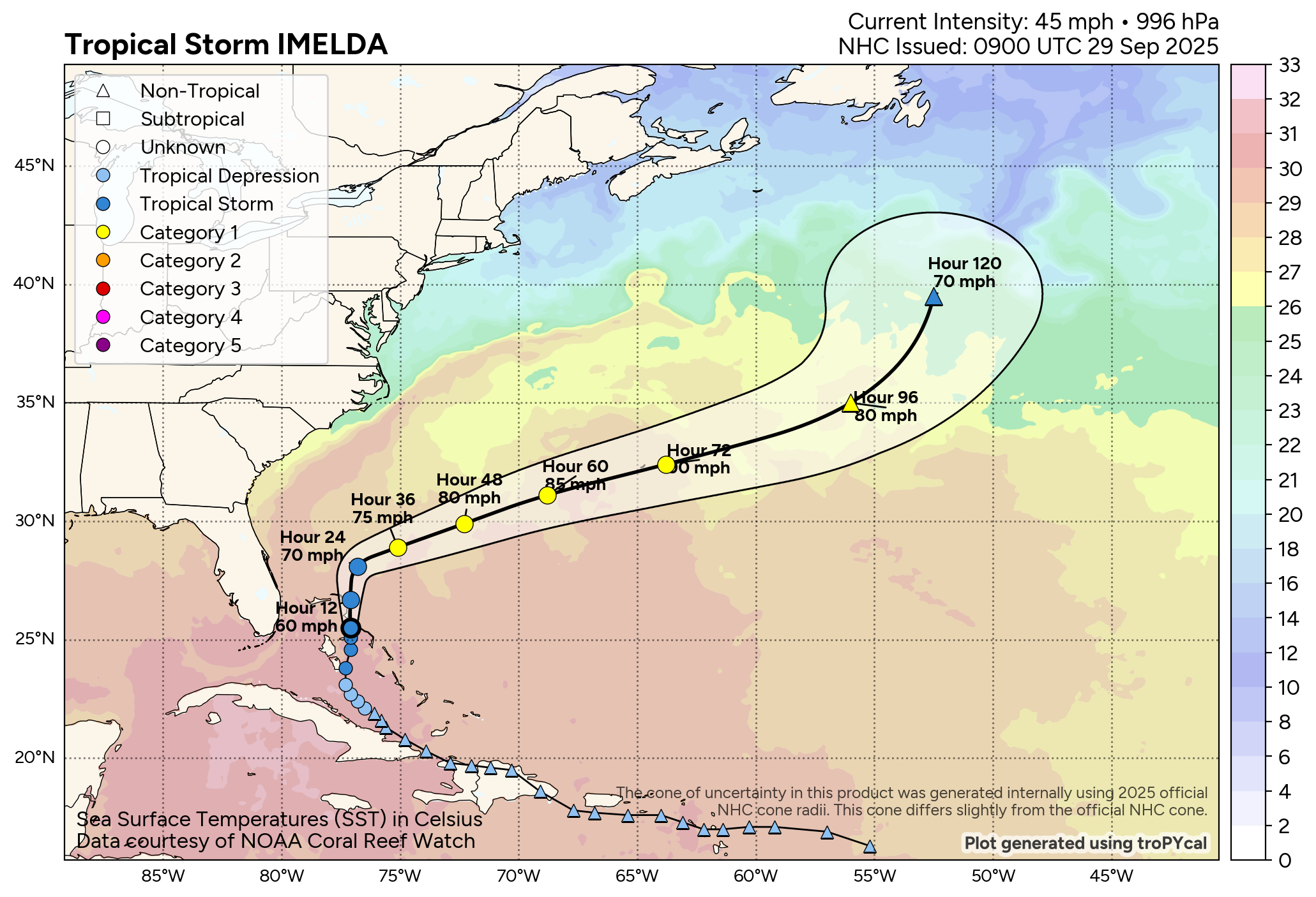
Tropical Storm Imelda: Imelda seems to be gradually becoming better organized today with satellite imagery showing deep convection occurring very near the center of circulation, which is located right over Abaco Island in the northwestern Bahamas. Additionally, reconnaissance aircraft investigation Imelda have found that the central barometric pressure has fallen to 994 millibars with maximum winds in the 45-50 mph range.
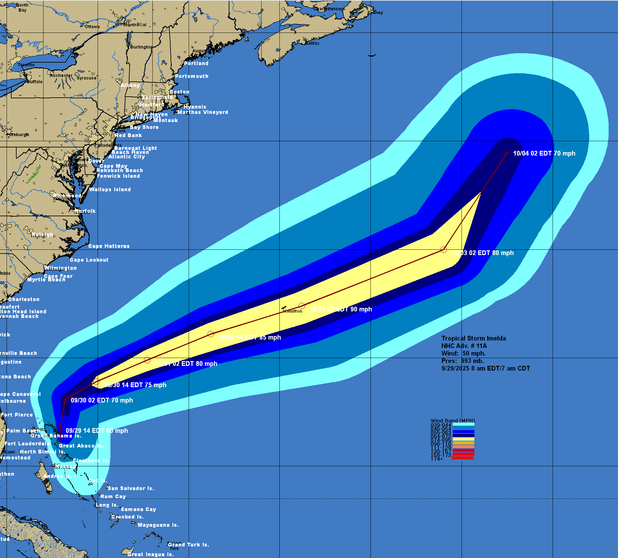
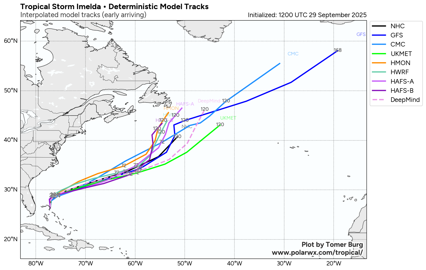
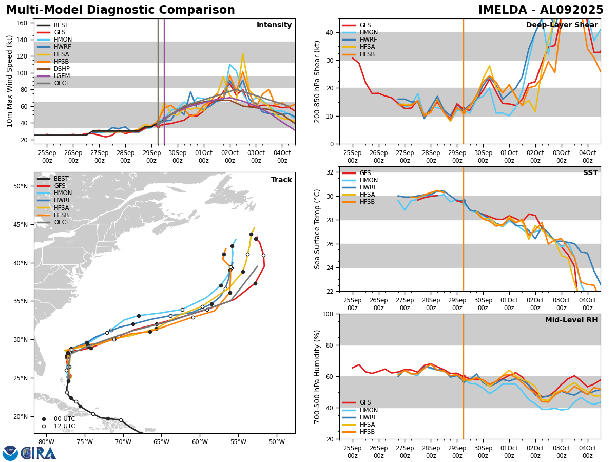
Imelda is moving slowly towards the north & it is expected that this northward track will continue throughout the rest of today and tonight. During Tuesday, Hurricane Humberto, which is located to the east of Imelda, is expected to break down the high pressure ridge causing Imelda to turn abruptly to the east-northeast. This east-northeasterly track is then expected to continue through the middle and later parts of this week.
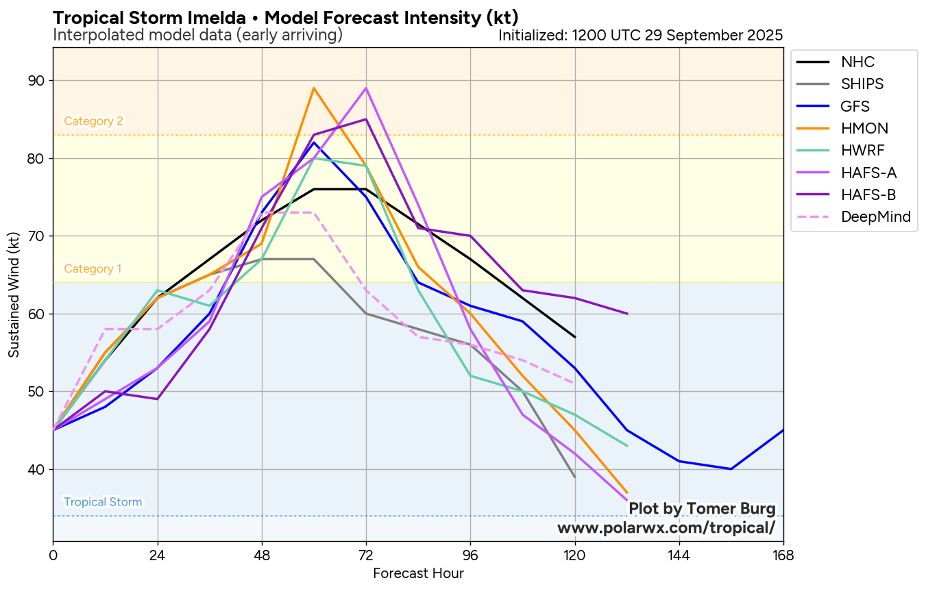
This means that it is all but guaranteed that Imelda will stay well offshore of the US Southeast Coast. This also means that Imelda is now expected to directly impact the island of Bermuda as a Category 1 or 2 hurricane on Wednesday night into Thursday morning.
Forecast Impacts:
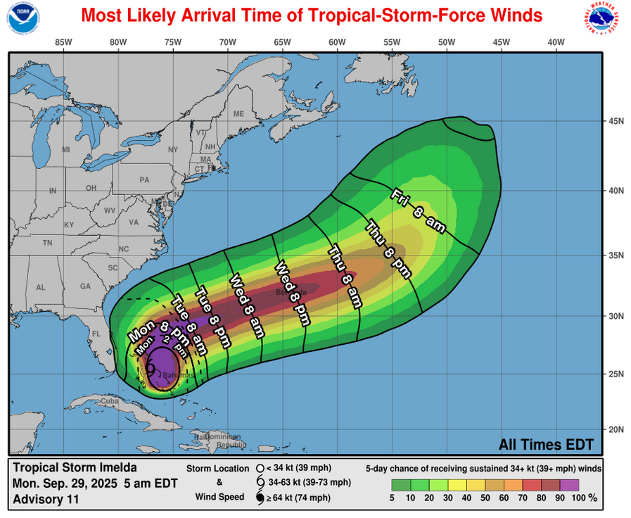
For The Northwestern Bahamas: Squally weather with occasional wind gusts of up to tropical storm force are expected across the northwestern Bahamas throughout the rest of today. Conditions will then improve as we get into Tuesday.
For Florida’s East Coast: The circulation on the western side of Imelda is likely to continue to produce gusty northerly winds throughout the day today along Florida’s East Coast from about Daytona Beach southward through Vero Beach and Stuart. These winds will diminish as we get into tonight and especially on Tuesday.
Coastal Parts Of South Carolina & North Carolina: Some additional rain, which will be locally heavy at times, is expected across coastal parts of South Carolina and southeastern North Carolina throughout today, tonight and Tuesday. Additional rainfall amounts of up to one more inch can be expected in some areas. Weather conditions are likely to improve as we get into Tuesday night and especially Wednesday.
Bermuda: A direct hurricane impact from Imelda is expected on the island of Bermuda on Wednesday night as it appears quite possible that the eye of the hurricane will pass right over the island. This means that tropical storm conditions will develop on Bermuda during Wednesday afternoon. Hurricane conditions with wind gusts of about 100 mph look likely on Wednesday night into Thursday morning. Weather conditions then will rapidly improve by late Thursday and especially Friday.
It should be noted that this is in addition to the tropical storm conditions that are expected on Bermuda from the outer bands from Humberto. These tropical storm conditions are expected during tonight and Tuesday.
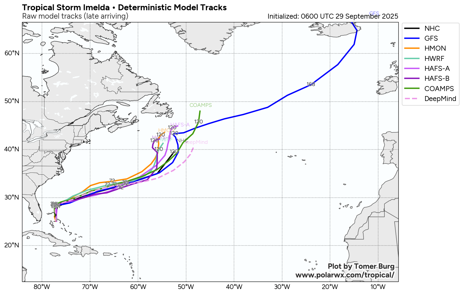
Model Track Forecast:
Satellite Imagery:

The next tropical weather discussion will be issued on Tuesday.