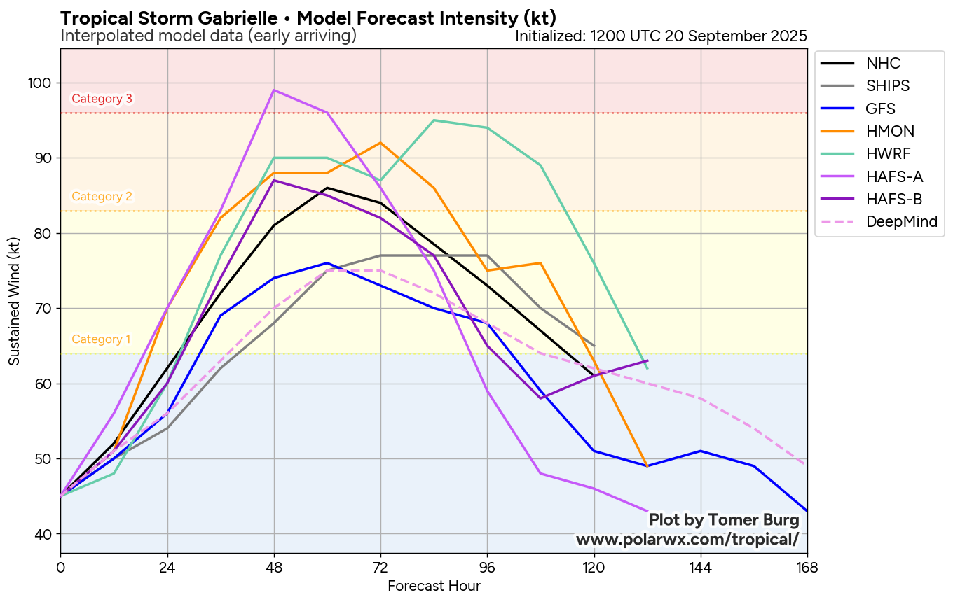
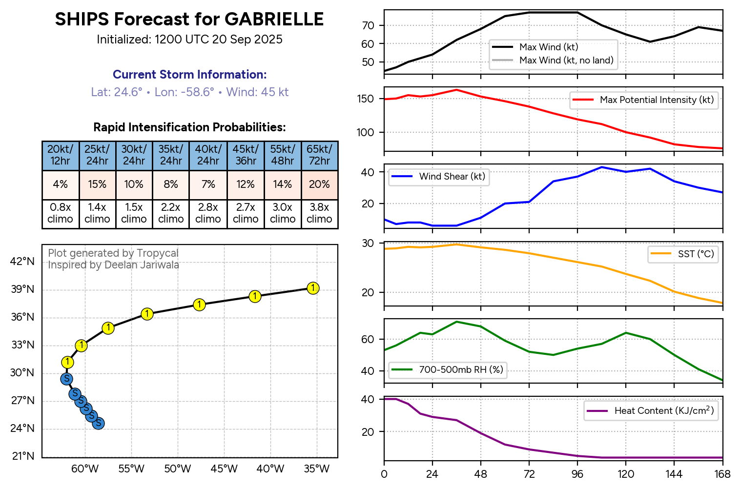
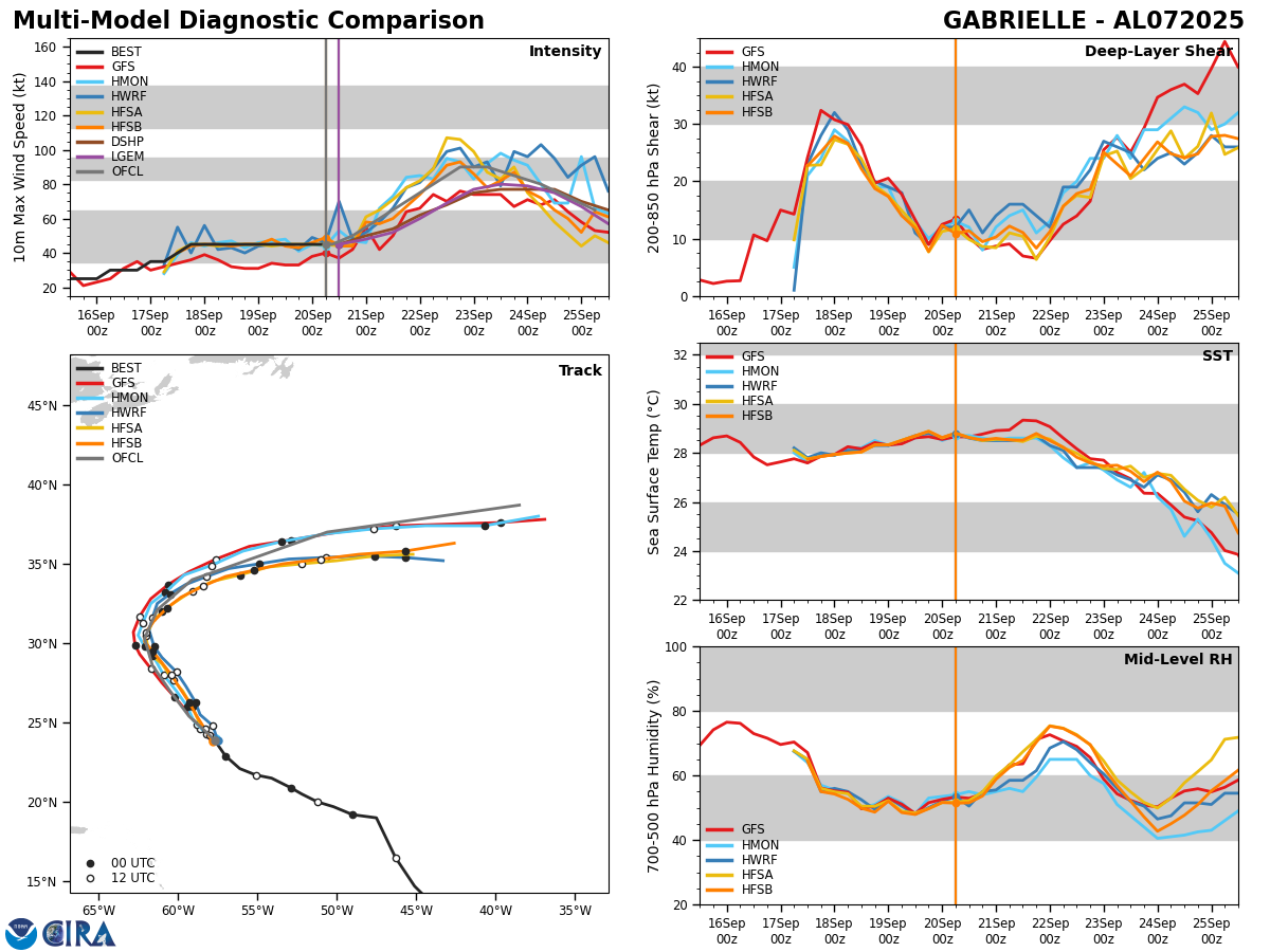
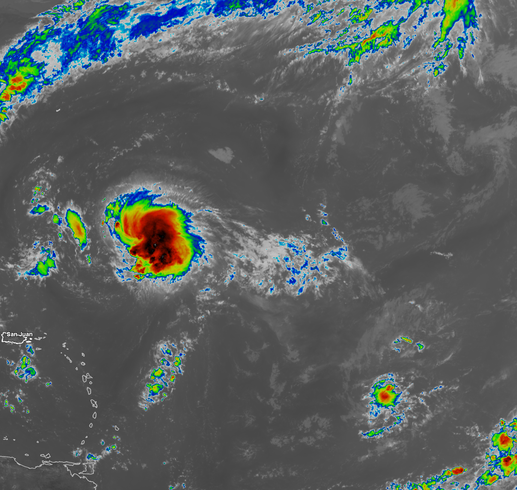
Tropical Storm Gabrielle: Some westerly wind shear is affecting Gabrielle this morning as most of the convection is located just to the east of the low-level center. That said, the convection that is occurring today is quite intense & thus once the wind shear does decrease over Gabrielle, it’ll probably strengthen fairly quickly.
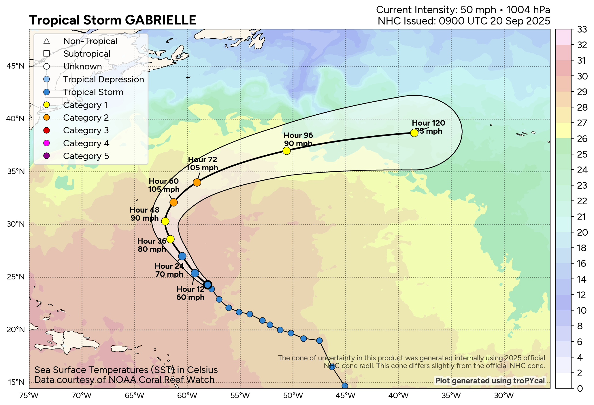
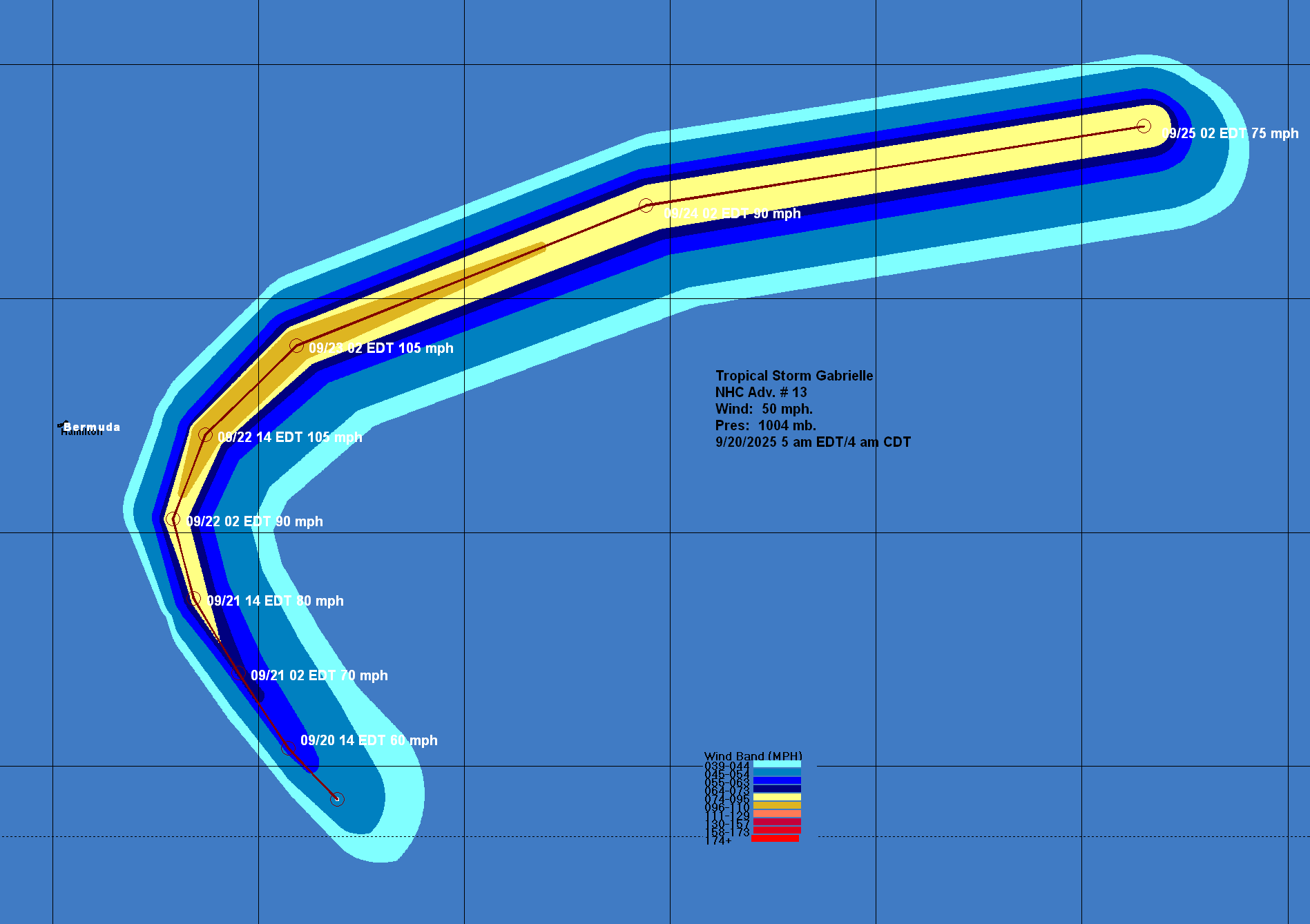
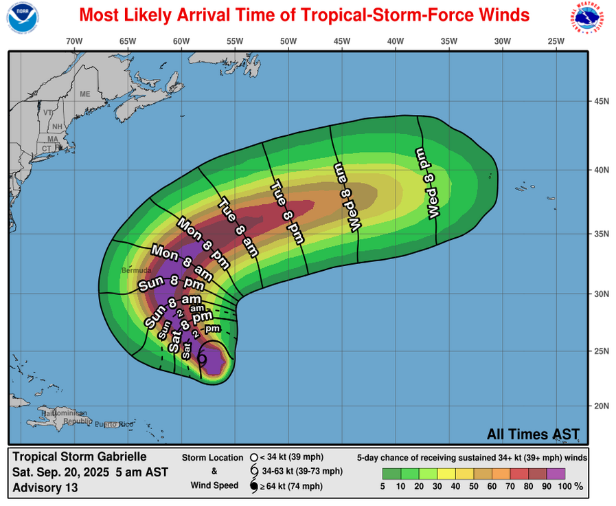
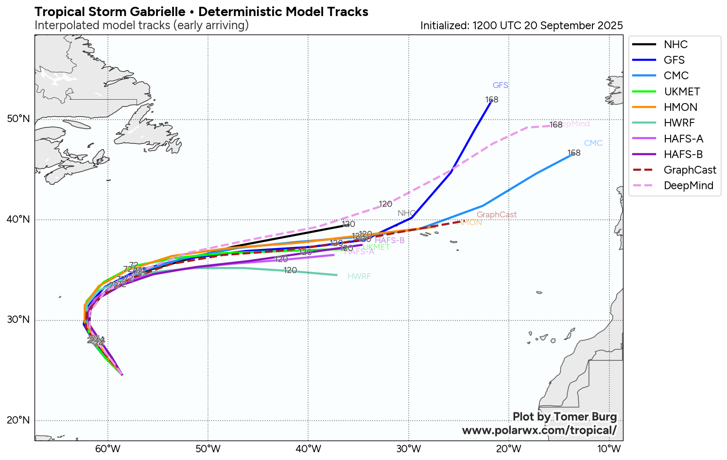
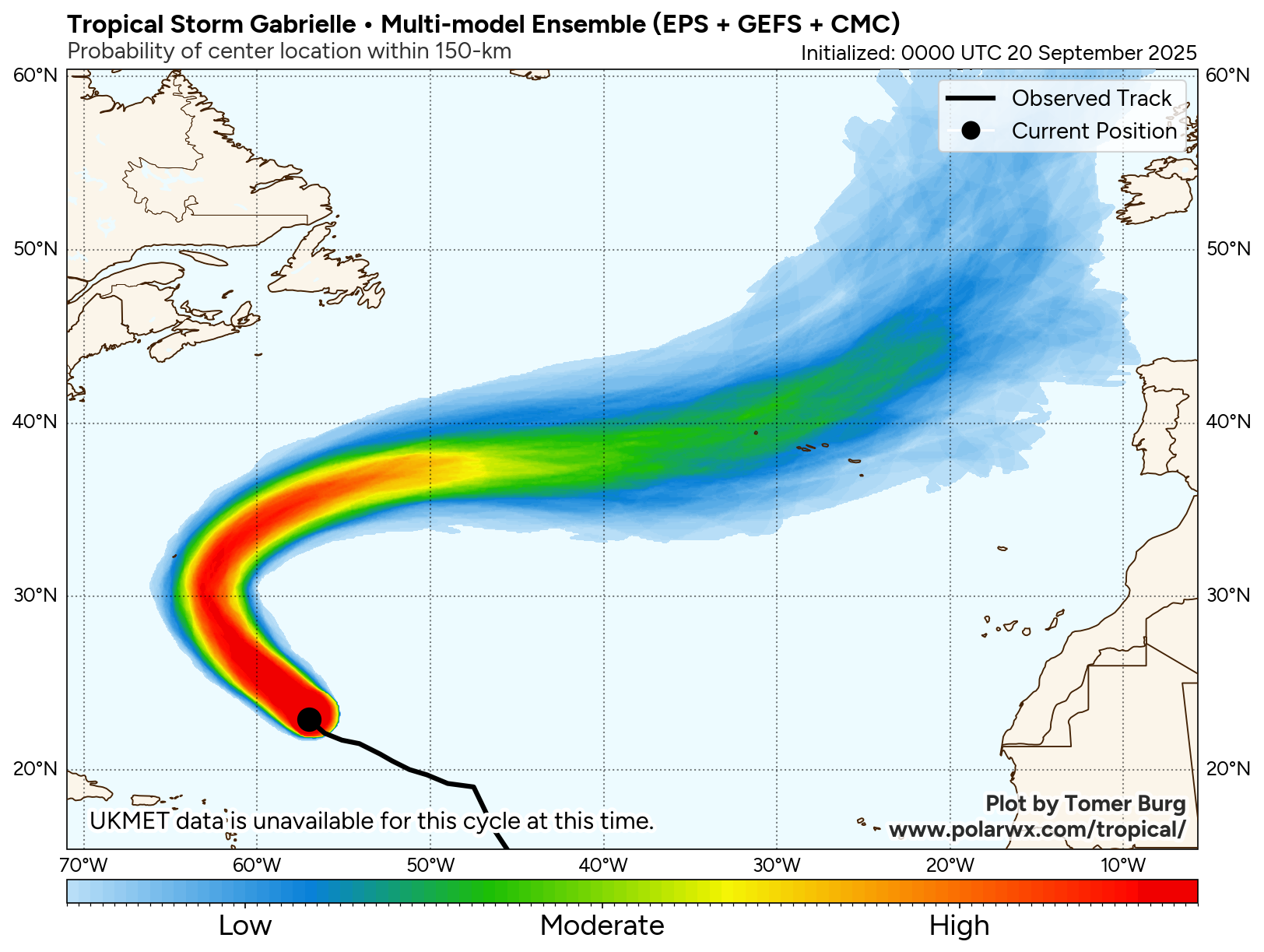
Gabrielle is heading in a northwesterly direction today and this northwesterly movement is expected to continue throughout this weekend. By Monday, it is expected that Gabrielle will turn to the north and northeast and pass well east of Bermuda during the day on Monday. From there, Gabrielle will likely head out into the open Atlantic and not be a threat to anyone.
As I already mentioned, the wind shear values over Gabrielle will likely decrease over the next couple of days and this should allow the storm to undergo some quick strengthening as we get into early next week. This means that Gabrielle will likely become a hurricane as soon as late Sunday and may end up peaking at around Category 2 strength during Monday and Tuesday, just as it’s passing to the east of Bermuda.
Not only does it look likely that Gabrielle will not be a threat to the Bahamas or the United States, but it also looks likely now that Gabrielle will pose no significant threat to Bermuda. That said, Gabrielle may still produce some rough surf and rip currents to Bermuda during the early part of next week.
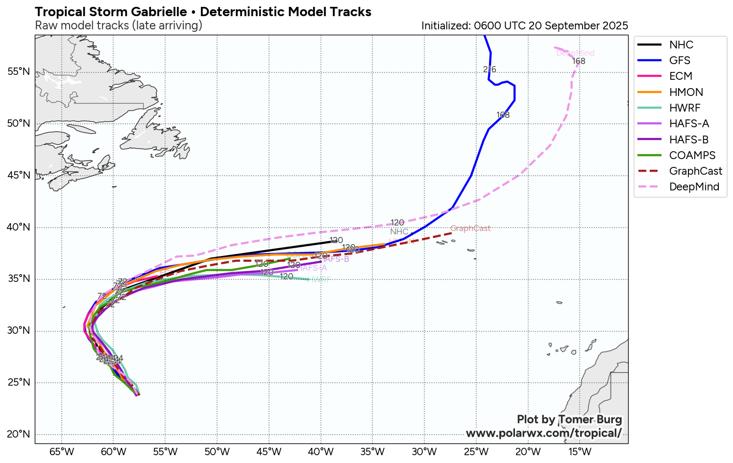
Model Track Forecast:
Satellite Imagery:
Finally – Quiet conditions are expected throughout the rest of this weekend across the rest of the Atlantic, Caribbean and Gulf. There are no other areas to be concerned about in terms of development.
I’m still keeping a close eye on the area from the western Caribbean to the Bay of Campeche and the southern Gulf for later this month. At this point though, there are no changes at all to what I wrote in yesterday’s update. Those thoughts were that I do think that the area from the western Caribbean through the Bay of Campeche and the southern Gulf will definitely need to be watched closely for possible tropical development during the week of September 29. Nothing concrete or likely at this time, but it is something to keep an eye on.
The next tropical weather discussion will be issued on Monday.