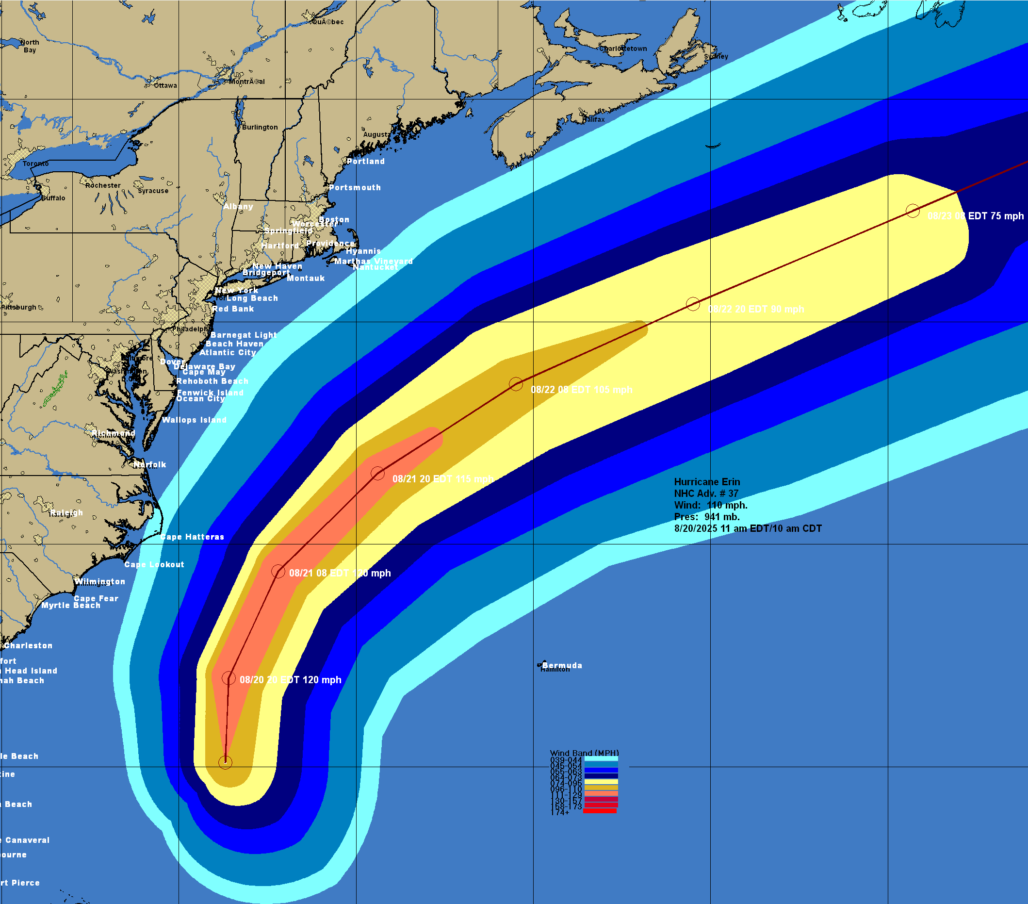
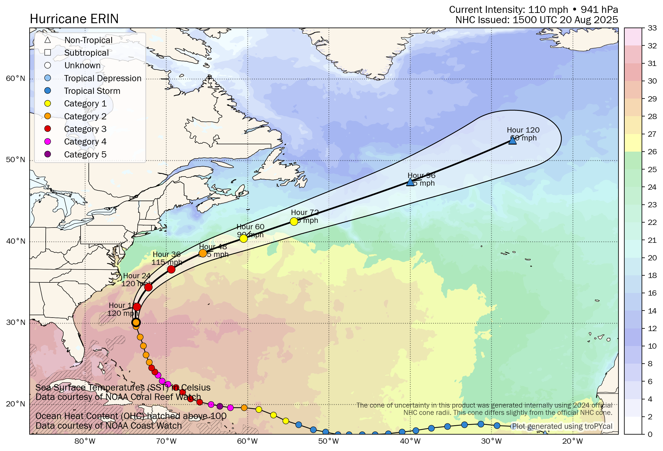
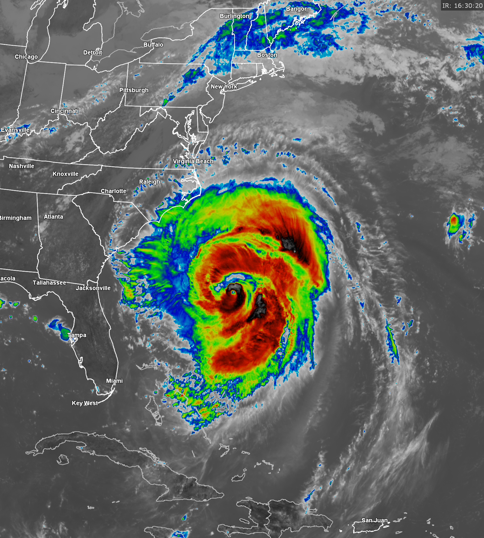
Hurricane Erin: Reports from reconnaissance aircraft and satellite imagery reveals that Erin is once again strengthening today. Erin, at the time of this writing, has maximum winds of around 110 mph with a central barometric pressure of 942 millibars.
A look at satellite imagery reveals that the hurricane has become much better organized as compared to what it looked like at this time yesterday. Also, it appears that an eye has once again appeared.
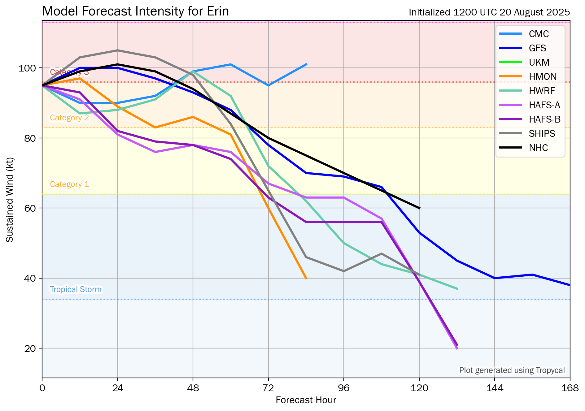
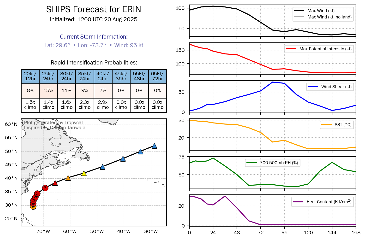
I do think that we will see Erin strengthen some more this afternoon and tonight and very likely will become a Category 3 hurricane. Very strong wind shear and cooler waters by the end of this week will cause Erin to transform into a large non-tropical storm that will head out into the open Atlantic.
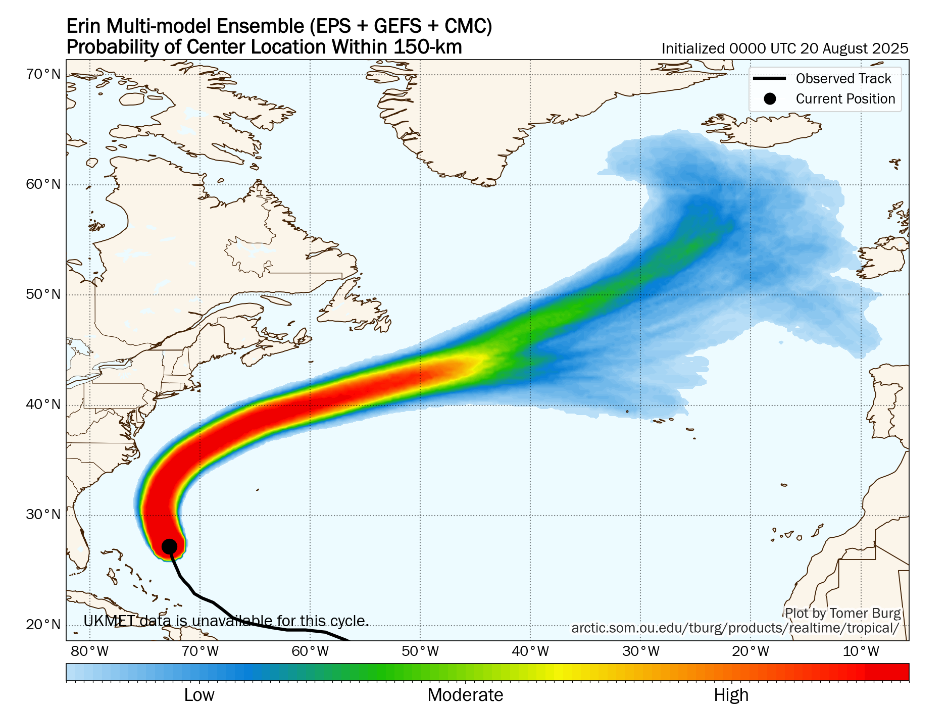
Erin’s is now moving on a northerly direction right along the 73.5 West Longitude line and this is very likely as far west as it will get. Erin should continue on its northerly track throughout the rest of today into tonight and will begin to turn to the northeast as we get into Thursday. An accelerated motion to the northeast and east-northeast into the open Atlantic is then expected from Friday through this weekend.
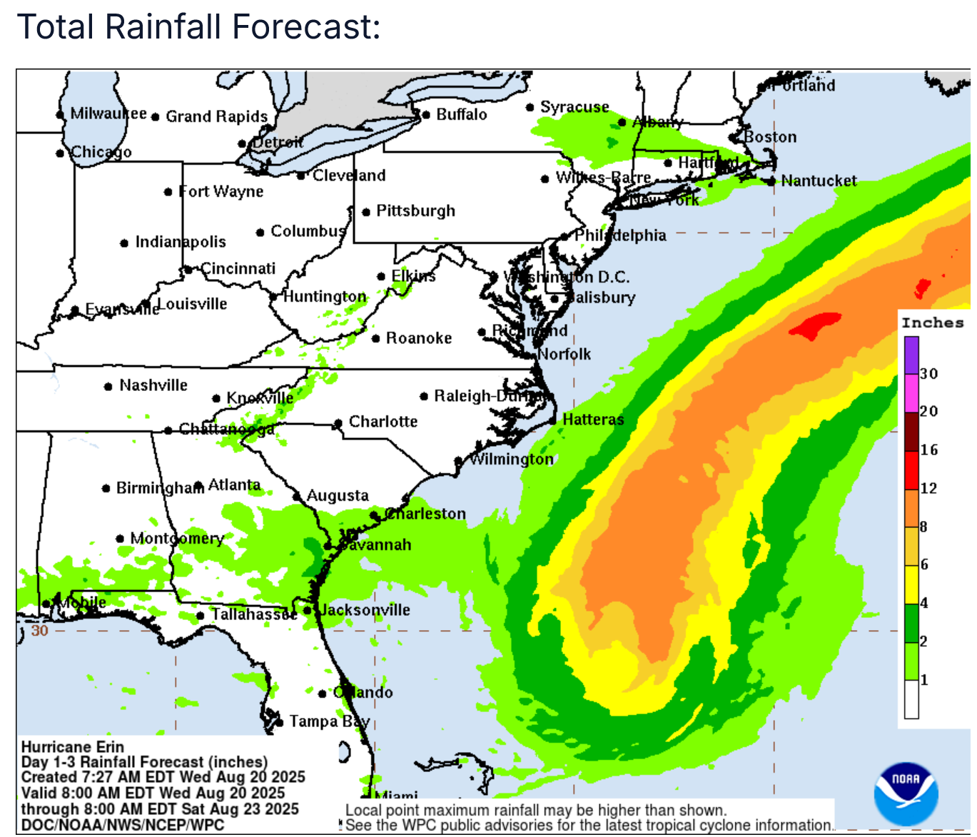
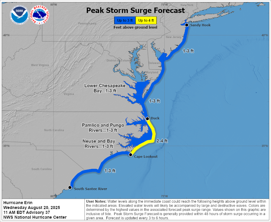
For The North Carolina Outer Banks: Storm surge flooding is expected across the Outer Banks through Thursday with around 2 to 4 feet of surge forecast. This surge will lead to numerous roads on the Outer Banks to be impassable. Significant beach erosion is also expected all across the Outer Banks.
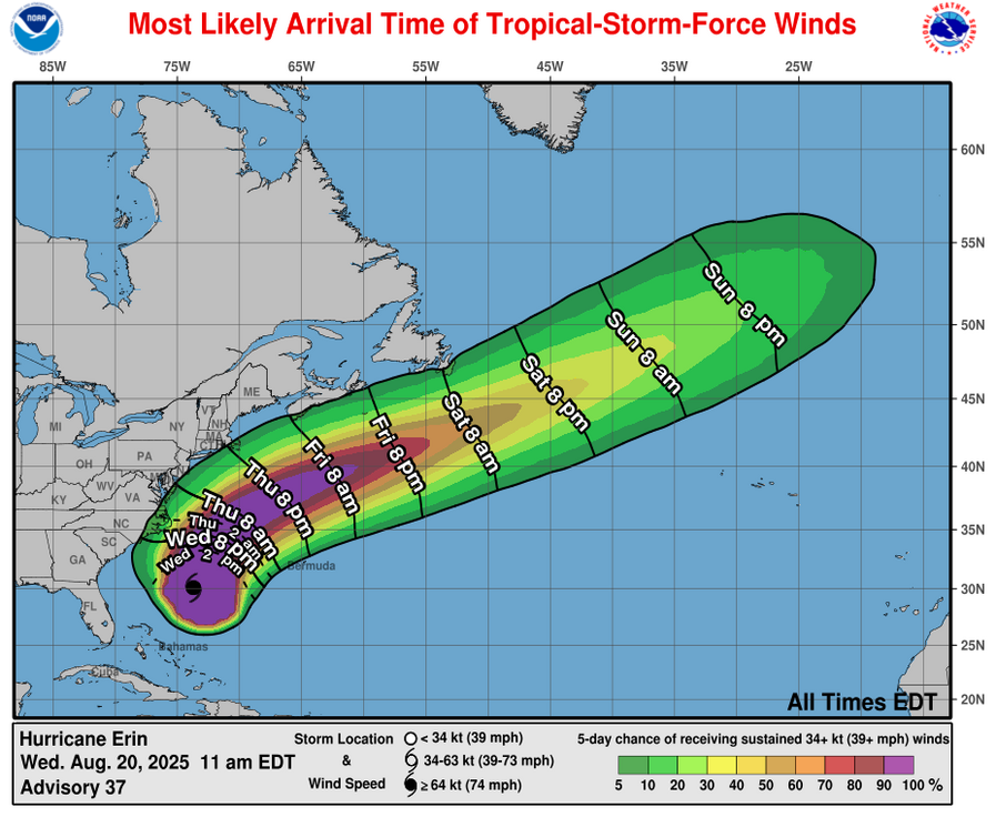
In addition to this, tropical storm conditions with wind gusts of up to 50 mph are expected across the Outer Banks from late today through tonight and into Thursday.
For The Virginia Coast: Storm surge flooding and tropical storm conditions are also expected along coastal Virginia during the day on Thursday.
A surge of 1 to 3 feet looks likely across coastal Virginia mostly during the day on Thursday. This will lead to significant beach erosion and moderate to even major coastal flooding in some areas.
Additionally, wind gusts of up to tropical storm force are expected on Thursday. Wind gusts look to be in the 40-45 mph range.
Forecast Impacts:
Wind:
Rainfall:
Storm Surge:
For The Rest Of The East Coast Of The United States: A very serious threat of very large waves, extremely rough surf, extremely dangerous rip currents and the threat for some coastal flooding exists throughout the rest of this week along the rest of the East Coast.
The worst days look to be today and Thursday along the Southeast and Mid-Atlantic coasts and the worst days along the Northeastern coast of the United States looks to be tonight, Thursday, Friday and even Saturday.
I cannot emphasize enough that the extremely rough surf and extremely dangerous rip current threat is going to make it deadly to go swimming & you may lose your life doing so.
Finally, it still looks fairly likely that Erin will pass far enough offshore of Cape Cod and Nantucket to not bring tropical storm conditions. That said, wind gusts of up to 40 mph are possible on Cape Cod and Nantucket on Thursday night into Friday.
For Bermuda: It continues to look very likely that Erin will pass far enough west of Bermuda to not be a direct impact. The very large size of Erin could lead to some of the outer bands of rain to affect the island through Thursday.
For Atlantic Canada: Erin is very likely to pass well south of Nova Scotia and Newfoundland to not be a threat in terms of wind or rain. The main threat from Erin for Atlantic Canada looks to be very large waves, rough surf and rip currents late this week through this weekend.
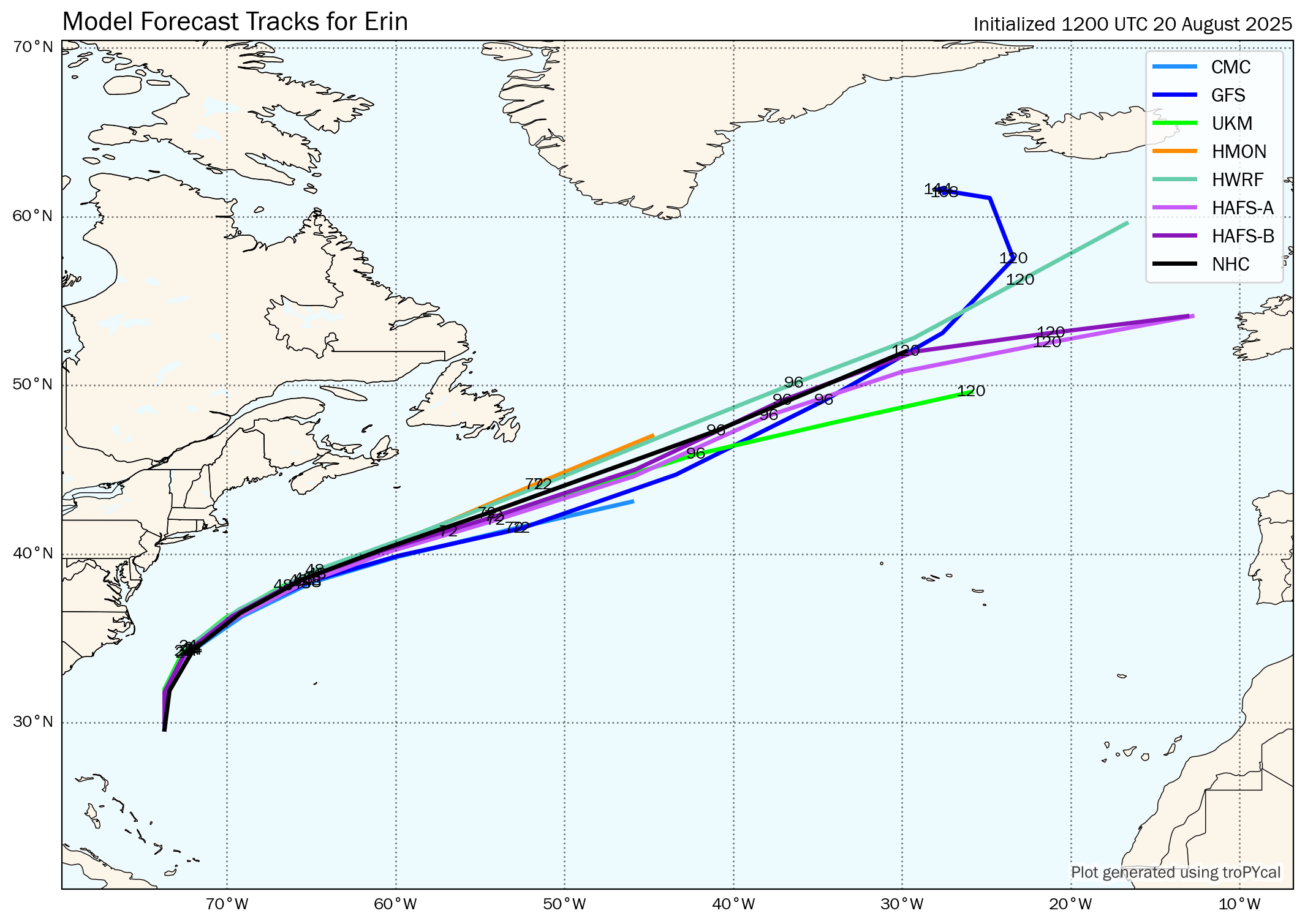
Model Track Forecast:
Satellite Imagery:
Area Of Disturbed Weather Located Over The Central Tropical Atlantic: A tropical wave now located over the central Tropical Atlantic near about 50 West Longitude. The convection with this wave has seemingly perked up some today and this is something that’ll need to be watched as it approaches the Leeward Islands on Thursday night and Friday.
The environmental conditions around this wave are actually kind of favorable for development, although very strong wind shear lurks just to the west of the wave.
Latest model guidance are pointing towards this wave to turn much more to the northwest as we get into Thursday and a majority of the ensemble guidance from the GFS and European models forecast this wave missing a majority of the Lesser Antilles. A few of the ensemble members do show a very close brush with the far northern Leeward Islands on Friday.
My take on this wave is that while it may brush by the northern Leeward Islands, it probably will not develop very much, if at all. I think that what might happen is that as soon as it tries to develop, it’ll be impacted by the stronger wind shear located very nearby leading to an end to any development.
In any case, some squally weather is possible across the northern Leeward Islands starting on Thursday afternoon and continuing through Thursday night and Friday.
Beyond this, it is expected that this disturbed weather will head out into the open Atlantic. That said, some impacts in terms of squally weather is possible early next week on the island of Bermuda.
Invest 99-L Located Over The Eastern Tropical Atlantic: Finally, I’m also keeping an eye on Invest 99-L, which is a tropical wave located over the eastern Tropical Atlantic near about 30 West Longitude.
Satellite imagery today reveals that this wave is producing a concentrated area of convection that has persisted since yesterday.
While the environmental conditions are currently favorable for development and it’s possible that it could undergo some short-lived development into a tropical system, the conditions ahead of this wave are unfavorable for additional development.
This wave will likely head westward over the next several days and probably will eventually make it into the Caribbean in several days from now, there are no indications in the data that says it’ll develop there.
None of the latest model guidance show any sort of development from Invest 99-L. That being said, I am going to be keeping an eye on it anyways, just in case.
The next tropical weather discussion will be issued on Thursday.