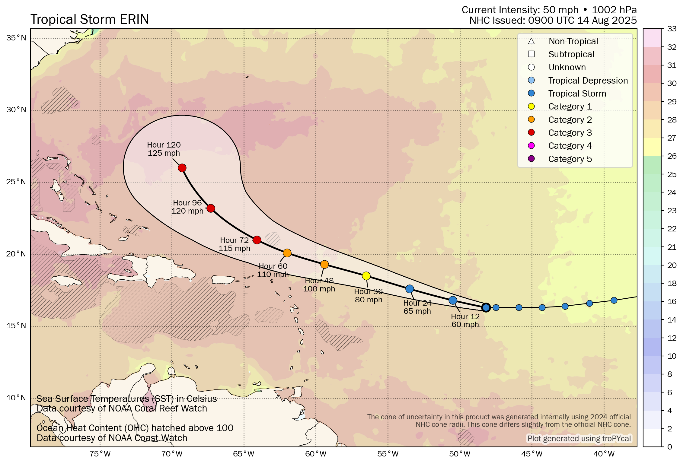
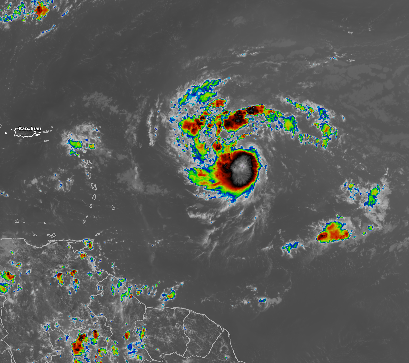
Tropical Storm Erin: Analysis of satellite imagery and other weather data reveals that Erin has become better organized so far today with deep convection firing near the center of the storm. In addition, some banding features have been noted on satellite imagery, which all seem to suggest that the storm is strengthening.
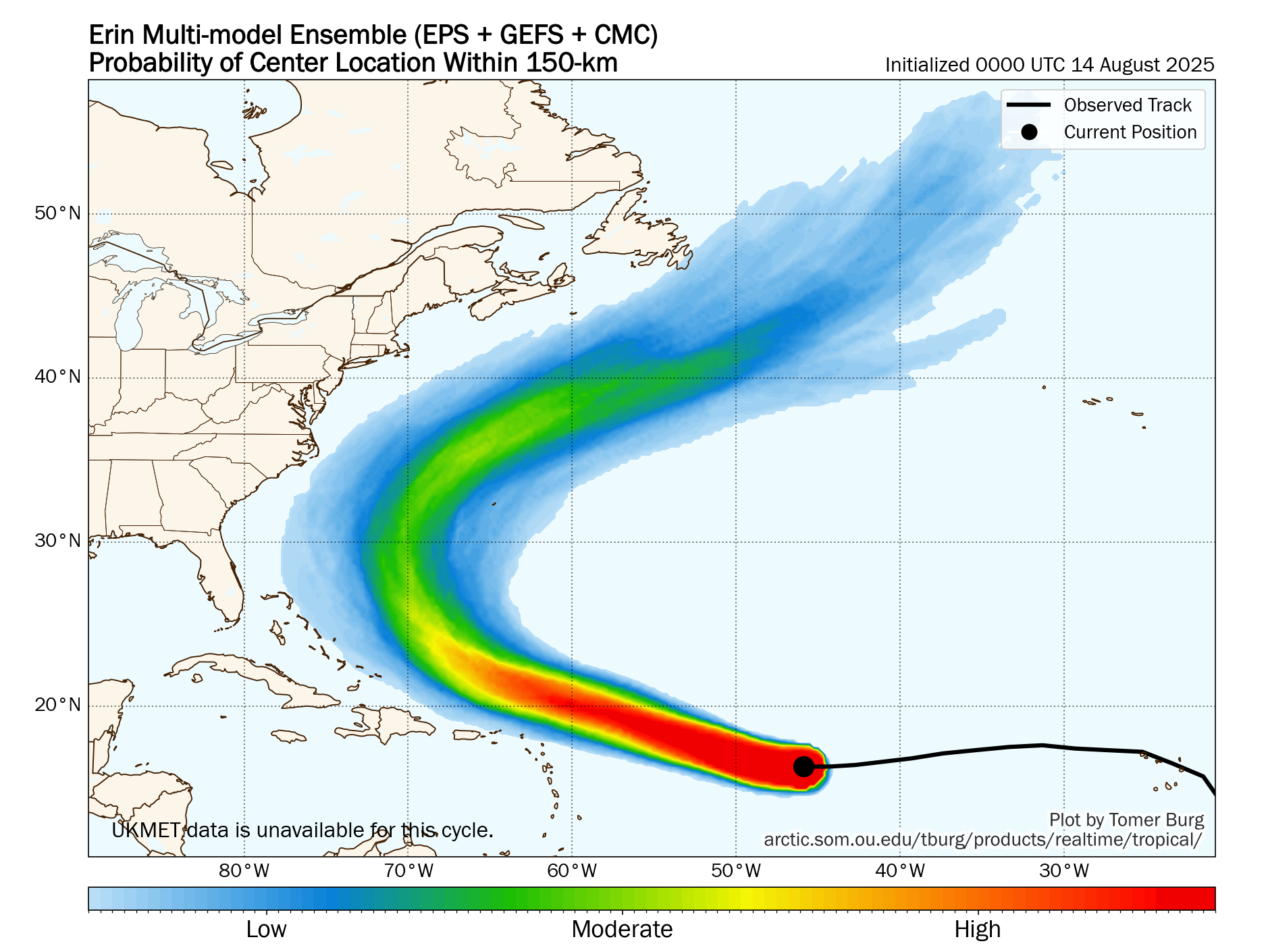
Erin is currently headed nearly due west as it’s being steered by a high pressure ridge to the north of the storm. This westward track is causing Erin to track south of what most model guidance have been suggesting over the last couple of days & because of this, we are going to really have to watch how close it gets to the northeastern Caribbean on Saturday.
For now, it still seems most plausible that Erin should turn just far enough to the west-northwest and then northwest to miss the northern Leeward Islands, the Virgin Islands and Puerto, but I do think that the distance it passes to the northeastern Caribbean could be closer than what was previously thought.
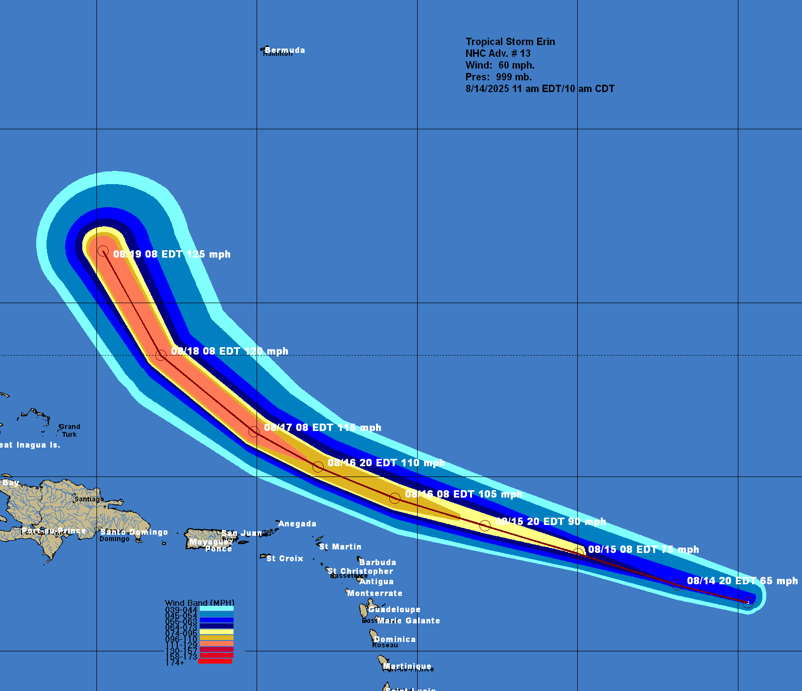
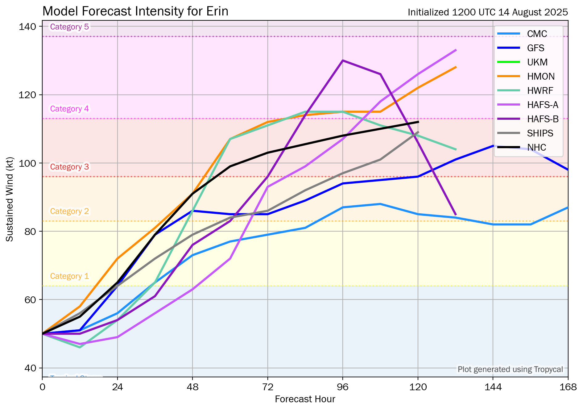
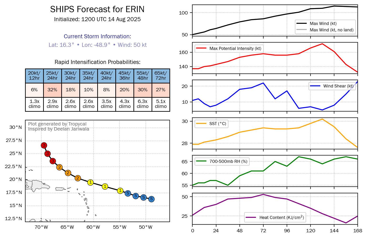
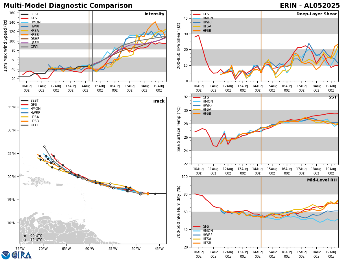
Additionally, Erin is expected to be moving through an environment that’s favorable for strengthening & all indications are pointing towards it becoming a hurricane by sometime on Friday. Steady strengthening is then expected this weekend as Erin passes north of the Leeward Islands, even though the environmental conditions look to be somewhat favorable. It’s possible that Erin will become a major hurricane by later Sunday or Monday.
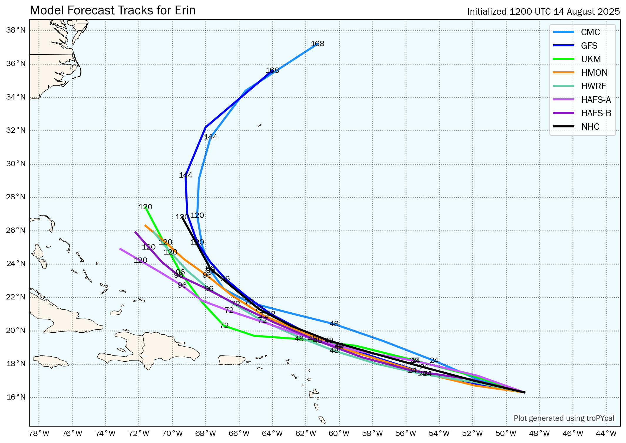
Model Guidance: The trends in the model guidance are not our friend today as many of them have shifted closer to the northeastern Caribbean, the Bahamas and the East Coast of the United States. These trends are going to have to be watched closely to see if these westward shifts in the forecast track continue.
Even though a majority of the track model guidance have shifted westward in their forecast track of Erin since yesterday, the overall forecast track consensus is for the storm to still track north of the Leeward Islands, the Virgin Islands and Puerto Rico this weekend. That said, this pass to the north of the northeastern Caribbean could be quite close with most guidance showing the center of Erin passing between 75 and 125 miles to the north of the northeastern Caribbean.
These westward shifts in the track guidance have Erin passing closer to the Bahamas and the East Coast of the United States, as compared to what the guidance showed yesterday.
The reason for the shifts westward in the model guidance is due to the models trending towards a stronger high pressure ridge that narrows the weakness in the guidance. This delays Erin’s turn to the north. Still though, guidance seems to be in good agreement in forecasting that there will be a weakness in the high pressure ridge, which will allow Erin to turn to the north in the area about halfway between the East Coast of the United States and Bermuda (latest consensus guidance shows the northward turning occurring around 70-71 West Longitude).
It goes without saying that these trends in the model guidance will need to be watched closely for any additional shifts towards a more threatening look.
Here Are My Thoughts: I do still think that Erin will pass just north of the Leeward Islands, the Virgin Islands and Puerto Rico during Saturday, but this pass to the north looks quite close & the progress of Erin needs to be watched very closely.
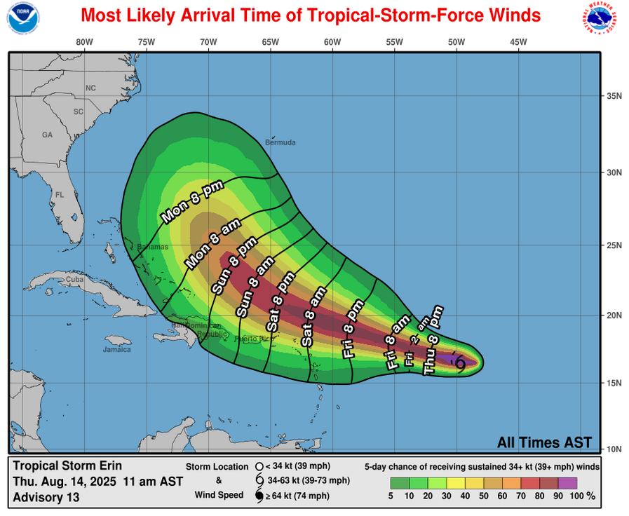
Even though the core of the storm should stay north of the northeastern Caribbean, squalls of rain and gusty winds on the south side of the storm will affect the northern Leeward Islands, the Virgin Islands and Puerto Rico beginning on Friday night and continuing through this weekend. Localized flash flooding looks quite possible across the northeastern Caribbean this weekend.
Those of you in the Leeward Islands, especially the northern Leeward Islands, the Virgin Islands and Puerto Rico should keep a close eye on the progress of Erin, in case the track of the storm shifts closer to the northeastern Caribbean.
As for the Bahamas and the East Coast of the United States – I still think that a direct impact from Erin is unlikely as the weakness in the high pressure ridge should be just enough to turn it northward. That being said, there is a small chance, probably around 10 percent or so, that Erin could track far enough west to directly impact the Bahamas and the US East Coast.
Even though in all likelihood Erin will not directly impact the Bahamas and the East Coast of the United States, it will definitely produce very high surf, dangerous waves and rip currents up and down the US East Coast throughout next week.
Those of you on the island of Bermuda definitely still needs to closely watch the progress of Erin as it could certainly pose a threat to you around the middle part of next week.
Model Track Forecast:
Satellite Imagery:
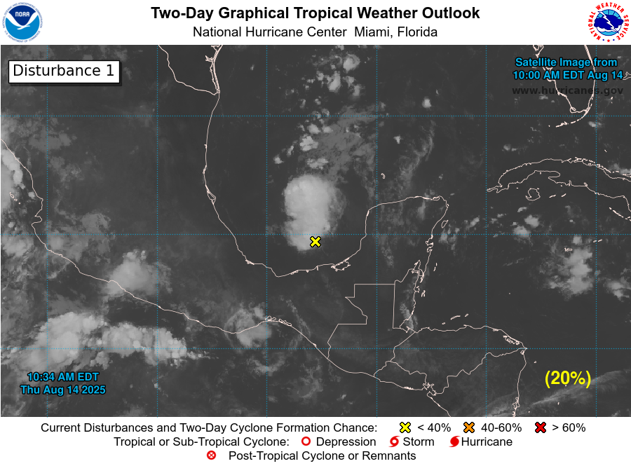
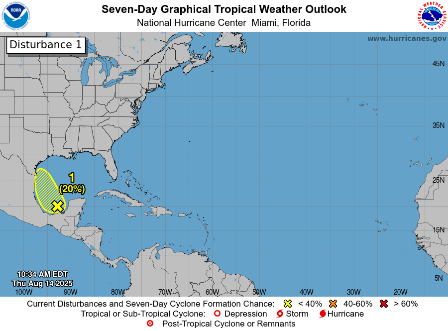
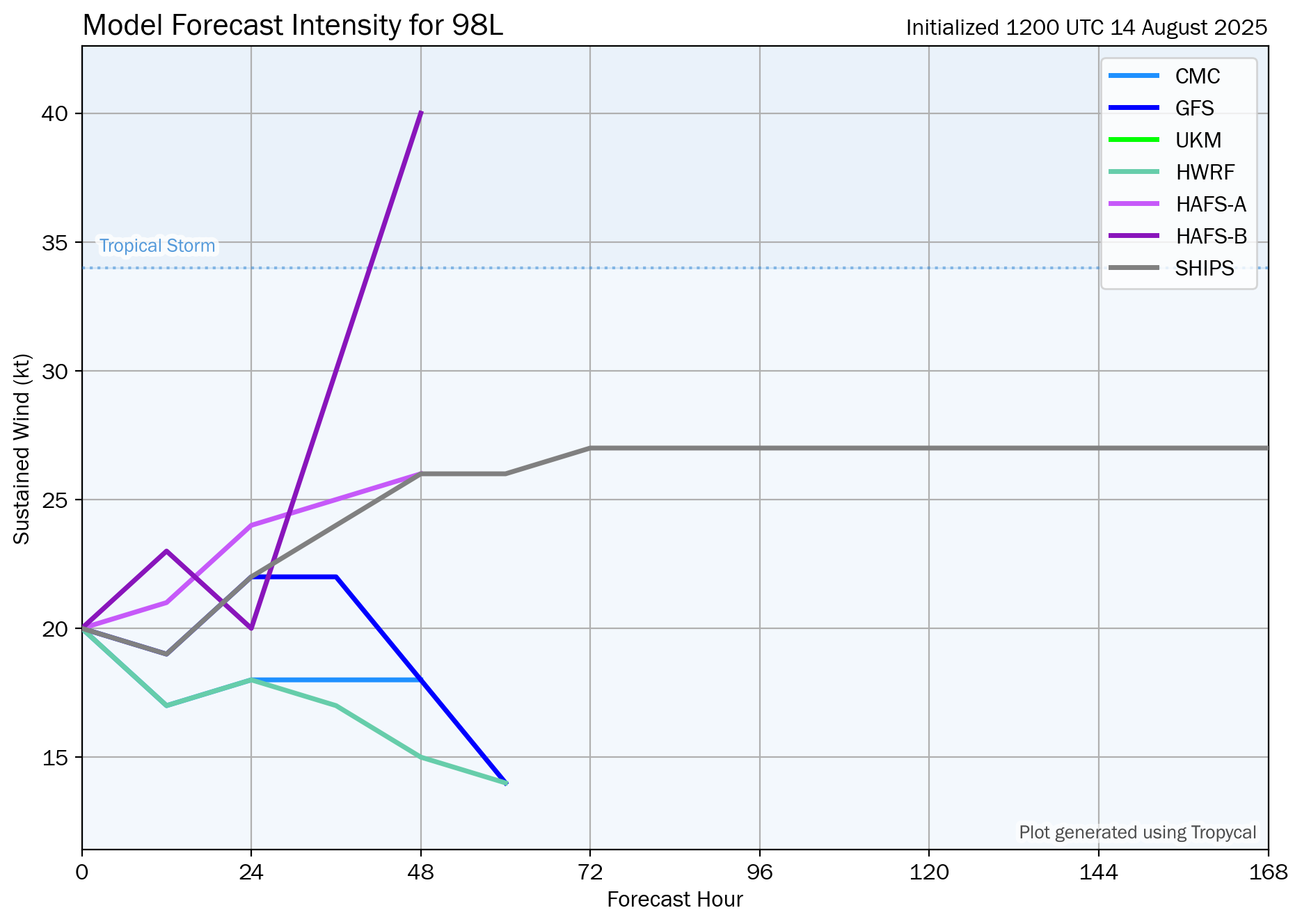
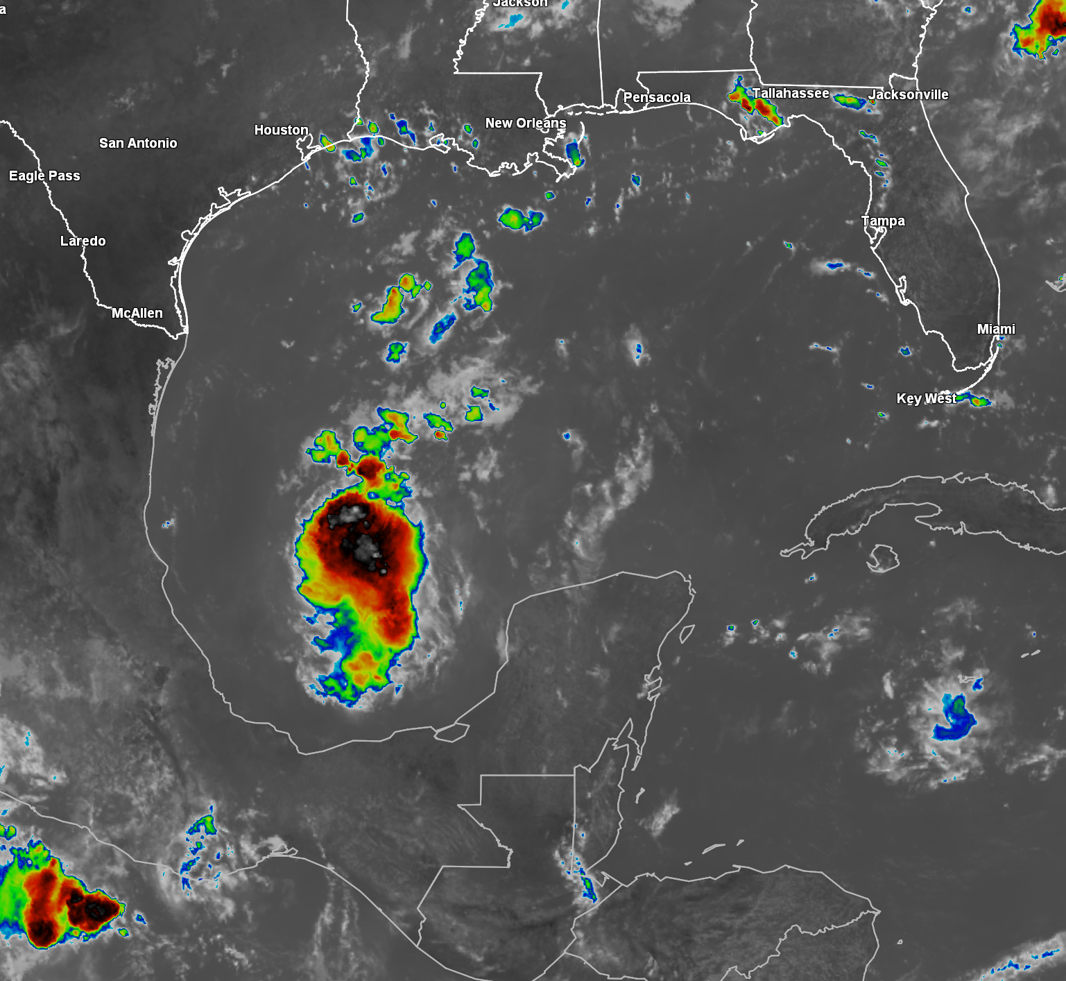
Invest 98-L Located Over The Bay Of Campeche: I’m also keeping a very close eye on Invest 98-L, which is located in the Bay of Campeche today.
Satellite imagery indicates that there is deep, but disorganized convection occurring with this system. Additionally, there seems to be some spin noted in satellite loops.
The Bay of Campeche and the southwestern and western Gulf is an area that can overproduce in terms of tropical development. The shape of the coastline in this area can increase the spin of any disturbances moving through the area causing them to quickly develop into a tropical system.
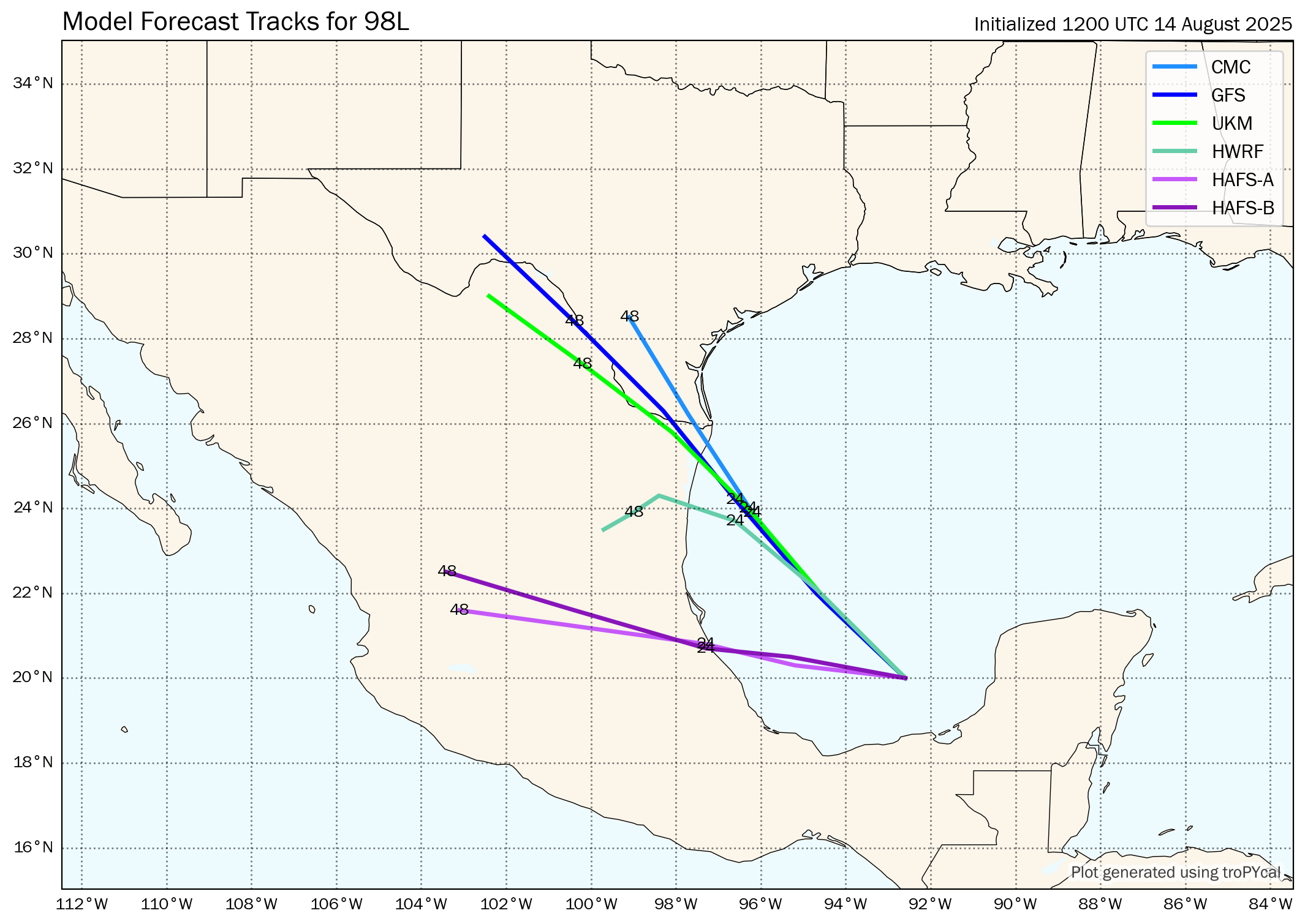
What is concerning is that the environmental conditions are quite favorable for development due to low amounts of wind shear. Fortunately though, Invest 98-L has a limited amount of time to be over water as it’ll be moving inland near the Texas-Mexico border by late Friday.
All-in-all, it would not surprise me at all to see Invest 98-L become a depression or even a low end tropical storm before it moves inland over northern Mexico and South Texas late Friday.
Even if Invest 98-L does not develop into a depression or a tropical storm, it will bring locally heavy rainfall across the lower Texas coast and the Lower Rio Grande Valley starting Friday afternoon and continuing through Saturday.
Model Track Forecast:
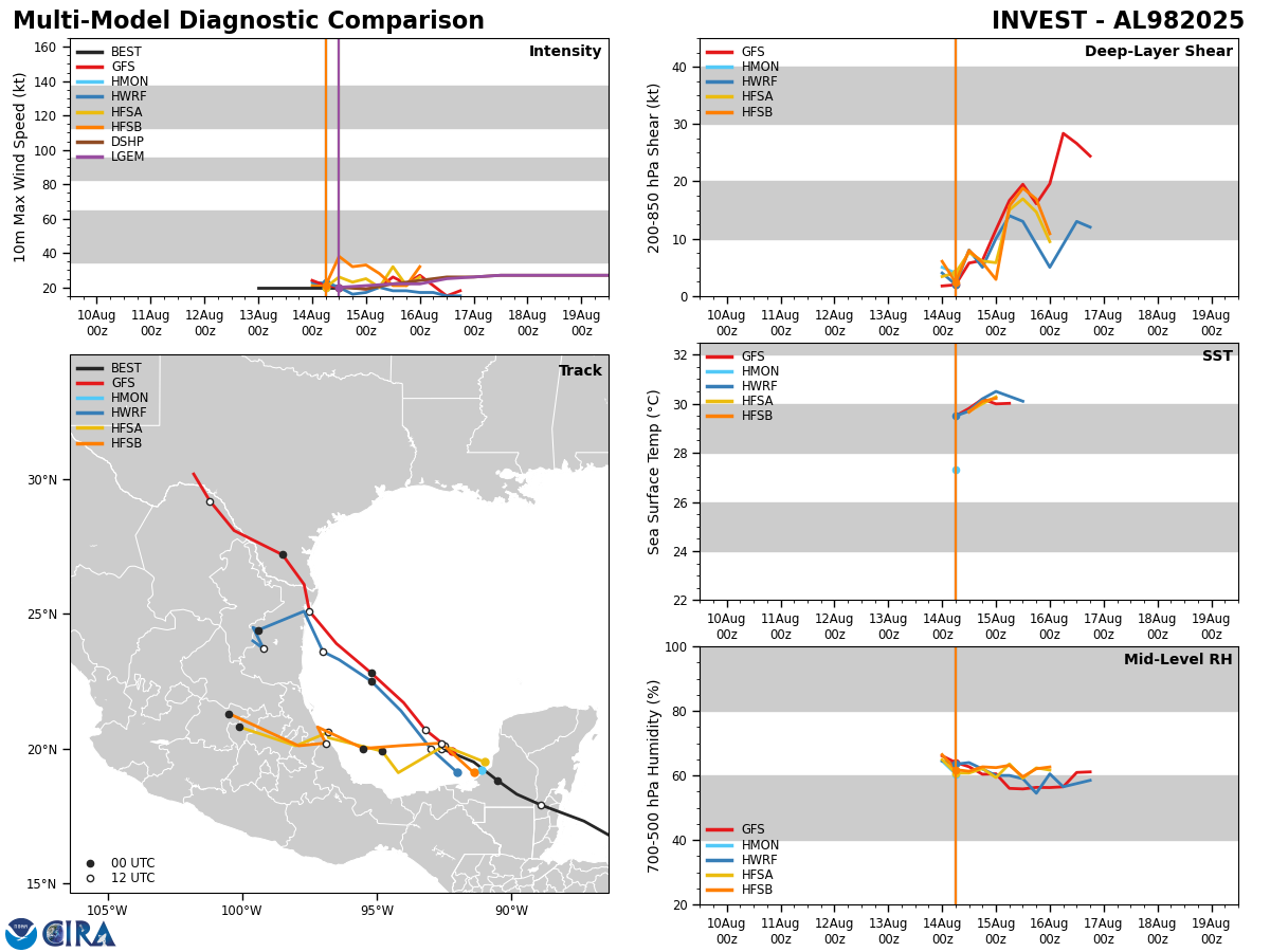
Satellite Imagery:
Also Watching A Couple Of Other Tropical Waves That’ll Be Pushing Into The Eastern Atlantic: There are a couple of other tropical waves that’ll be pushing off of the coast of Africa into the far eastern Atlantic over the next several days.
Some of the model guidance are showing that the more westward positioned tropical wave may try to develop into a tropical system as it heads westward into the central Atlantic by the middle part of next week. In fact, the ensemble model guidance seems to suggest this wave may take a more southerly track and be more of a threat to the eastern and northeastern Caribbean around late next week.
The additional waves pushing off of Africa will be watched closely as we get into next week. That said, I wouldn’t stress or worry about it right now.
The next tropical weather discussion will be issued on Friday.