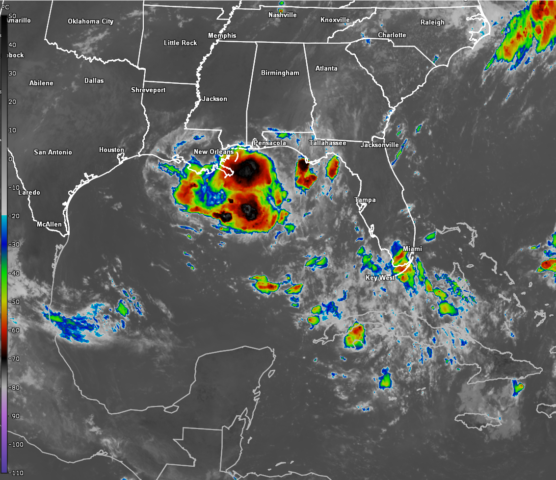
Invest 93-L Located Over The Florida Panhandle: Invest 93-L tracked much further north across the Florida Peninsula yesterday than what was anticipated. Because of this, Invest 93-L never emerged over the waters of the northeast Gulf and instead is now located just inland over the Florida Panhandle.
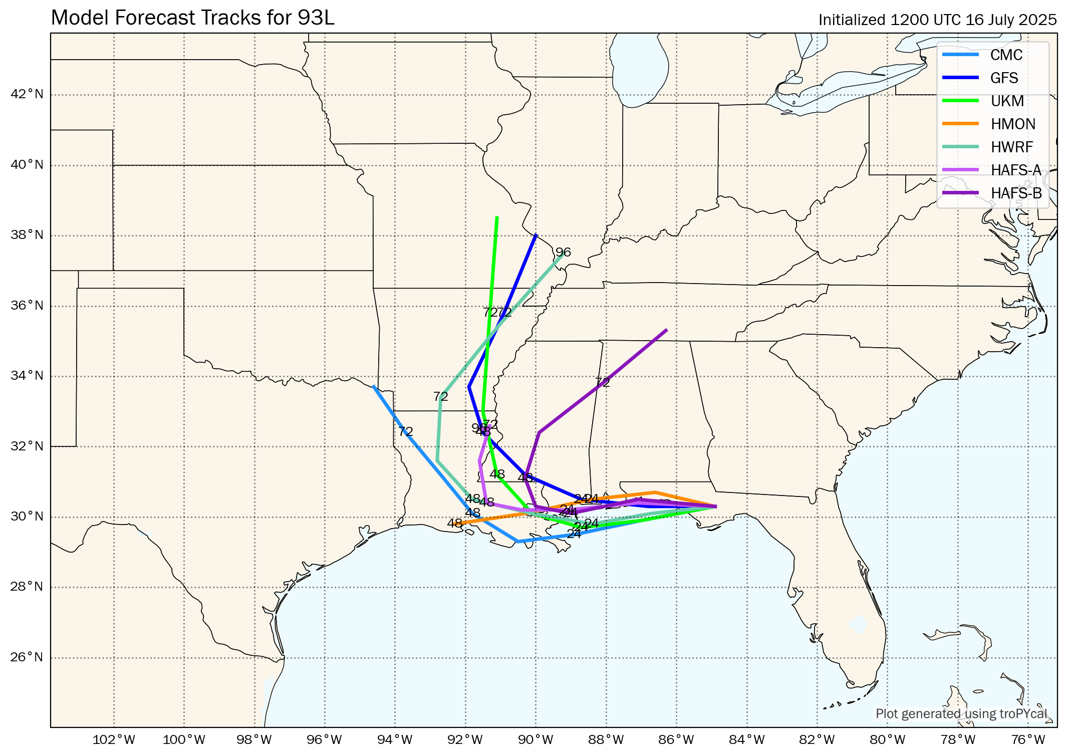
Current analysis seems to suggest the low pressure center associated with Invest 93-L is located very near Panama City with the whole system tracking to the west and perhaps even a little to the west-southwest. This means that the low pressure center associated with Invest 93-L looks to “splash-down” over the waters of the northern Gulf just south of Pensacola by later today. A track right over the extreme northern Gulf just offshore of southern Alabama and southern Mississippi looks to occur during tonight and Thursday.
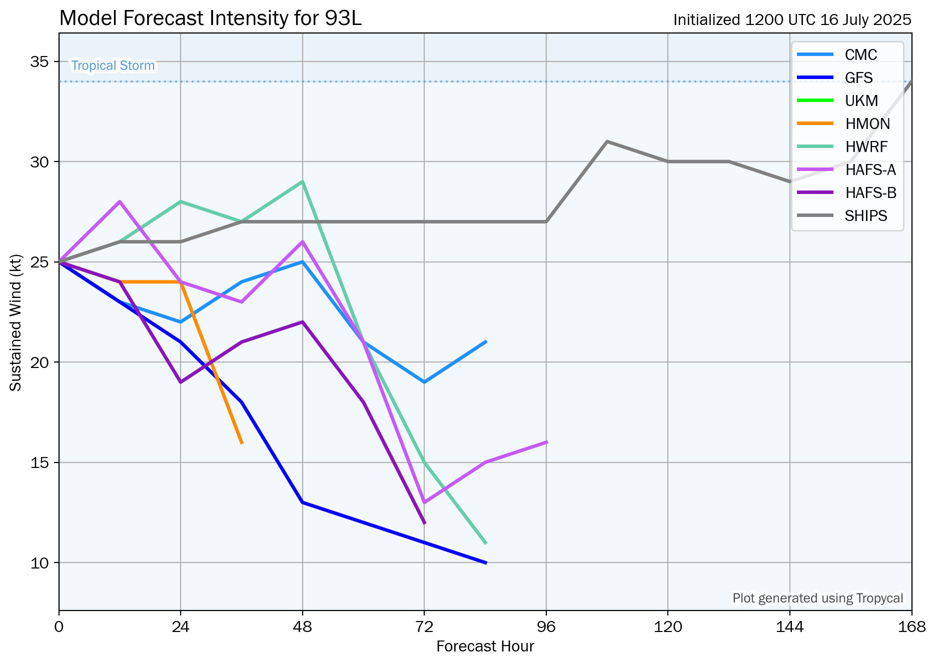
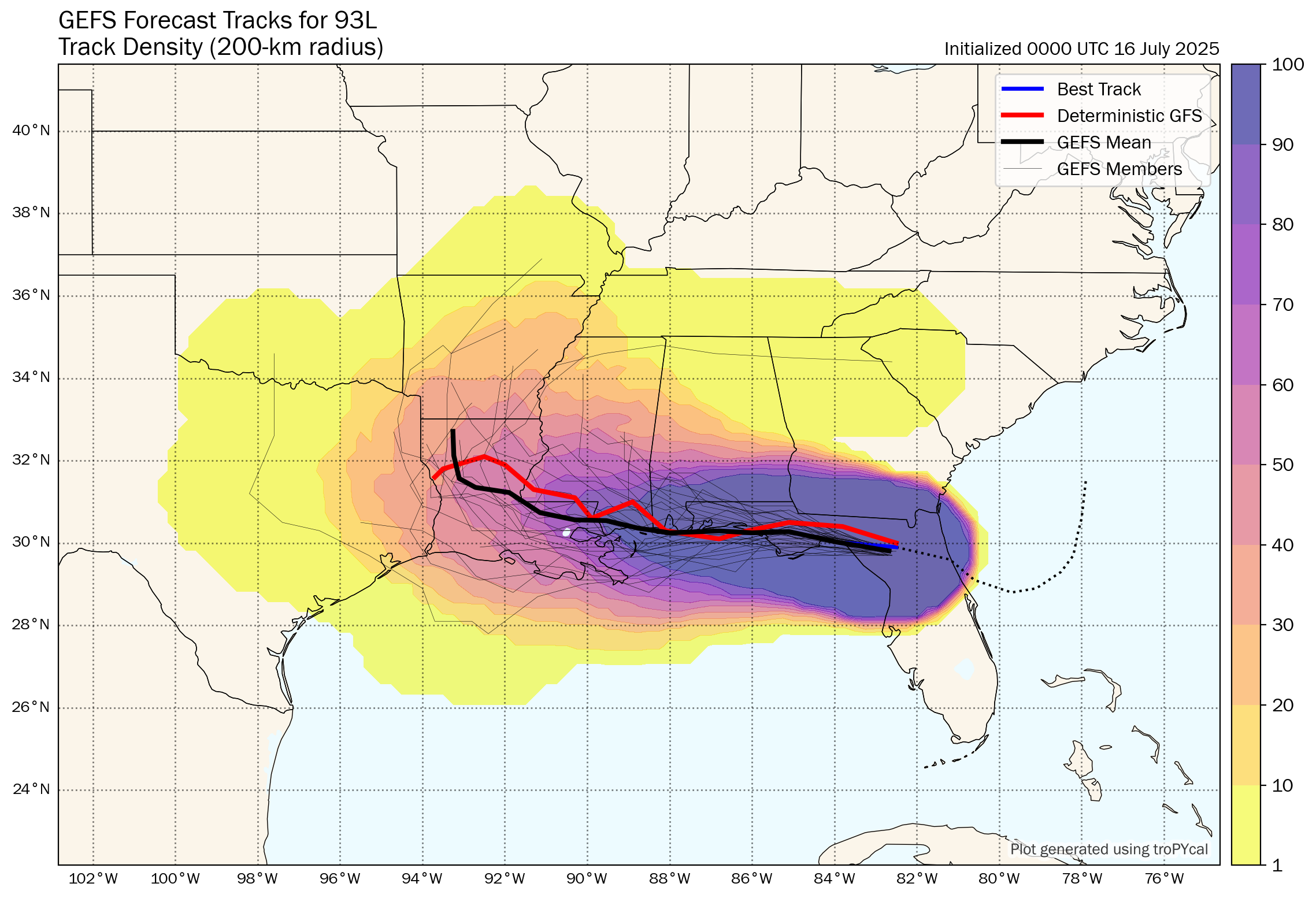
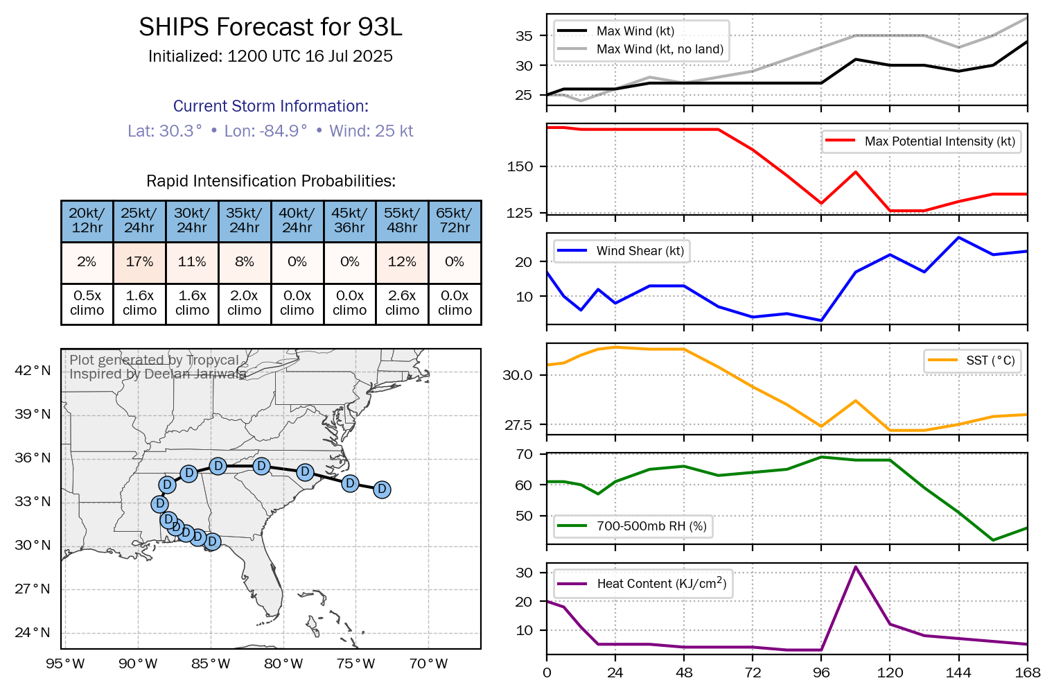
A majority of the track model guidance are forecasting that Invest 93-L will come ashore in southeastern Louisiana late Thursday as barely a tropical depression. That said, Invest 93-L has a very small window of time to consolidate and develop (around 24 hours, at the most) and because of this, I think the chances of this system becoming a depression have decreased significantly since yesterday.
Whether Invest 93-L becomes a depression or not, the main focus on this system is going to be heavy rainfall and the flooding potential across southern and southeastern Louisiana, southern Mississippi and southern Alabama.
Model Track Forecast:
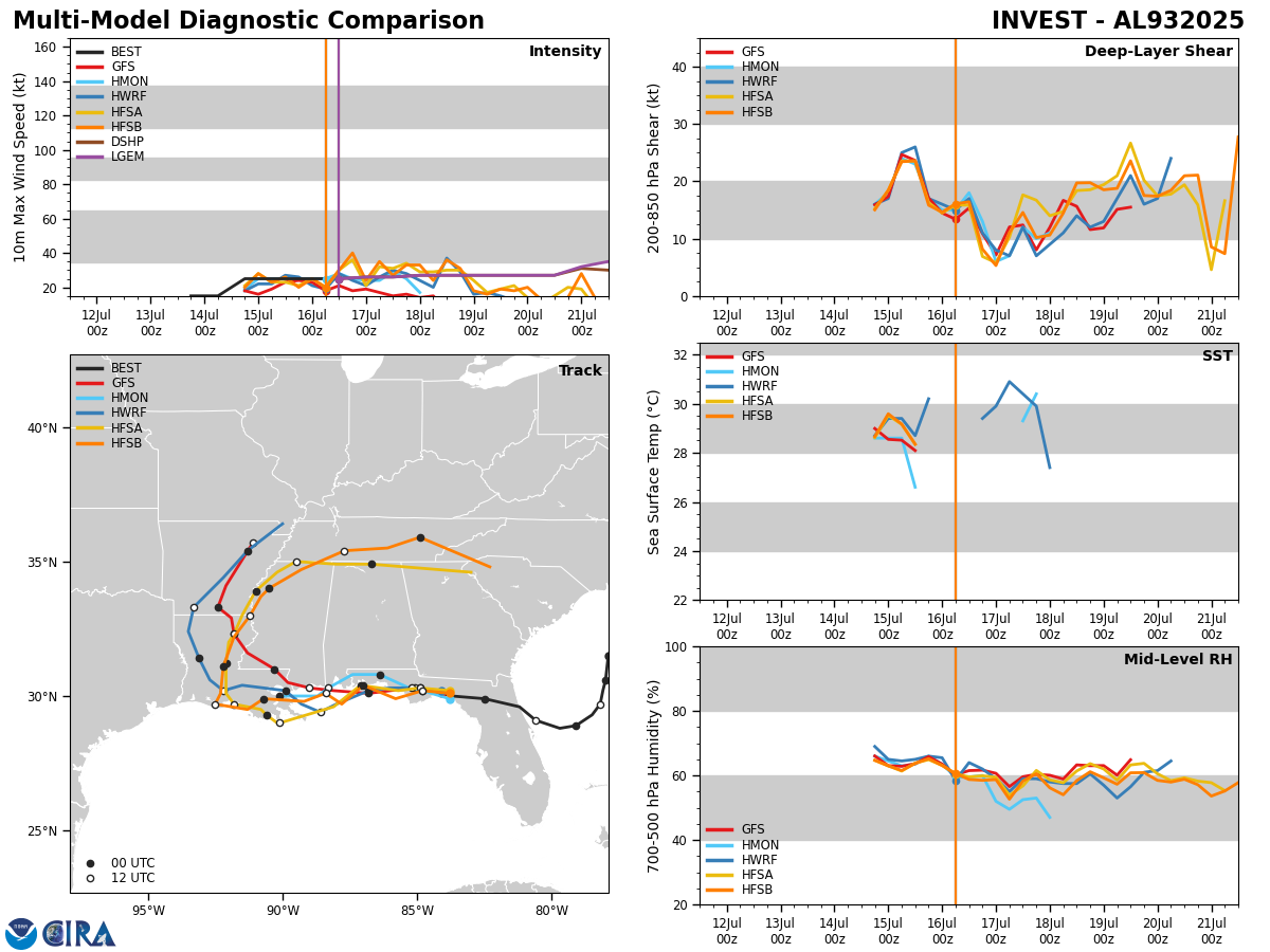
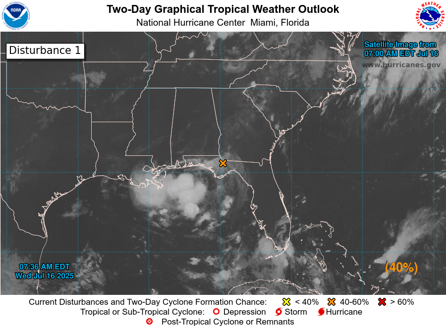
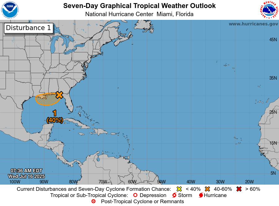
Satellite Imagery:
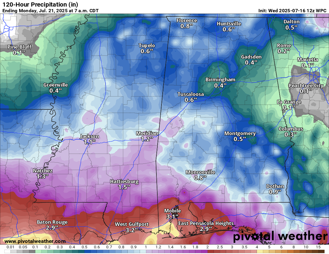
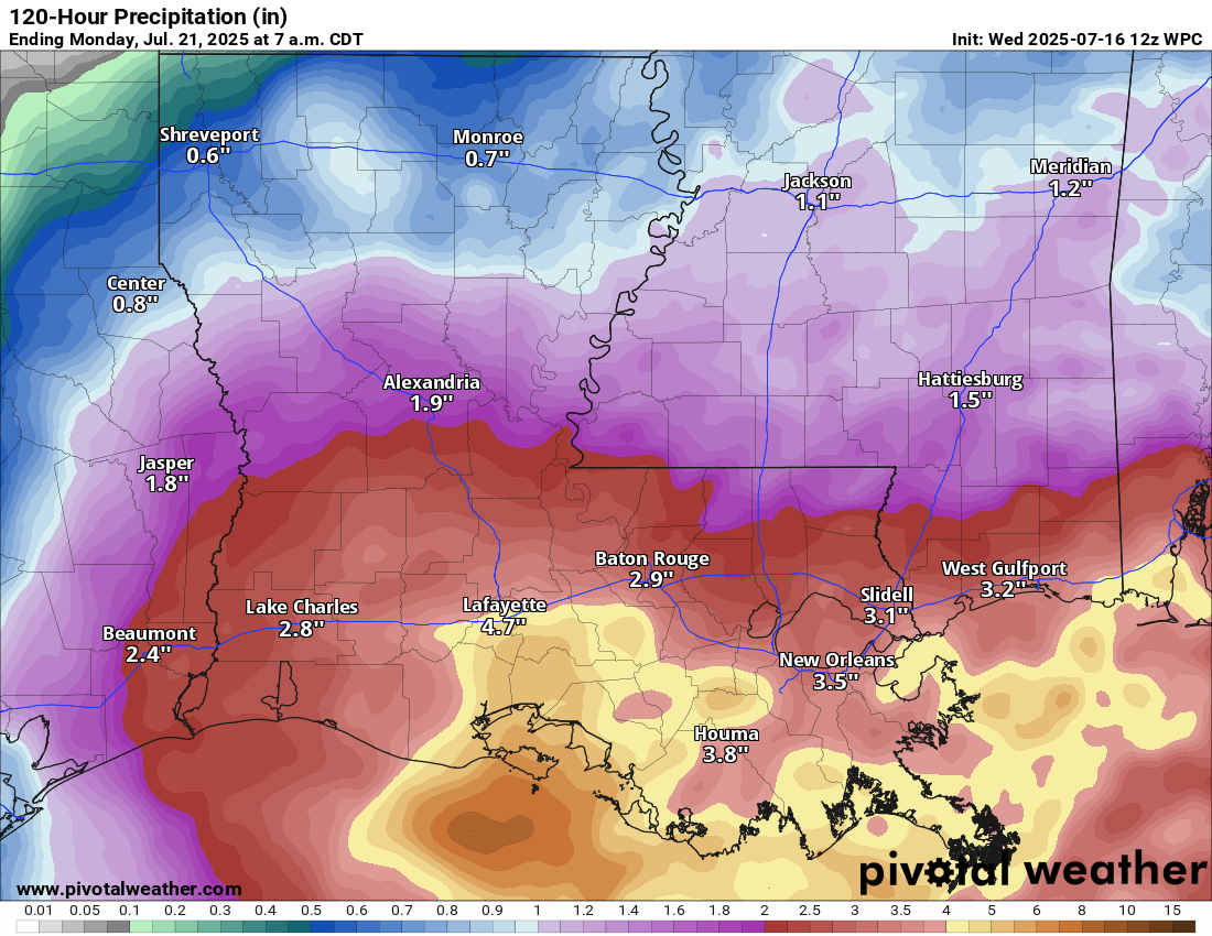
Rain With Flooding Is Likely Across Southern & Southeastern Louisiana, Southern Mississippi & Southern Alabama Over The Next Few Days: There is some good news in regards to the expected rainfall and flooding over the next few days and that is the amount of forecast rainfall looks a little less as compared to what was forecast yesterday.
It now appears that rainfall totals of 3 to 6 inches is expected across much of southern and southeastern Louisiana with 2 to 4 inches of total rainfall expected across southern Mississippi and southern Alabama over the next few days. Higher rainfall totals are a distinct possibility across south-central Louisiana and across the Mississippi Delta region.
While flooding still looks likely across southern and southeastern Louisiana, southern Mississippi and southern Alabama, especially during Thursday, Friday and Saturday, the threat for significant to major flooding looks lower as compared to yesterday.
Elsewhere Across The Atlantic, Caribbean & Gulf: There are no other areas of concern in terms of tropical development across the rest of the Atlantic Basin right now. In fact, no tropical development is expected throughout the rest of this week right through this weekend.
I did want to mention the tropical wave that is located over the far eastern Tropical Atlantic today. While satellite imagery does indicate that this wave is producing shower and thunderstorm activity, the environmental conditions to the west of this wave is unfavorable for development. Because of this, I do not expect to see any sort of development of this tropical wave as it heads westward over the next few days.
What this tropical wave might do is moisten up the environment for a couple of other tropical disturbances that are still located over west-central and central Africa. These disturbances are expected to push off of the west coast of Africa and into the far eastern Tropical Atlantic as we get into this weekend and early next week. It should be noted that the European ensemble model guidance is forecasting a 30 percent chance of development of one of the waves still over central Africa when it reaches the eastern Tropical Atlantic during the first half of next week. It then shows weakening of this disturbance by the time it approaches the islands of the eastern Caribbean late next week and next weekend.
So, the two disturbances might be something to keep an eye on next week as they head westward across the eastern and central Tropical Atlantic, but I’m not really worried about them becoming a real issue for the islands of the Caribbean or anywhere else.
The next tropical weather discussion will be issued on Thursday.