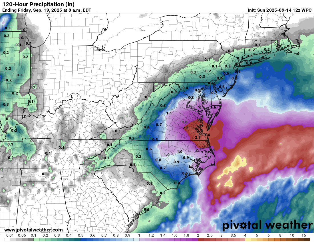
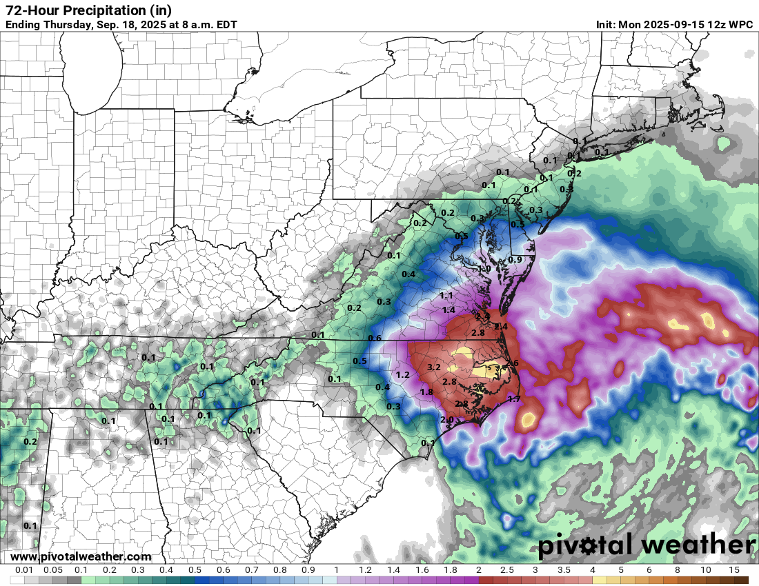
Coastal Storm Located Near The North Carolina Outer Banks: The latest weather analysis indicates that there is a coastal low pressure system that’s located about 100 miles to the southeast of the North Carolina Outer Banks.
This low pressure system is expected to slowly move in a northwesterly direction and move inland over eastern North Carolina by Tuesday.
It is then expected that this low pressure system will sit and spin in the area around eastern North Carolina and southeastern Virginia through Wednesday before it weakens and heads out into the open Atlantic.
There is likely to be a tight pressure gradient between this low pressure system and an area of high pressure located over the northeastern United States. This will lead to some quite gusty onshore winds occurring across eastern North Carolina, southeastern Virginia, coastal Maryland and much of Delaware from the rest of today through Tuesday and into Wednesday. Wind gusts on the order of 35-45 mph can be expected at times, especially along the immediate coast.
In addition, bands of moderate to heavy rain on the west, northwest and north sides of this low pressure system will affect much of eastern North Carolina, the North Carolina Outer Banks, southeastern Virginia, southern and eastern Maryland and eastern Delaware from the rest of today through Tuesday and into Wednesday. Rainfall totals of 2 to 4 inches with locally higher amounts can be expected.
Finally, the onshore gusty winds will probably lead to at least some minor coastal flooding occurring across eastern North Carolina and the outer banks, eastern and southeastern Virginia, coastal Maryland and coastal Delaware during the high tides this afternoon, tonight, Tuesday, Tuesday night and Wednesday.
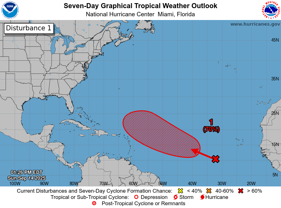
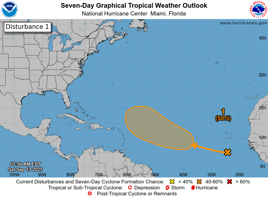
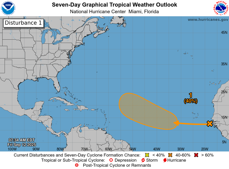
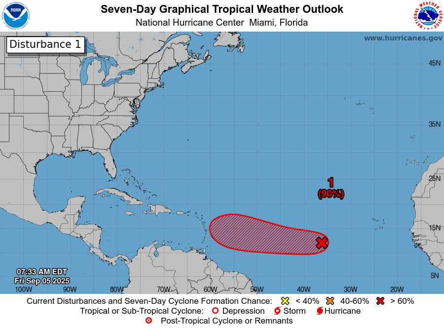
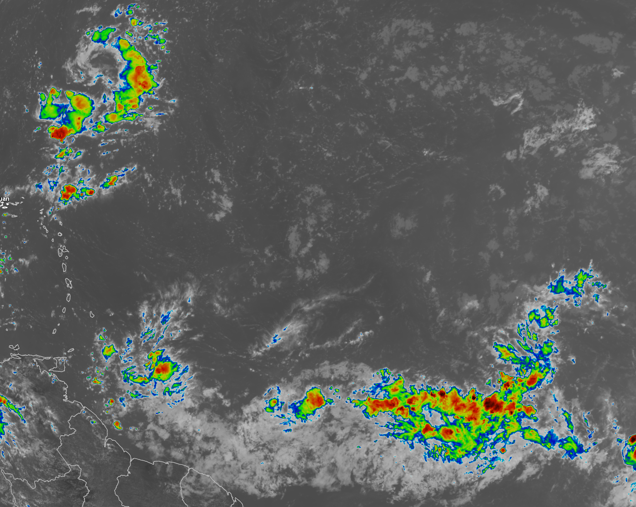
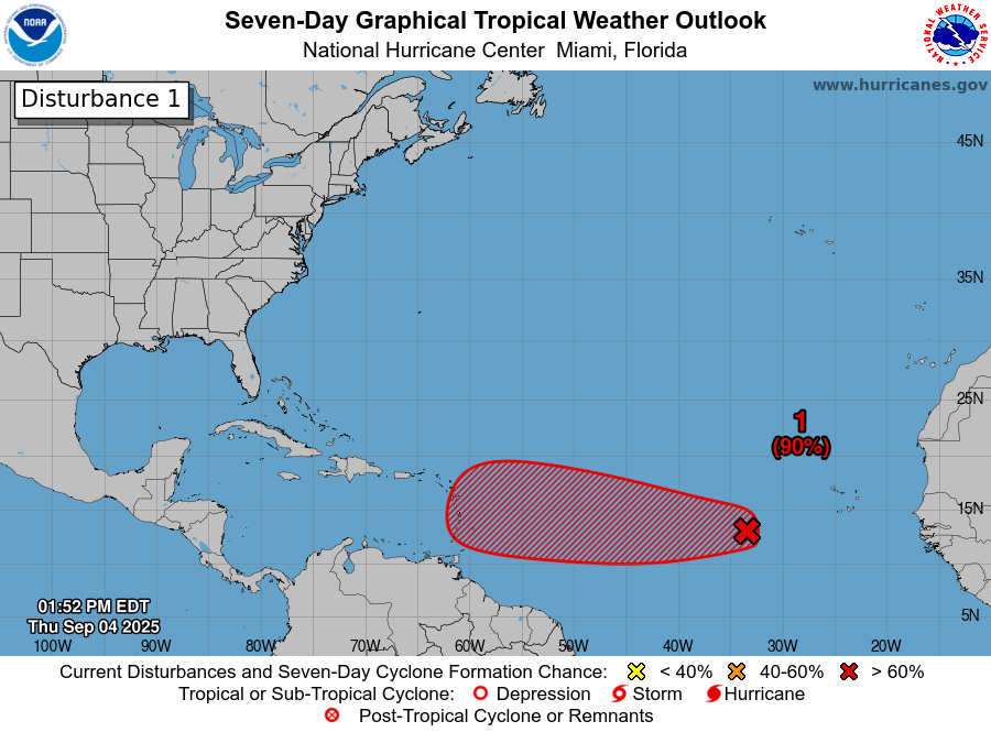
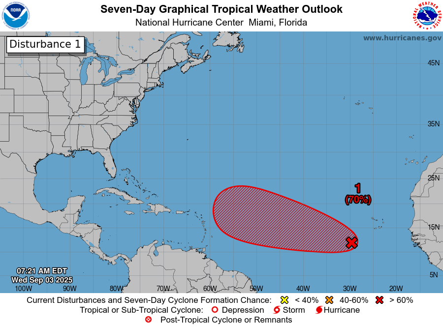
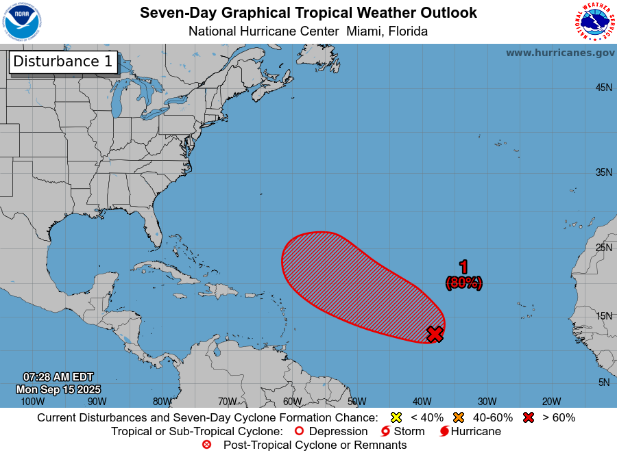
Invest 92-L Located Over The Central Tropical Atlantic: The tropical wave that we have been watching over the last few days has been designated Invest 92-L by the National Hurricane Center. At the time of this writing, Invest 92-L is located over the central Tropical Atlantic near 40 West Longitude.
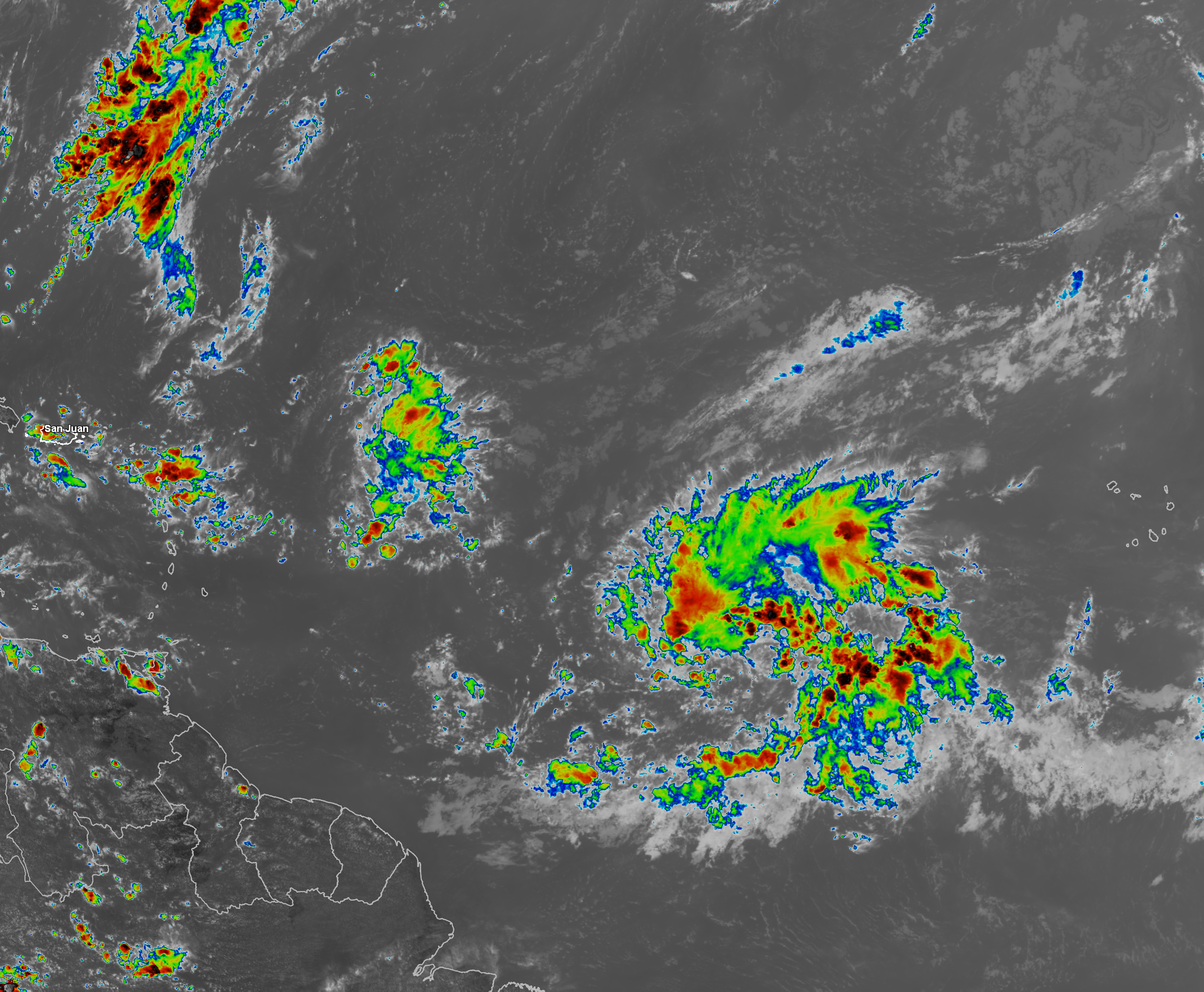
Satellite imagery today reveals that Invest 92-L is producing some deeper convection now, however, this system is fairly disorganized and has a ways to go before becoming a depression or a tropical storm. That said, loops of satellite imagery does show that there is a wide area of low-level turning with this wave and the overall size of this wave is fairly large. This says to me that when Invest 92-L does develop into a tropical cyclone, it may be a rather large storm in overall size.
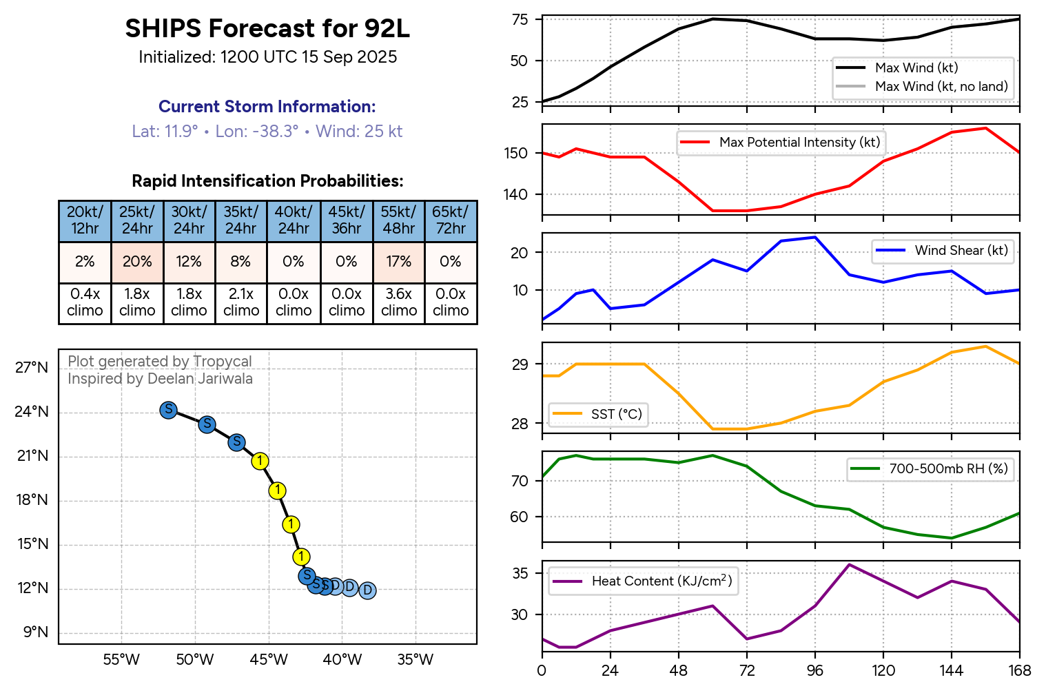
The environmental conditions around Invest 92-L remain marginally favorable for development & that is being generous. There is still an axis of strong wind shear and dry air located just to the north of this system that is being produced by an upper level low pressure system. This should keep Invest 92-L in-check in terms of how much it can develop over the next few days or so.
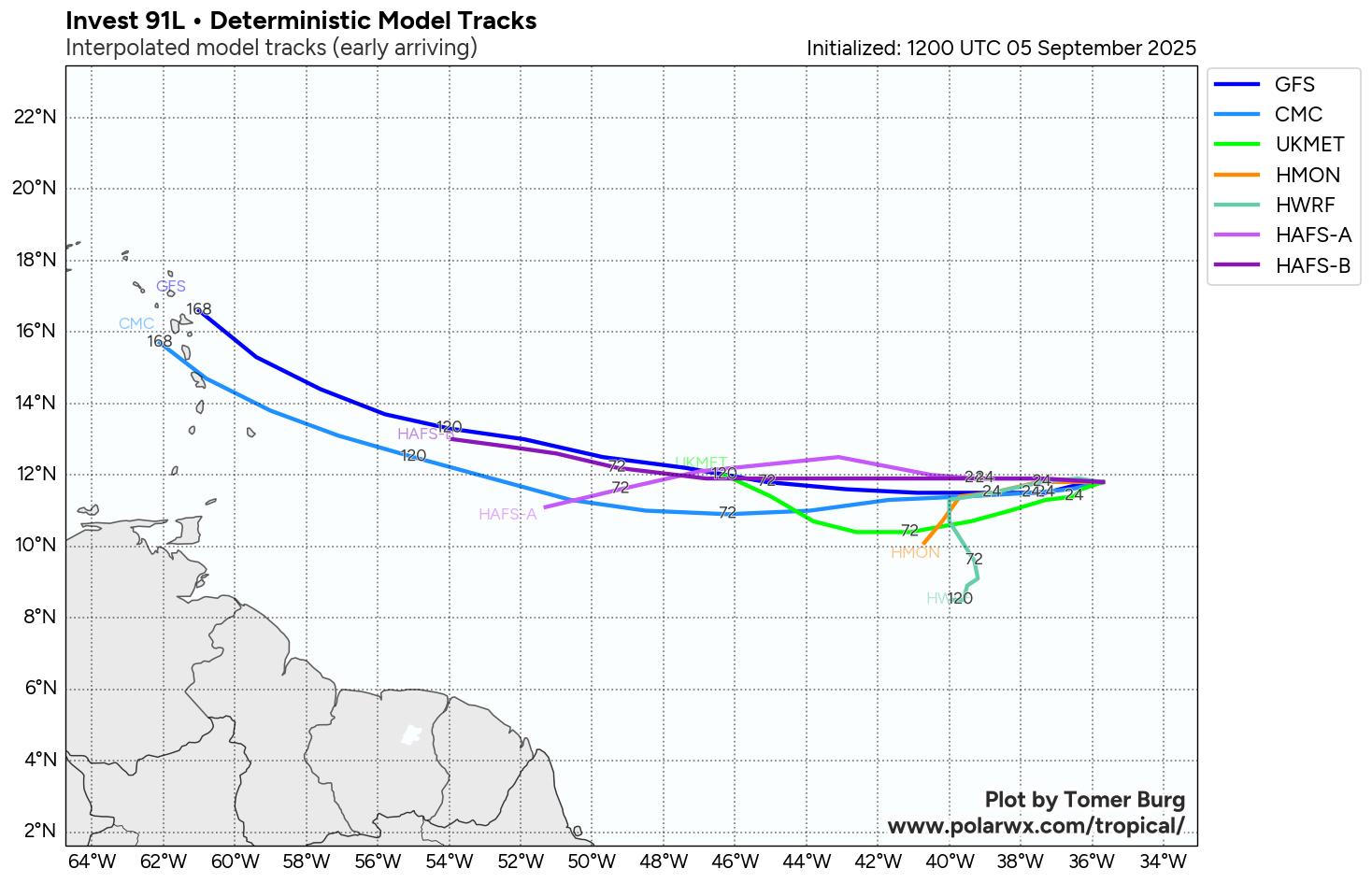
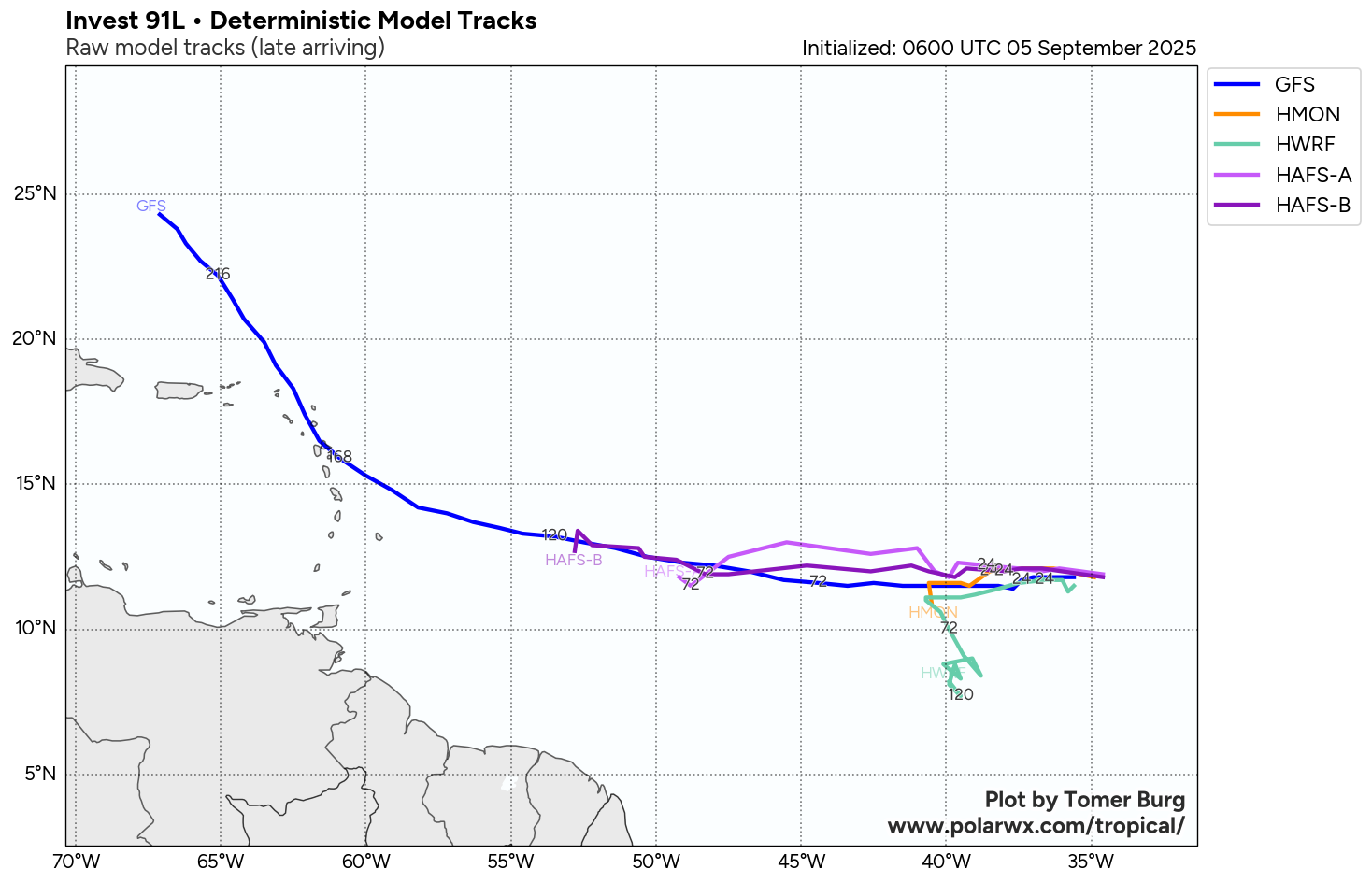
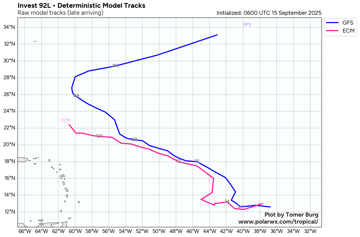
It looks very likely that Invest 92-L will head in a west-northwesterly direction throughout this week and this will likely keep this system to the north of the Lesser Antilles and the northeastern Caribbean by late this week and this weekend.
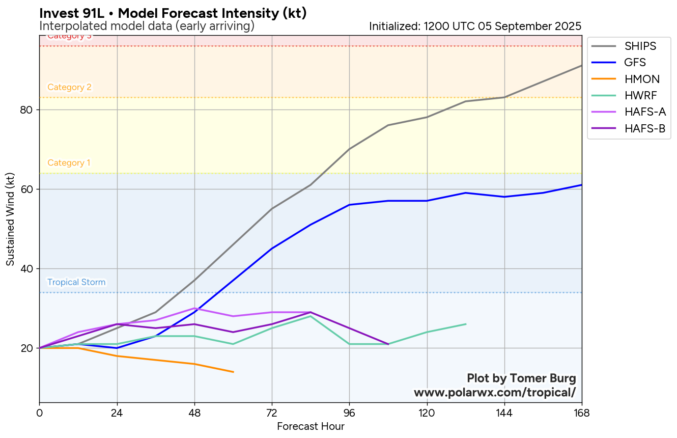
Looking beyond this, I do still think that we will see Invest 92-L organize and strengthen once it is located to the north of Lesser Antilles this weekend. In fact, some of the model guidance are pointing towards the possibility of this system being quite a strong hurricane at some point when it’s located in the North Atlantic.
Additionally, model guidance seems to suggest that there will be an upper level trough in place over the western North Atlantic this weekend into next week. This should put up a barrier of sorts & keep this system from heading towards the Bahamas or the East Coast of the United States. Instead, it looks more plausible that Invest 92-L will head to the north and may end up threatening or directly impacting the island of Bermuda near the middle part of next week.
All-in-all, this system continues to pose no direct threat to the Caribbean, the Bahamas or the United States. The only area that this system may be a threat to is the island of Bermuda around the middle part of next week. It should be noted though that if this system does become a strong hurricane in the middle of the North Atlantic, it could produce another round of rough surf and rip currents along the East Coast of the United States during next week.
Model Track Forecast:
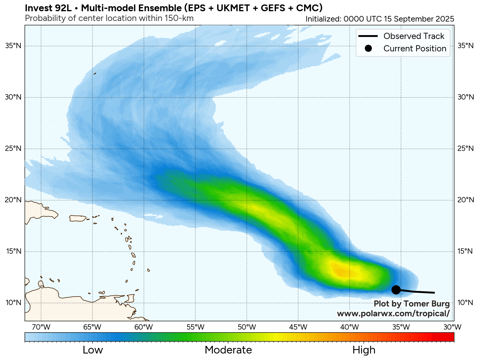
Satellite Imagery:
The next tropical weather discussion will be issued on Tuesday.