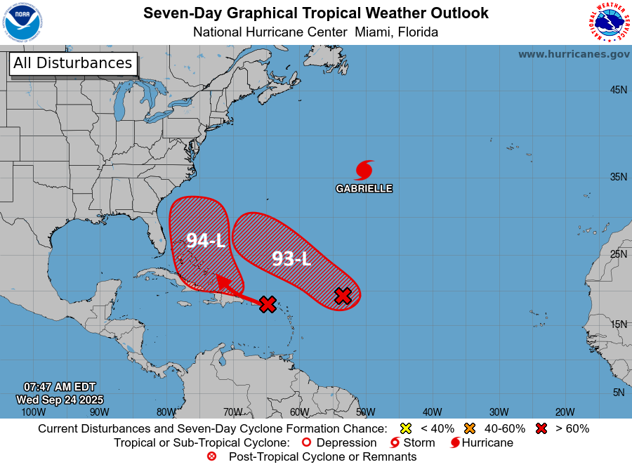
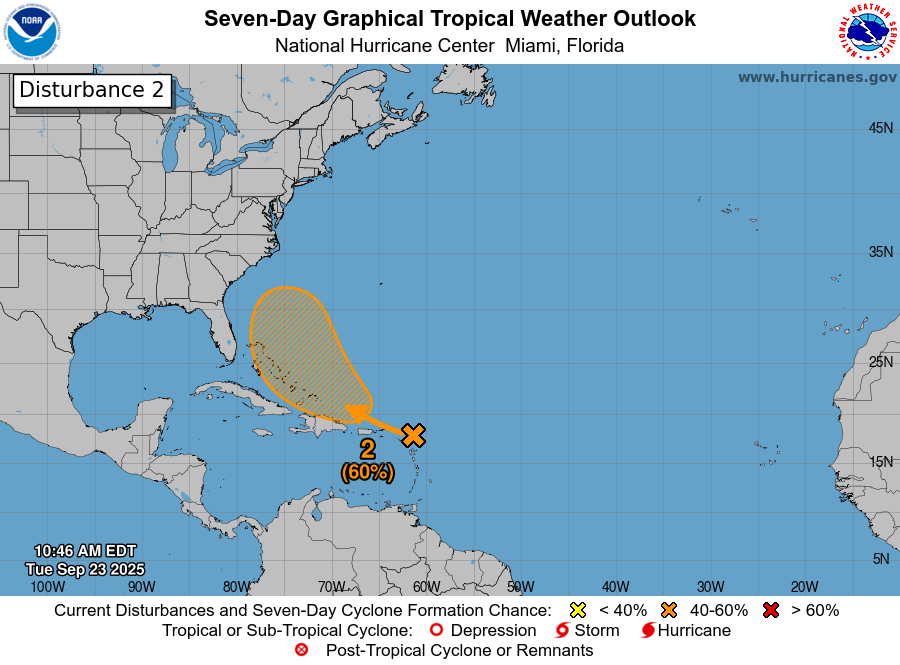
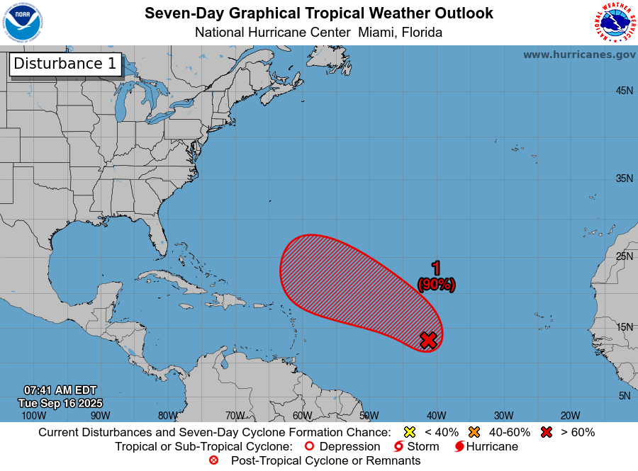
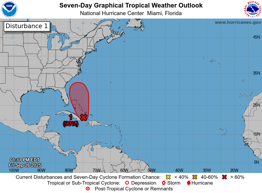
Invest 94-L (Future Imelda): First things first, it continues to look like that Invest 94-L (future Imelda) is going to be a definite threat and very possibly directly impact some part of the Carolinas early next week. That said, areas, including northeast Florida, coastal Georgia and eastern and southeastern Virginia need to watch the progress of Invest 94-L extremely closely as impacts in these areas are quite possible. Also, there continues to be a huge amount of uncertainty as to the exact track of this system & whether it’ll barrel inland or stall and then sit and spin very near the Carolina coastline next week. Needless to say, Invest 94-L is a system that needs to be watched extremely closely.
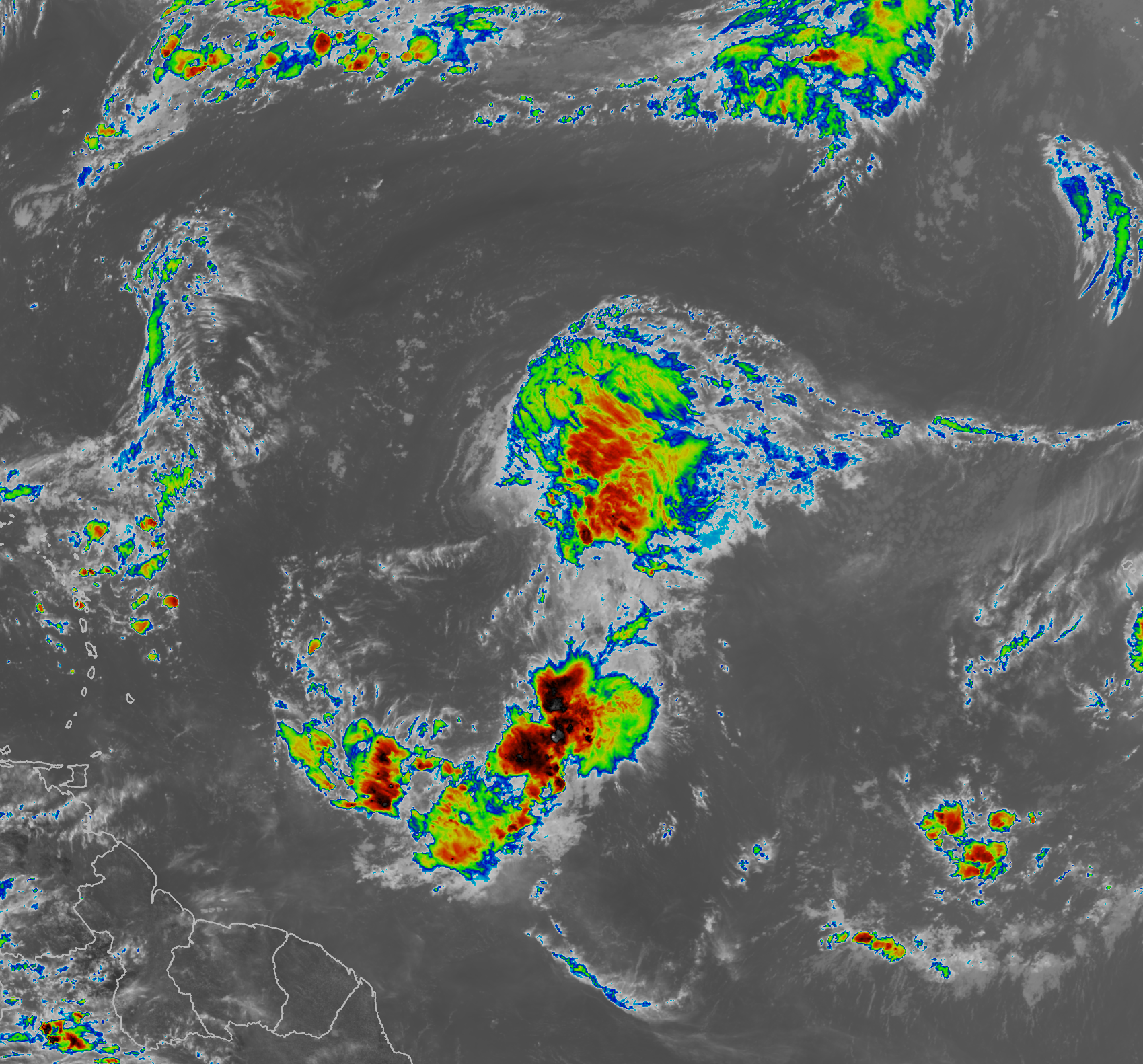
Satellite imagery and weather analysis indicates that the convection around Invest 94-L seems to be gradually organizing. In addition, it appears that a low pressure system has formed somewhere between the southeast coast of Cuba and the Turks and Caicos Islands.
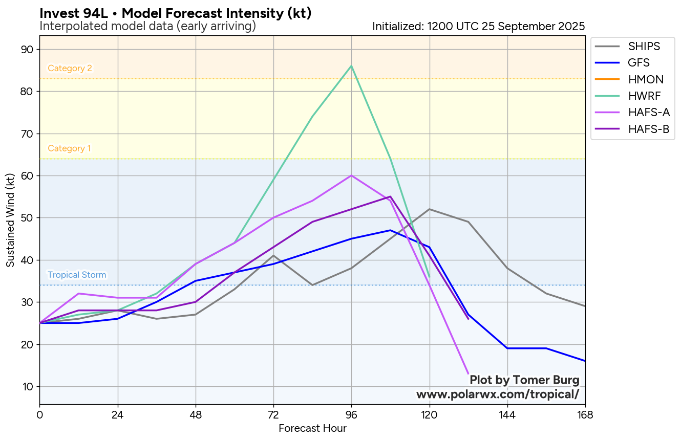
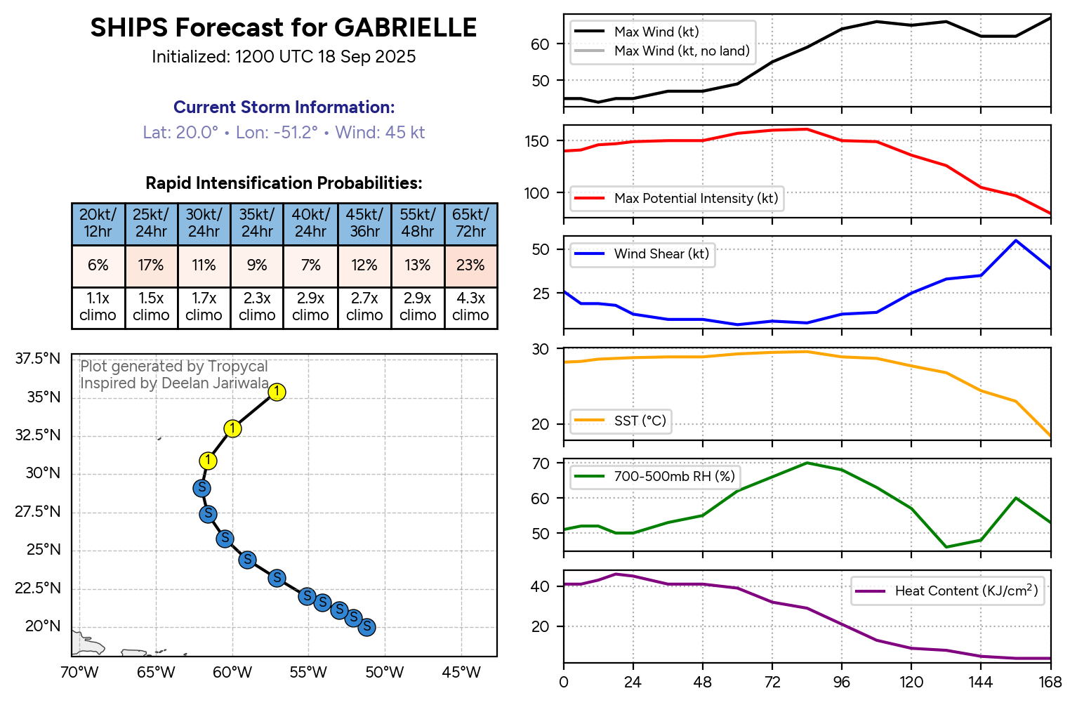
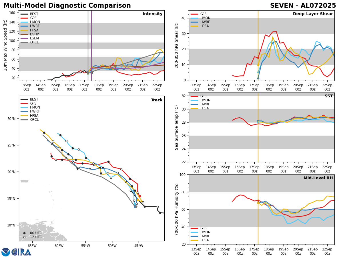
Analysis of the environmental conditions around Invest 94-L reveals that there is a bit less wind shear over this system as compared to yesterday. Also, it appears that Invest 94-L will be heading into lower wind shear conditions and more favorable conditions for development during this weekend. This means that it is extremely likely that Invest 94-L will become Tropical Storm Imelda within the next couple of days or so.
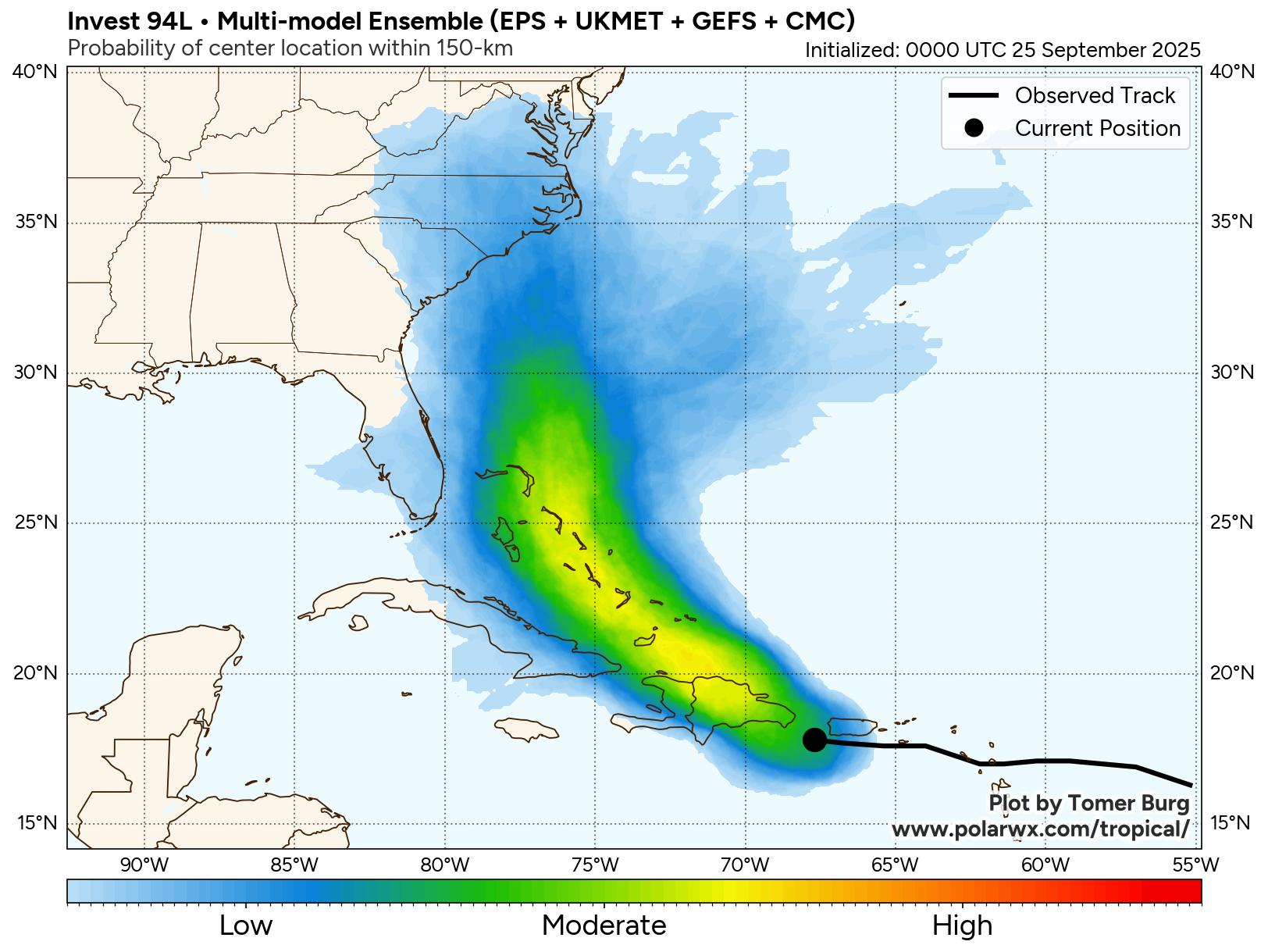
In addition, it is expected that Invest 94-L will move from southeast to northwest through the southeastern and central Bahamas through Saturday and then track across the northwestern Bahamas during Sunday.
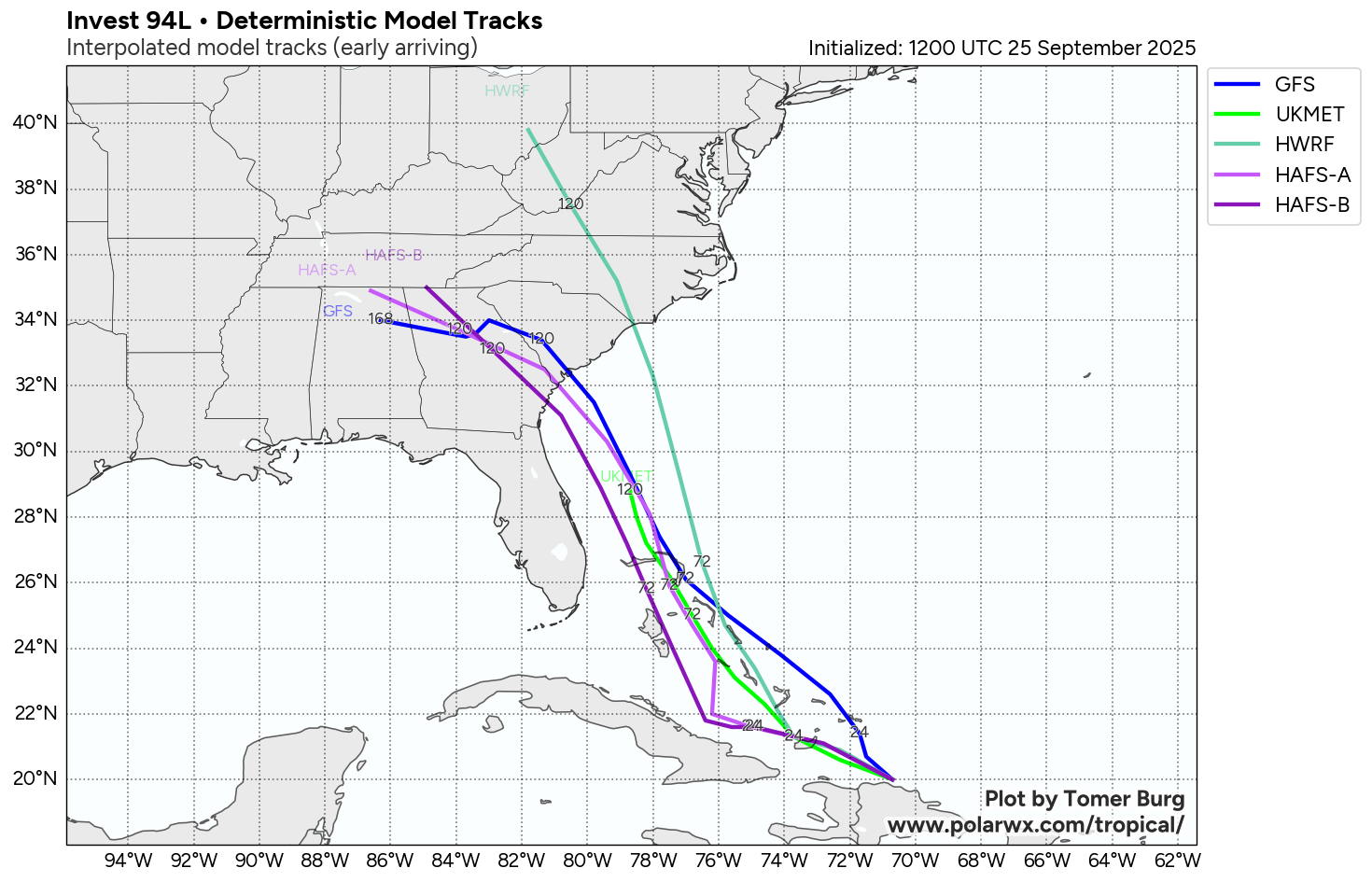
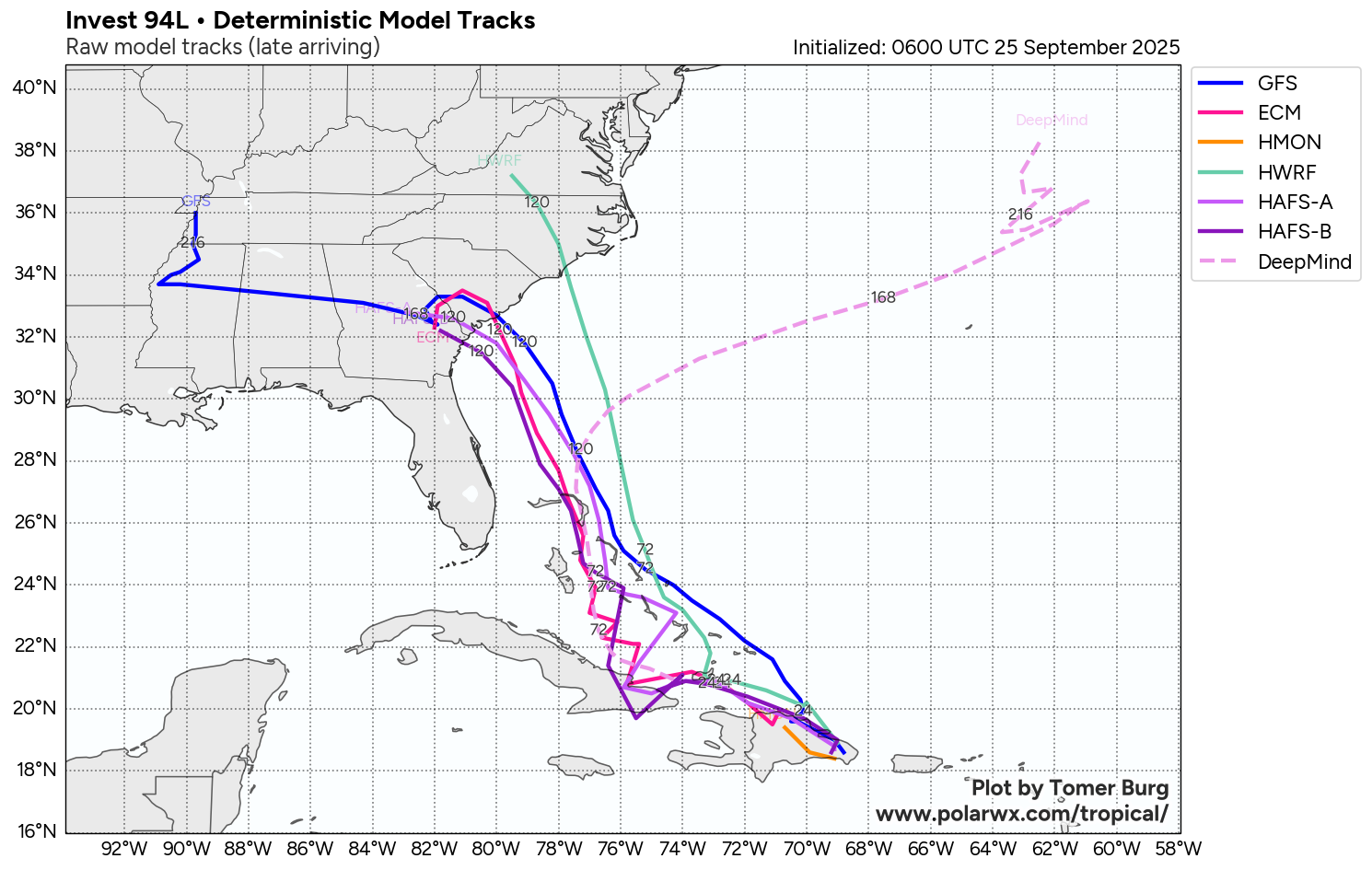
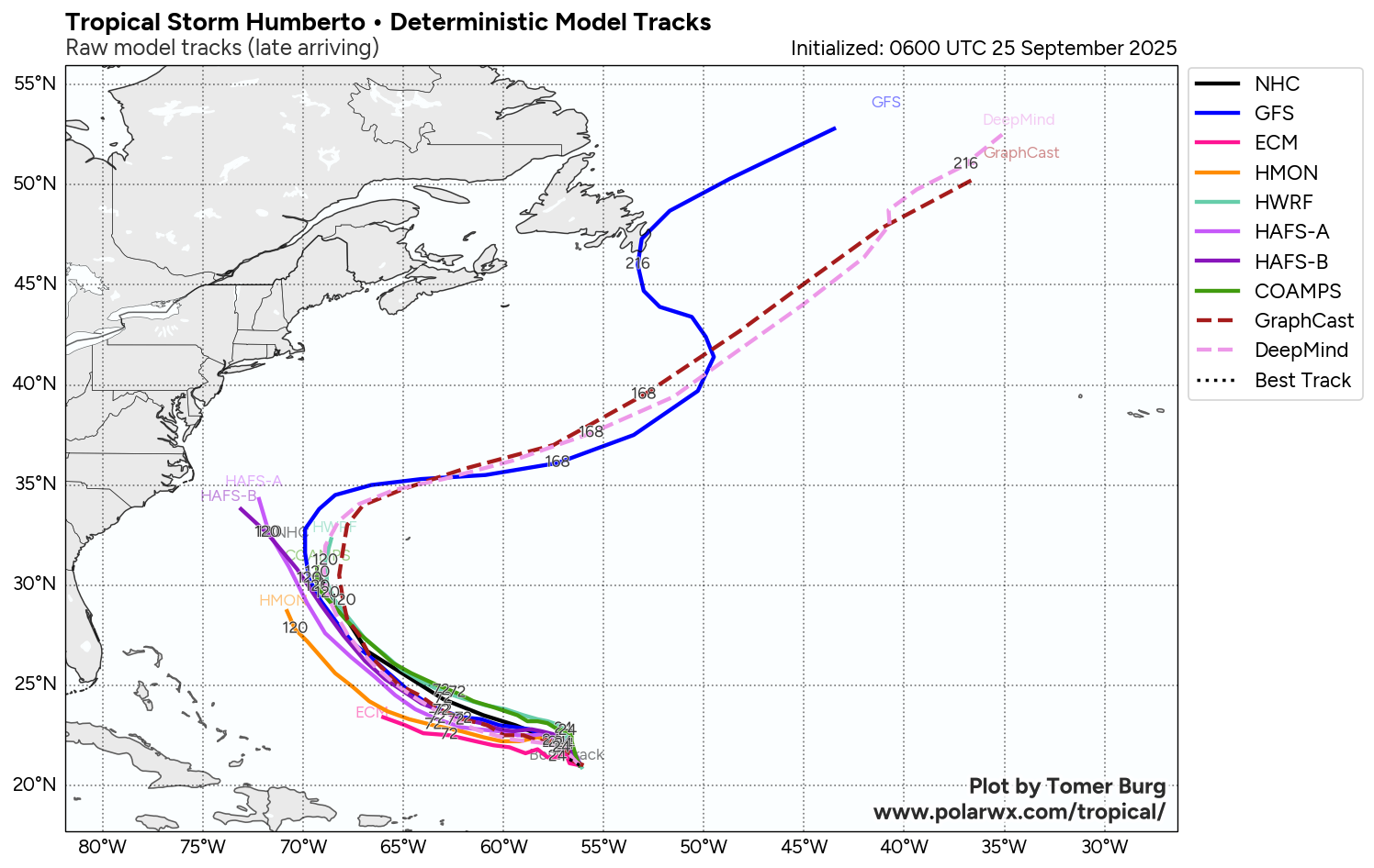
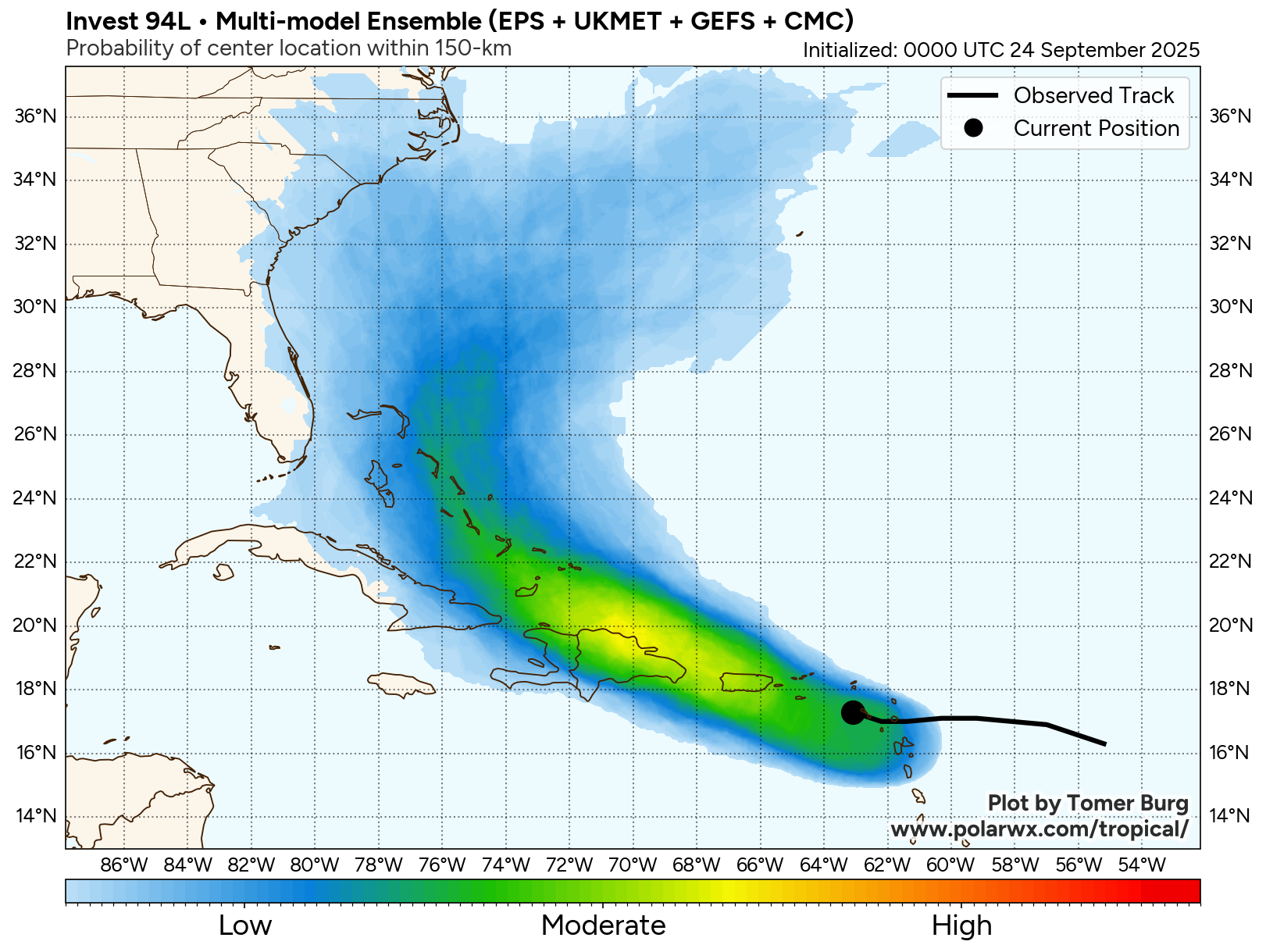
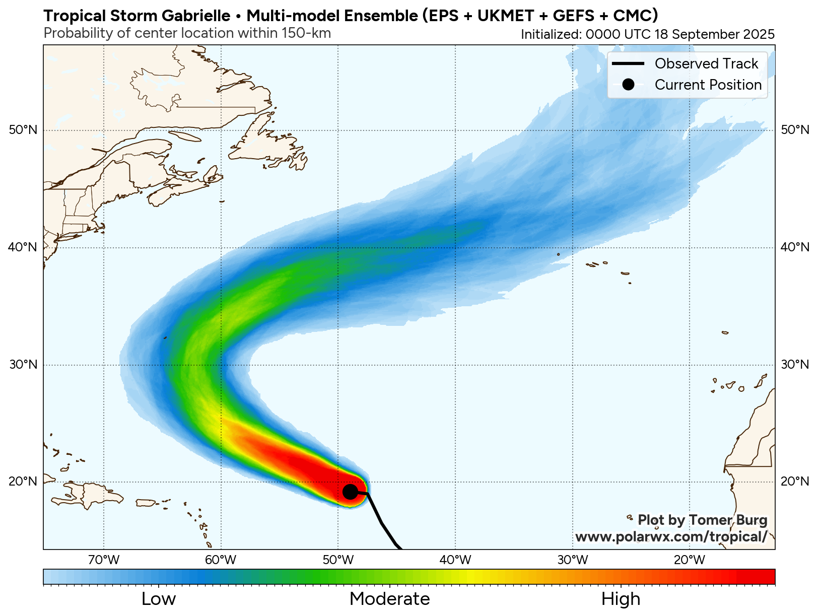
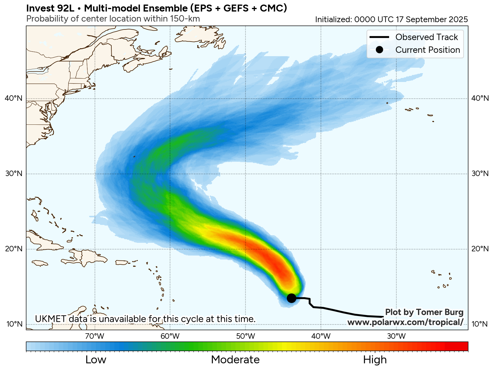
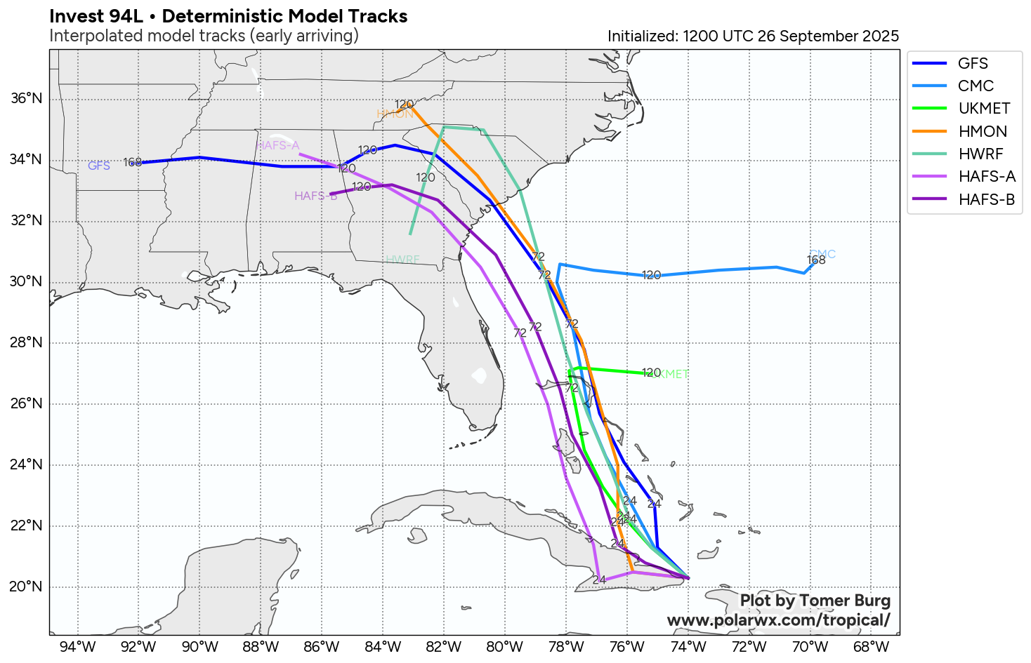
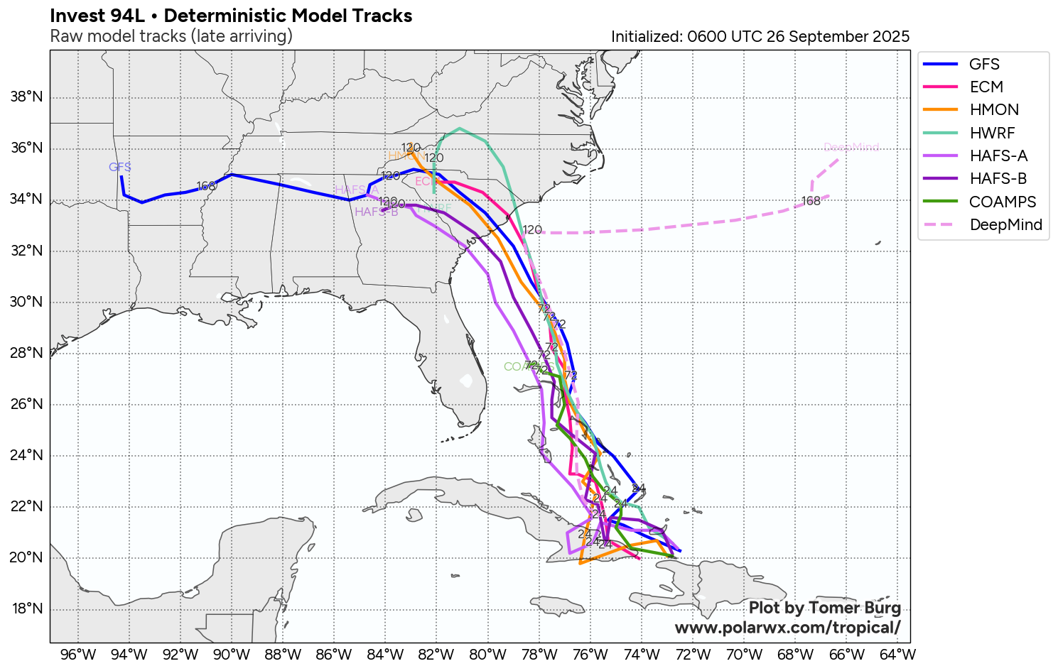
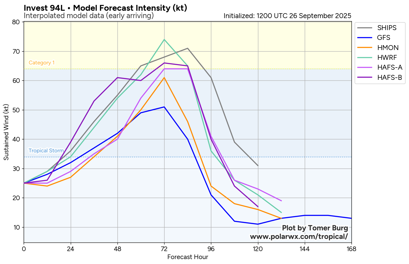
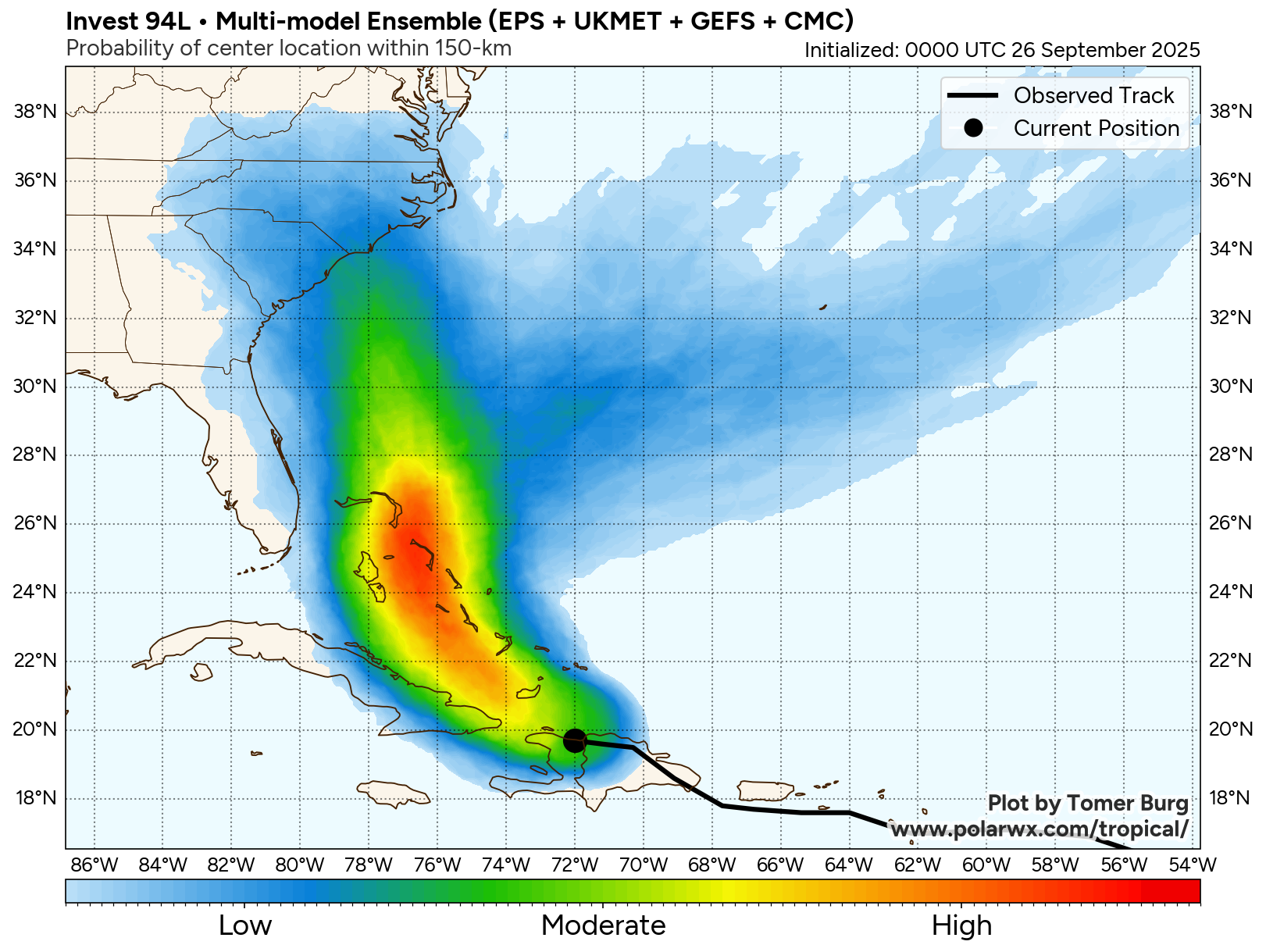
By Monday, the uncertainty of where Invest 94-L will go once it is north of the Bahamas is extremely high. The model guidance diverge quite a bit in their forecasts of where this system might go.
The GFS model and a majority of its ensemble members show a track that takes Invest 94-L directly inland into South Carolina and far southeastern North Carolina around Monday night and Tuesday.
The most recent European model run also now shows Invest 94-L moving directly inland into South Carolina on Monday night and Tuesday. As for the ensemble members of the European model, a majority of them show a track that takes this system directly inland somewhere between Hilton Head and Myrtle Beach with a few members showing a landfall as far northeast as southeastern and eastern North Carolina.
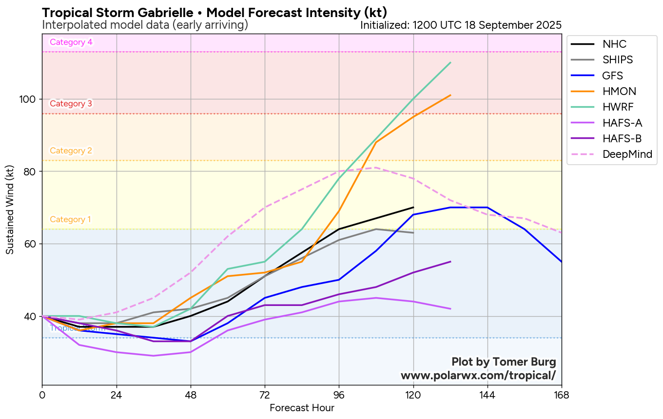
As for the Google Deep Mind AI ensemble model, they are split right down the middle. Half of the members showing a direct inland track right into South Carolina. The other half of ensemble members show Invest 94-L getting turned abruptly to the east as it approaches the coast of the Carolinas due to its interaction with Humberto leading to Invest 94-L to not make landfall at all.
Here Are My Thoughts: While I do think that it is looking fairly likely that Invest 94-L will directly impact somewhere between Savannah, Georgia and Wilmington, North Carolina, the uncertainty with the exact track and strength of this system is very high.
It cannot be emphasized enough how complicated the weather pattern is going to be during this weekend into next week and this will certainly affect where Invest 94-L goes.
The first player in the weather pattern is Hurricane Humberto, which is located to the east of Invest 94-L. The closer Humberto and Invest 94-L are in distance, the more they will affect each other with track and strength.
The second player in the weather pattern is an upper level low pressure system over the southeastern United States. If Humberto does not alter the track of Invest 94-L, then it looks plausible that this upper level low pressure system will be able to pull Invest 94-L directly into the southeastern United States.
I think that there are at least a couple of scenarios that could occur with Invest 94-L:
Scenario Number 1 is that Imelda tracks fairly quickly to the northwest from the northern Bahamas on Sunday to the South Carolina coast by Monday night into Tuesday as that upper-level low pressure system captures Invest 94-L and pulls it inland.
This first scenario would lead to hurricane force winds and surge issues along the South Carolina coastline from Monday into Tuesday. In addition, we would be looking at a flooding rainfall across much of the Carolinas and the Piedmont during at least the first half of next week.
Scenario Number 2 is that Invest 94-L (Future Imelda) moves a bit slower in forward speed and is influenced more by Hurricane Humberto as that upper level low moves out of the way to the northeast. This leads to Invest 94-L to approach the Carolina coast, but then stalls just offshore being pulled to the east away from the coastline. This would make for an extraordinarily difficult forecast as it opens up multiple different other scenarios. This includes Humberto pulling Invest 94-L with it out into the open Atlantic. It also includes Humberto departing to the northeast and leaving Invest 94-L behind causing it to track again towards the coast for a second attempt at a landfall late next week.
It Is Of My Opinion that I think scenario number 1 may be more likely to occur than scenario number 2. This means that I think that it is likely Invest 94-L will become a depression within the next 24-30 hours or so as it tracks through the southeastern and central Bahamas. This system should then strengthen into a tropical storm and then a hurricane as it approaches the Carolinas on Monday and crosses the Gulf Stream as it does so.
I do think the area of highest threat right now of a landfall and direct hit from this system looks to be along the South Carolina coast on Monday night or Tuesday as a hurricane of perhaps Category 1 or low end Category 2 strength.
Now, is this a guaranteed forecast?? Absolutely not!! There are a lot of moving parts with the forecast of this system, including how quickly Humberto strengthens, Humberto’s forward speed, how strong the upper level high pressure system is & the evolution of the upper-level low pressure system over the Southeast United States.
It seems clear though that Invest 94-L is very likely to develop & become a tropical storm and then a hurricane. It also seems fairly likely now that Invest 94-L is a threat to the Southeastern coast of the US & especially the Carolinas.
In addition to the potential for impacts from tropical storm to hurricane force winds and surge issues along the South Carolina coast, I am also quite concerned about the potential for heavy rain and flood issues across the Lowcountry of South Carolina into central and eastern North Carolina and southern Virginia. In fact, it looks like the setup is favorable for a Predecessor Rain Event to occur out ahead of future Imelda this weekend across southern Virginia, central and especially eastern North Carolina and across the Lowcountry of South Carolina.
Now, we may end up adding in the heavy rainfall from Invest 94-L (future Imelda) into the mix and this could lead to some big time flood issues across southern Virginia, a large part of North Carolina and eastern and northeastern South Carolina. What concerns me is that there’s the possibility that future Imelda could slow way down or stall near the coastal Carolinas on Monday and Tuesday and exacerbate the rainfall issues.
Over the next day or two, I should be able to tell you in more detail exactly which parts of the Carolinas will see the most impactful conditions. I strongly urge everyone from southeastern Georgia through the Carolinas to southern Virginia to closely monitor the updates of this system. If it were me, I would start preparing now for tropical storm and hurricane conditions along the coast & for the potential of serious rainfall produced flash flooding for areas along the coast and areas inland across the Carolinas and southern Virginia.
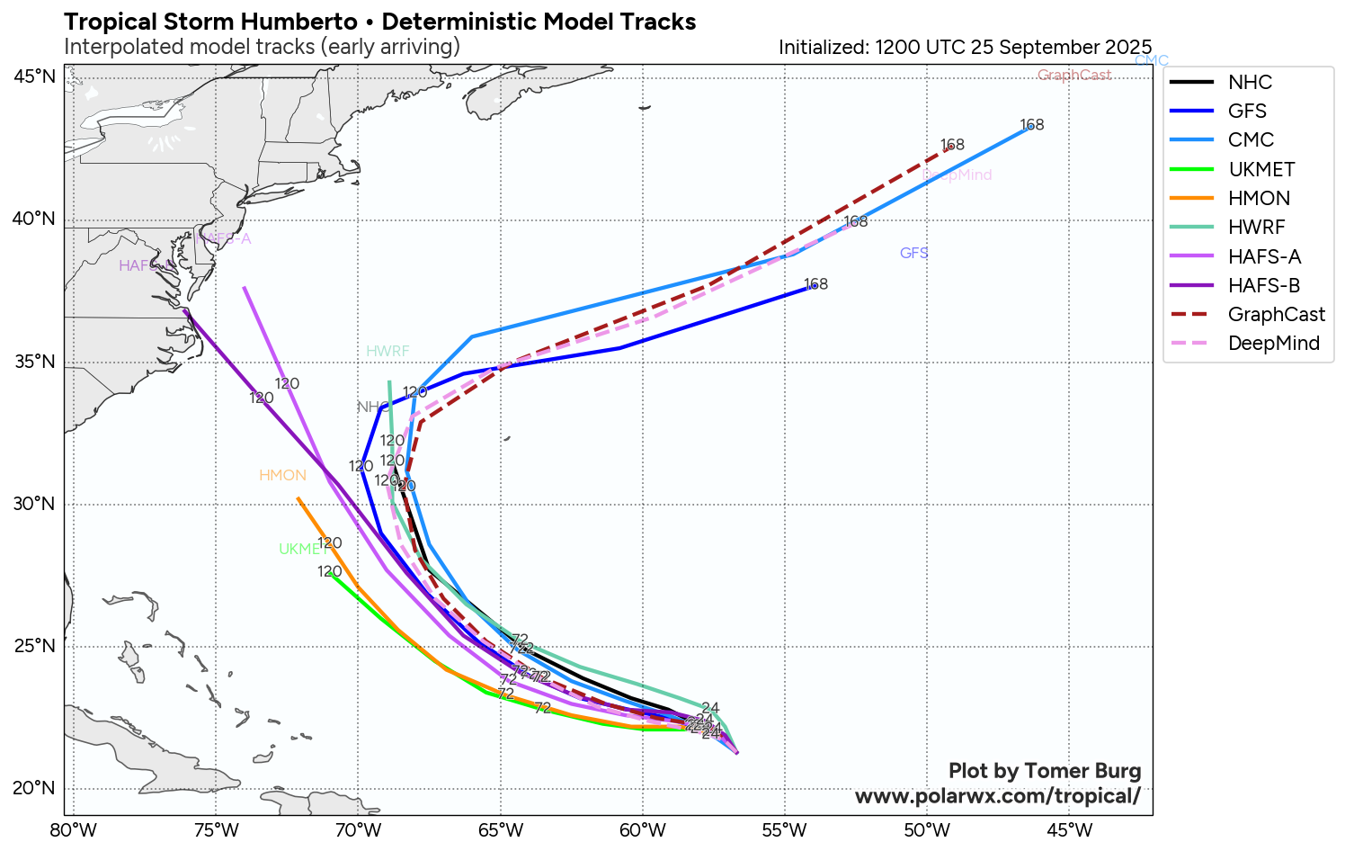
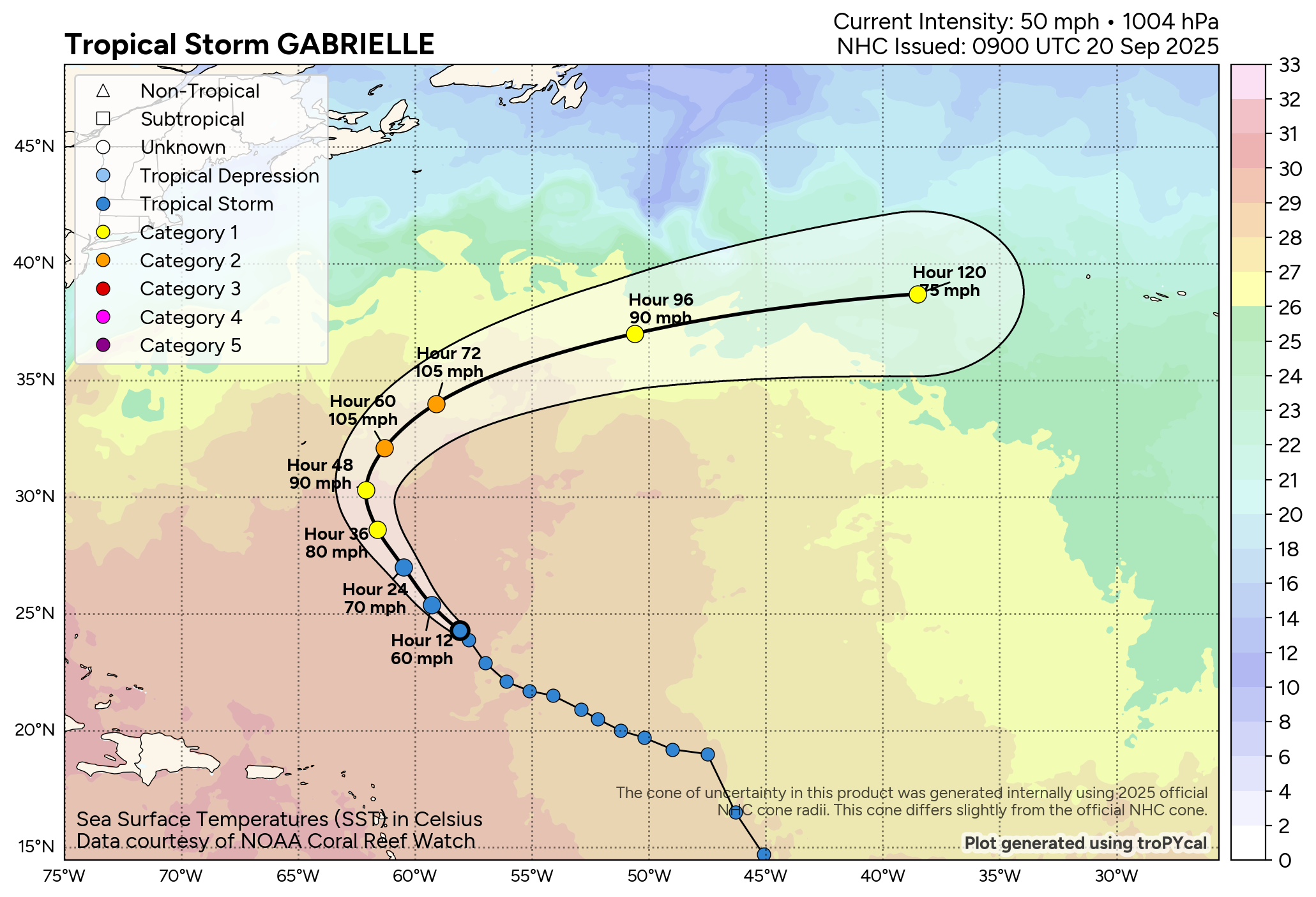
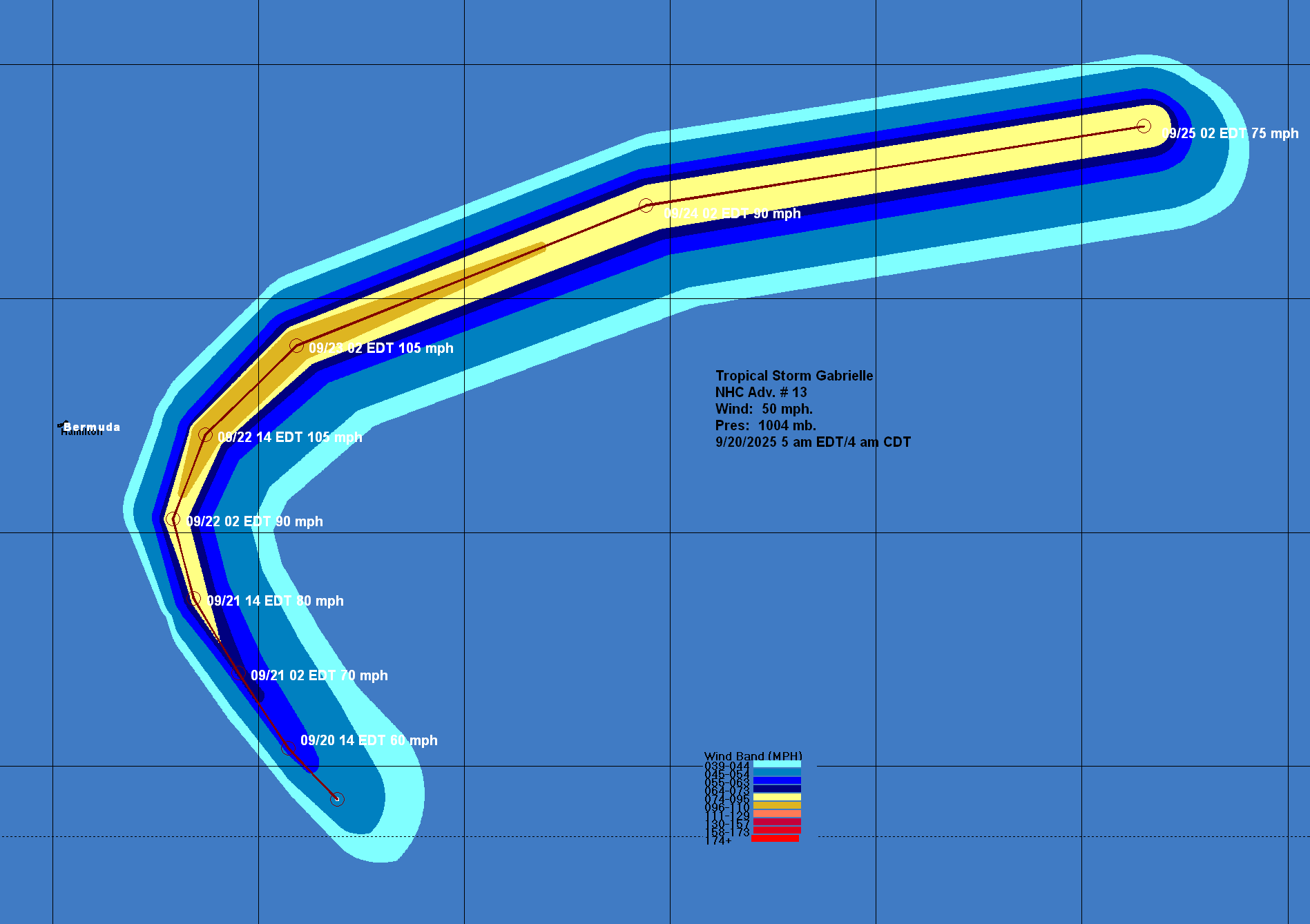
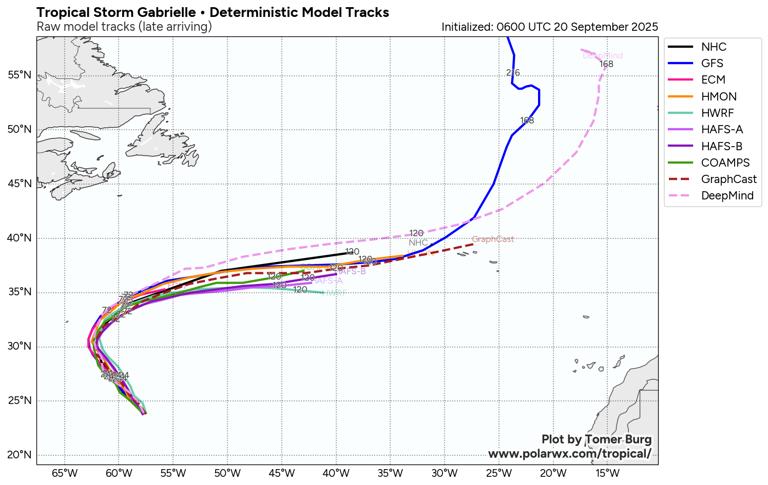
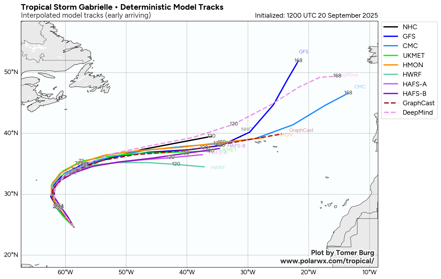
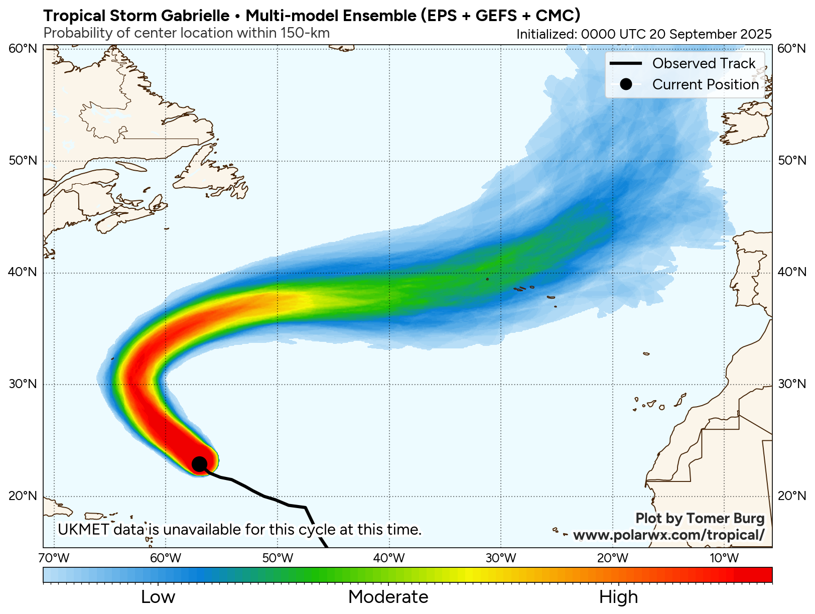
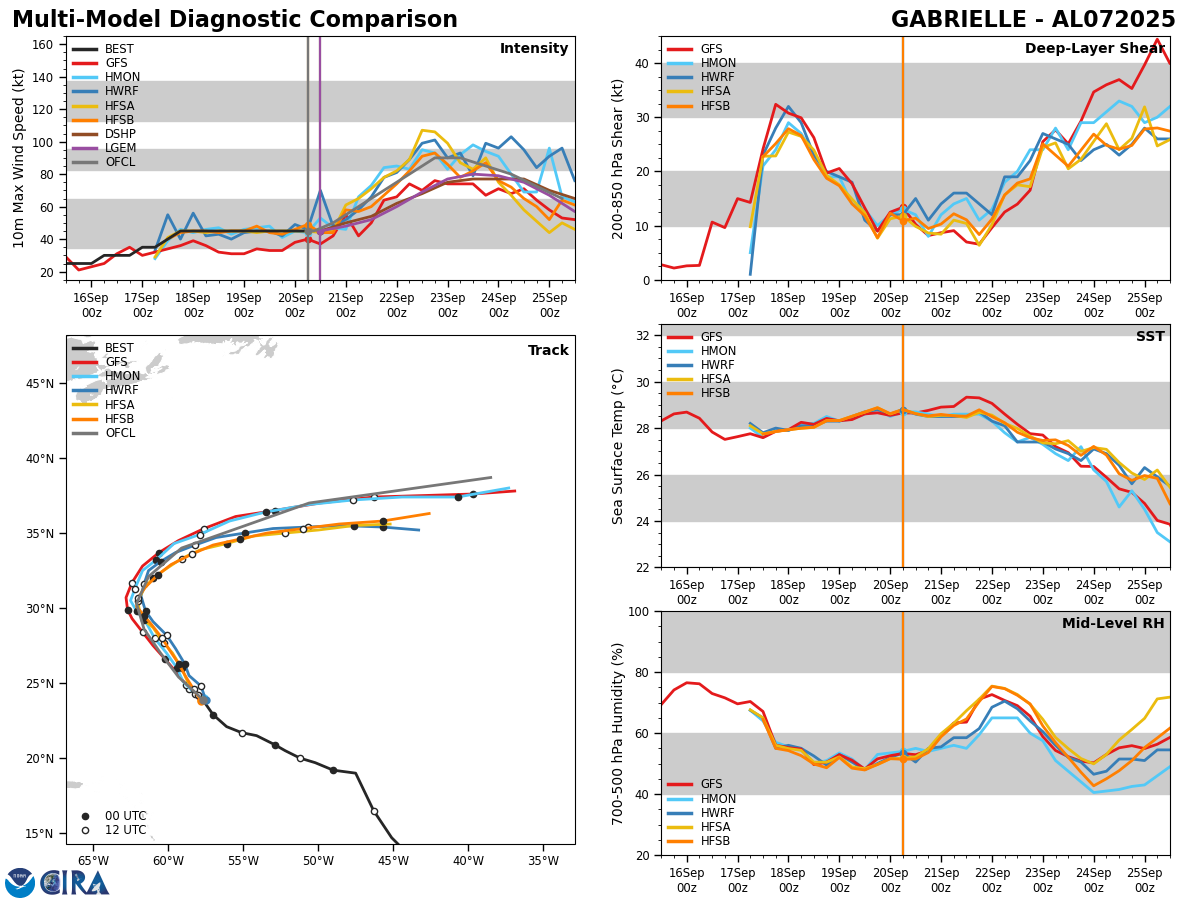
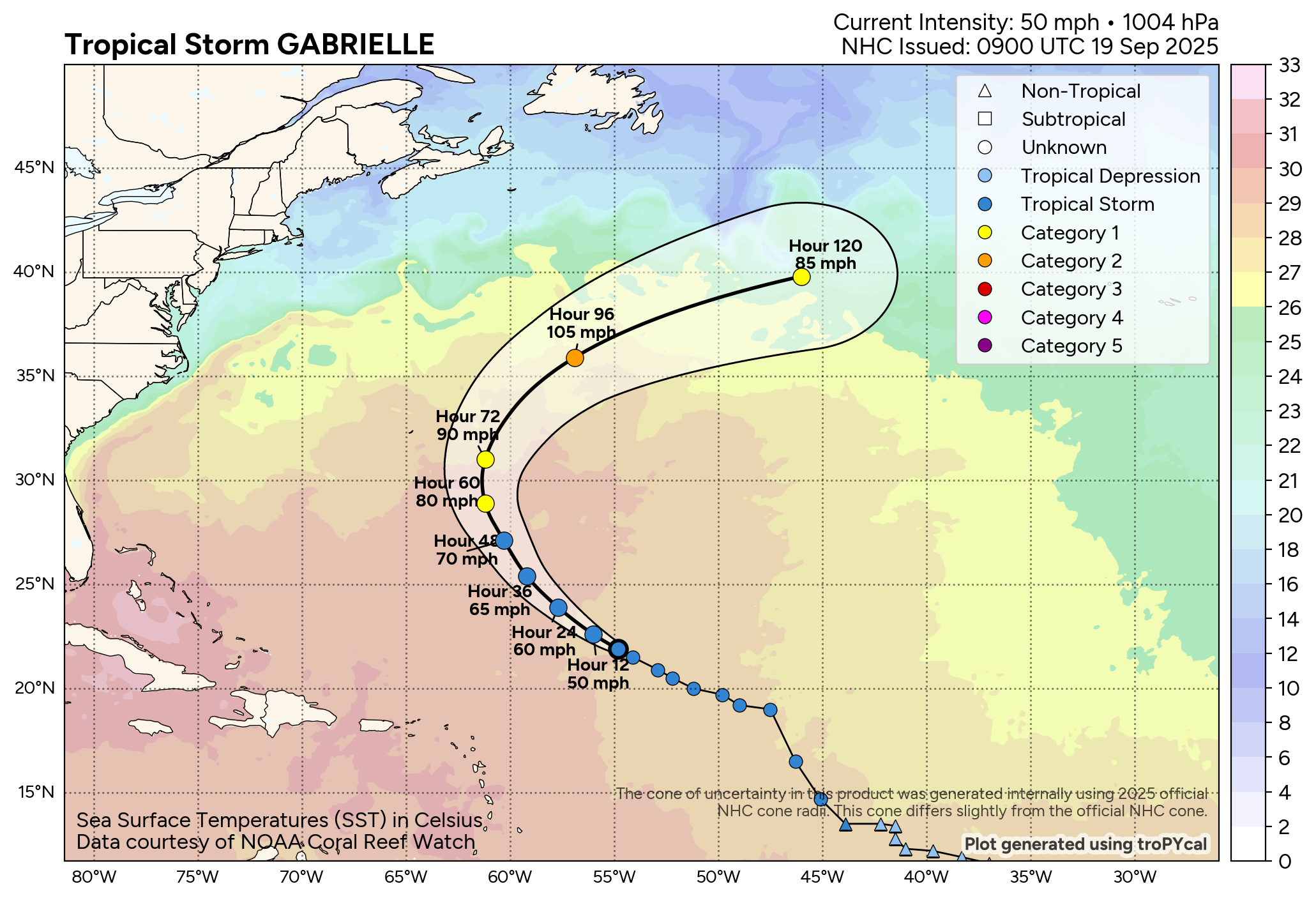
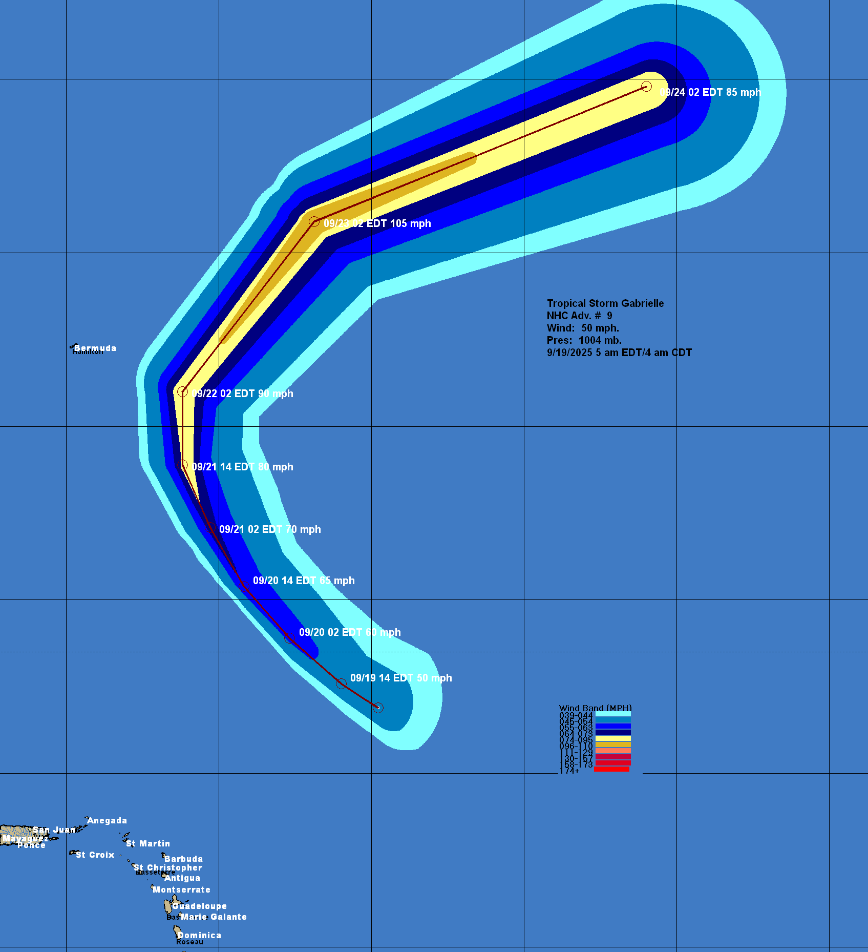
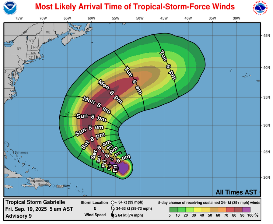
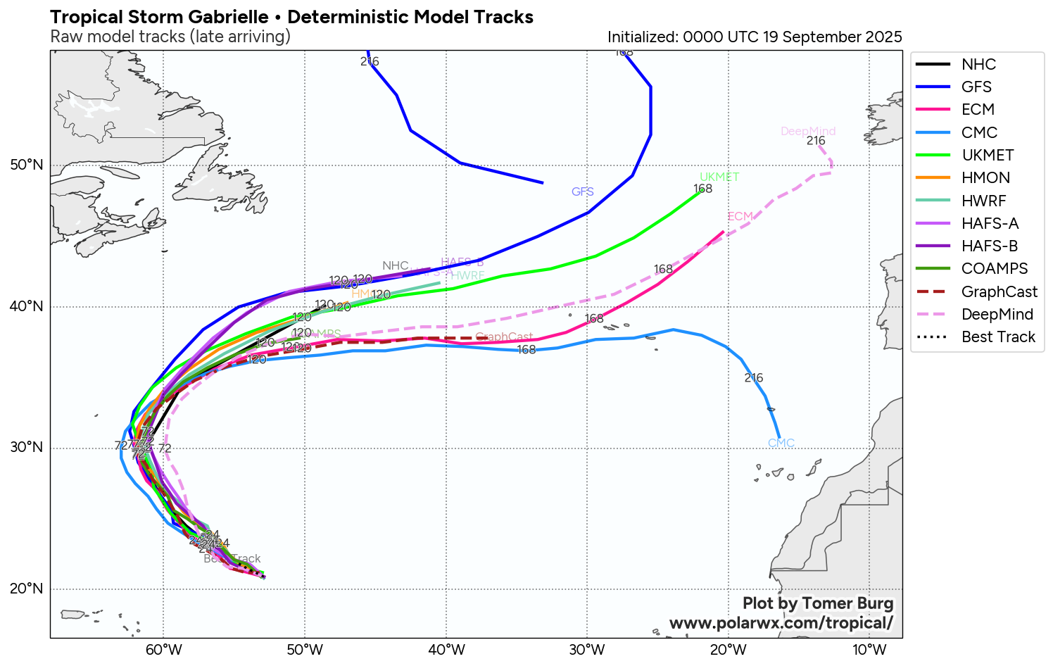
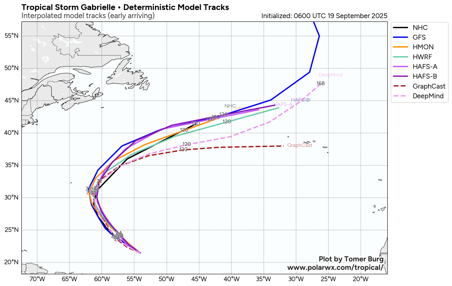
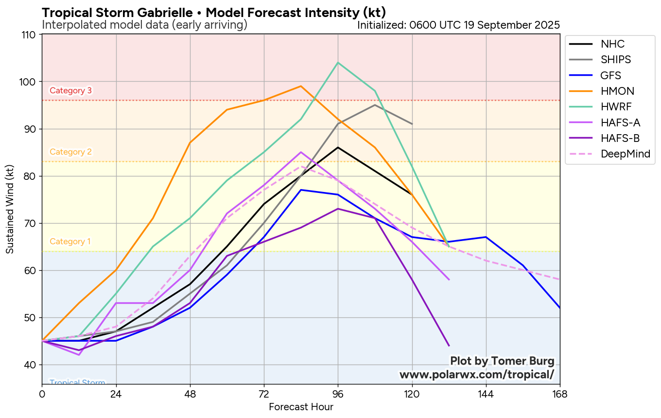
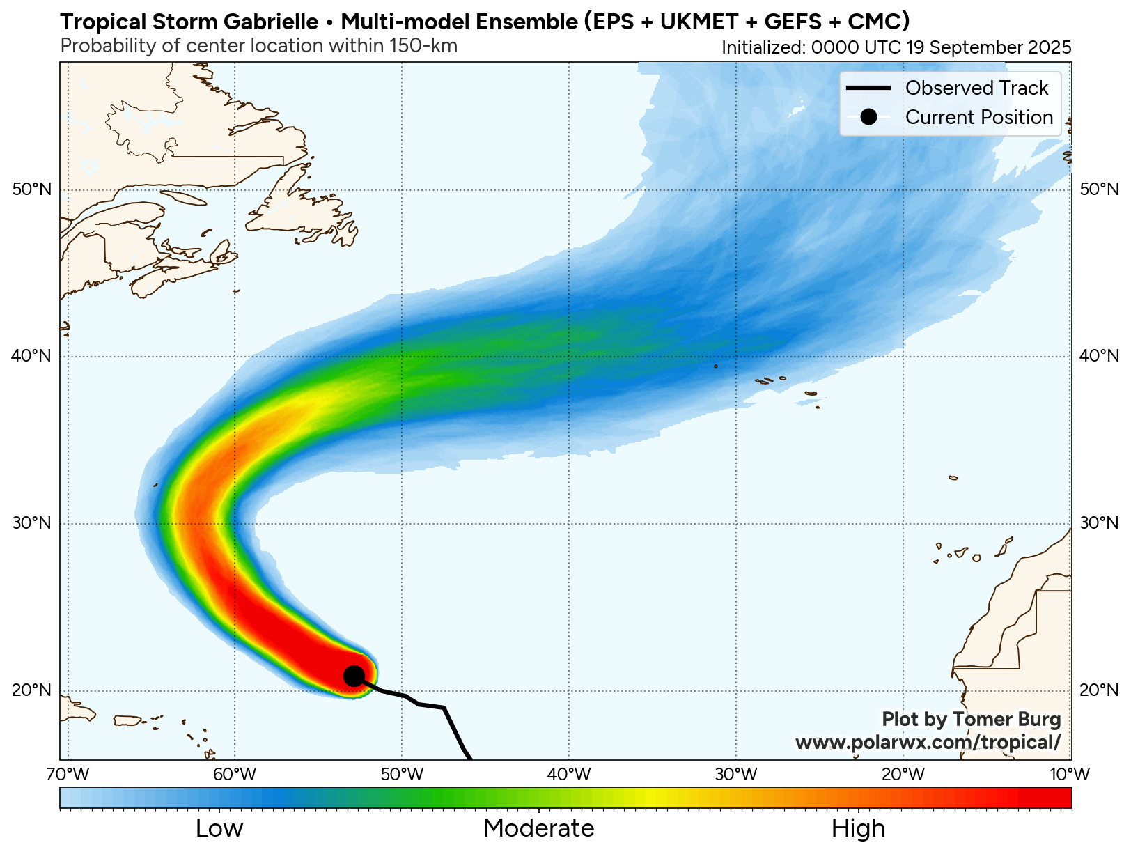
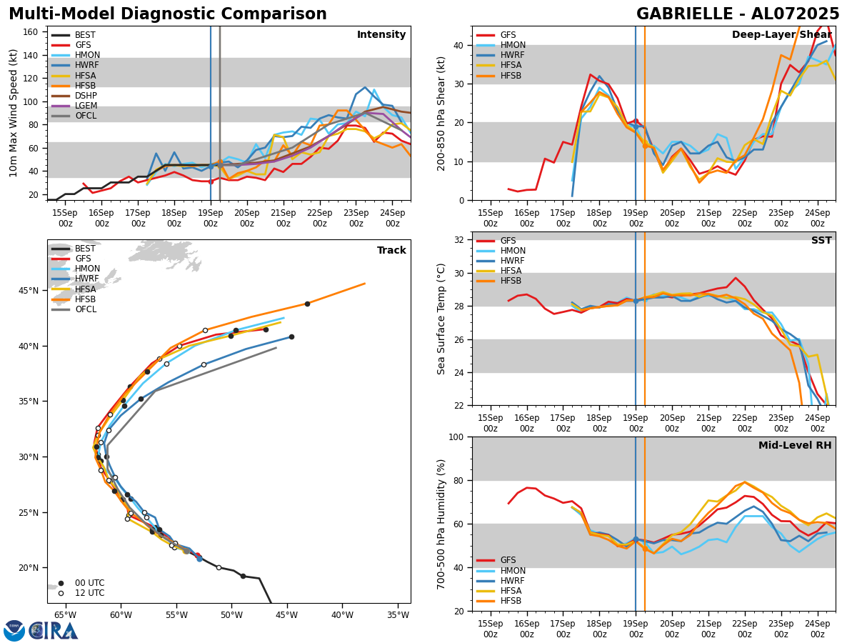
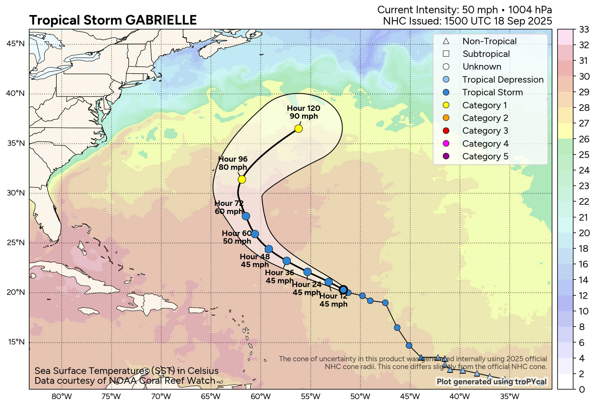
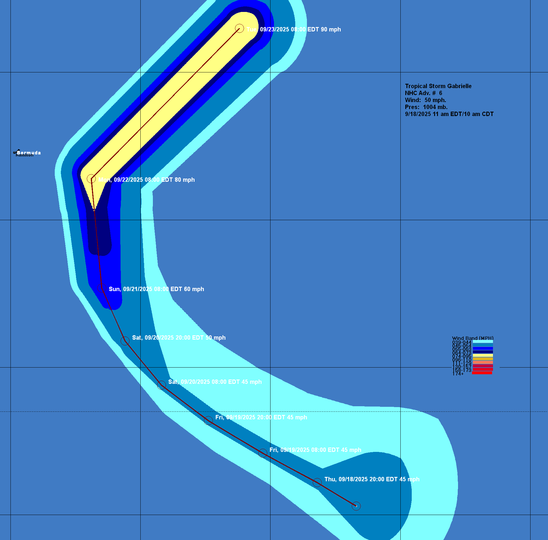
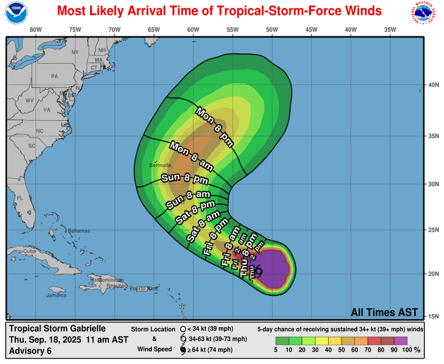
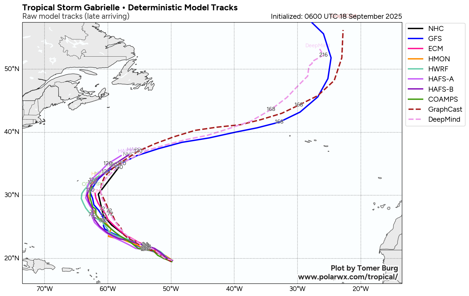
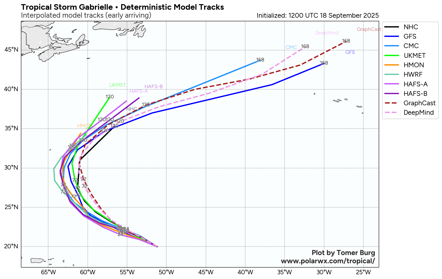
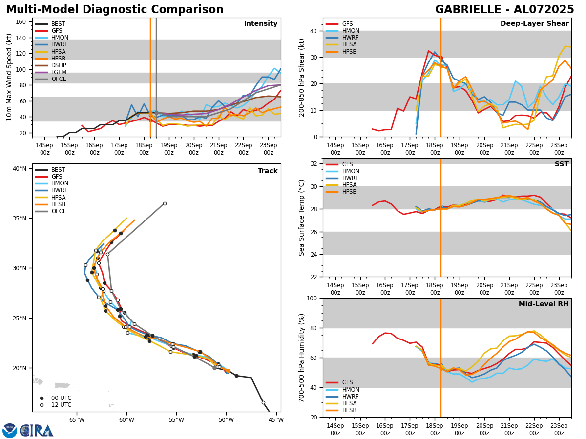
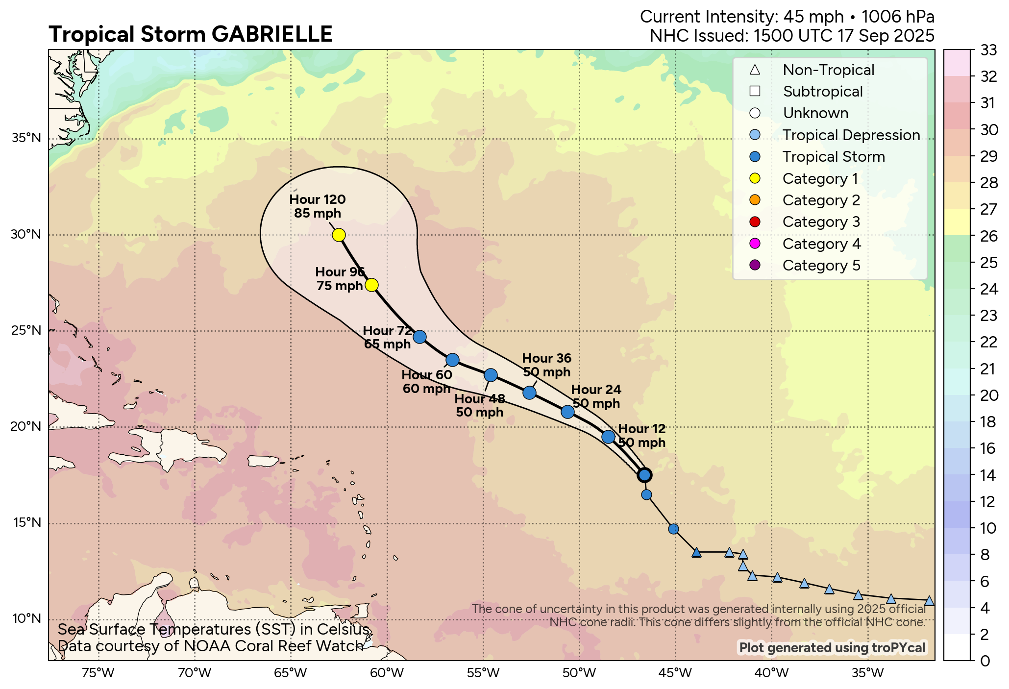
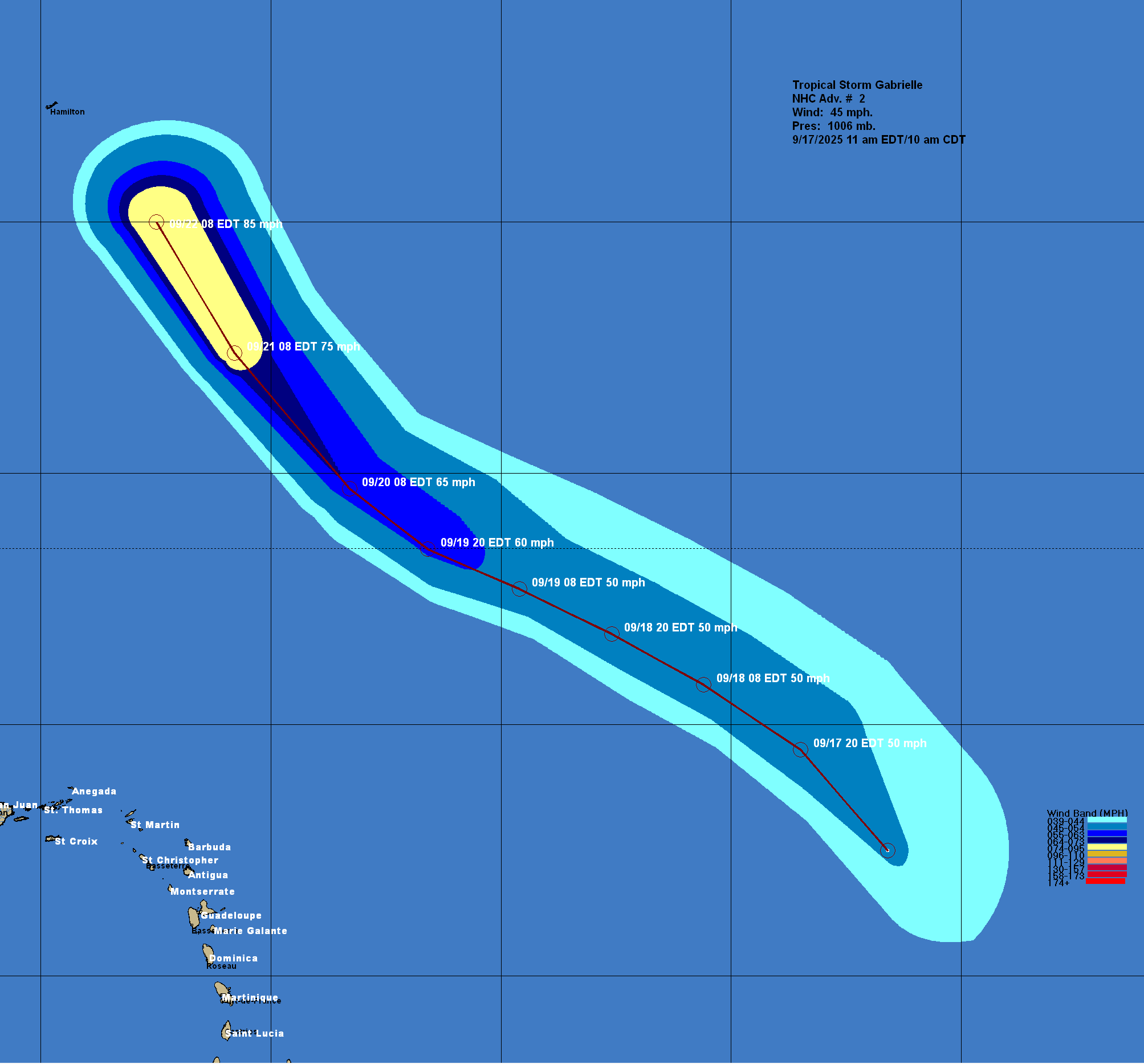
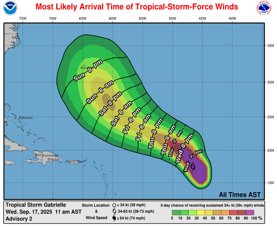
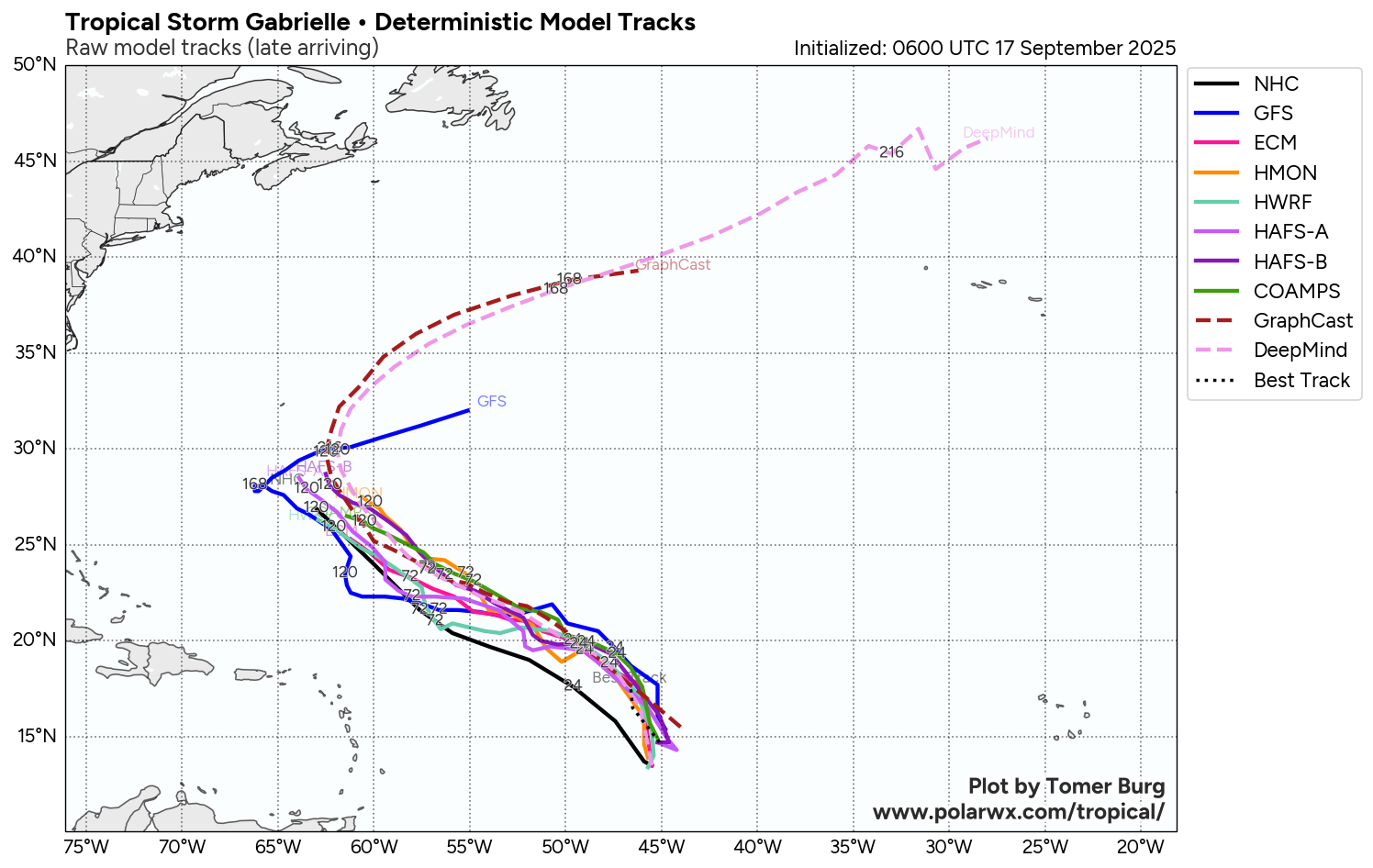
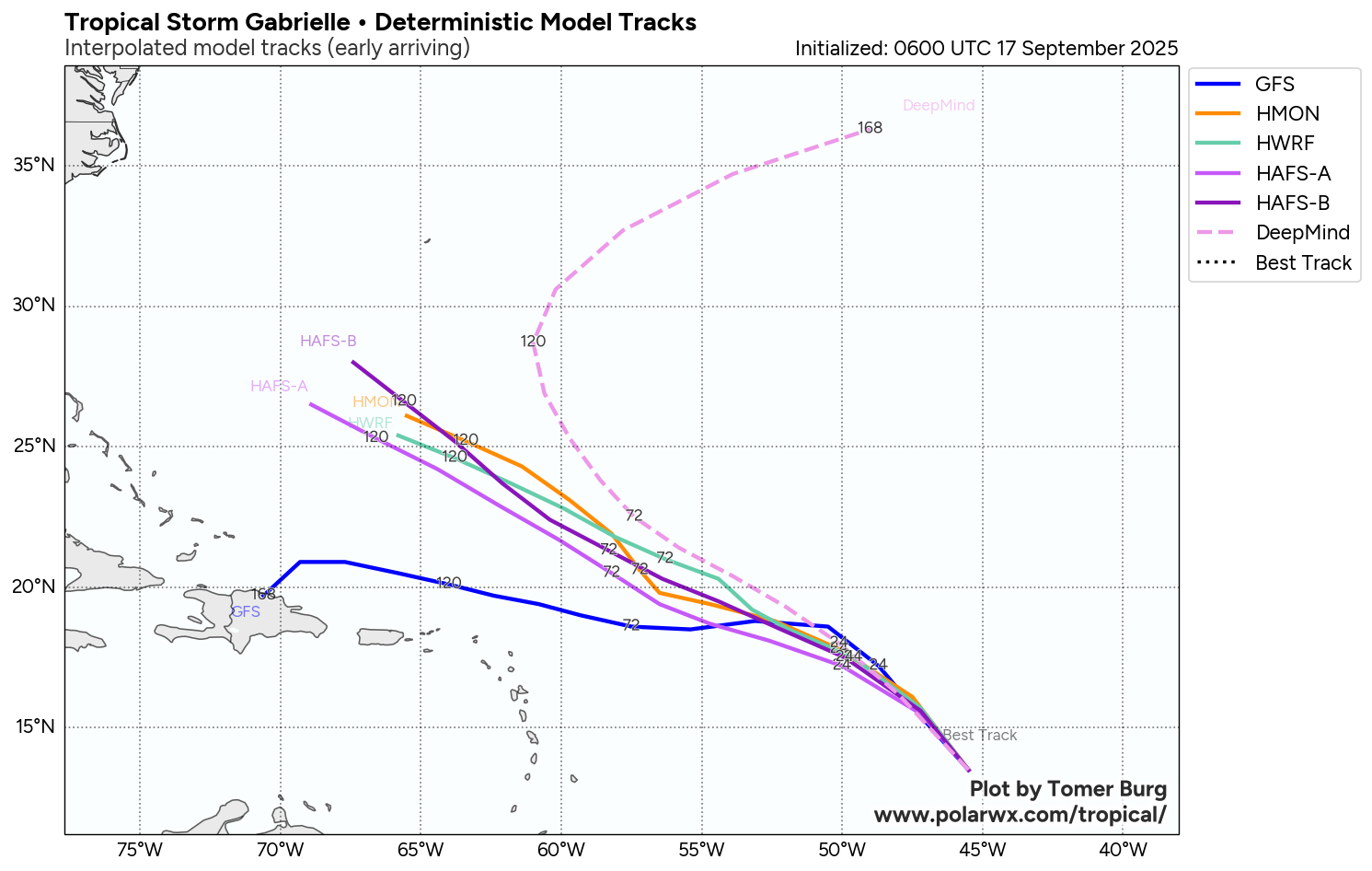
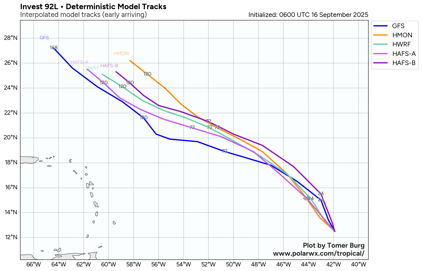
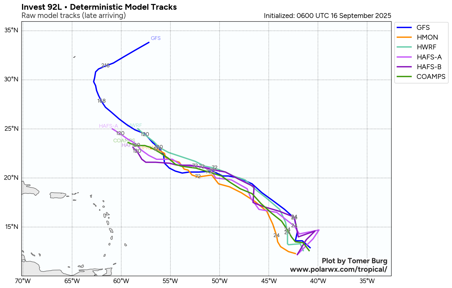
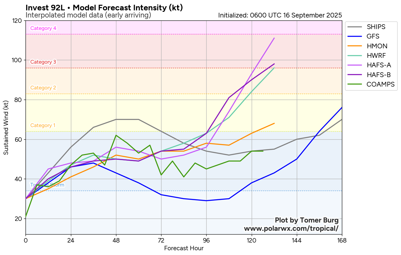
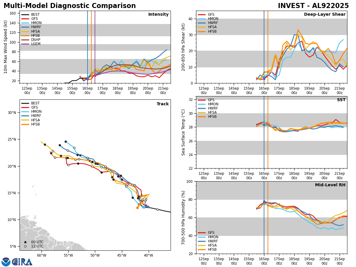
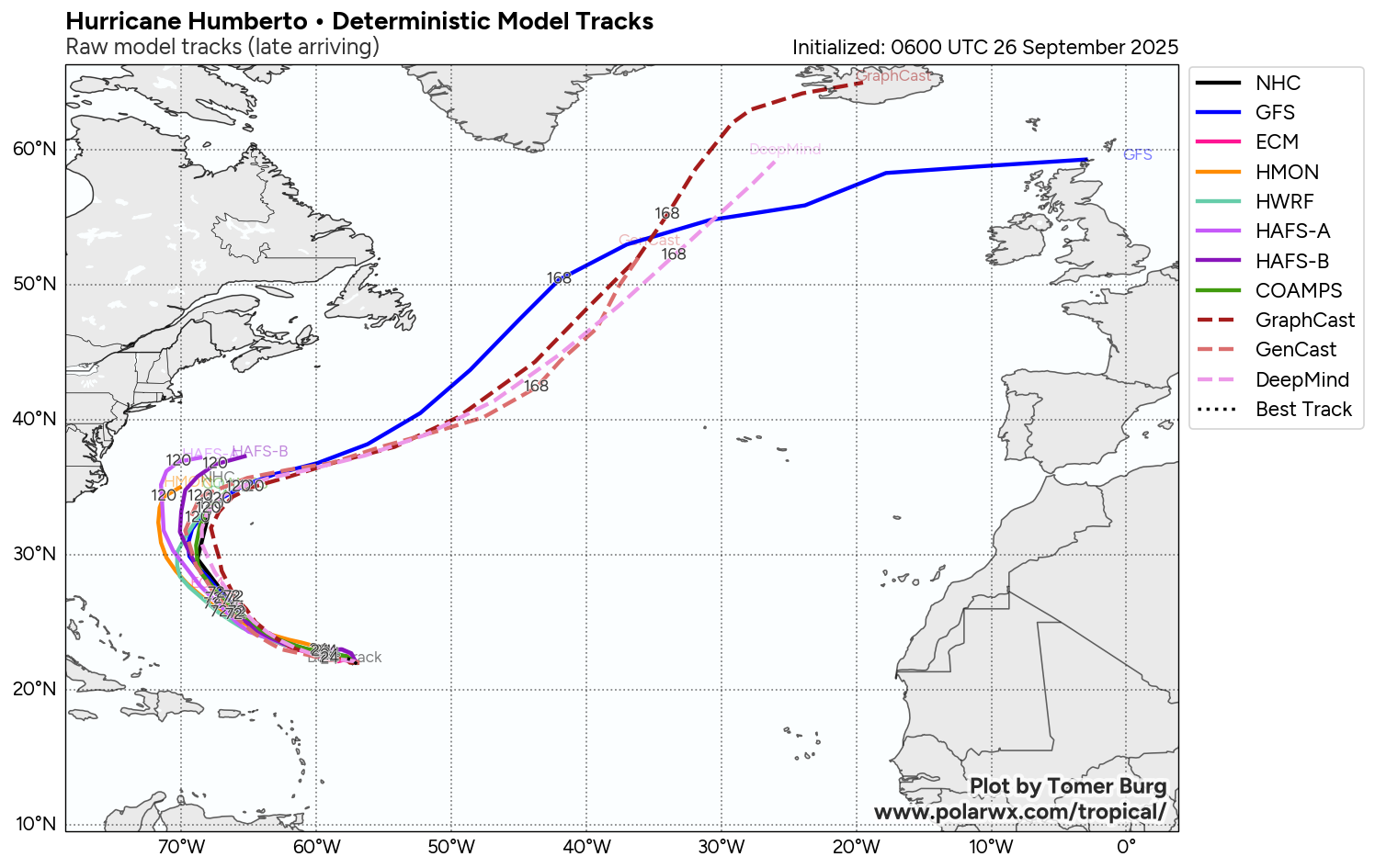
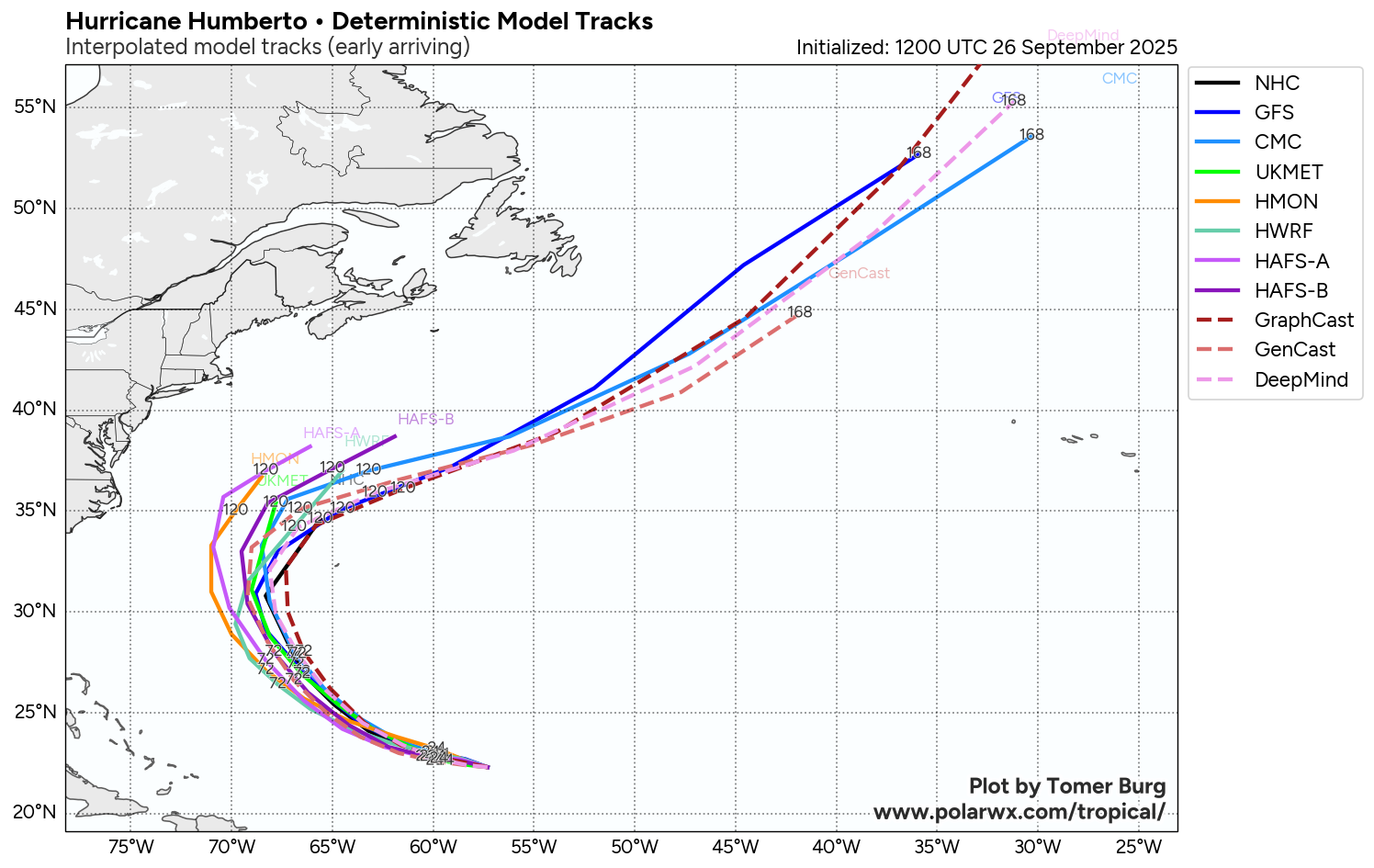
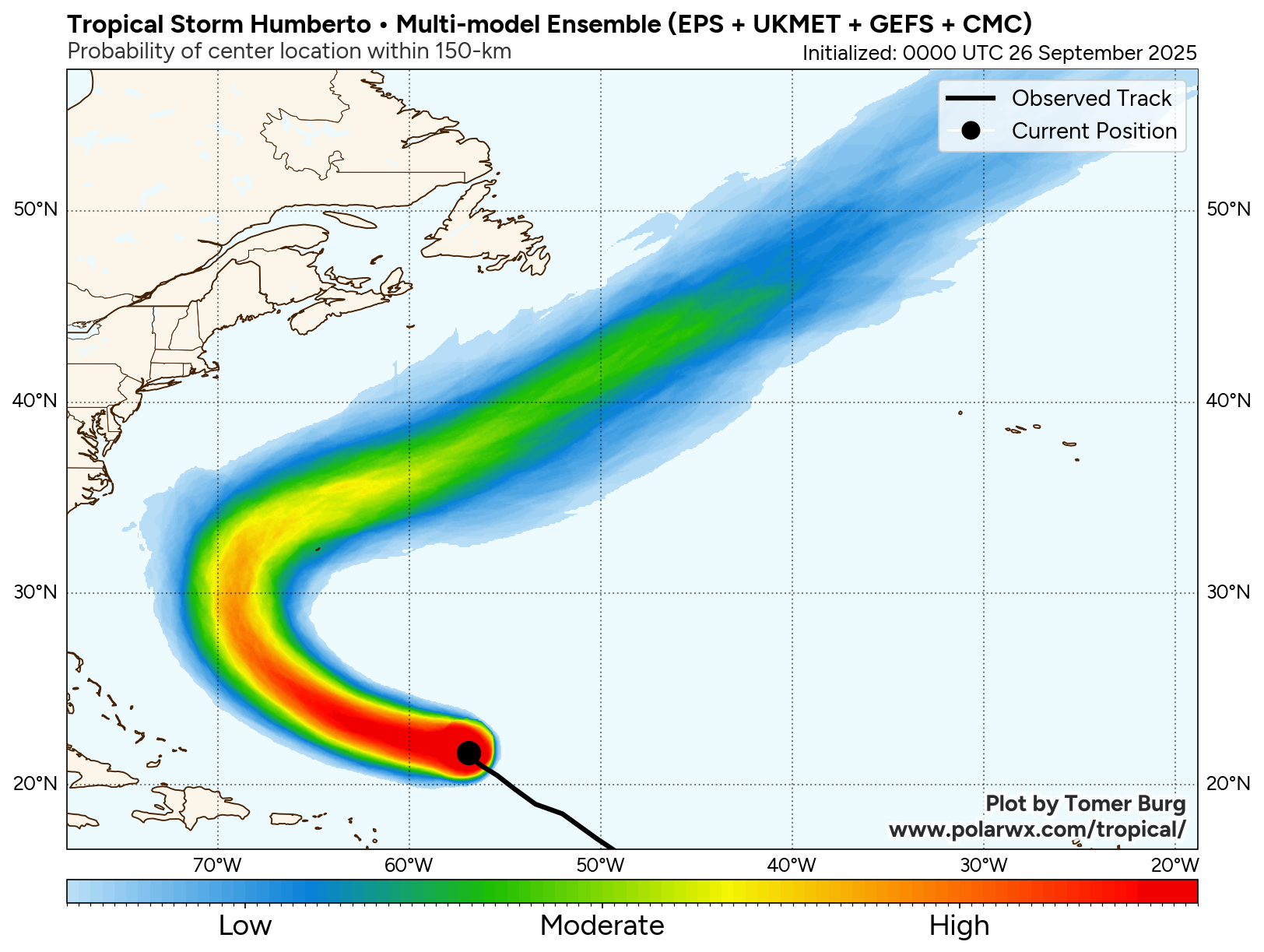
Model Track Forecast:

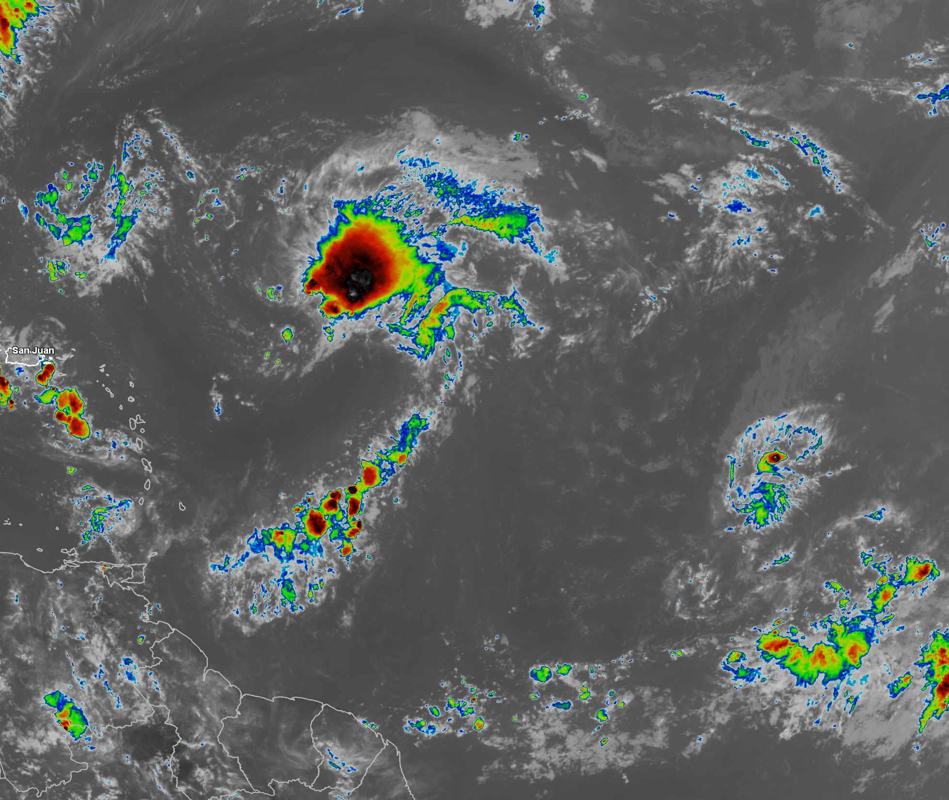
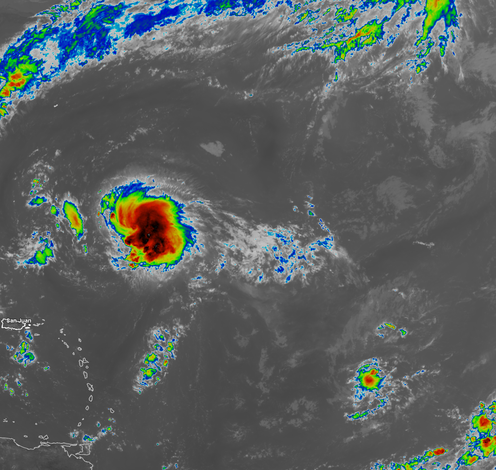
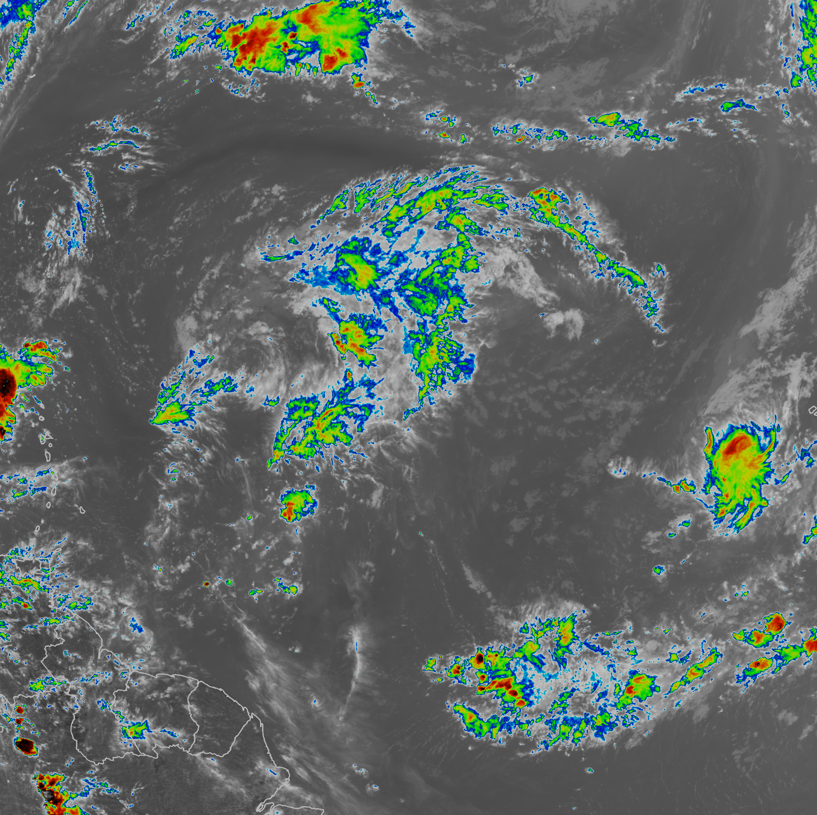
Satellite Imagery:

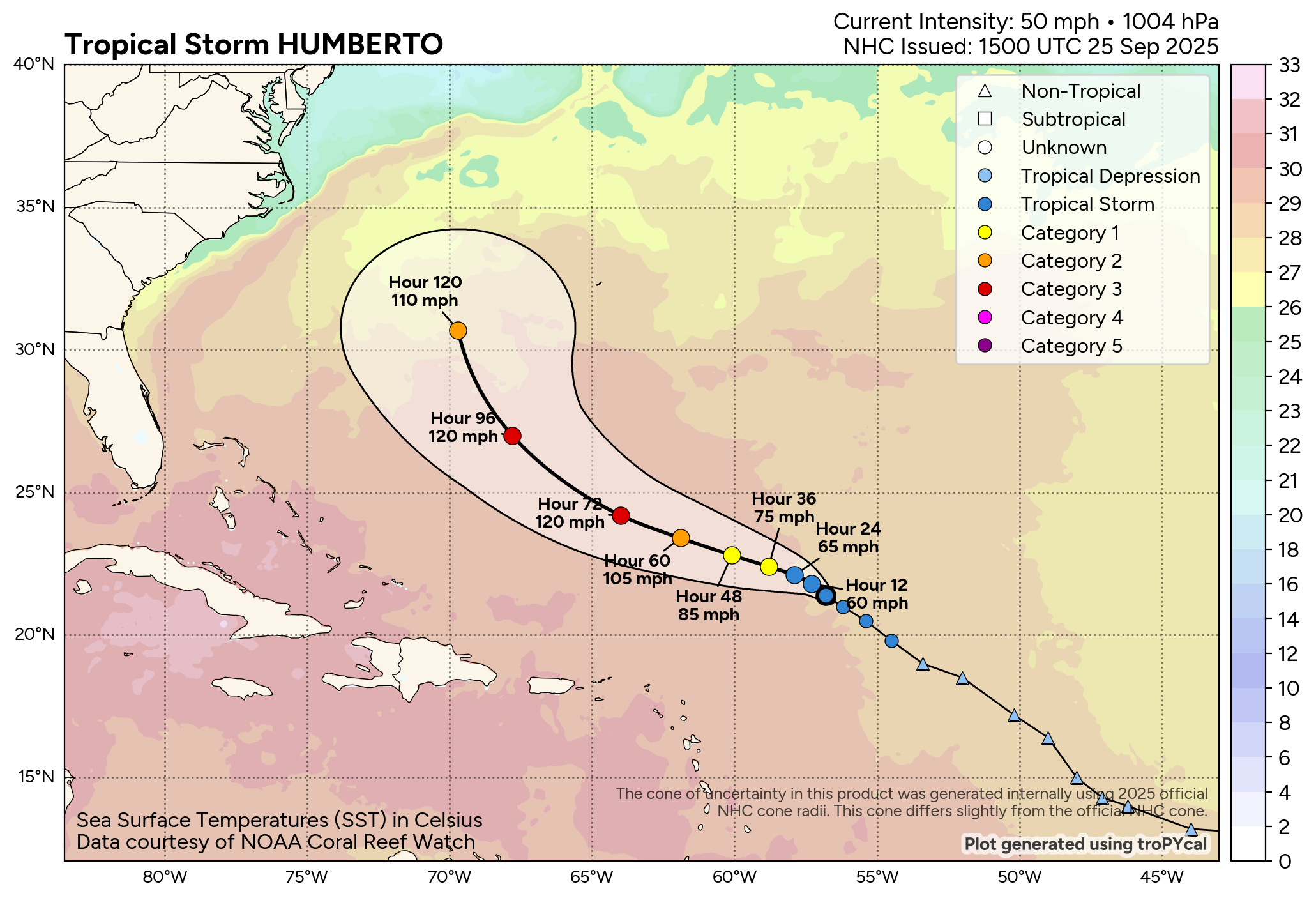
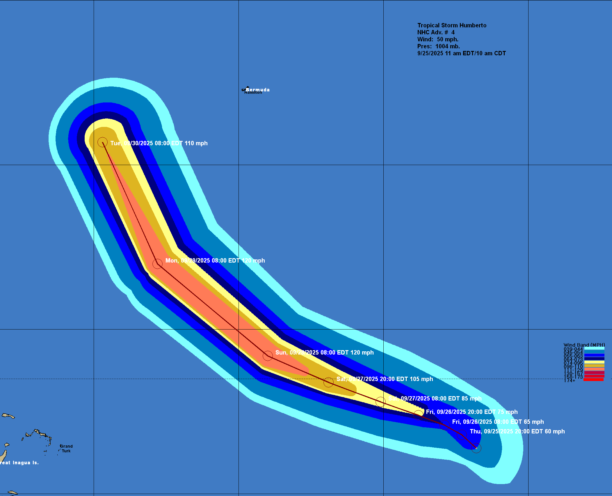
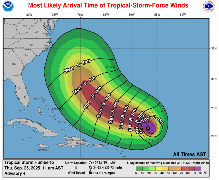
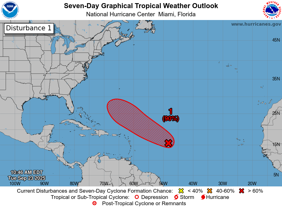
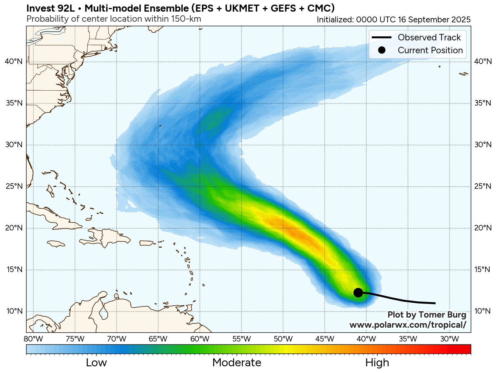
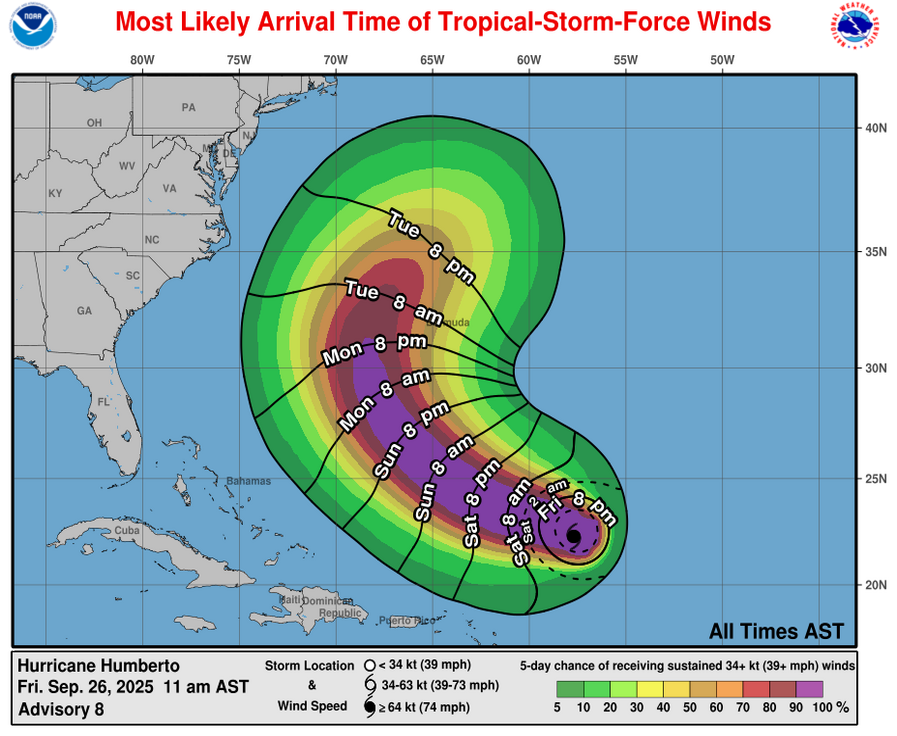
Hurricane Humberto: The discussion on Humberto will be a very short one again, as most of my attention is on Invest 94-L (future Imelda).
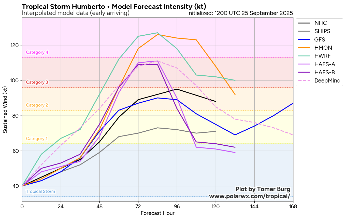
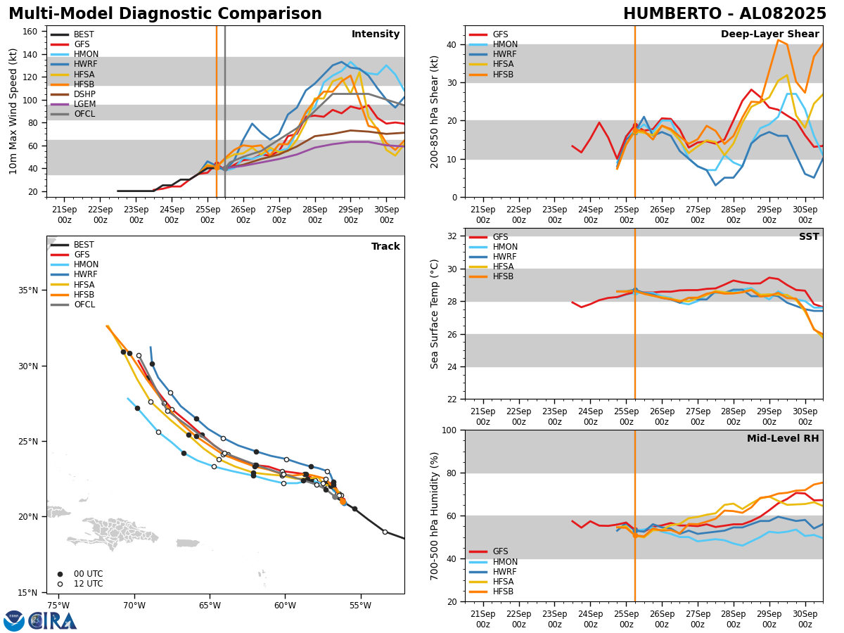
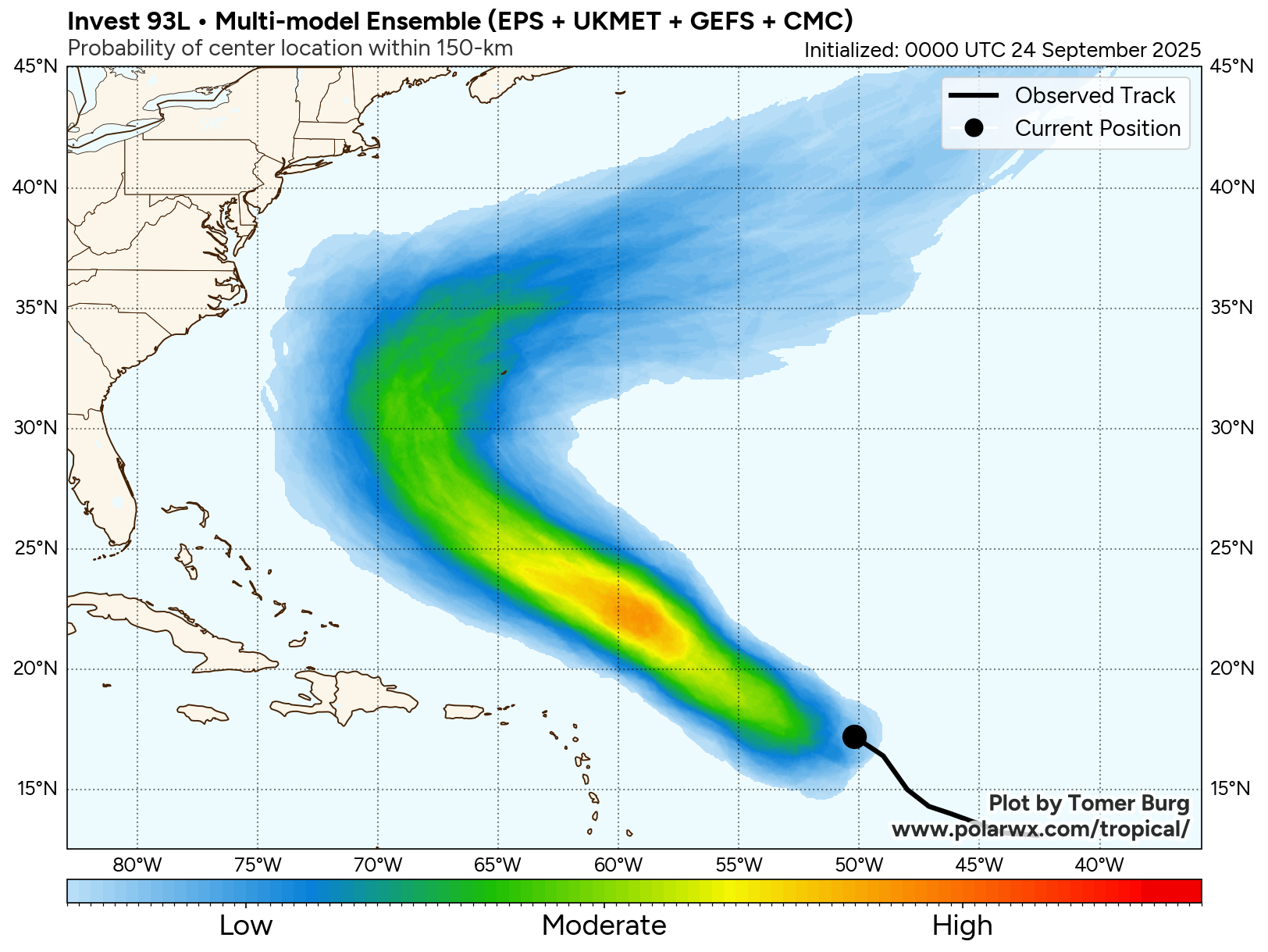
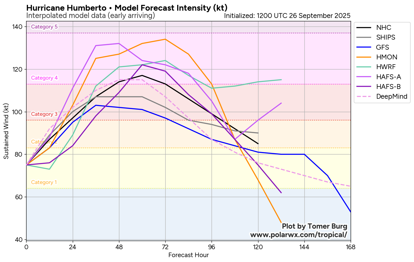
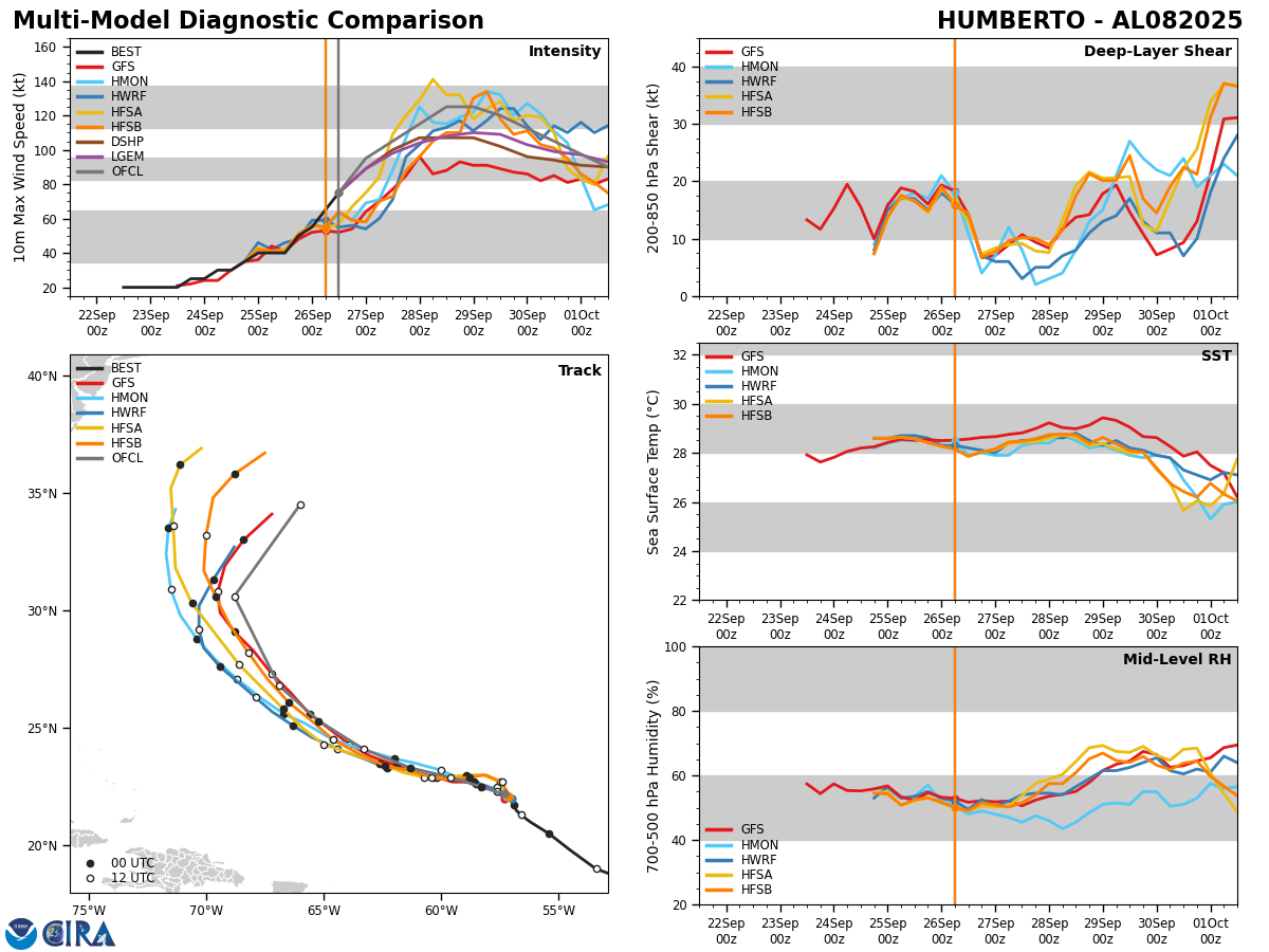
Humberto is undergoing rapid strengthening today and it looks quite likely that it will be a major hurricane as soon as tonight. Humberto looks to probably peak at Category 4 strength as it begins to turn to the northwest and shoot the gap between the Bahamas and Bermuda this weekend.
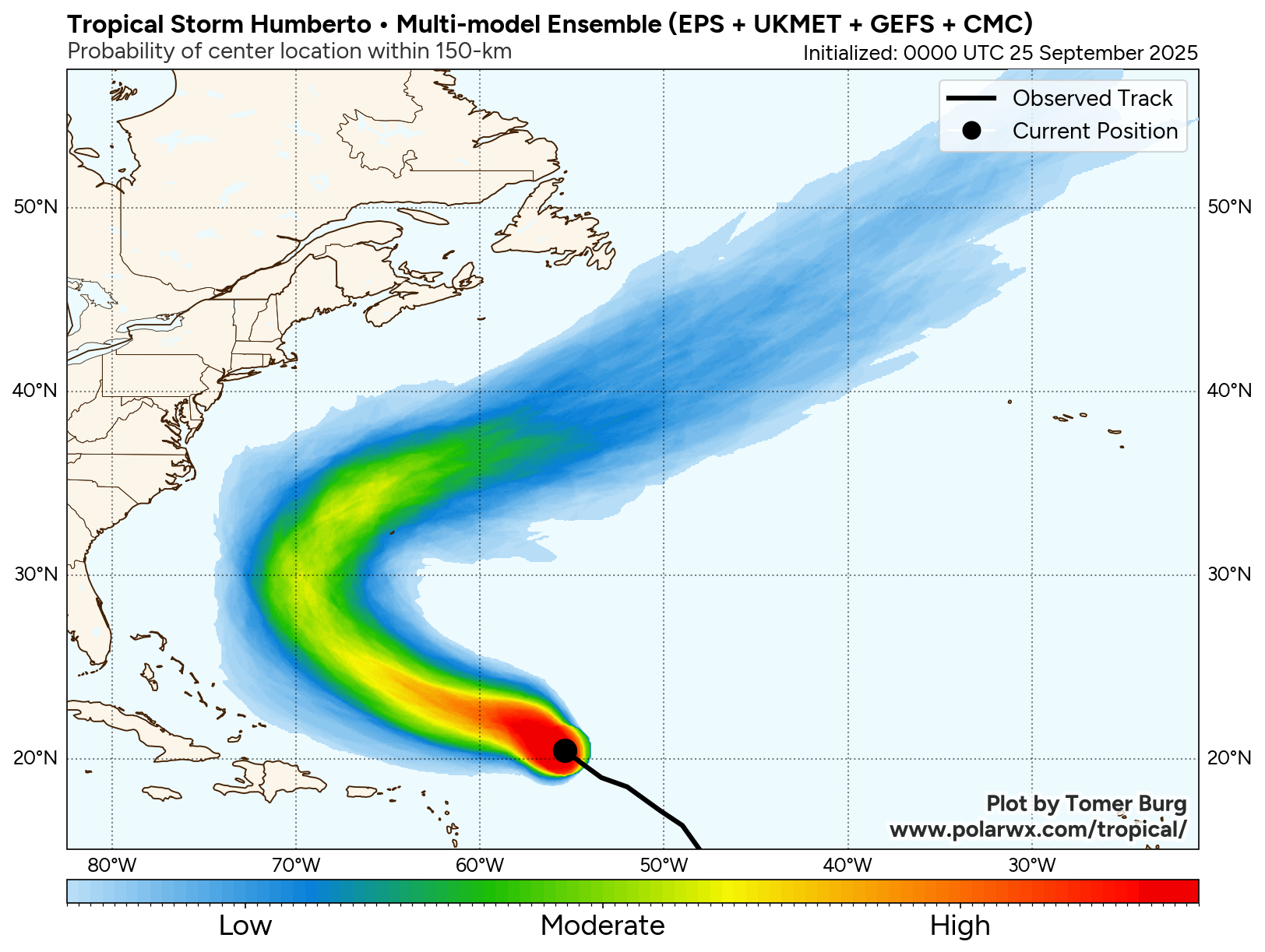
As we get into the first half of next week, Humberto looks to curve to the north and northeast around the western side of a high pressure ridge over the central North Atlantic. Because of this, it still looks likely that Humberto will remain east of the Bahamas and the East Coast of the United States.
As for Bermuda, it looks as if Humberto will track far enough to the west of the island around Tuesday and Wednesday to not directly impact Bermuda. That being said, some impacts to Bermuda are possible, especially in terms of rough surf and some of the outer rain bands affecting the island during the first half of next week.
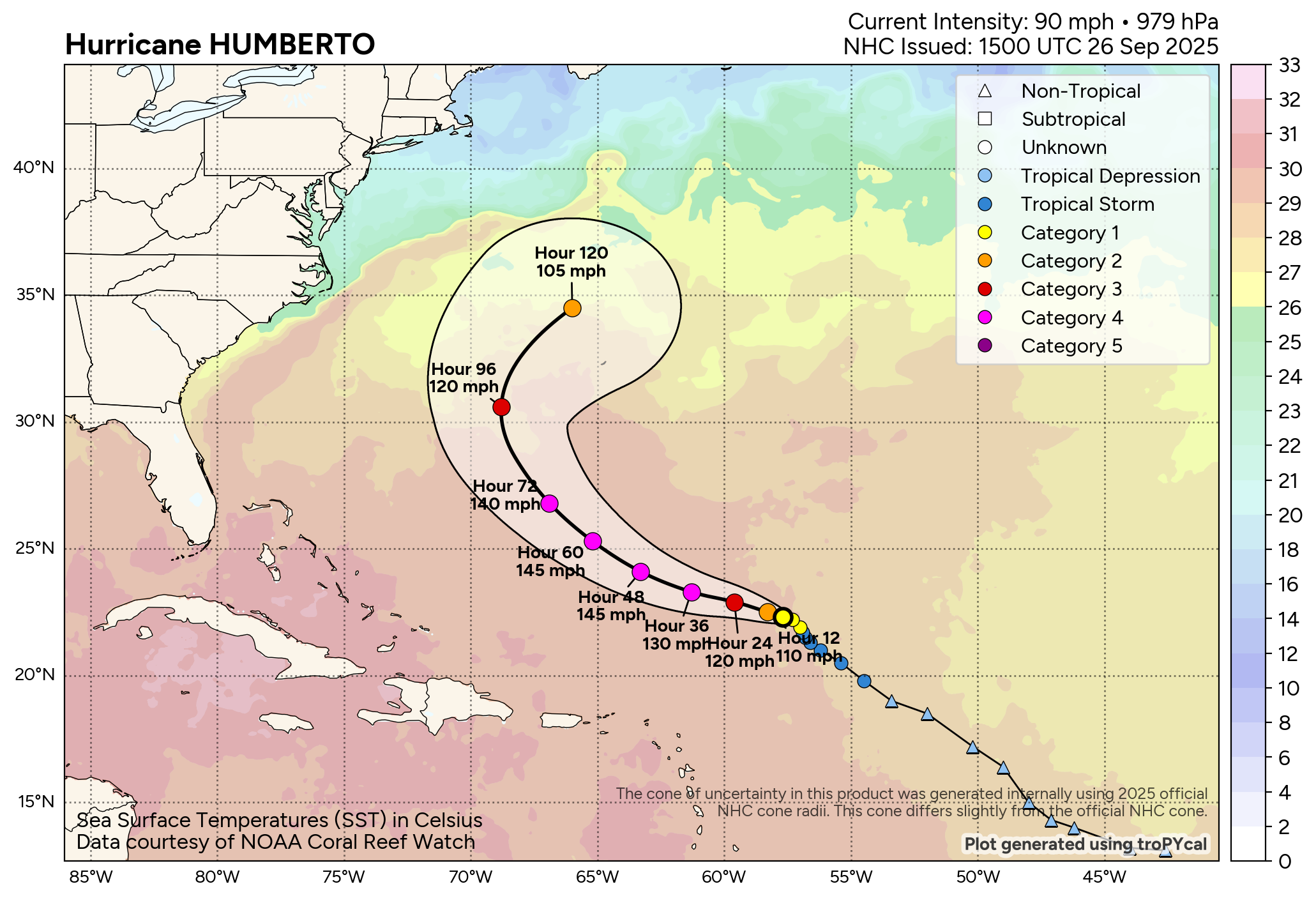
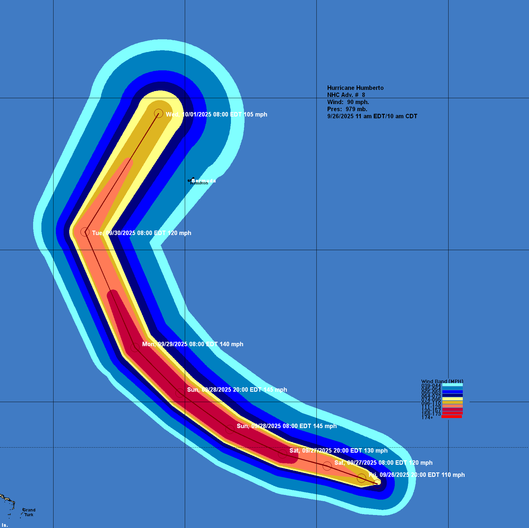
Model Track Forecast:
Satellite Imagery:

The next tropical weather discussion will be issued on Saturday.