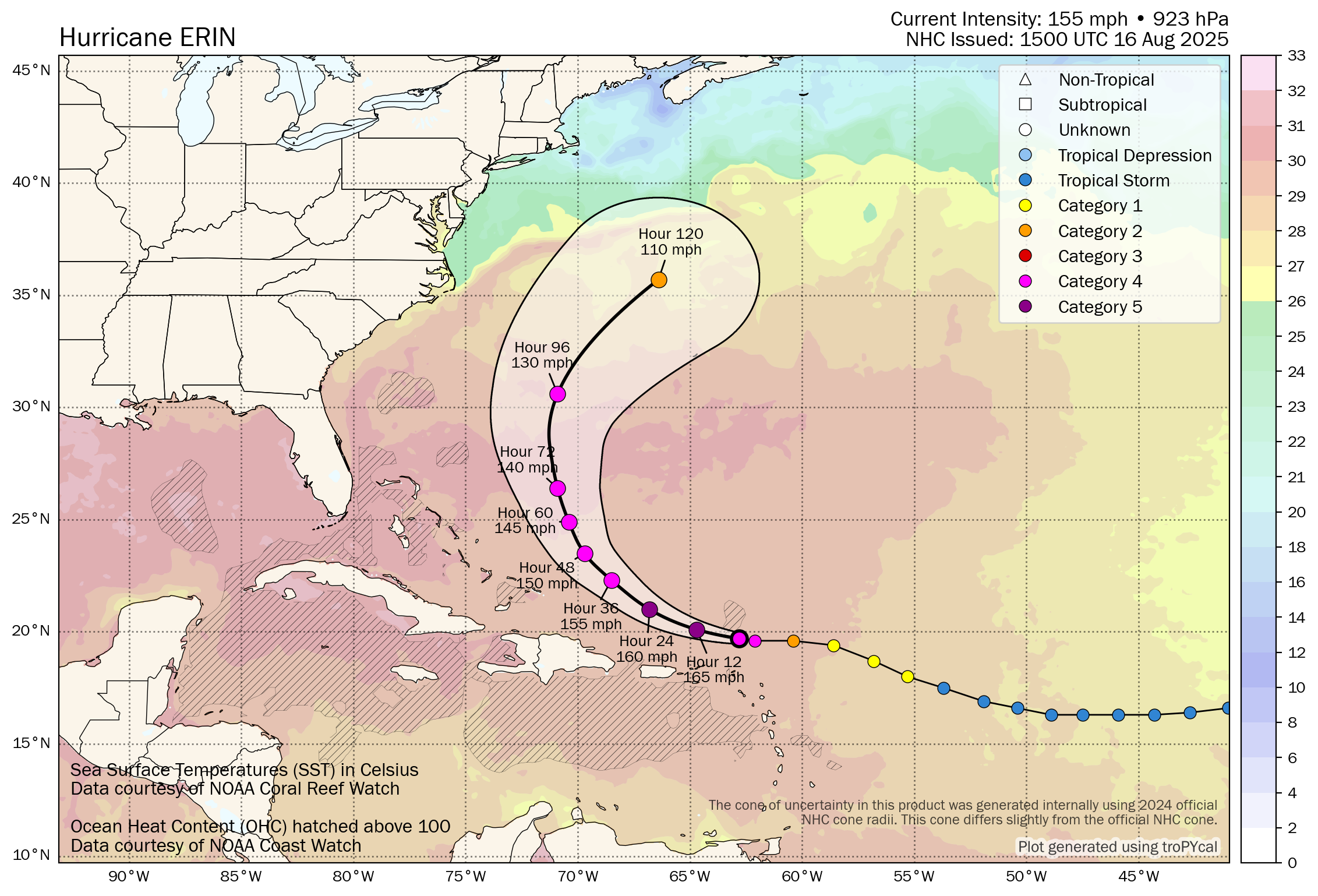
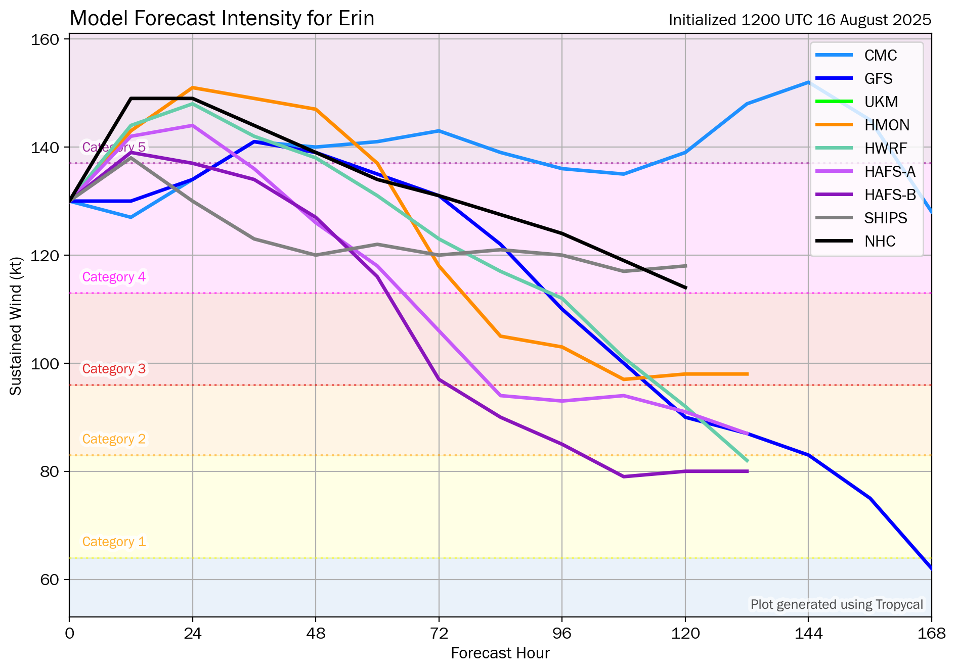
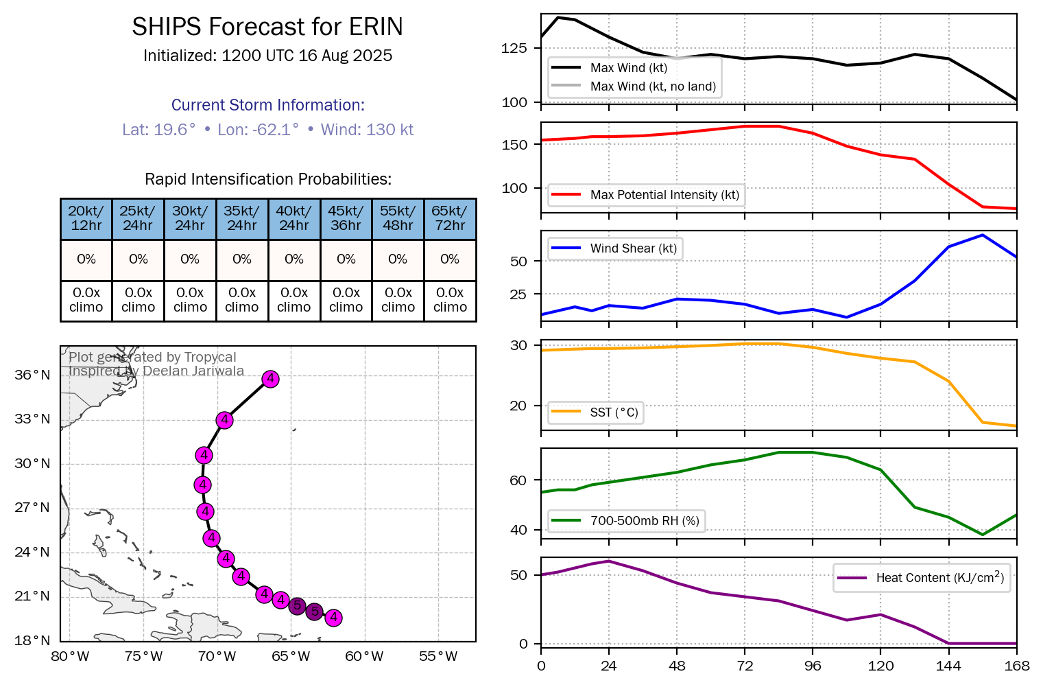
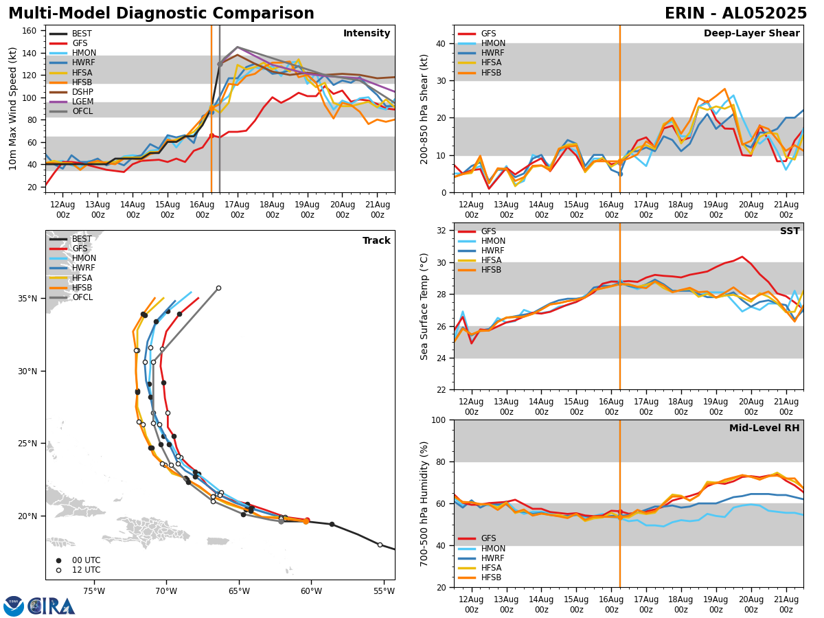
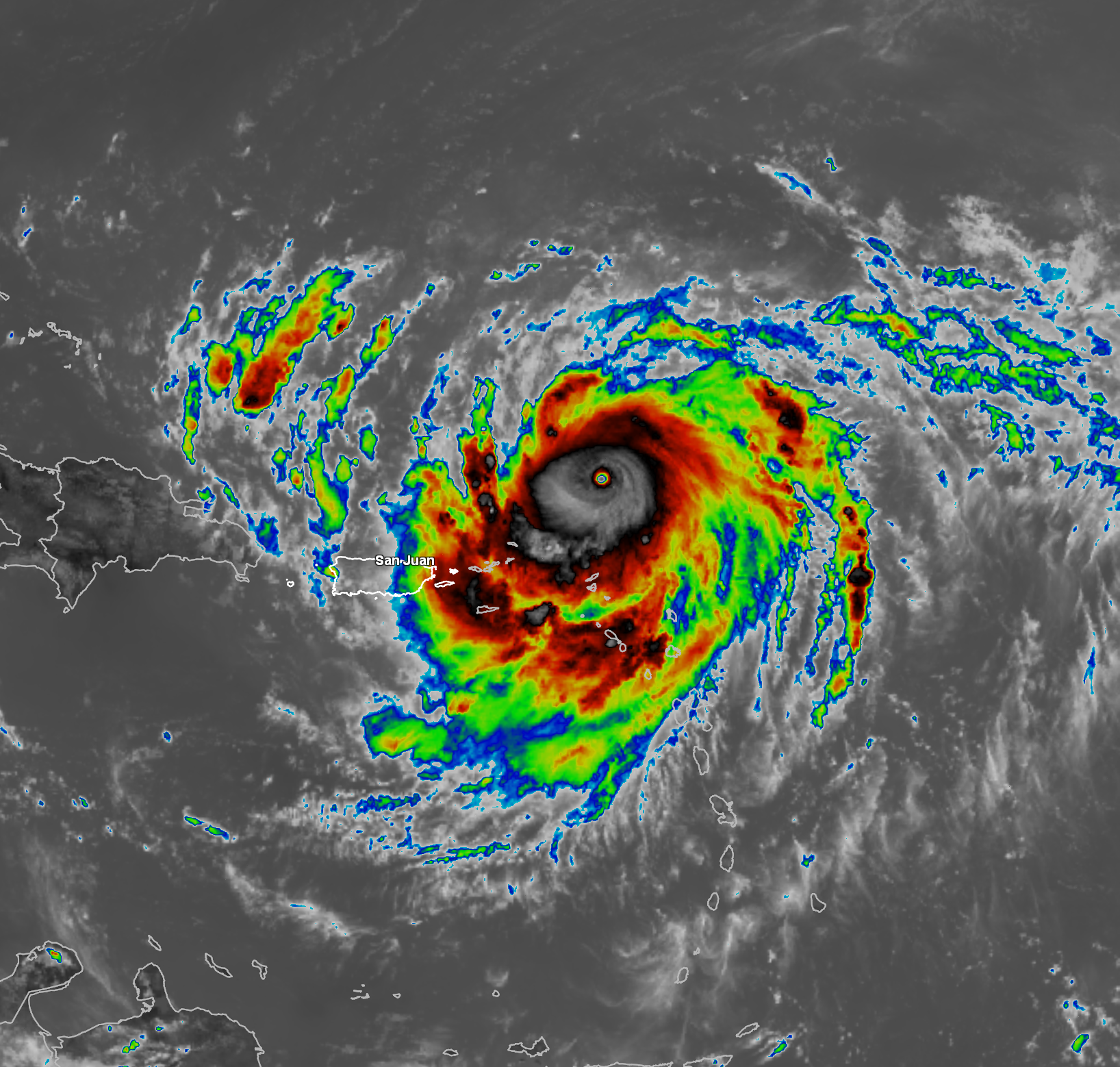
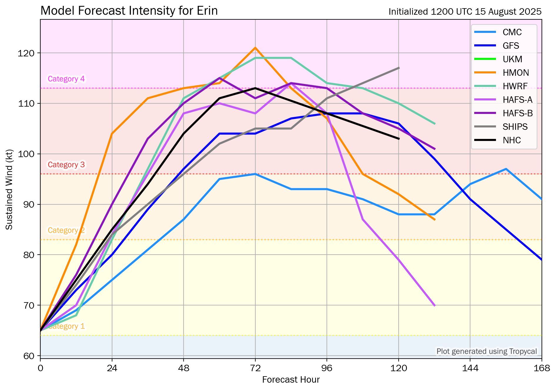
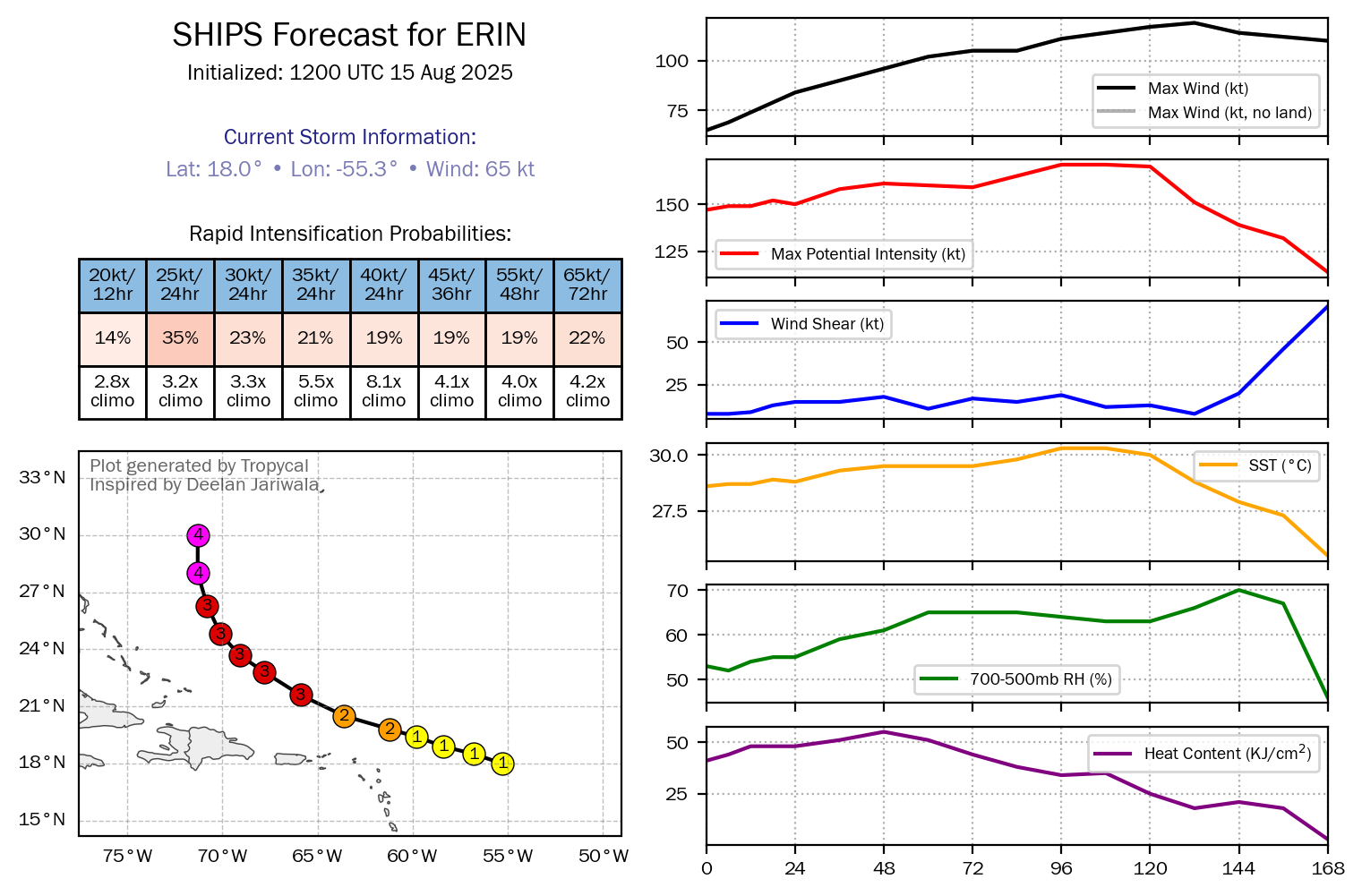
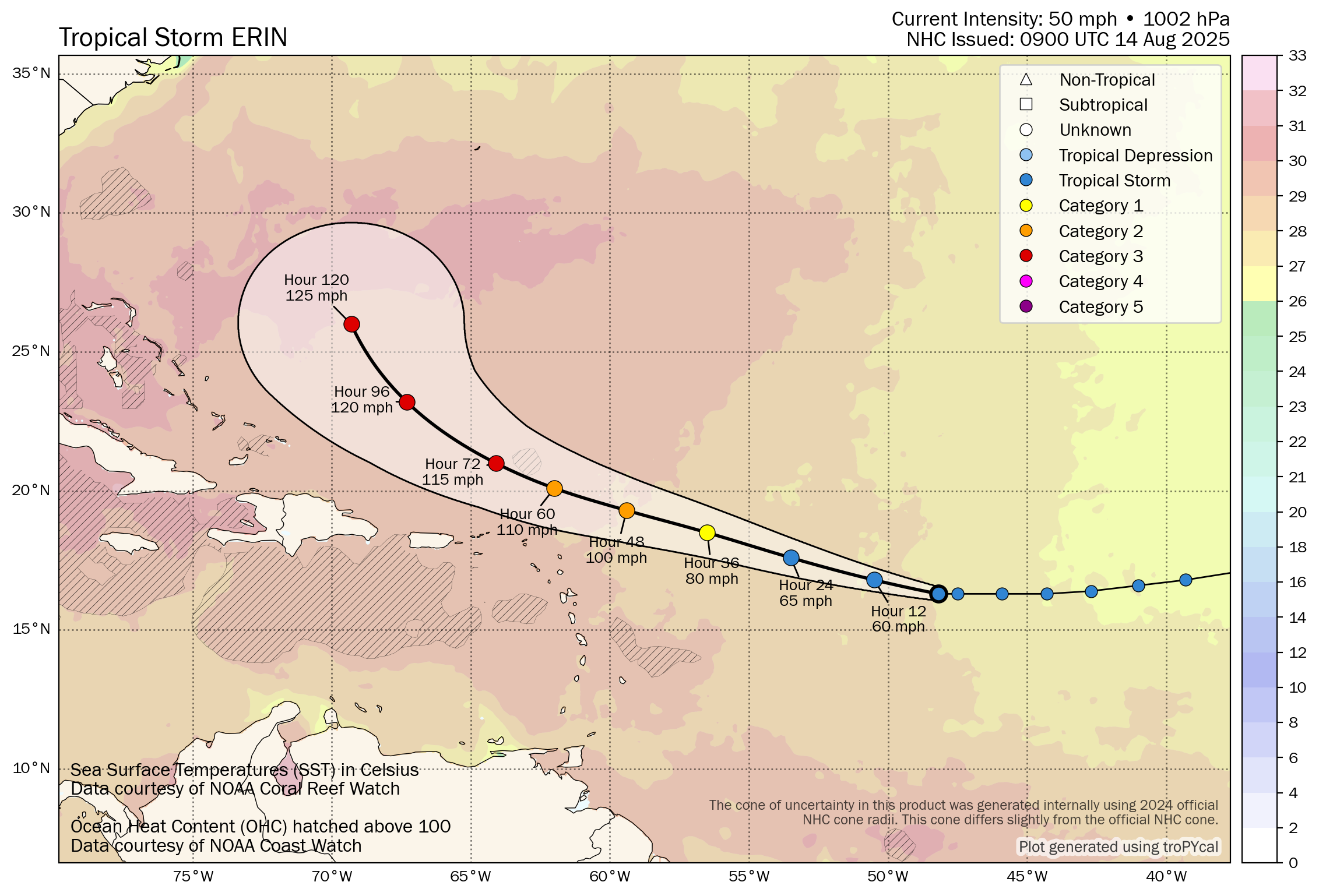
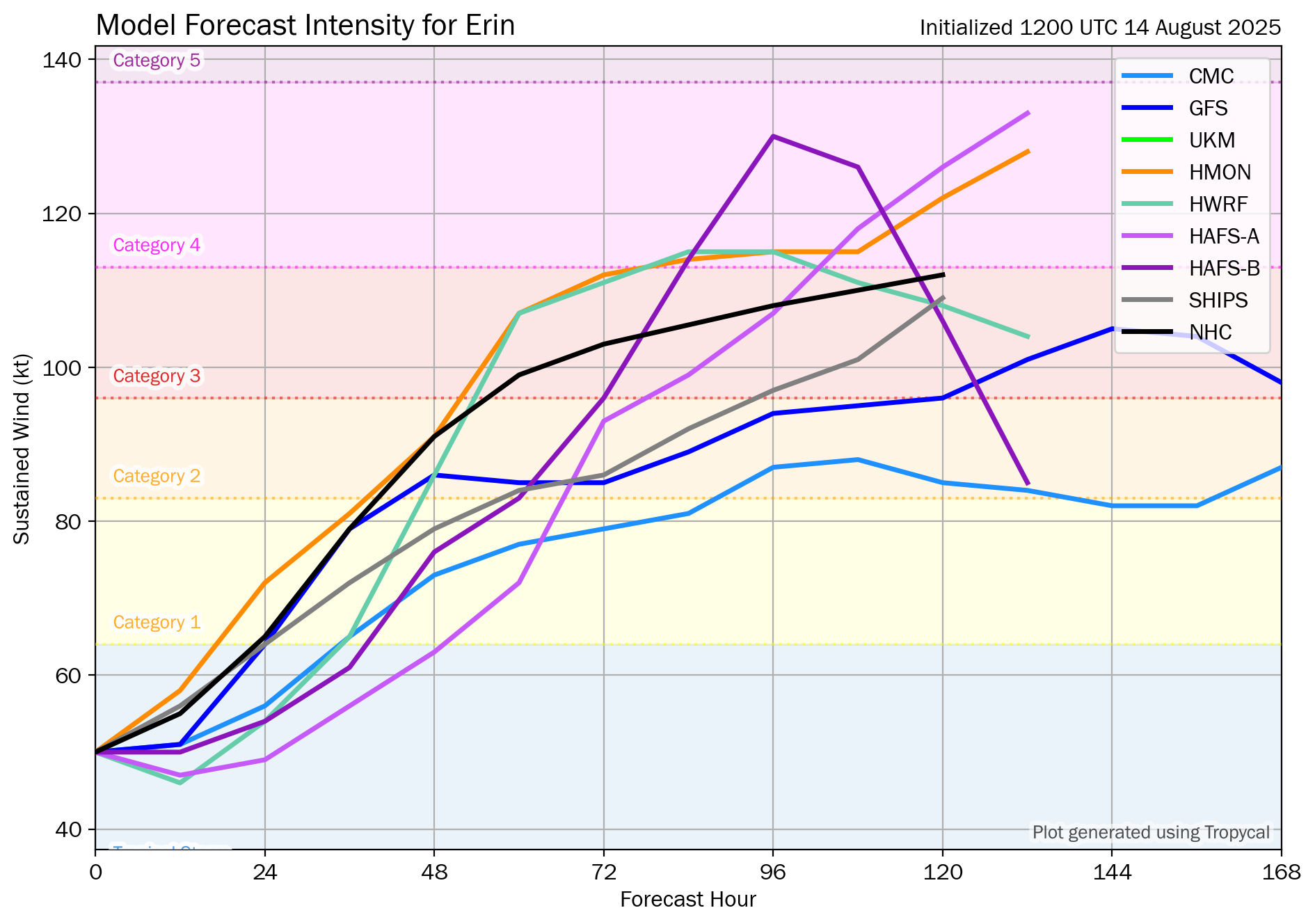
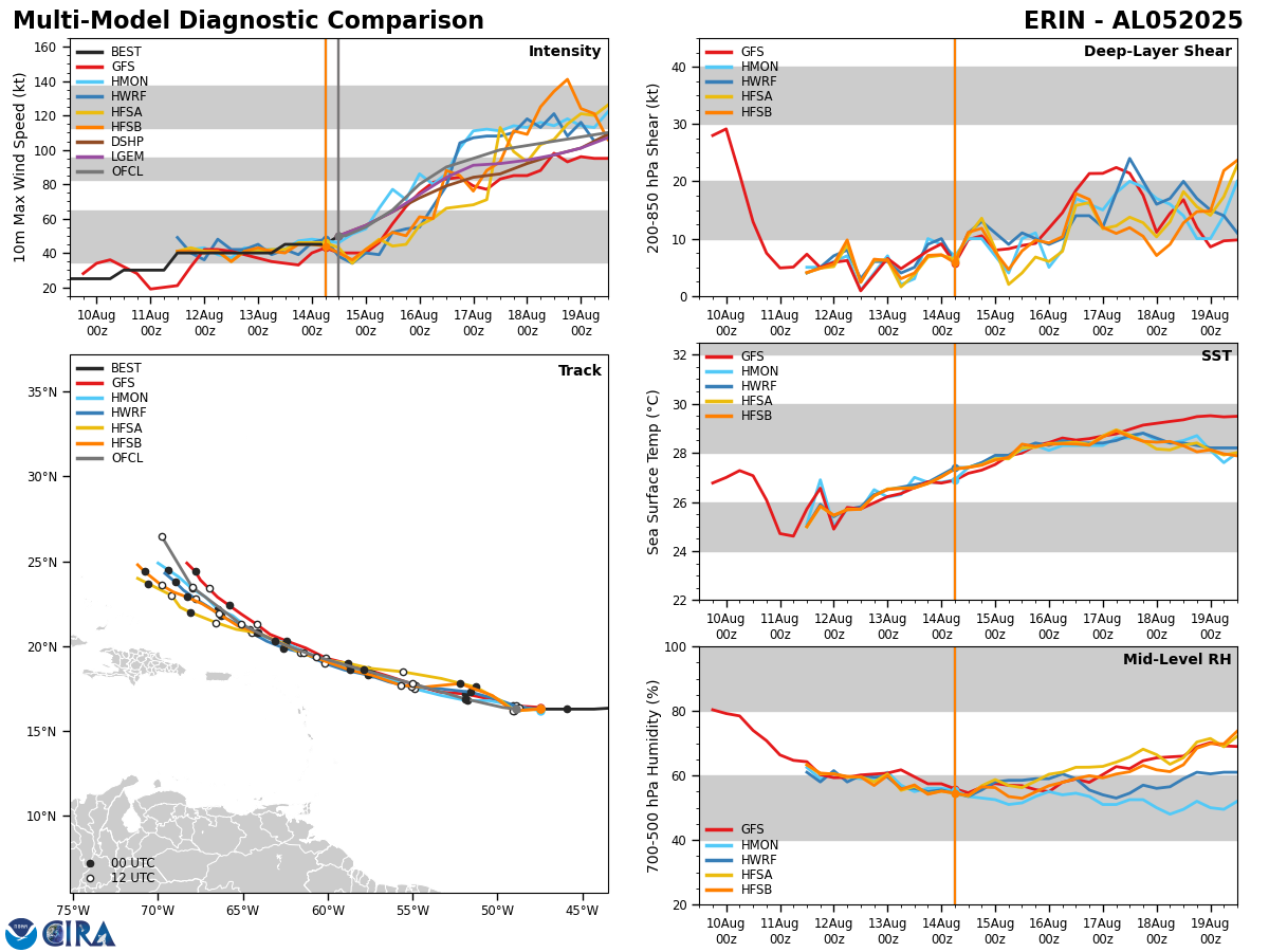
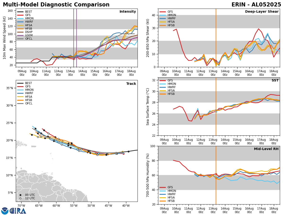
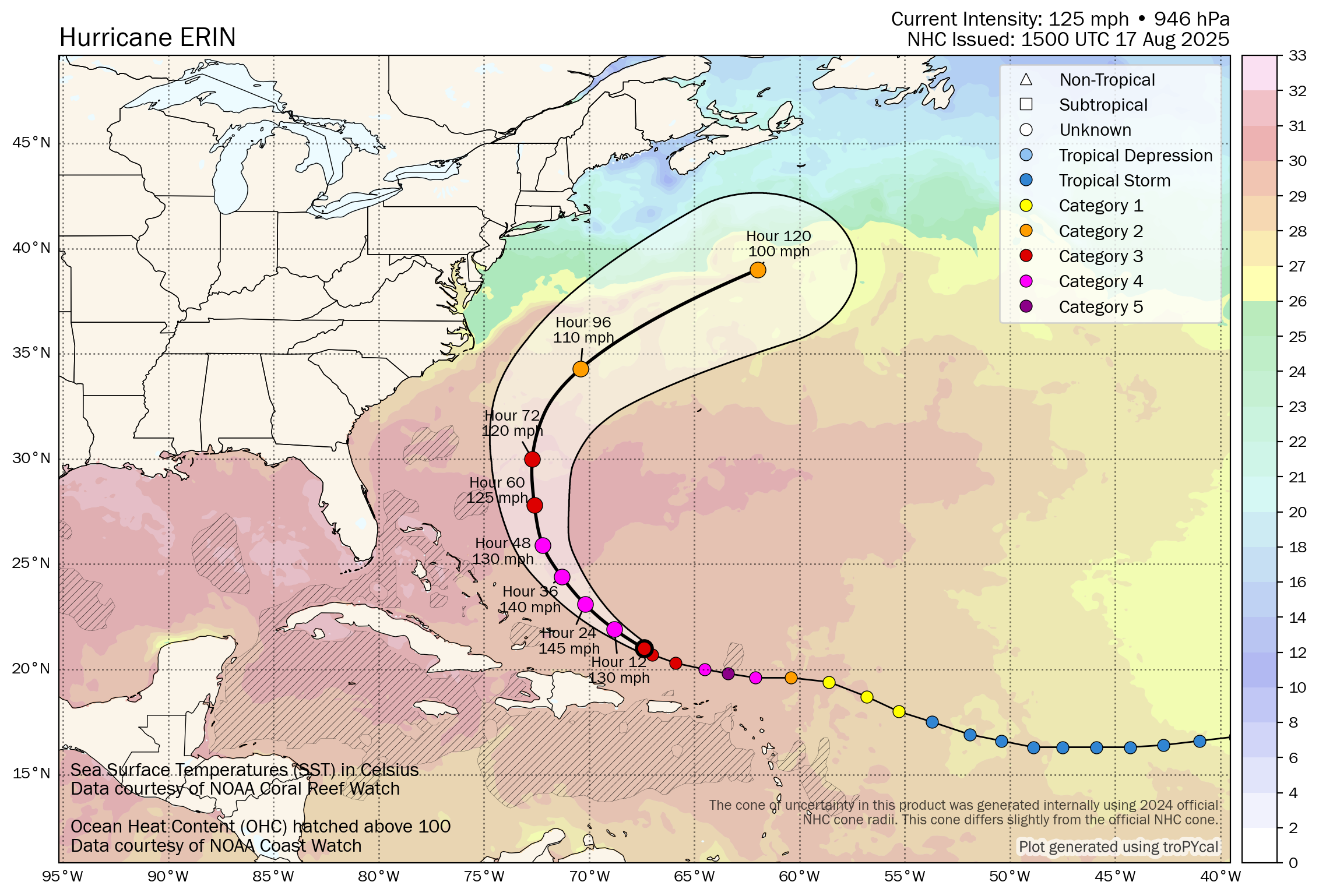
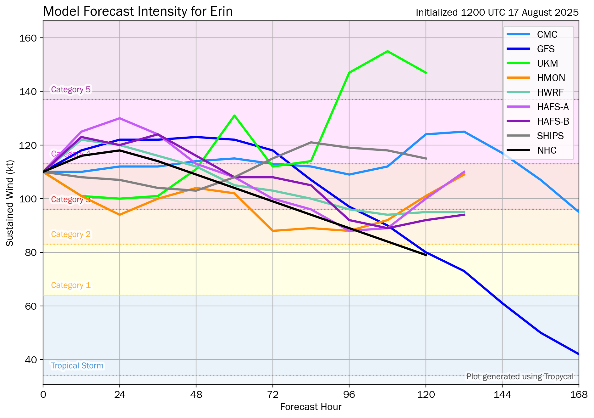
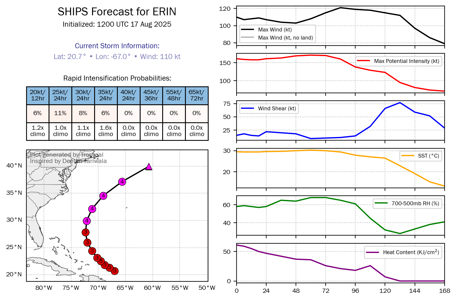
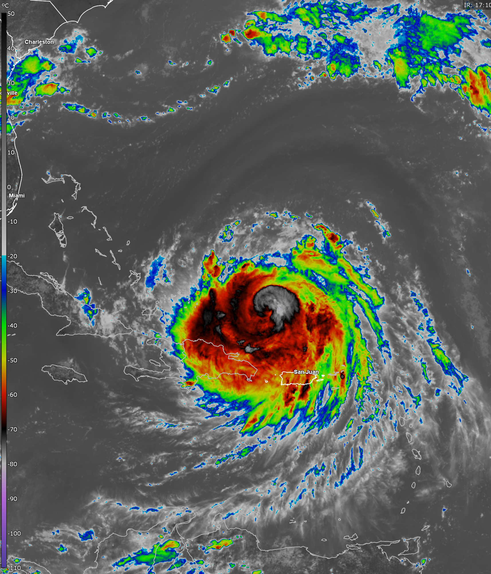
Major Hurricane Erin: It appears that Erin has been undergoing an eye wall replacement cycle since late yesterday where the original eye collapses & a new eye then forms and begins to contract. This process leads to a hurricane that does weaken for a while, but also then has a larger eye and a larger and more expansive wind field.
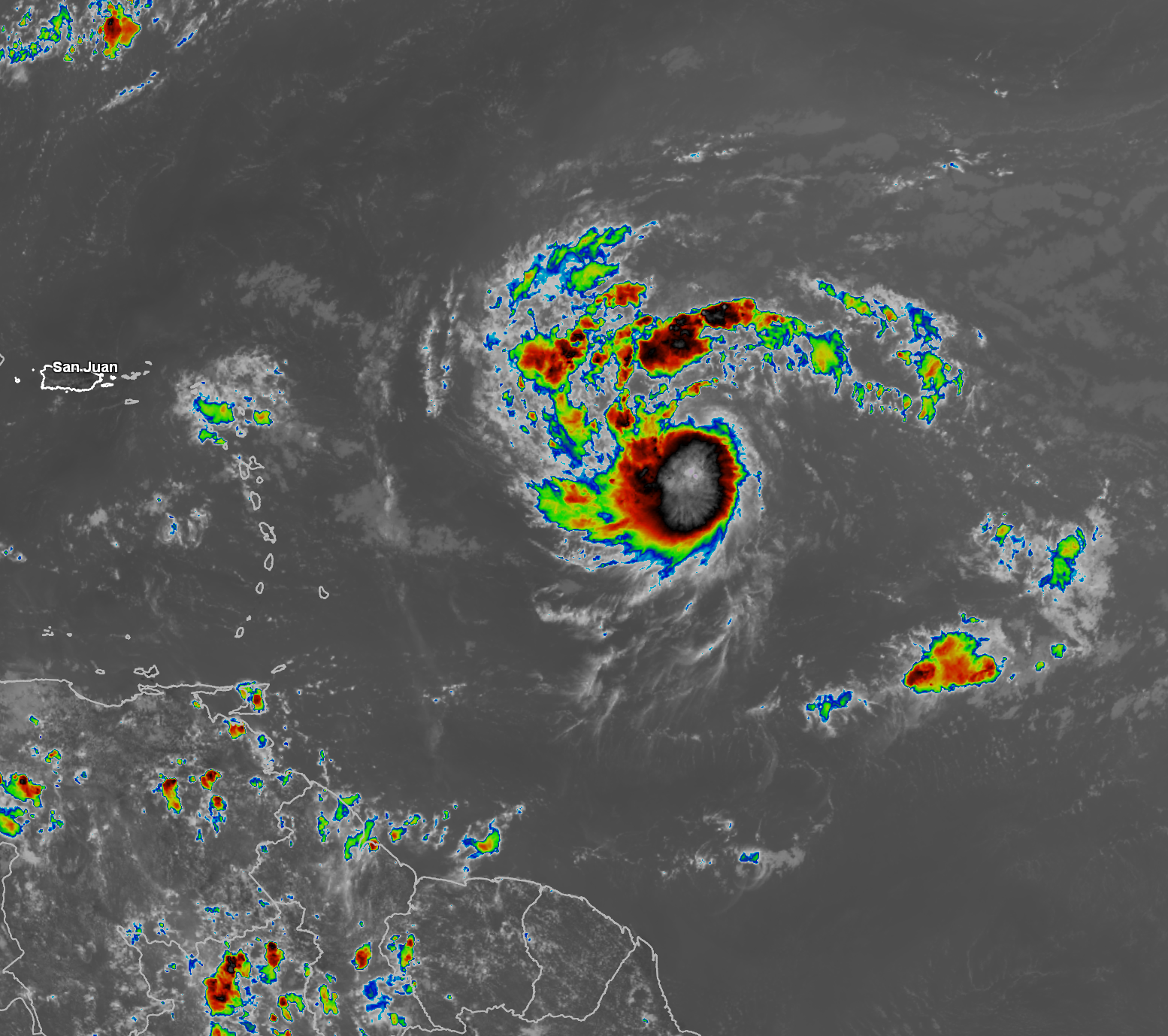
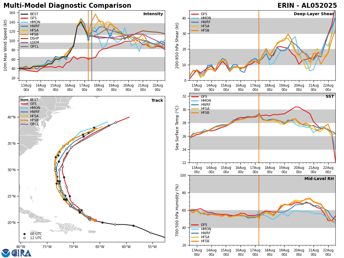
This means that Erin’s eye is no longer visible on satellite imagery and it seems that Erin has weakened to a Category 3 hurricane. We probably will end up seeing a new round of strengthening later today and especially tonight once Erin reorganizes itself from the eye wall replacement.
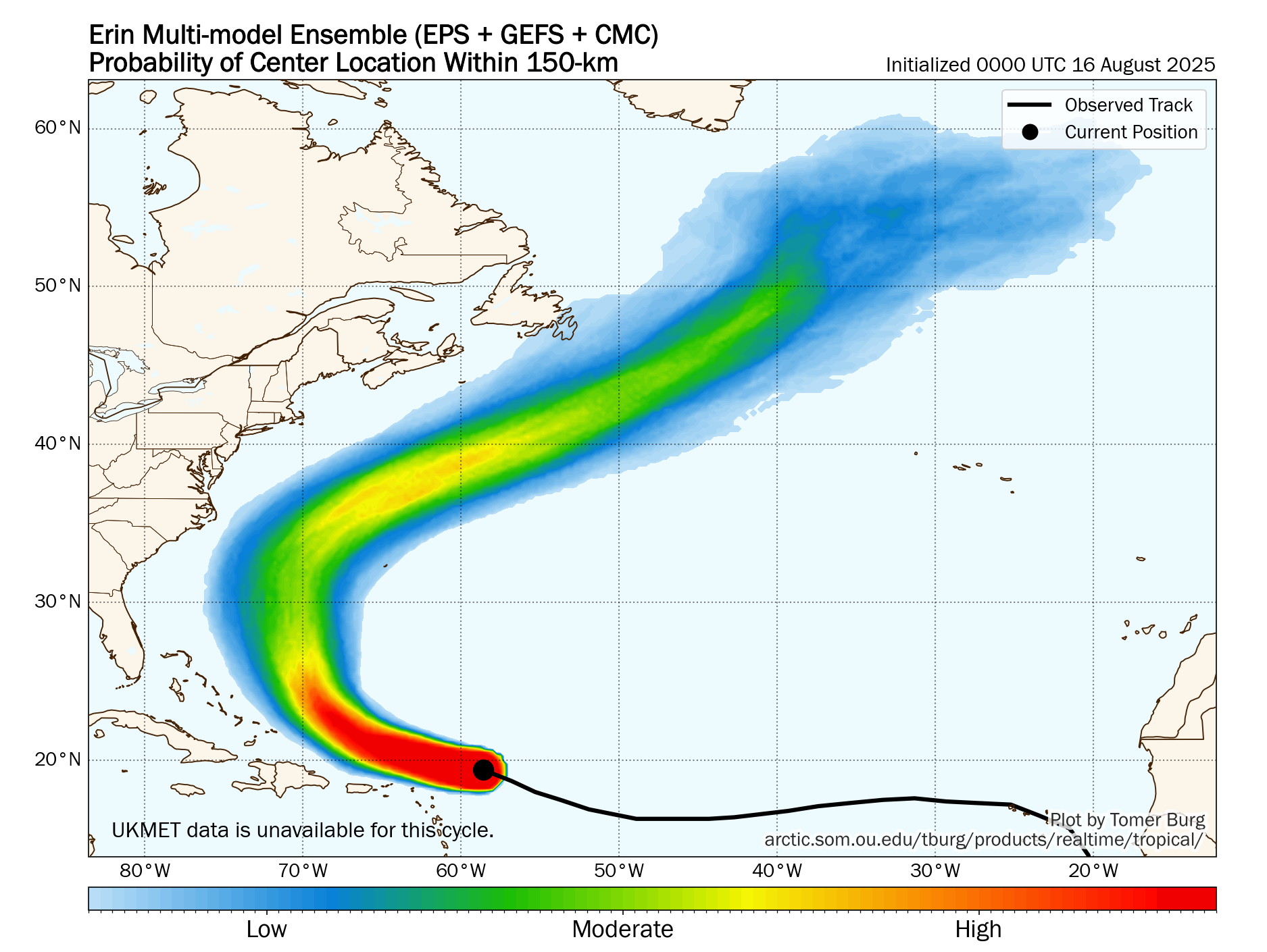
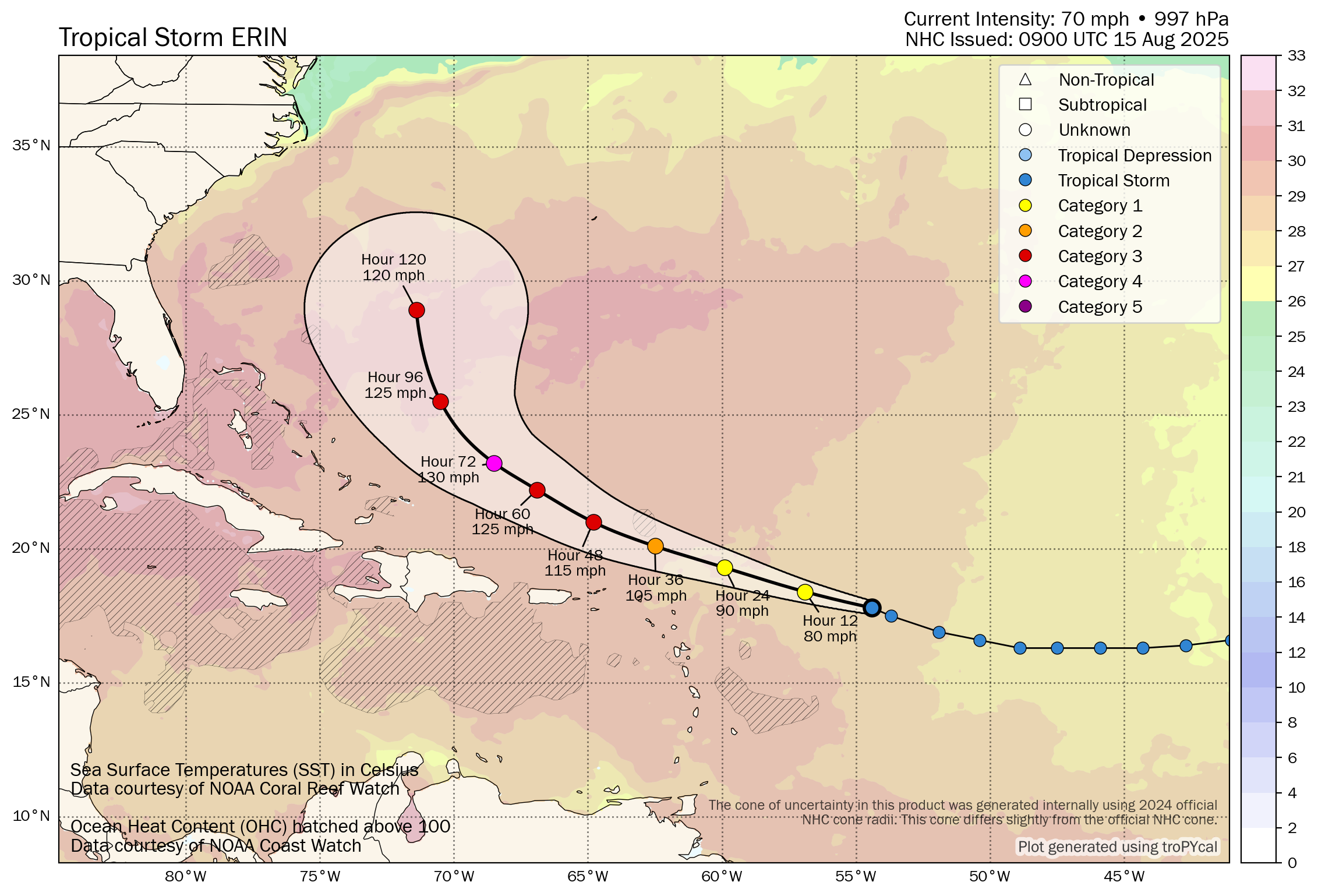
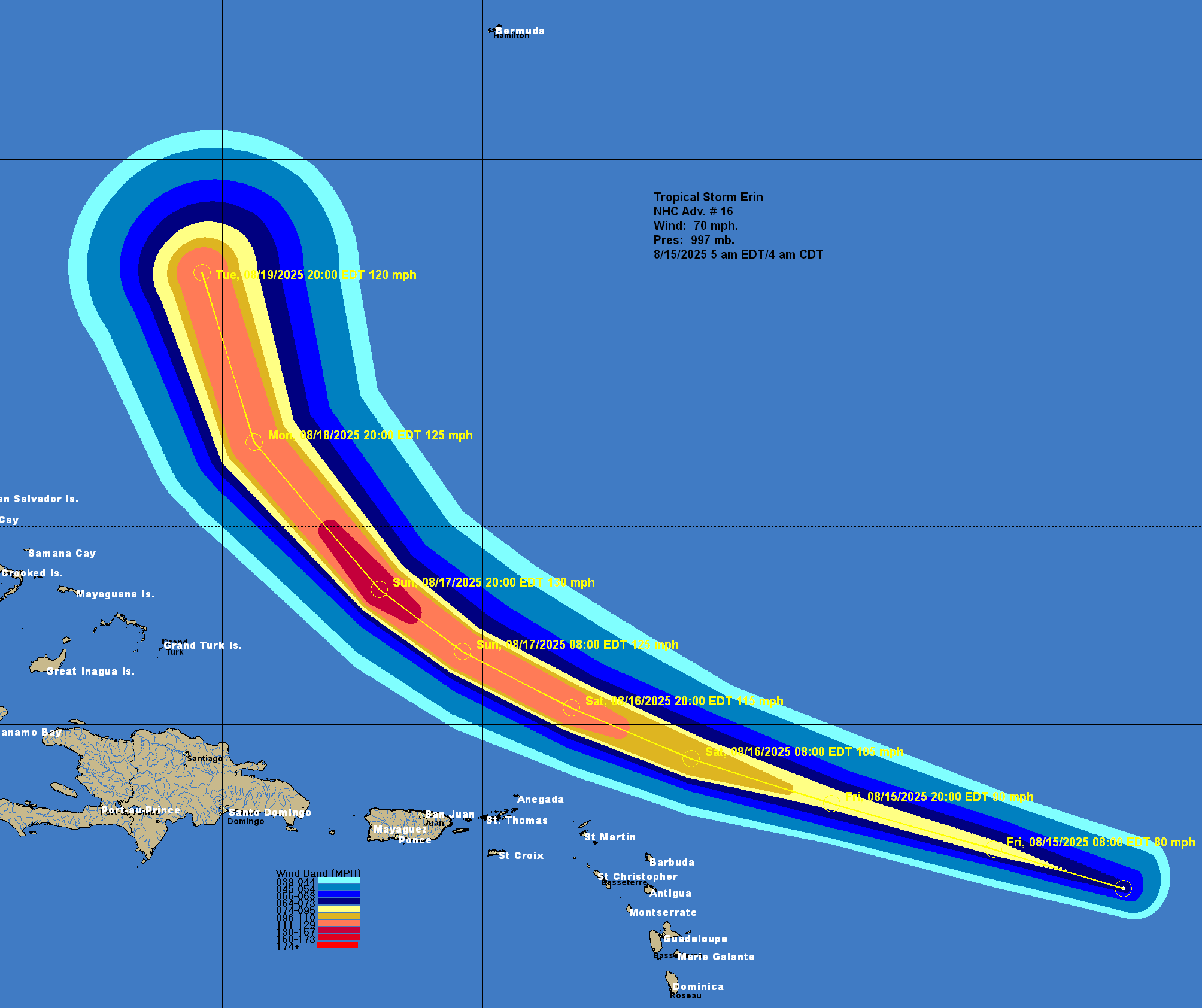
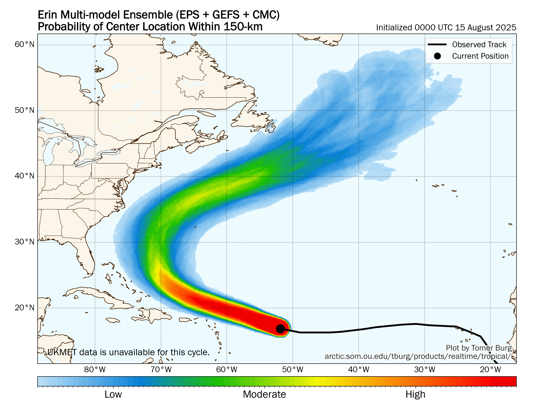
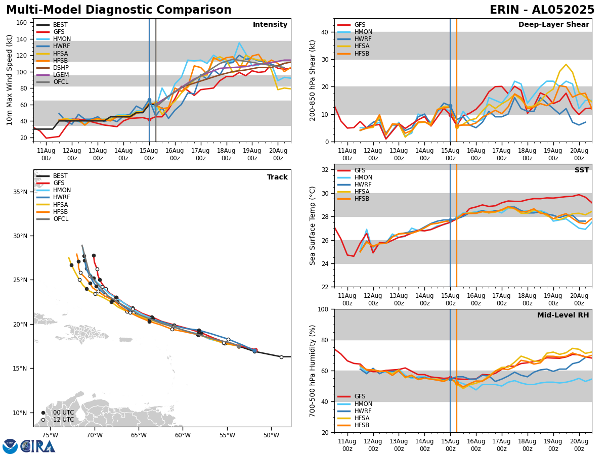
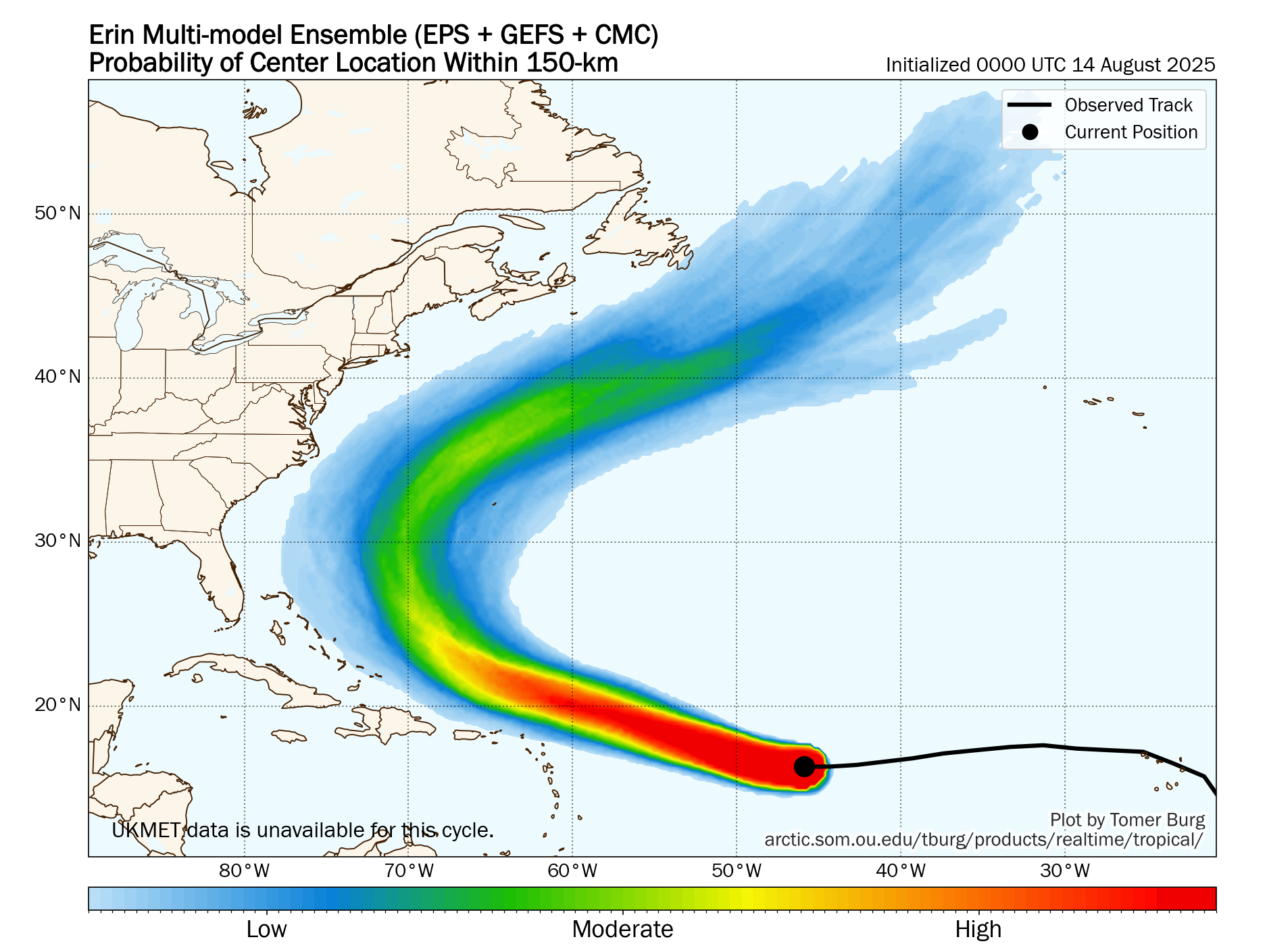
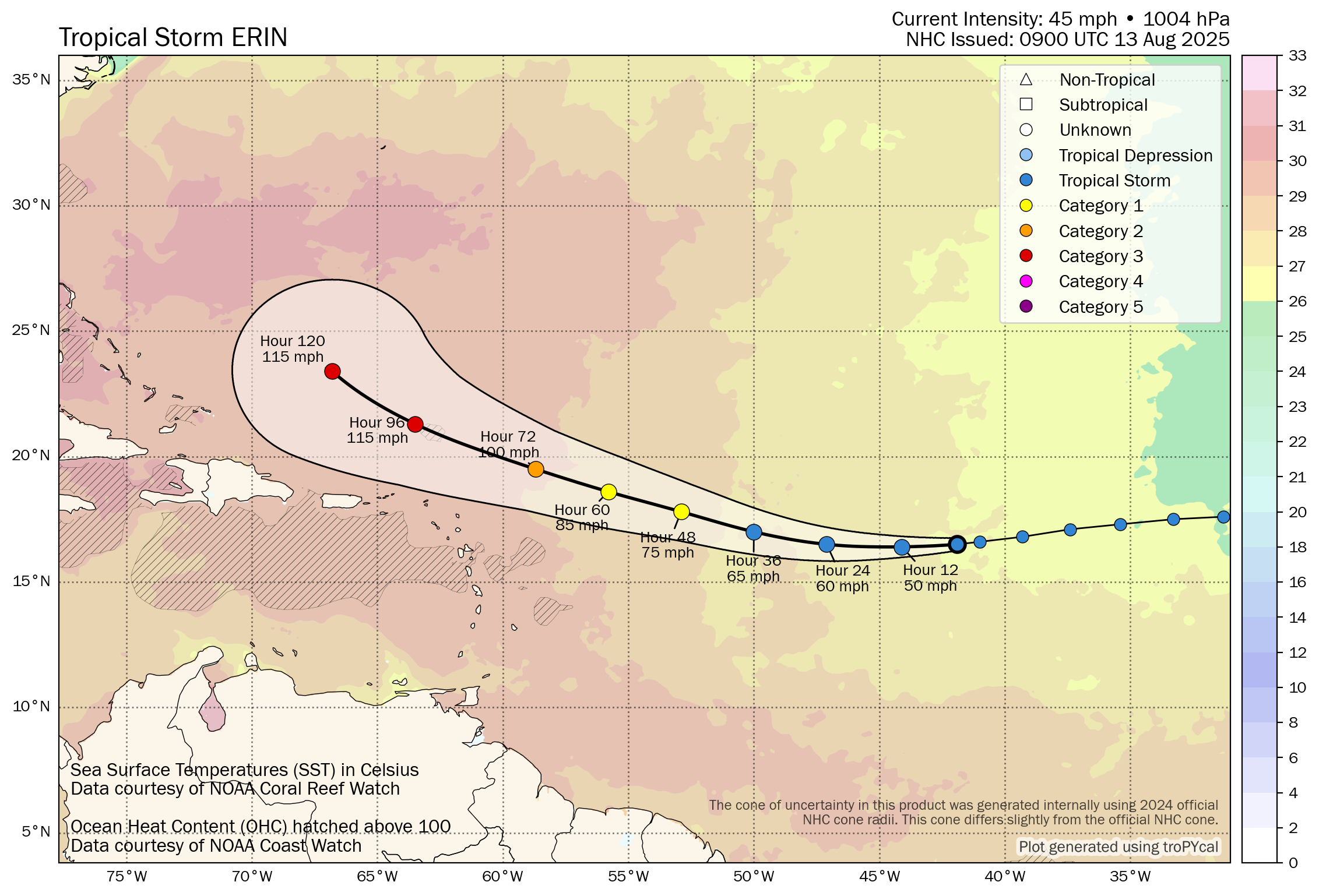
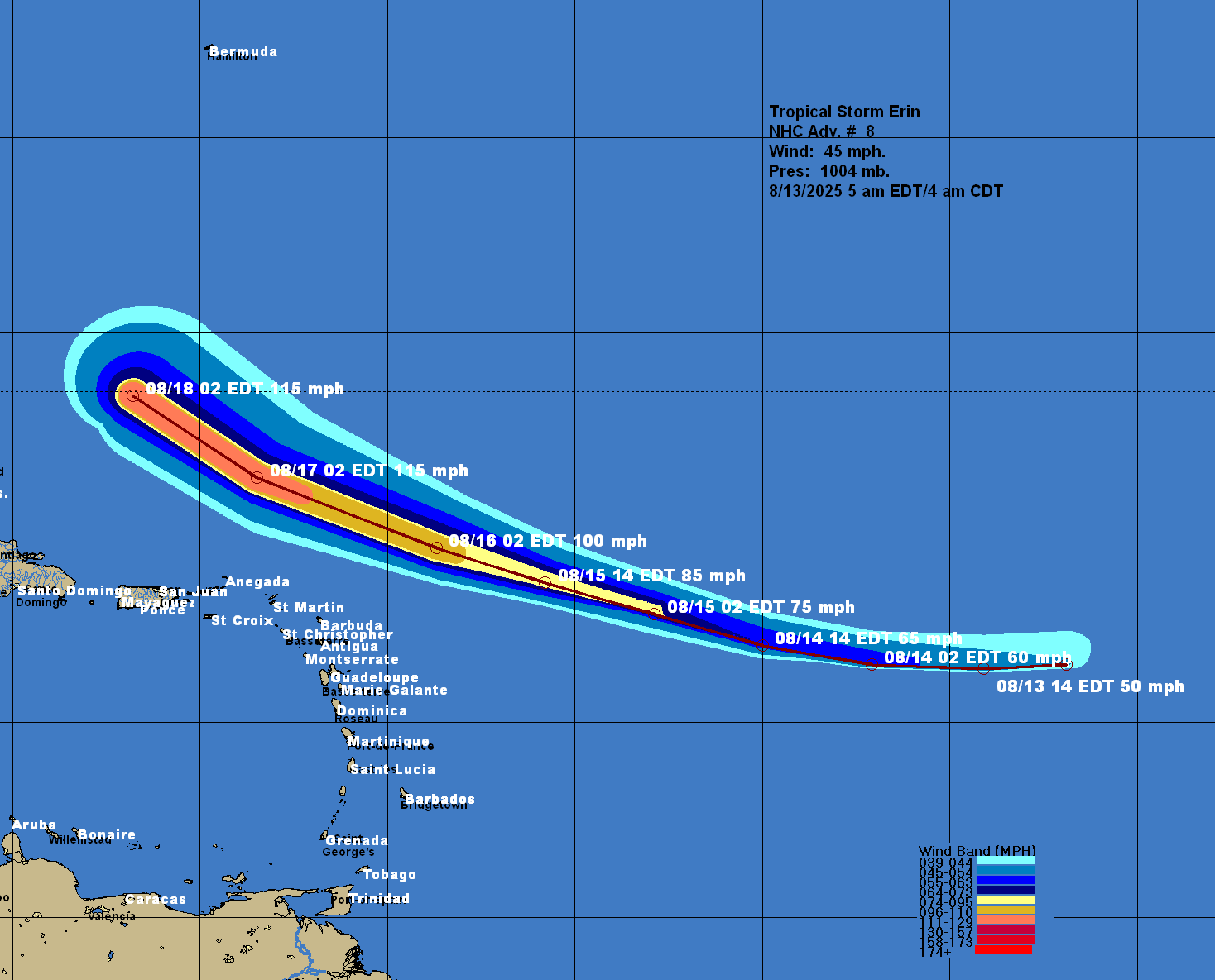
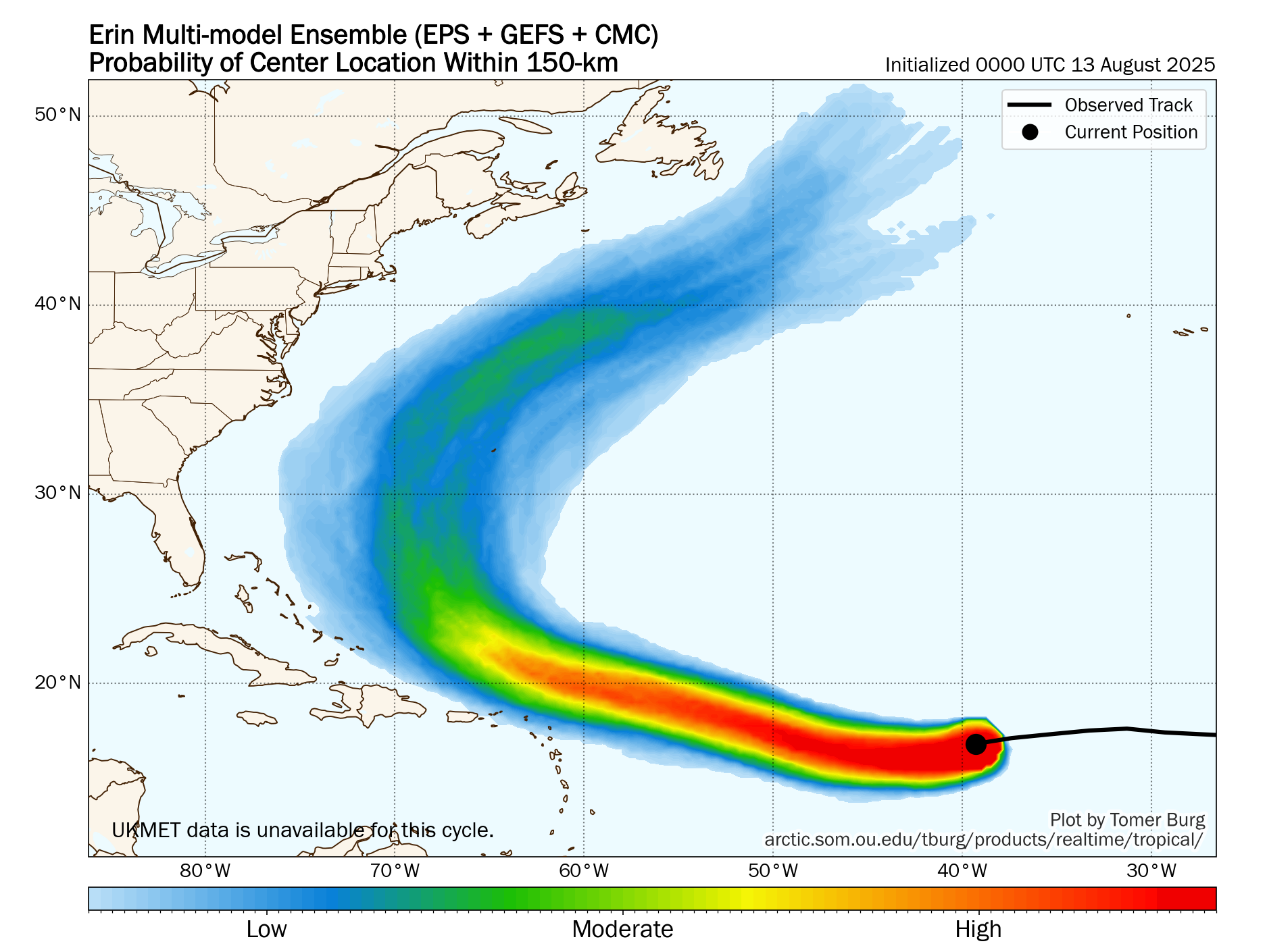
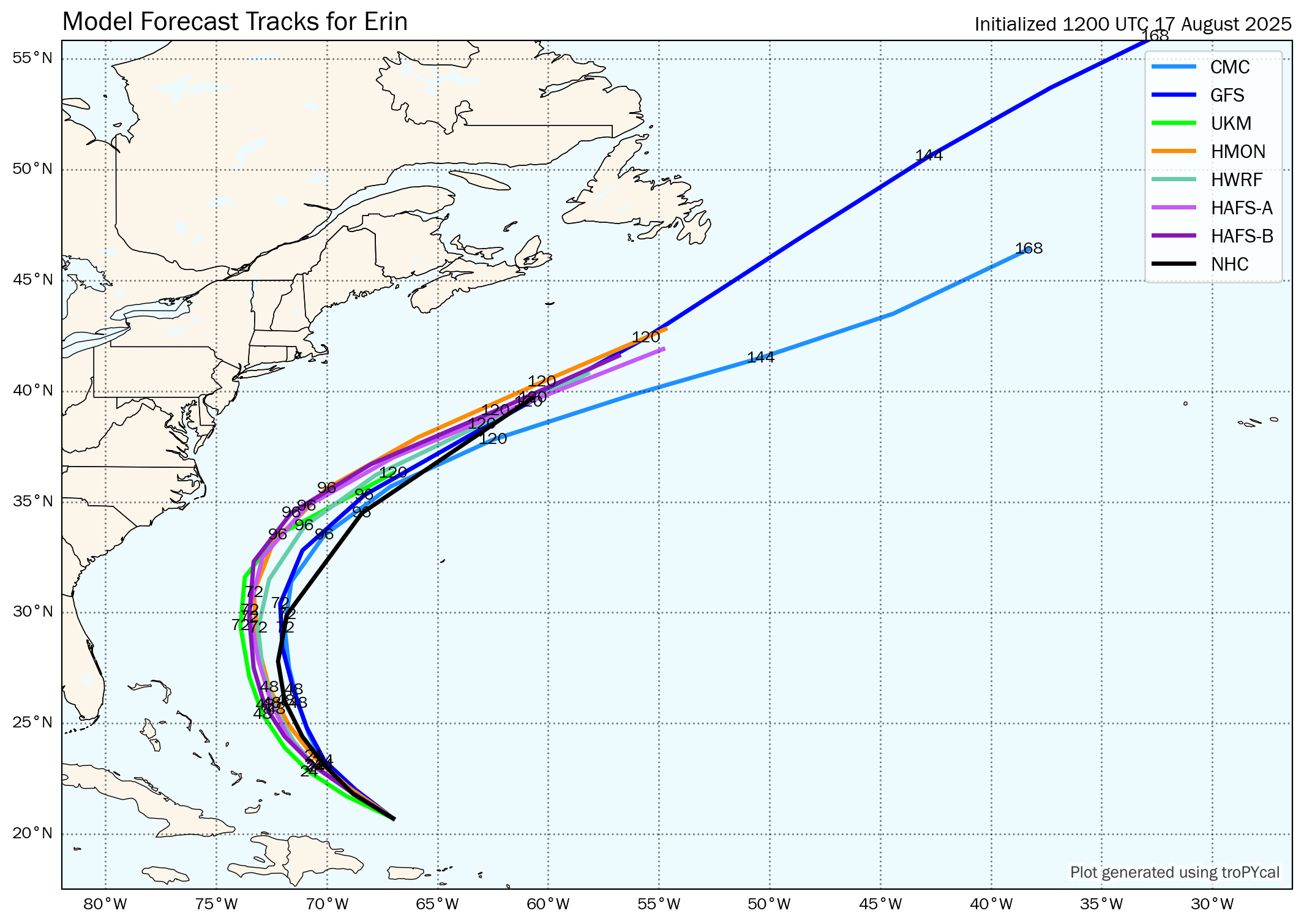
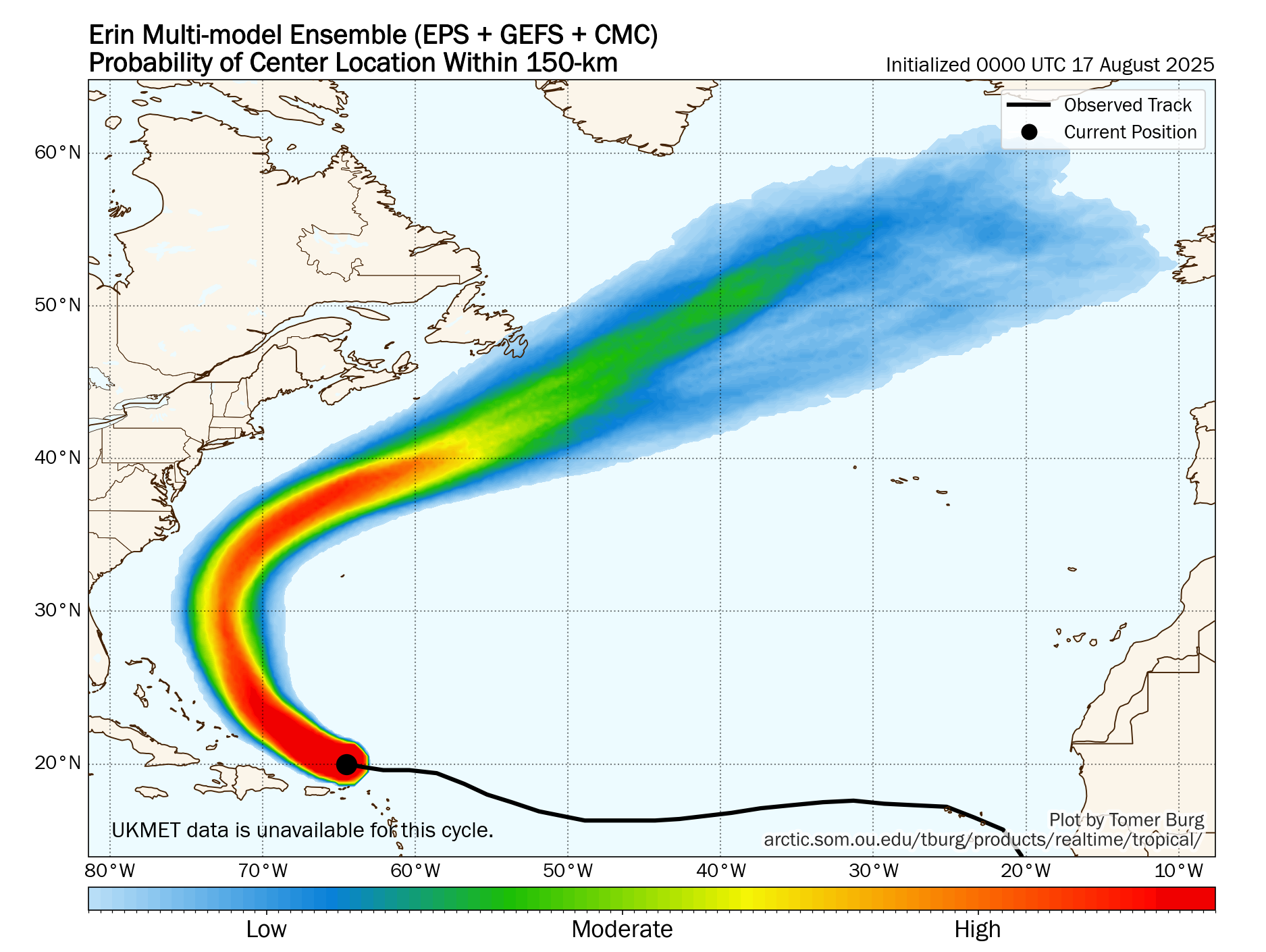
Erin seems to be heading in a west-northwesterly direction today and the ultimate track of the hurricane is going to hinge on how quickly it turns to the northwest and then to the north. The weather feature that looks to facilitate this turn is a weakness in the high pressure ridge that can now be seen in weather analysis and water vapor satellite imagery.
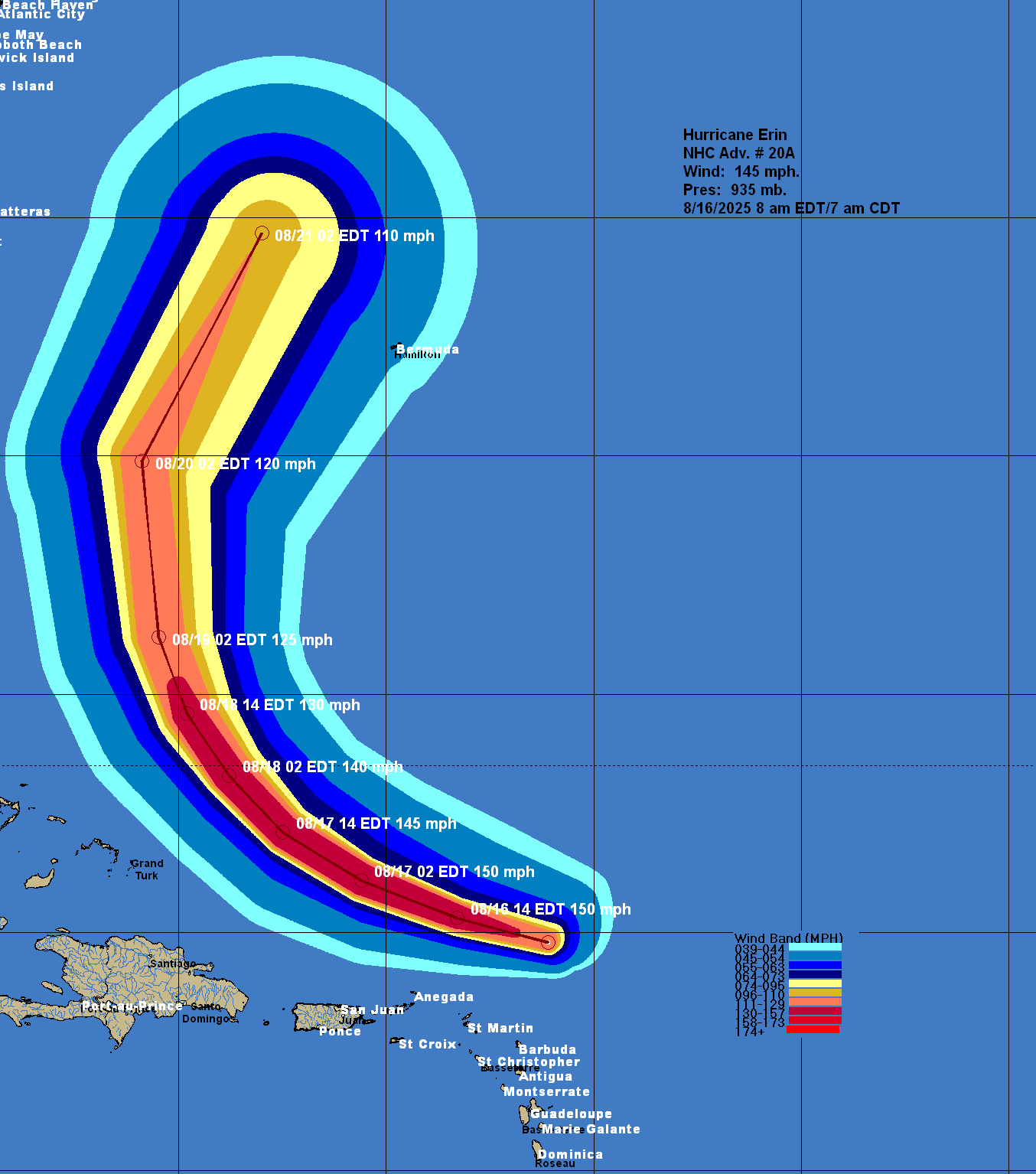
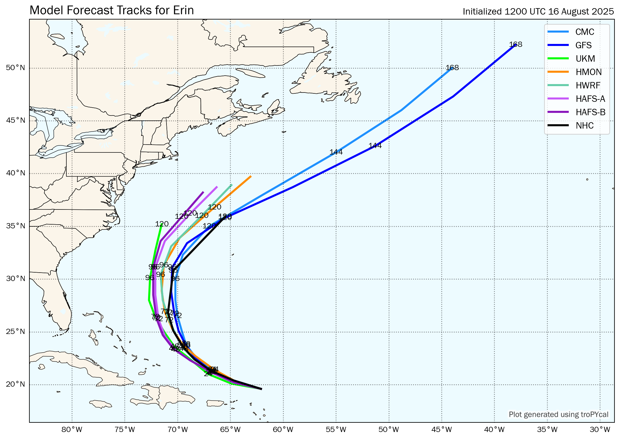
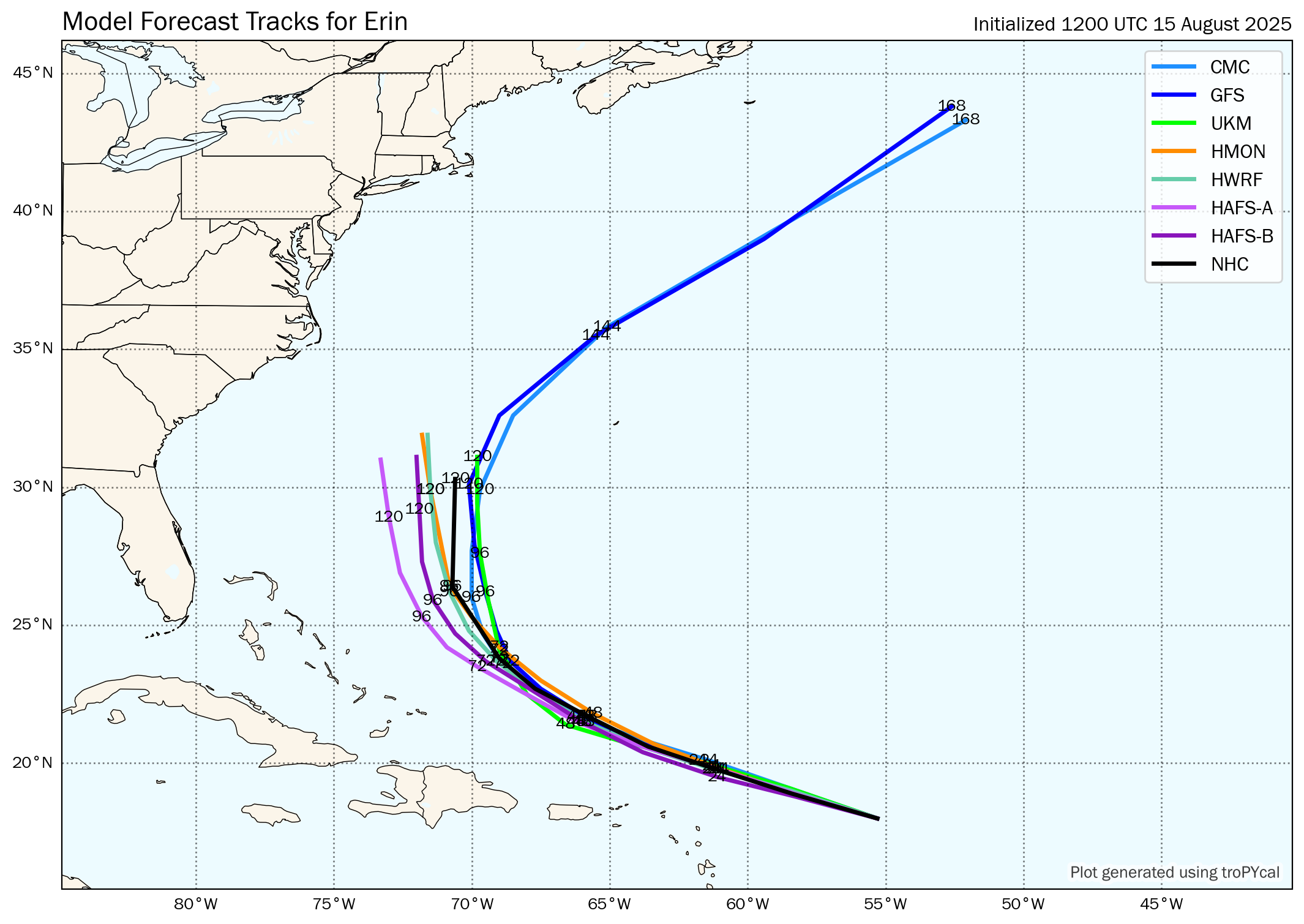
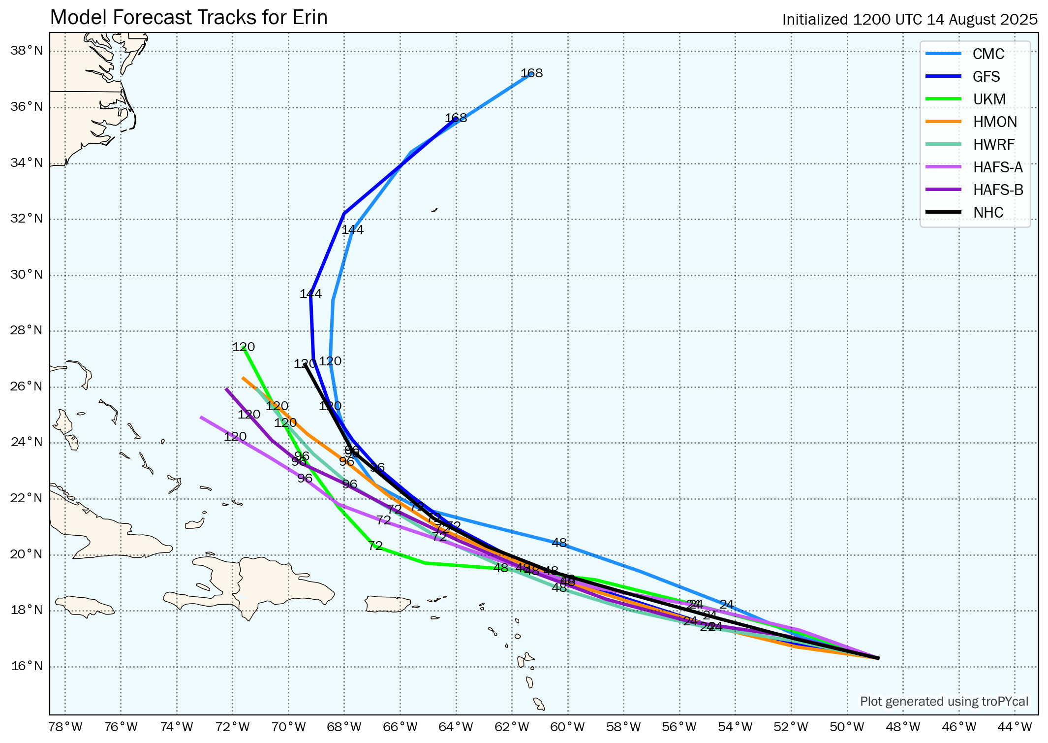
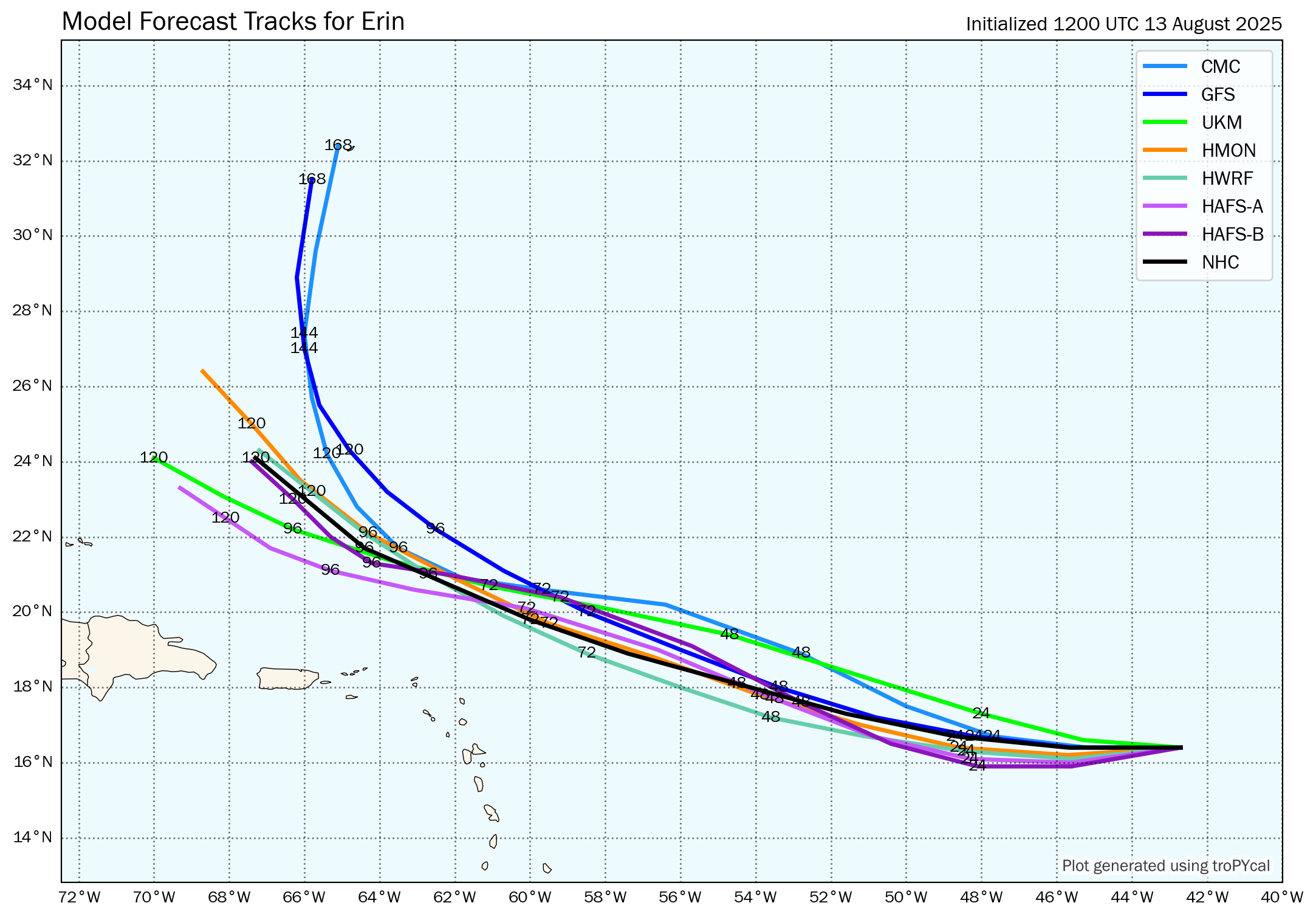
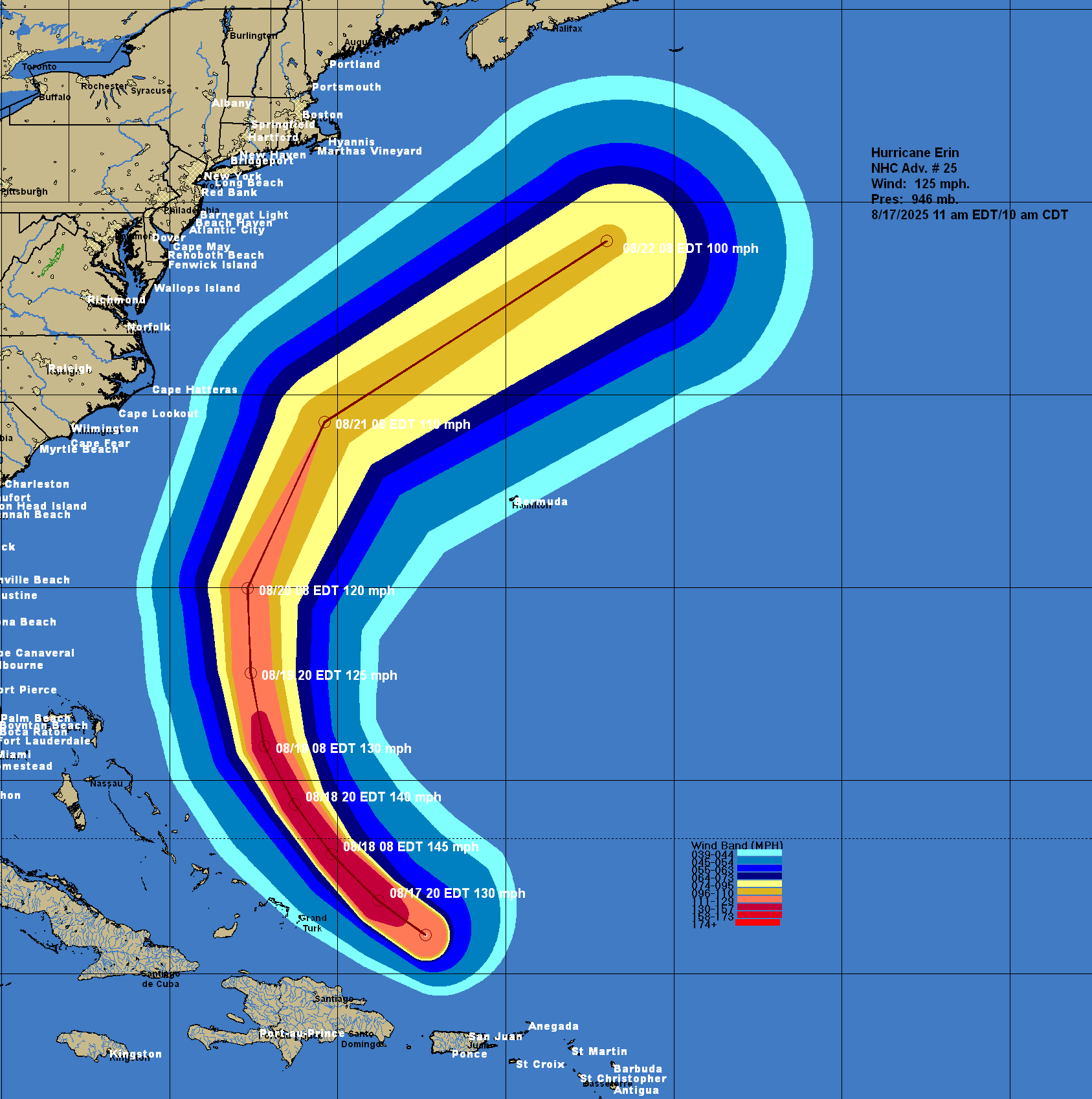
While the track model guidance with Erin are in good agreement in showing the hurricane making that turn to the north, they do still disagree on how quickly this turn will occur & thus how close Erin gets to the Bahamas and the North Carolina Outer Banks. It should be noted that the track guidance has been continually shifting westward in their forecasts of Erin & this has raised my concern slightly for the eastern Bahamas and the North Carolina Outer Banks. I do want to emphasize though that there are no models at all that are forecasting a direct hit on the Bahamas or the East Coast of the United States. Instead, some of the guidance are showing a close brush.
Here Are My Thoughts: As I just mentioned, the big question continues to be when and where will Erin make that turn to the northwest and north.
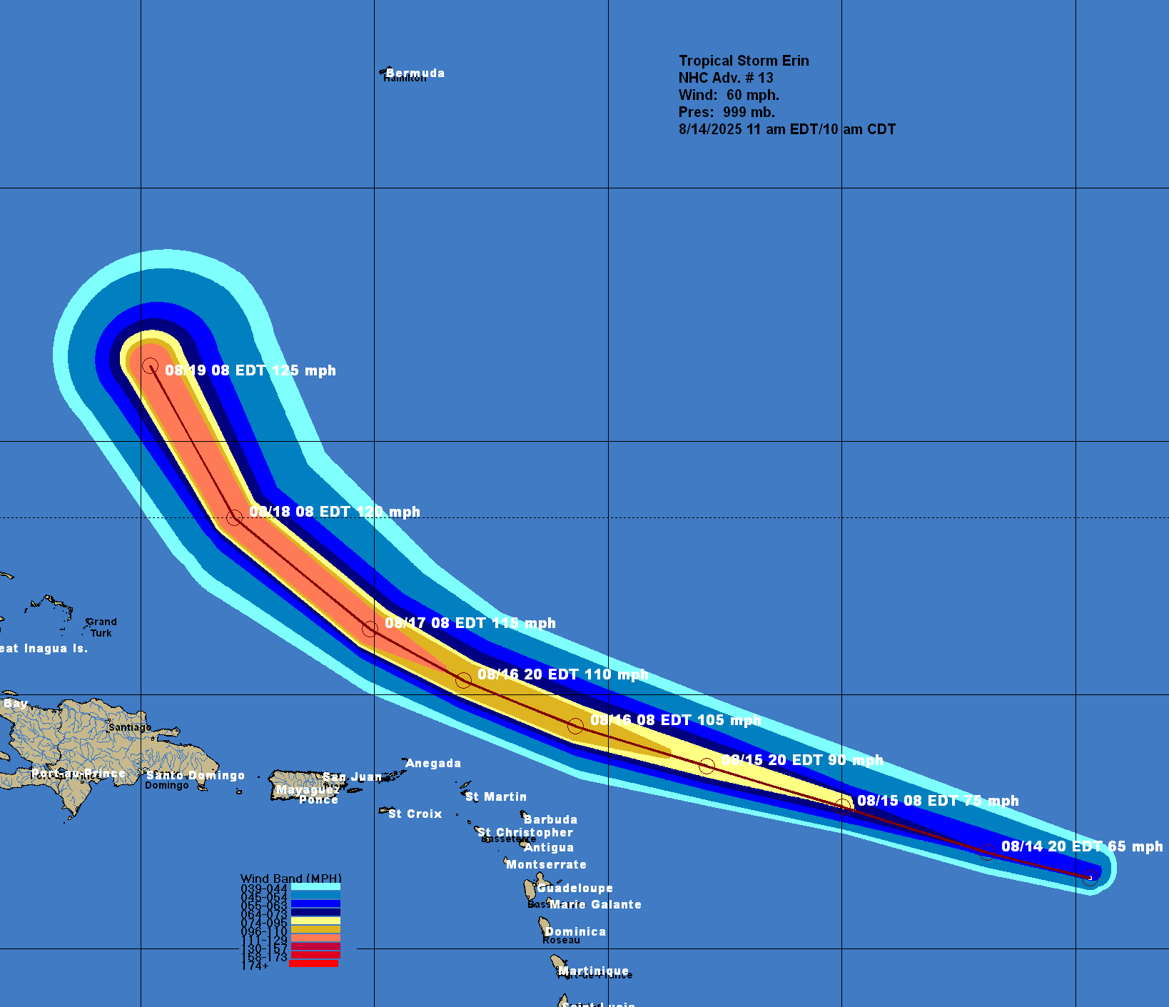
So, while I definitely expect Erin to make that turn to the northwest sometime on Monday and then to the north by late Tuesday and Wednesday, it looks quite possible that Erin could get to about 73 West Longitude before it begins to turn out to the northeast on Thursday.
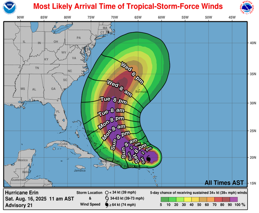
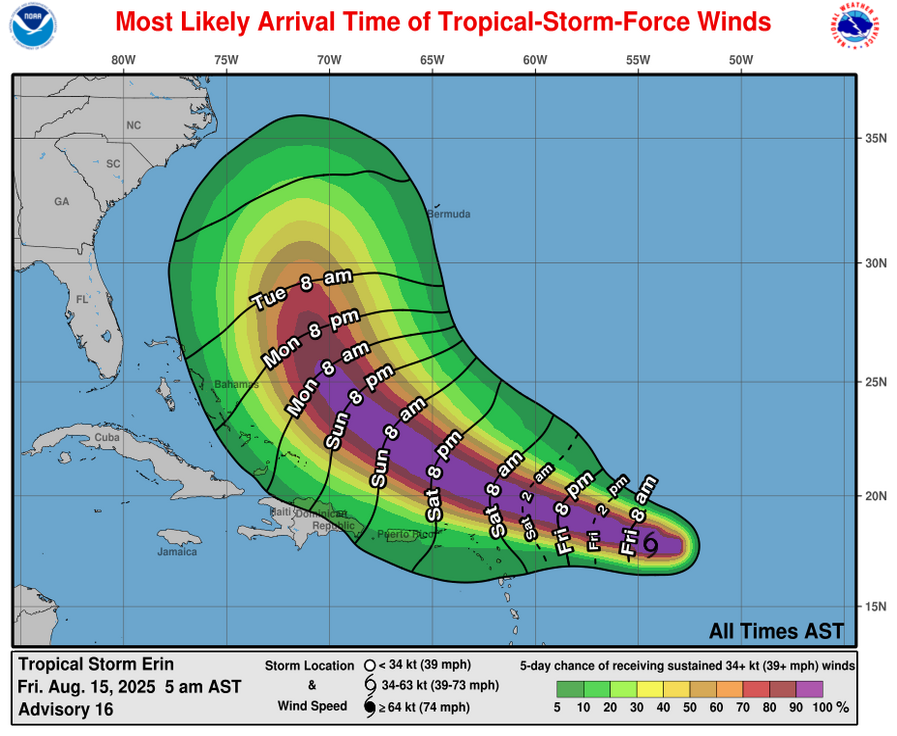
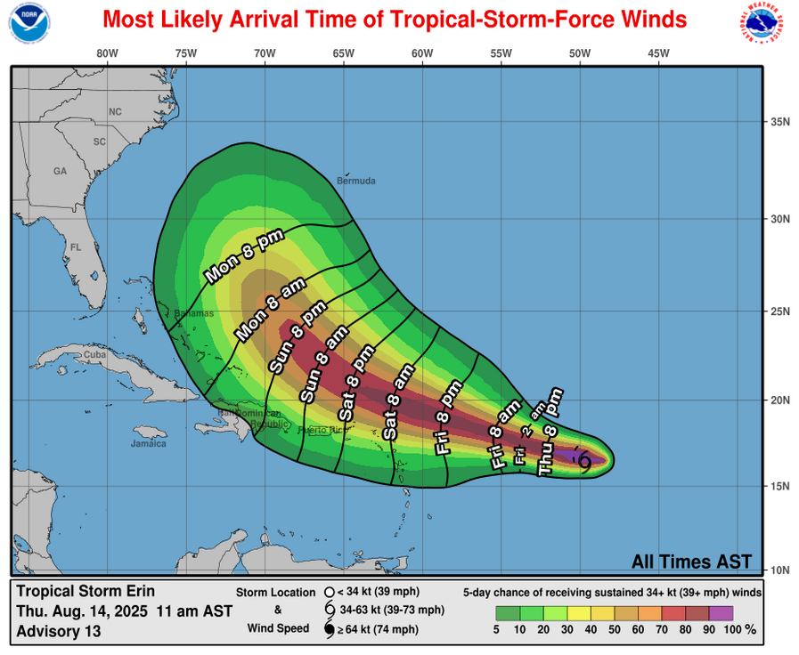
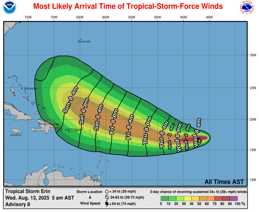
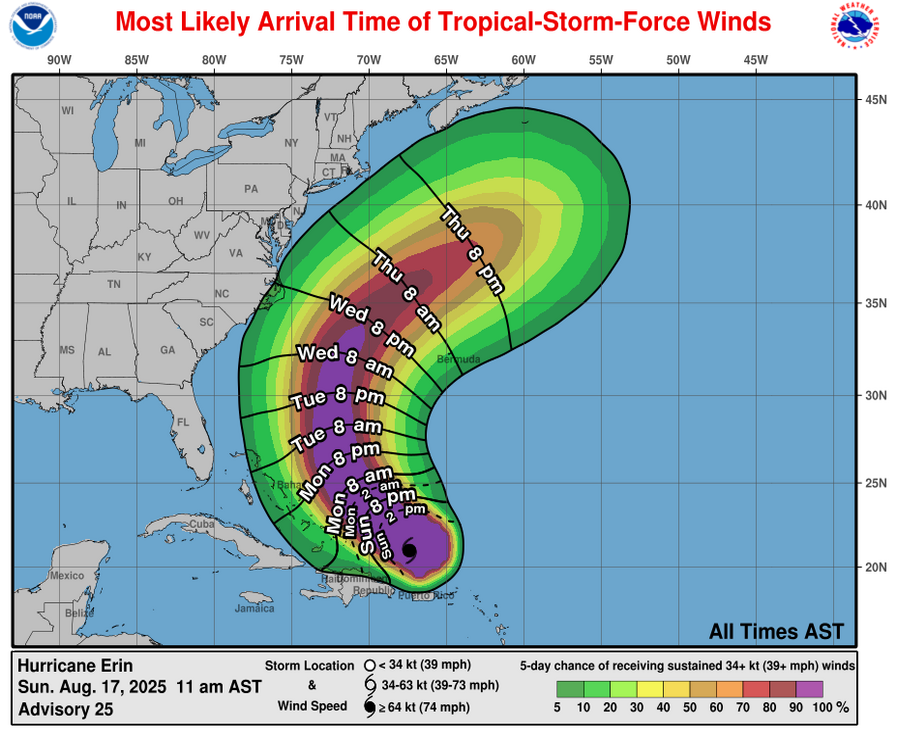
This means that it appears that Erin will track close enough to the eastern Bahamas to probably bring them tropical storm conditions on Monday into Tuesday. I then think that Erin could track close enough to the North Carolina Outer Banks (about 150 miles or so offshore) to bring them tropical storm conditions & bands of gusty showers on Thursday.
For Those Of You In The Bahamas: It looks quite plausible that the Turks and Caicos Islands will be affected by tropical storm conditions this afternoon and tonight. This will include bands of heavy showers and some gusty winds of tropical storm force.
The Eastern Bahamas probably will see tropical storm conditions during Monday that lasts into Tuesday. This will include bands of heavy showers and tropical storm force winds at times.
For The East Coast Of The United States & Particularly The North Carolina Outer Banks: First things first, ignore the clickbait on social media, Erin IS NOT going to directly strike the East Coast of the United States. It is, however, expected to pass just offshore of the US East Coast, close enough to the North Carolina Outer Banks to perhaps bring tropical storm conditions there during the day on Thursday.
The much bigger threat to the entire Eastern Seaboard of the United States is going to be the very large waves that’ll be impacted the shore throughout this coming week. I strongly urge anyone planning on visiting the beach or going swimming from Florida all the way northward to New England to not go swimming at all. The extremely rough surf and extremely dangerous rip current threat will make it extremely unsafe to go swimming & you will be risking your life doing so.
As I just mentioned, the outer bands of Erin may make it as far west as the Outer Banks of North Carolina on Thursday leading to the possibility of gusty and squally showers that produce winds of up to tropical storm force at times. My recommendation to those of you in eastern North Carolina and especially the Outer Banks is to continue keeping a very close watch on the progress of Erin.
Further north, it does look very likely that Erin will pass far enough offshore of Cape Cod and Nantucket to not be a threat in terms of tropical storm conditions. The much, much bigger threat to the New England coastline will be the large waves, very rough surf and extremely dangerous rip current threat.
For Bermuda: It continues to look very likely that Erin will pass far enough west of Bermuda to not be a direct impact. The very large size of Erin could lead to some of the outer bands of rain to affect the island on Wednesday and Thursday.
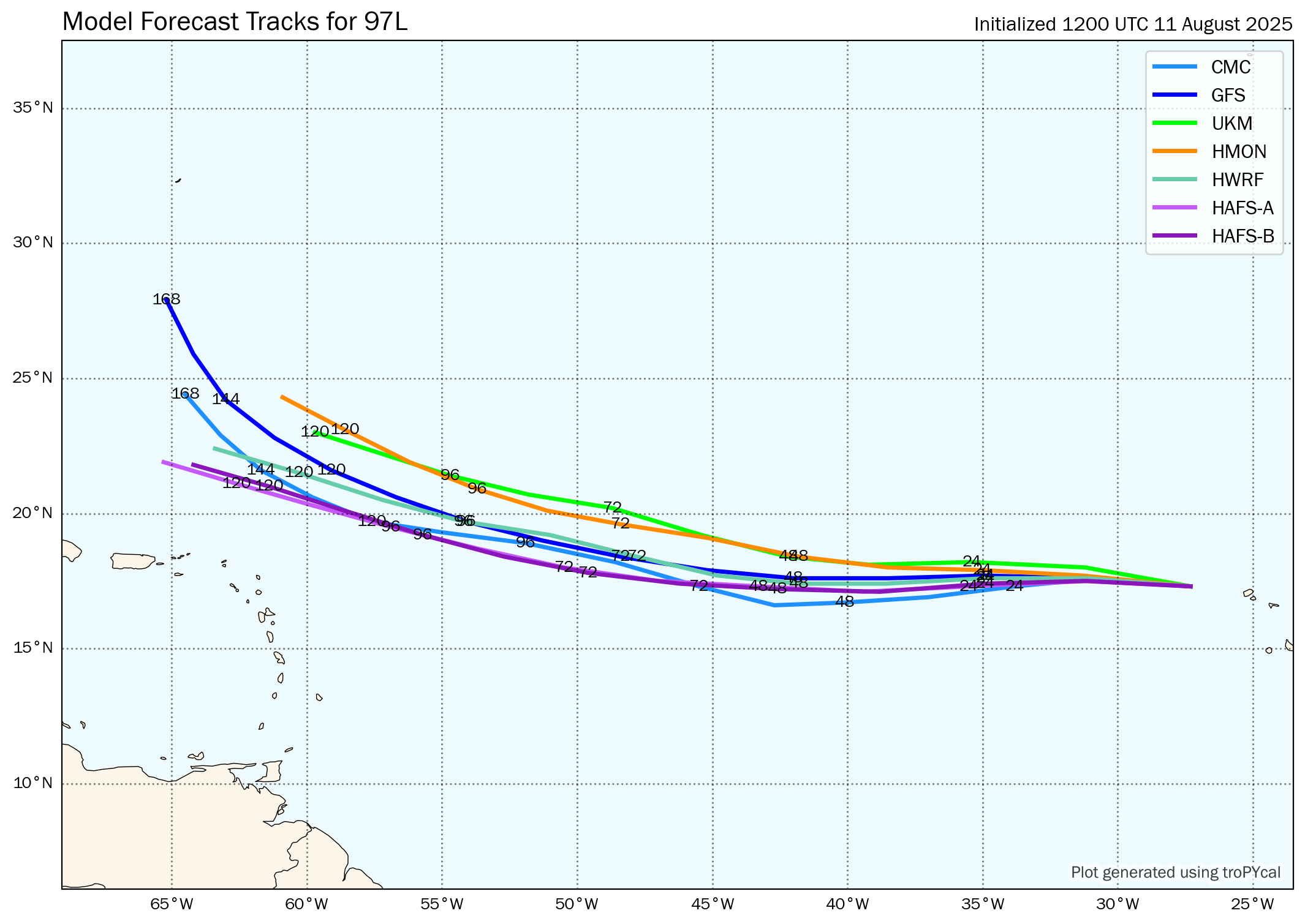
Model Track Forecast:
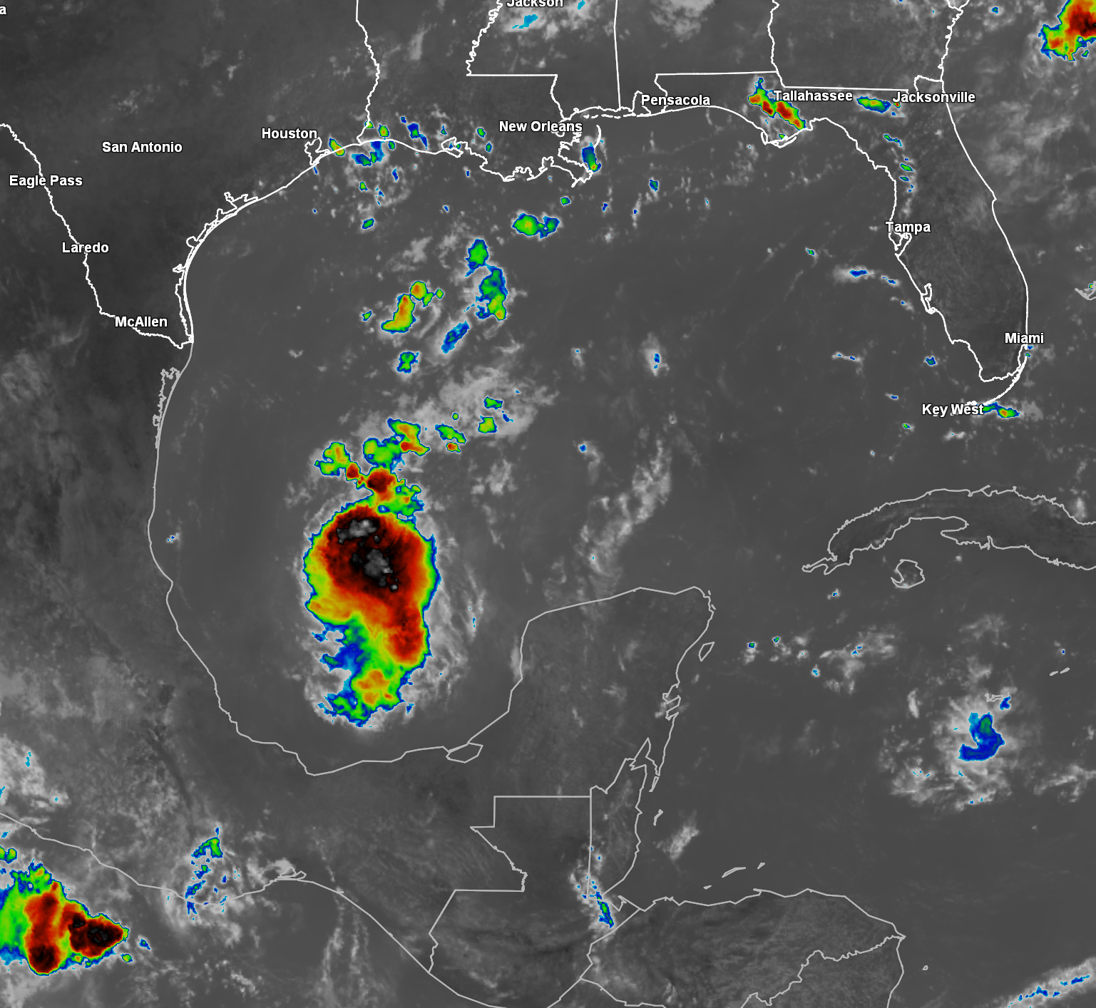
Satellite Imagery:
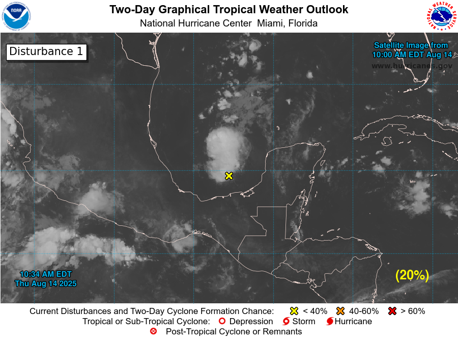
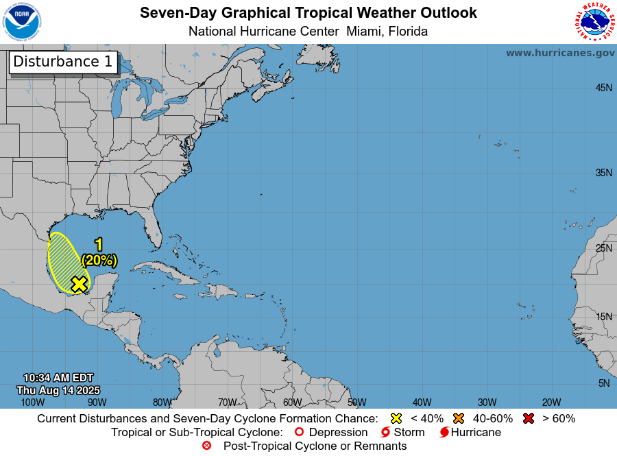
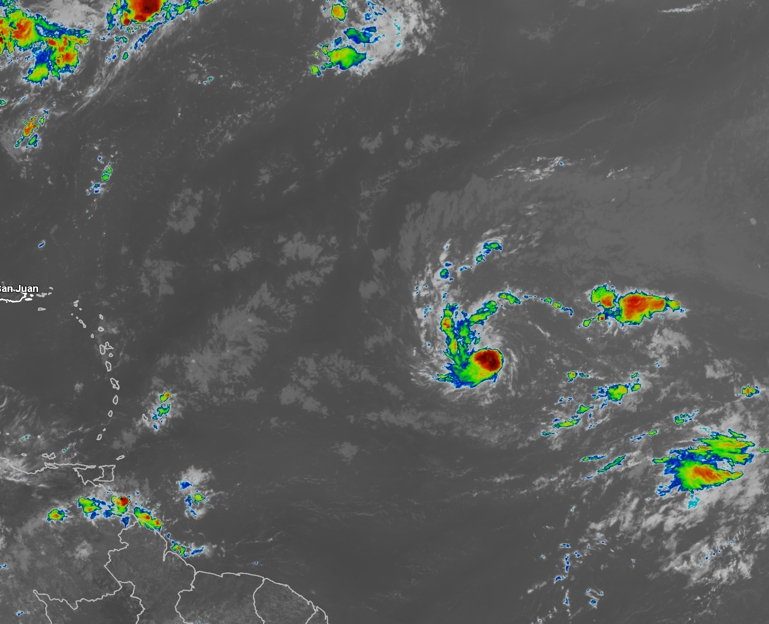
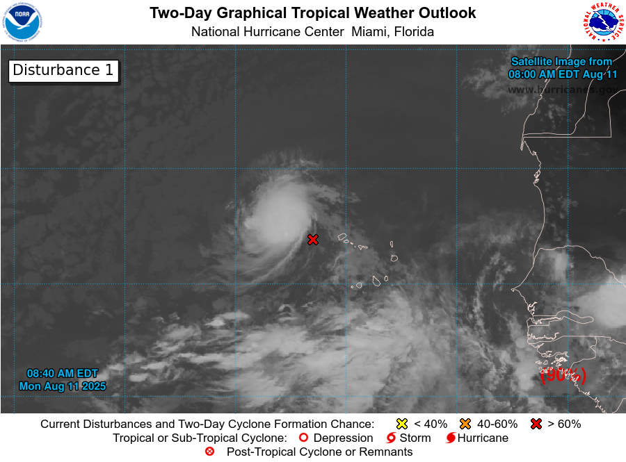
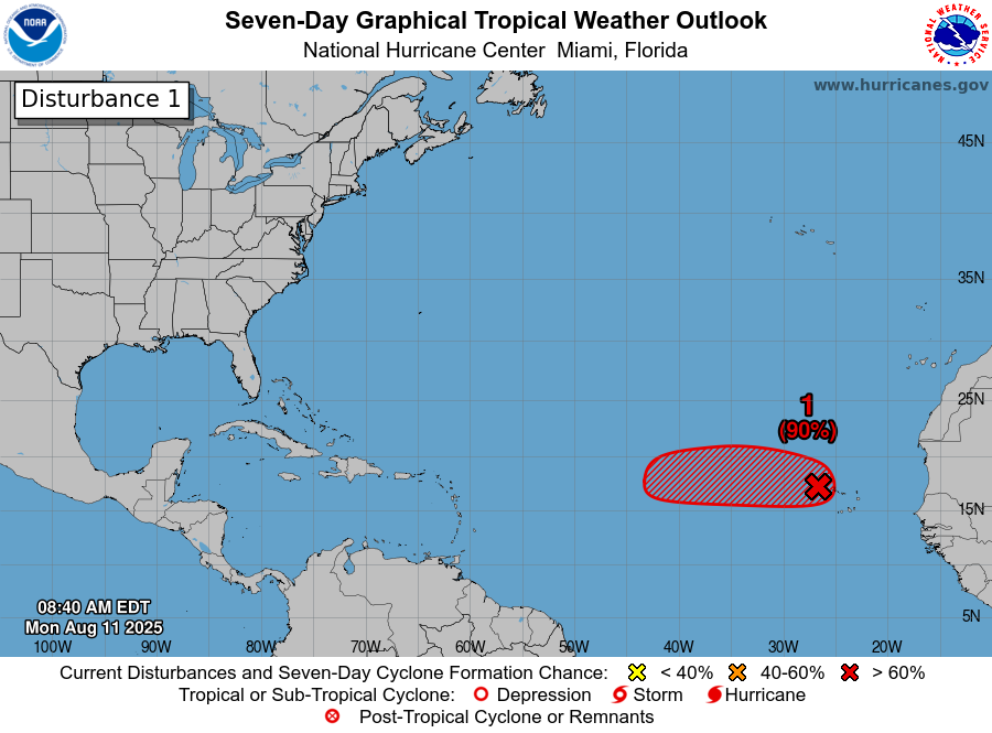
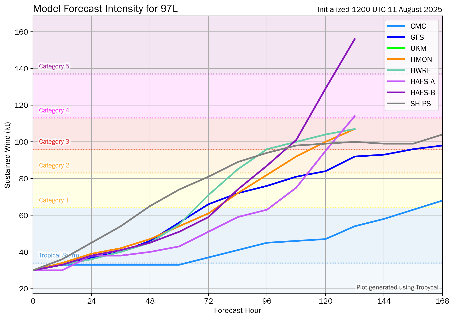
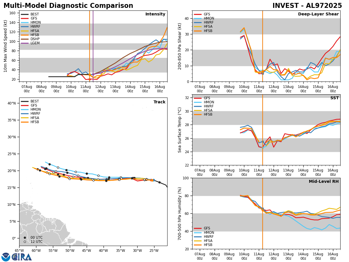
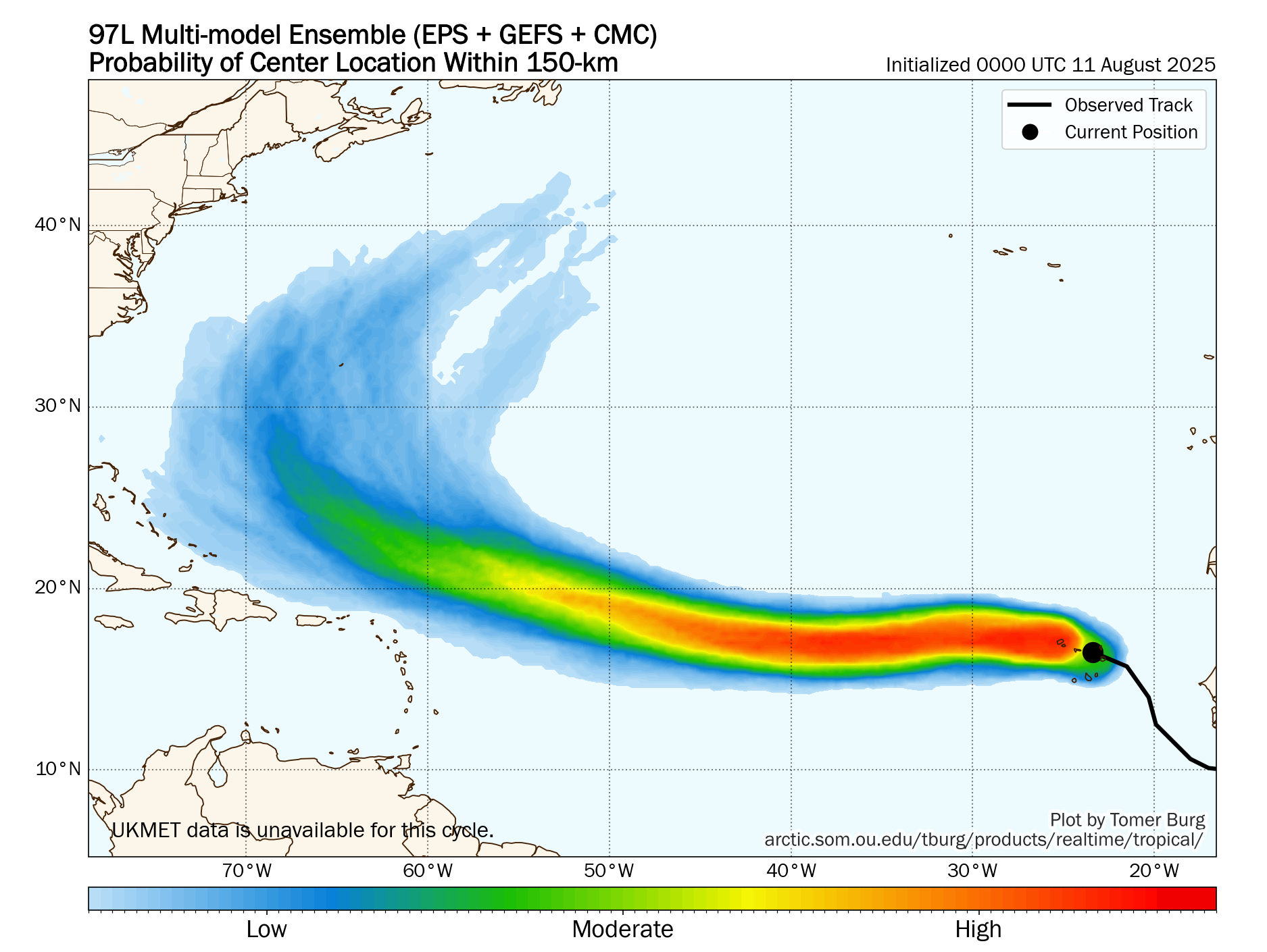
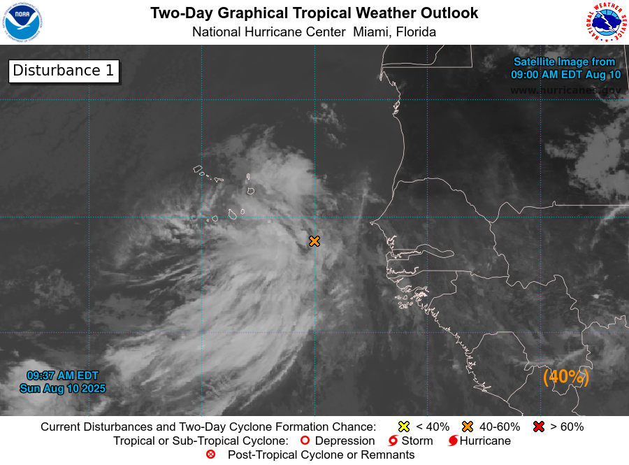
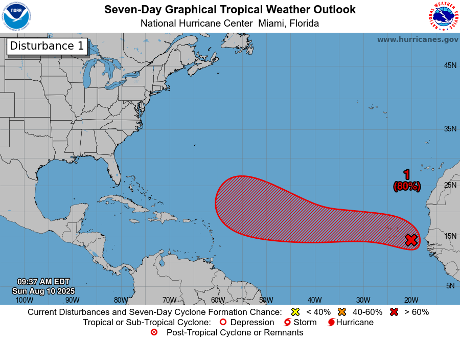
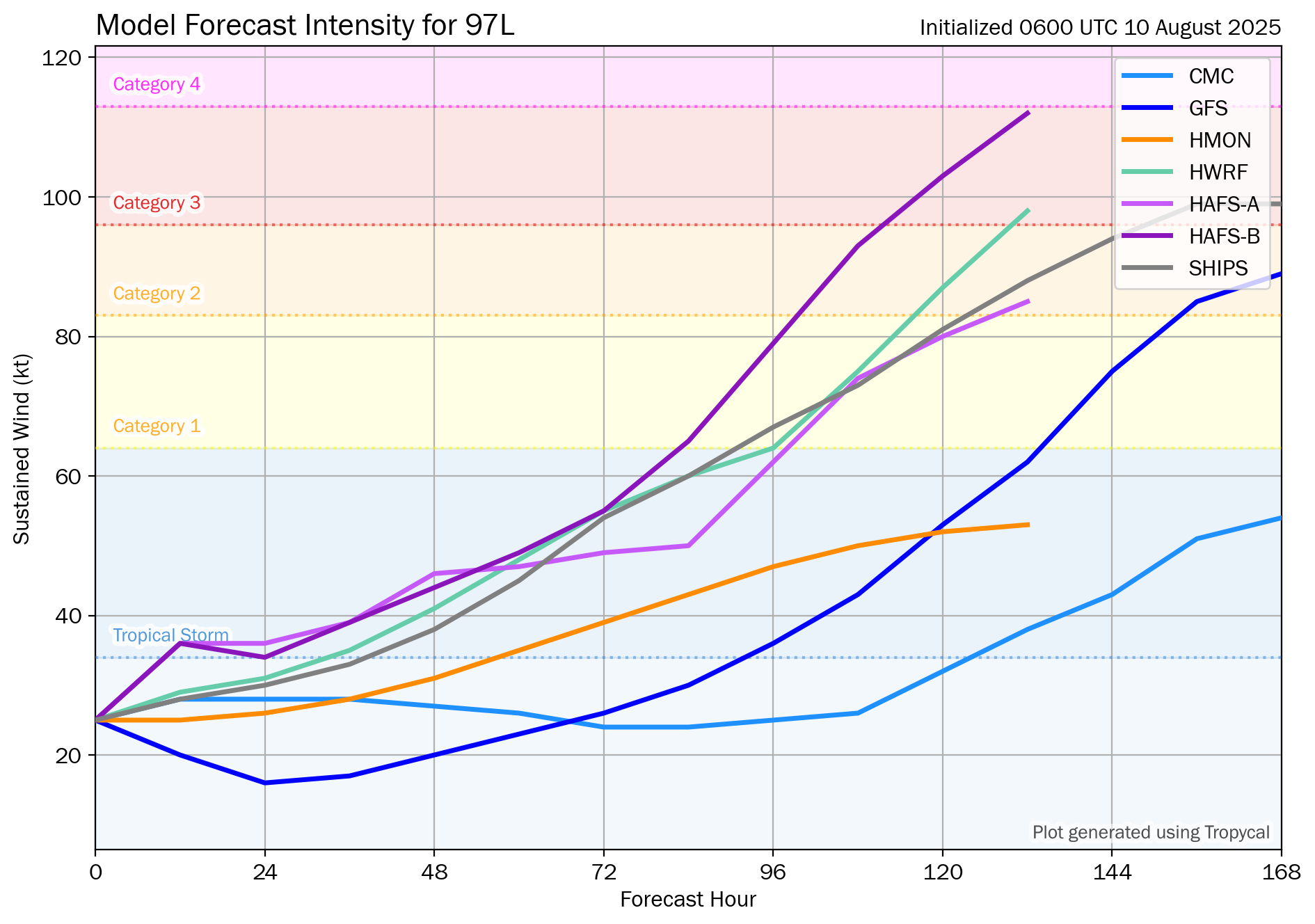
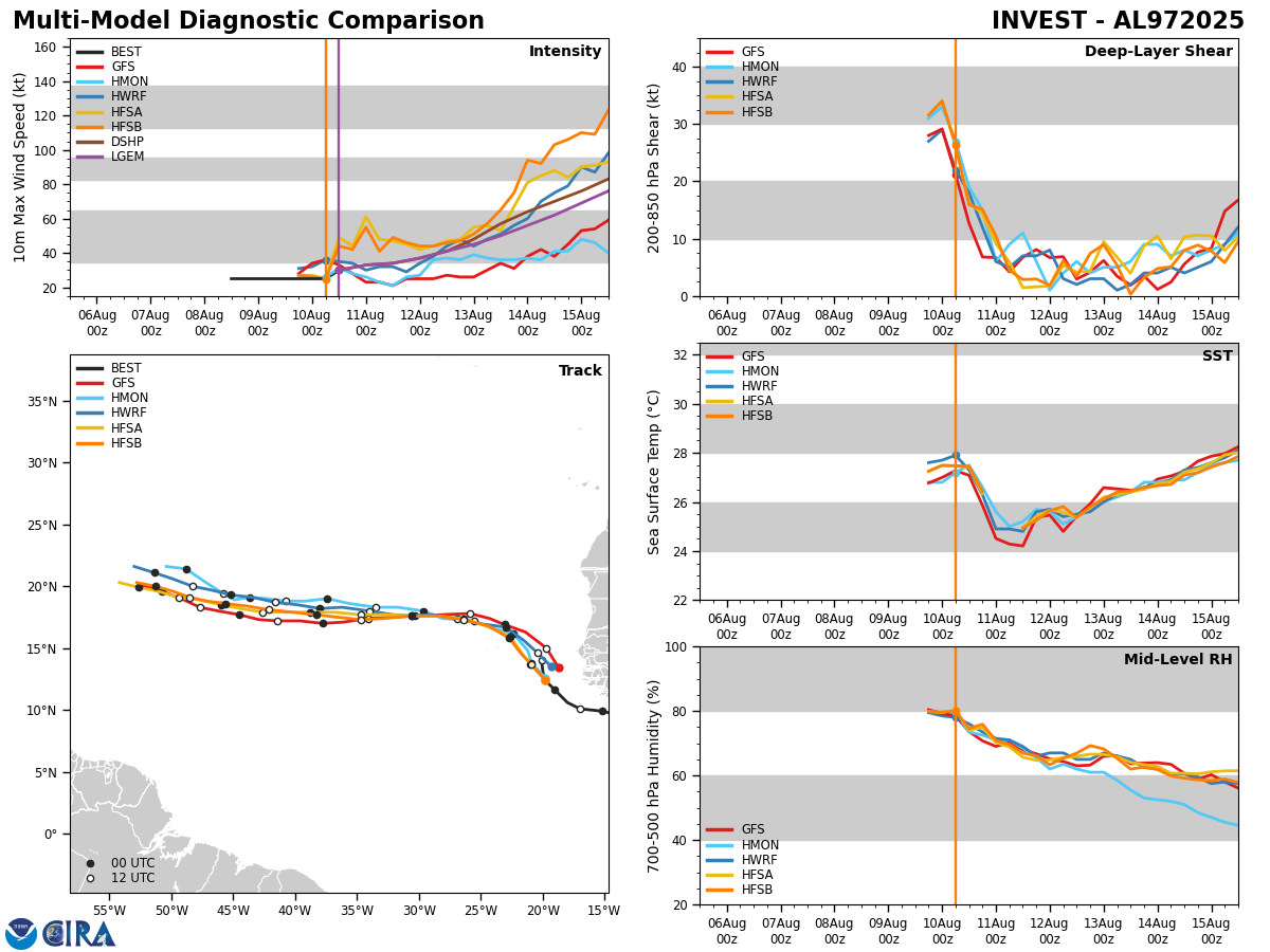
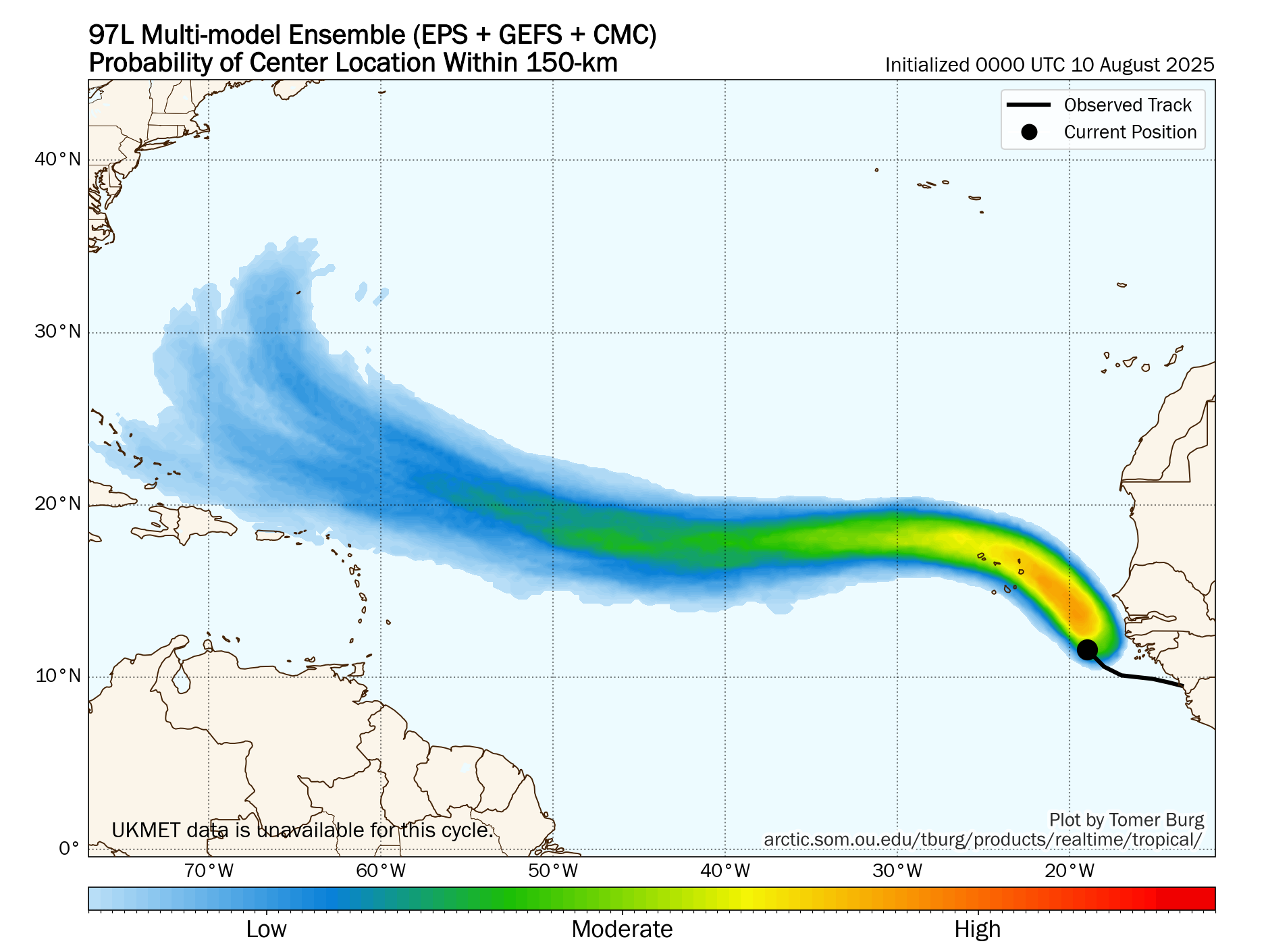
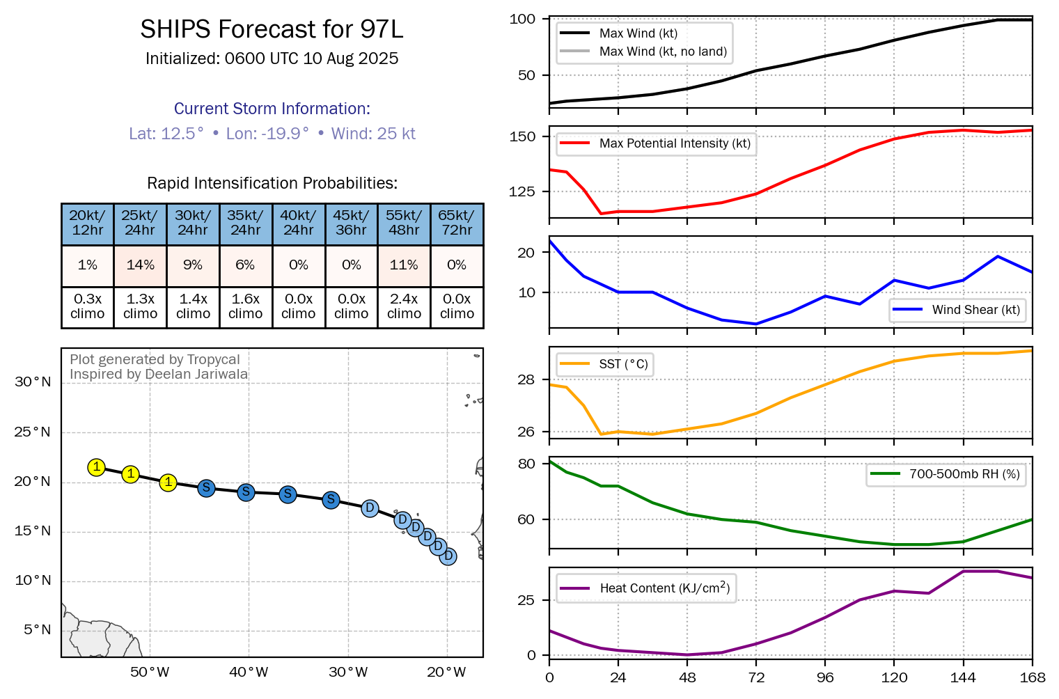
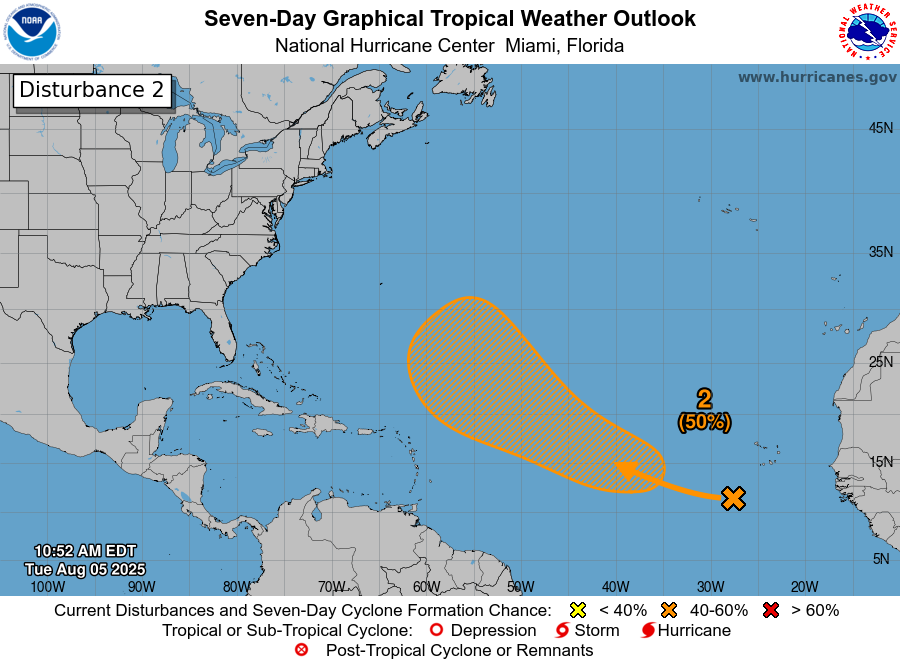
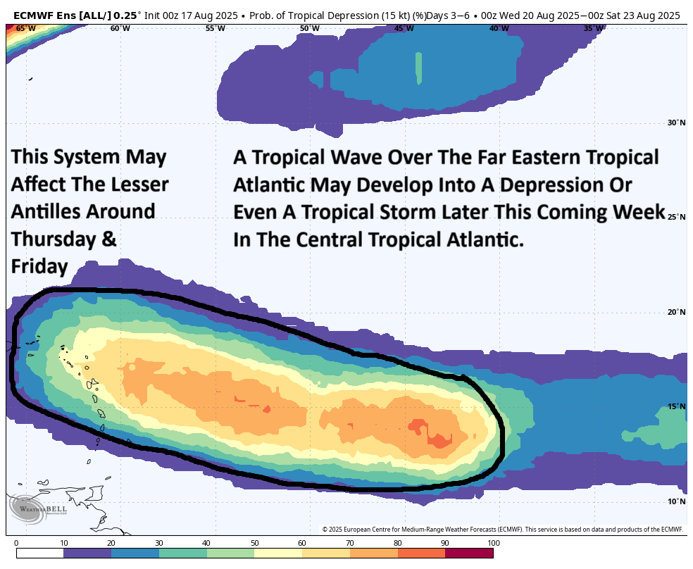
Area Of Disturbed Weather Located Over The Eastern Atlantic: There is a tropical wave located over the far eastern Atlantic that will need to be watched throughout this upcoming week as it heads westward.
Satellite imagery today reveals that the convection associated with the wave is quite disorganized. Analysis reveals that the environmental conditions are marginal, at best, for development west of 30 West Longitude. These marginally favorable conditions across the tropical Atlantic last until about the eastern Caribbean. A lot of this stronger wind shear is due to the outflow from Hurricane Erin.
This means that I do think that this wave will struggle to develop as it heads westward, but once Erin begins to lift to the north and northeast during the second half of this week, the conditions across the tropical Atlantic should become more favorable, just as this wave is approaching the Lesser Antilles.
My take is that I think that this wave may become a depression around Thursday or Friday as it reaches about 55 West Longitude. Also, I think we are looking at a wave that tracks further west across the Atlantic than Erin ever did. The reason why I think this is because the more it struggles & refuses to really develop, the more it’ll track with the lower level winds & not be picked up by a weakness in the high pressure ridge left behind by Erin.
My recommendation for those of you in the Lesser Antilles and the eastern Caribbean is to monitor this wave extremely closely during this upcoming week and be aware that it could be a depression or even a tropical storm by the time it reaches the islands of the eastern Caribbean around Thursday into Friday.
Beyond this, it is way, way too early to speculate where this system might go after it reaches the area around the Lesser Antilles.
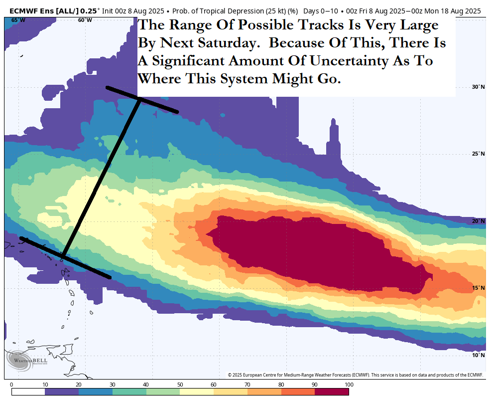
The weather pattern by next weekend may consist of a high pressure ridge to the north of this wave that could extend fairly far west. Should this high pressure ridge remain stout & not relent and weaken, it could guide this system quite far to the west. That said, there is the possibility of an upper level trough of low pressure to dive into the eastern United States by around the August 24-26 time frame. It’s possible that this trough could be strong enough to pull this system north and northeastward and guide it away from the United States. It’s just as equally possible that the trough will miss this system causing it to become a threat to the Southeast coast of the US or the Gulf coast.
The model guidance are of little use this far out in time as they have many different scenarios with each new forecast run, ranging from a Gulf threat all the way to a path that takes it safely out into the open Atlantic.
My recommendation to you is that you should monitor the progress of this wave in the coming days. For now though, it is of nothing to be overly concerned or worried about.
The next tropical weather discussion will be issued on Sunday.