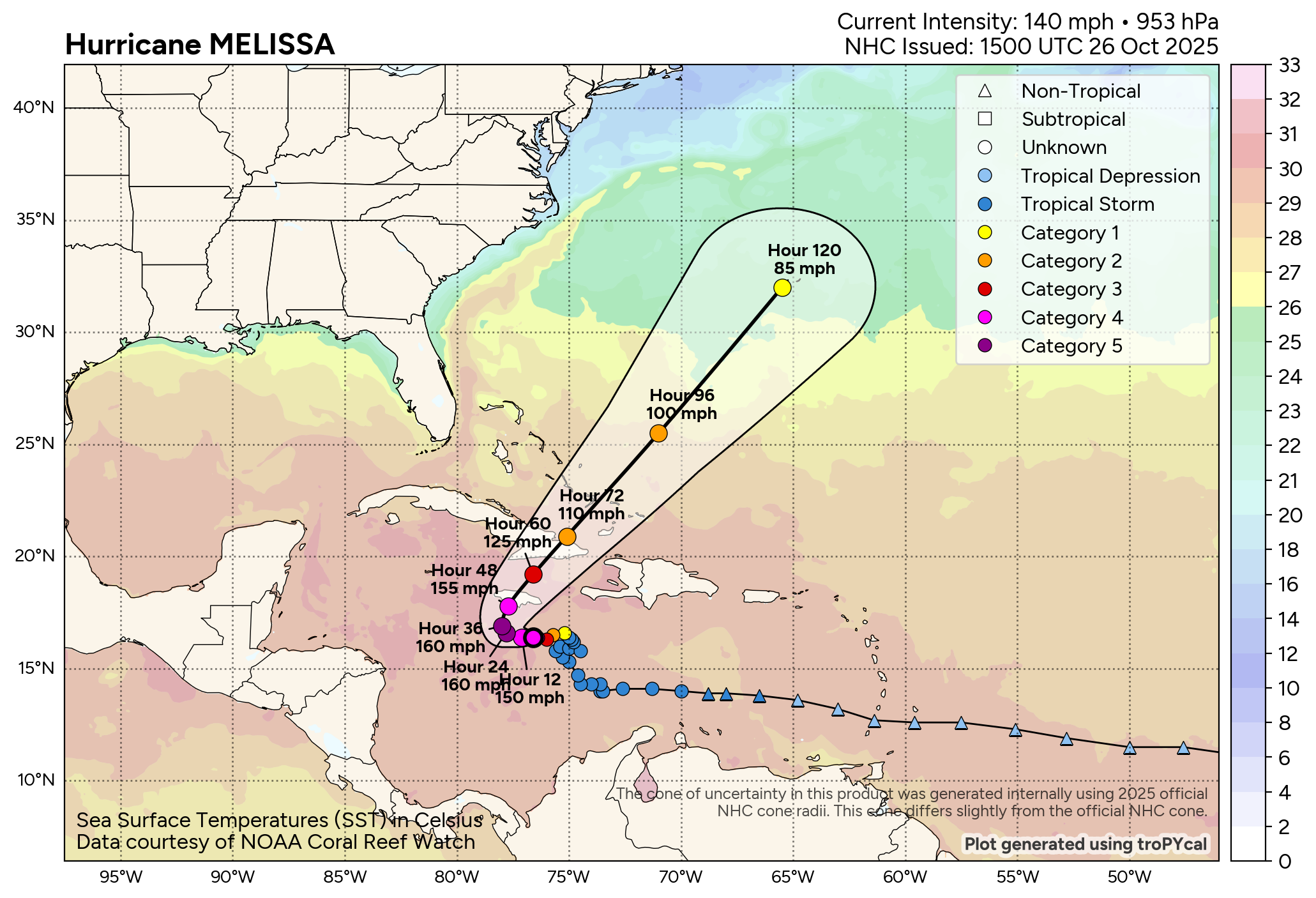
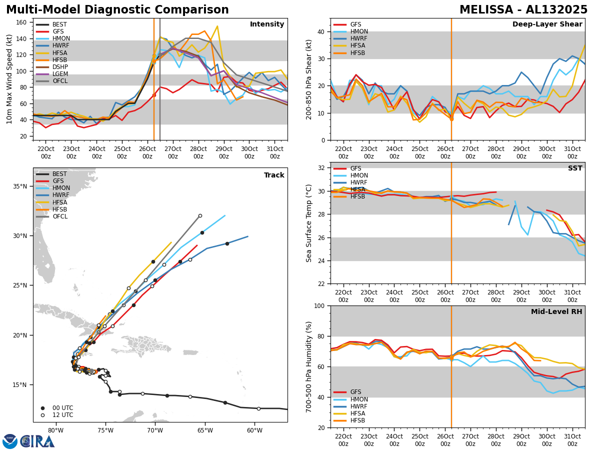
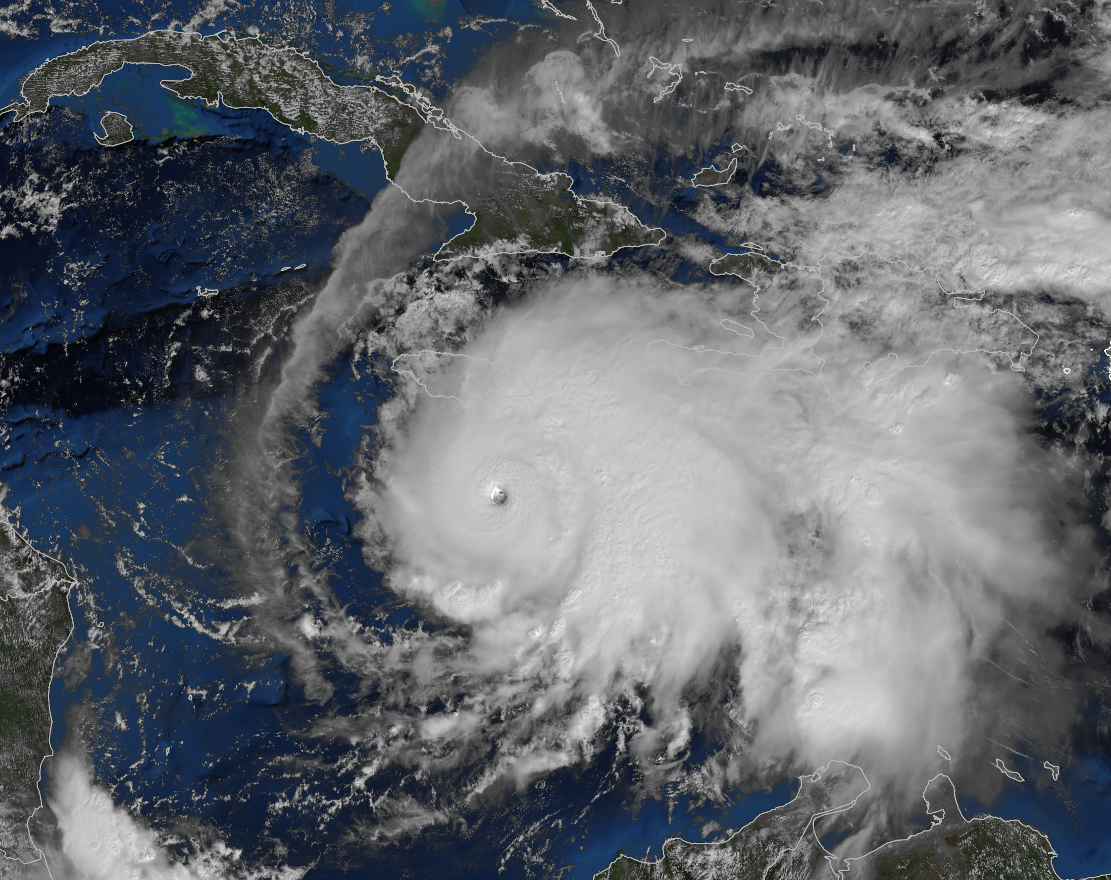
Major Hurricane Melissa: Melissa underwent explosive strengthening last night with the hurricane intensifying from a minimal hurricane early Saturday afternoon to a 140 mph Category 4 hurricane as of this morning. The amount of strengthening is double the threshold of what’s needed for rapid strengthening. This means that the rate of strengthening that Melissa underwent is at the upper limits of what’s ever been observed in the Atlantic.
It seems that Melissa has now taken a pause in strengthening as of the time of this writing. The reason for this seems to have to do with some westerly wind shear that may be interrupting the outflow associated with Melissa. That said, reconnaissance aircraft are finding winds of between 140 and 150 mph inside Melissa during their last flight. It seems as if Melissa is still a very formidable Category 4 hurricane.
Melissa is now moving towards the west at a forward speed of barely 4 mph as of today. It is expected that this westward movement will continue throughout the rest of today into Monday as the hurricane is guided by a high pressure ridge located to the north.
As we get into later Monday and Monday night, an upper level trough of low pressure pushing into the southeastern United States will begin to pick Melissa up and turn it to the north and northeast, especially on Tuesday.
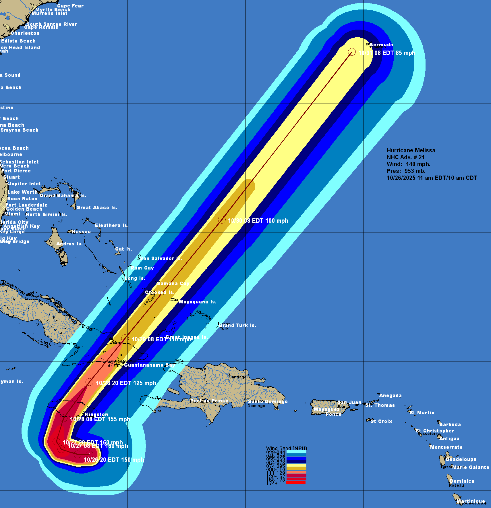
This means that Melissa will turn sharply to the north and then northeast & move directly over the island of Jamaica as a Category 4 to Category 5 hurricane during Tuesday morning. Melissa is then expected to move over eastern Cuba by Tuesday night as a major hurricane and across the southeastern Bahamas during the day on Wednesday as a hurricane.
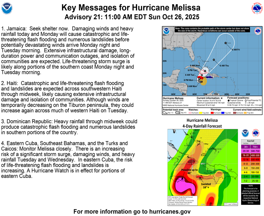
Jamaica: This continues to look like a worst case scenario in terms of a hurricane hit. Please prepare for this hurricane as if it is the worst hurricane you have ever experienced, because it will be.
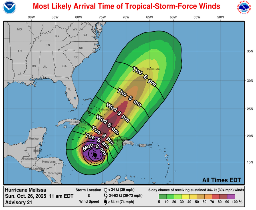
Tropical storm force winds are expected to begin to impact Jamaica as we get into this afternoon and this evening. Tropical storm conditions will then continue throughout all of tonight and all of Monday.
The core of Major Hurricane Melissa containing at least Category 4 strength winds will hit Jamaica directly from Monday night through Tuesday. Landfall on the island looks to occur during Tuesday morning.
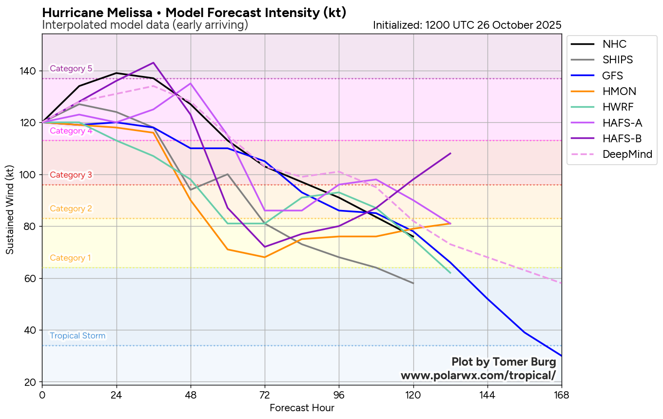
It should be noted that both of the very high resolution HAFS hurricane models are forecasting a peak intensity at landfall with these models forecasting Melissa having maximum winds of 170 to 175 mph. A majority of the Google Deep Mind AI ensemble models forecast a landfall intensity of Category 4 strength, however, a few members forecast Category 5 intensity.
Melissa is going to be moving over Jamaica from south to north & because of this, it will produce a catastrophic storm surge of 9 to 13 feet along Jamaica’s south shore, including Kingston Harbor and Norman Manley International Airport.
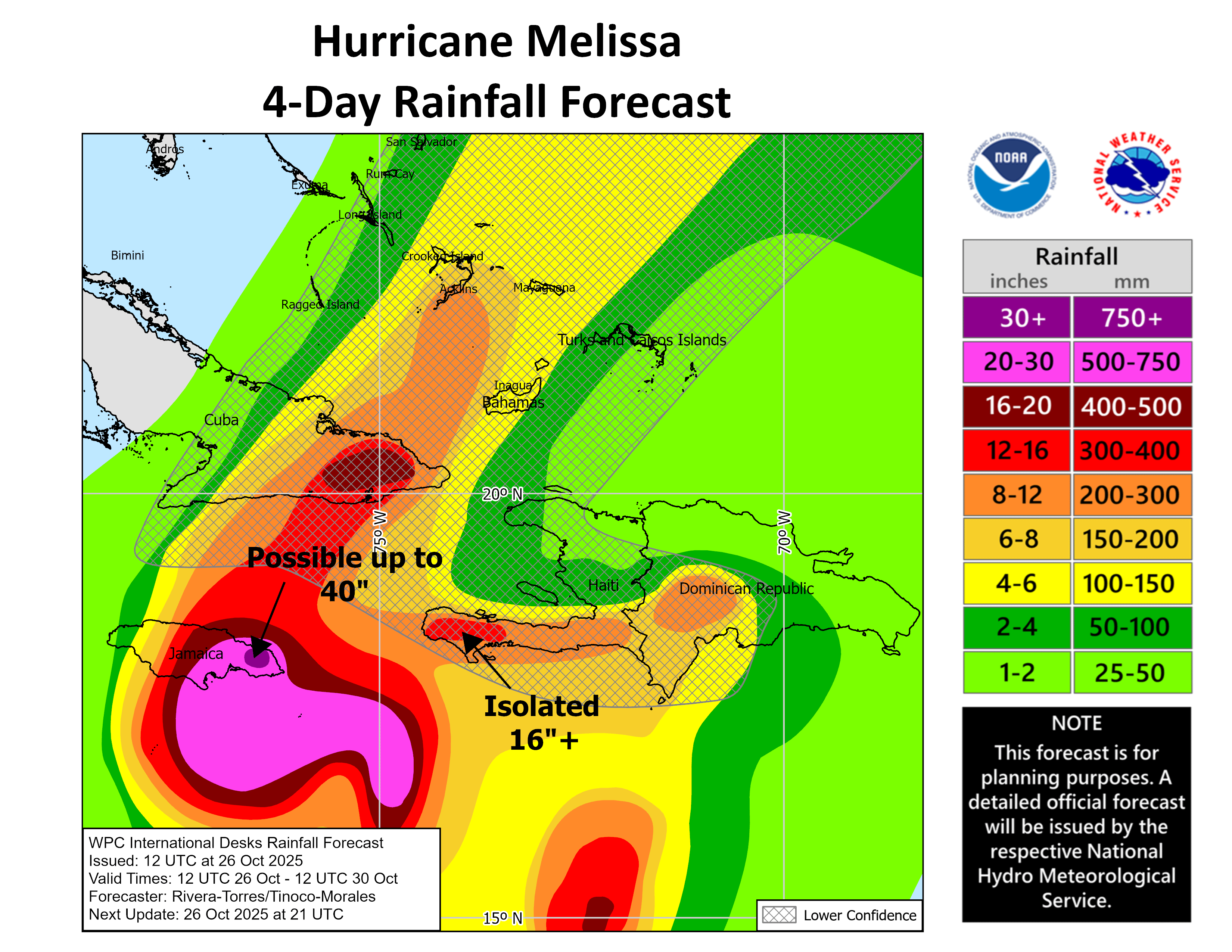
If that wasn’t enough, heavy and persistent rain will overspread Jamaica this afternoon from east to west. Once the rain begins to fall, it will not stop for about 3 days or so. Because of this, widespread rainfall totals of 20 to 30 inches (500 to 750 mm) are expected across much of Jamaica. Up to 40 inches (1000 mm) of total rainfall looks likely on the eastern side of Jamaica. These extreme rainfall totals will lead to catastrophic flooding and numerous landslides throughout the next several days.
The impacts from Melissa in terms of Category 4 to Category 5 strength winds, a very high storm surge & catastrophic flooding from rainfall could be one of Jamaica’s most destructive hurricanes.
Once again, if you are on the island of Jamaica, I implore you to take this hurricane extremely seriously. If you have friends or relatives on the island, please tell them to take this hurricane extremely seriously.
Extensive damage to infrastructure, long duration power and communication outages and complete isolation of communities are all expected with Melissa.
Make absolutely sure that you are in a very sturdy and safe building & be aware that you will be in that shelter for several days. Also be aware that you are going to be without power or any forms of communication to the outside world for potentially weeks.
Haiti: Catastrophic and life-threatening flash flooding and landslides are expected across southwestern Haiti over the next few days. This will lead to extensive infrastructural damage and isolation of communities.
Eastern Cuba & The Southeastern Bahamas: Once Melissa passes across Jamaica, it will speed up in its forward motion & cross eastern Cuba, the southeastern Bahamas and the Turks and Caicos on Tuesday night and Wednesday as a major hurricane.
This means that a significant storm surge, hurricane to major hurricane force winds and heavy rainfall can be expected across eastern Cuba on Tuesday night and then across the southeastern Bahamas on Wednesday.
Those of you in eastern Cuba and the southeastern Bahamas need to get ready for a pretty hard hit from a hurricane. Please take this hurricane very seriously if you are in eastern Cuba and the southeastern Bahamas.
Bermuda: It remains quite possible that Melissa could impact Bermuda as a hurricane on Thursday night. I urge all interests on the island to monitor the progress of Melissa extremely closely.
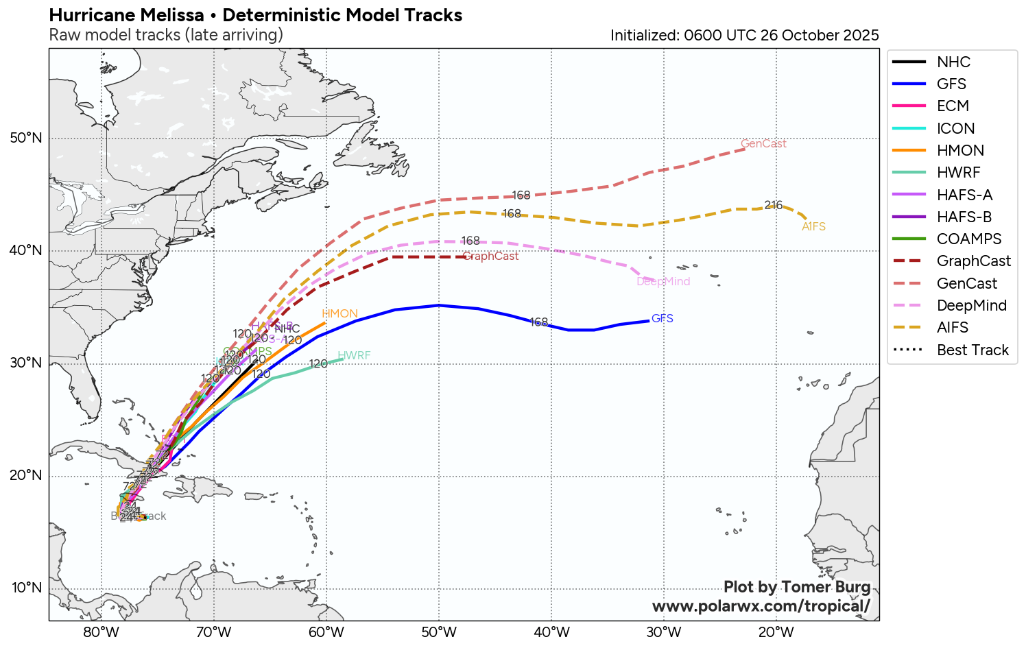
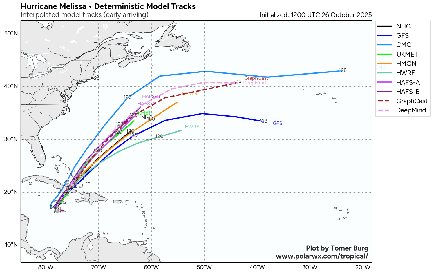
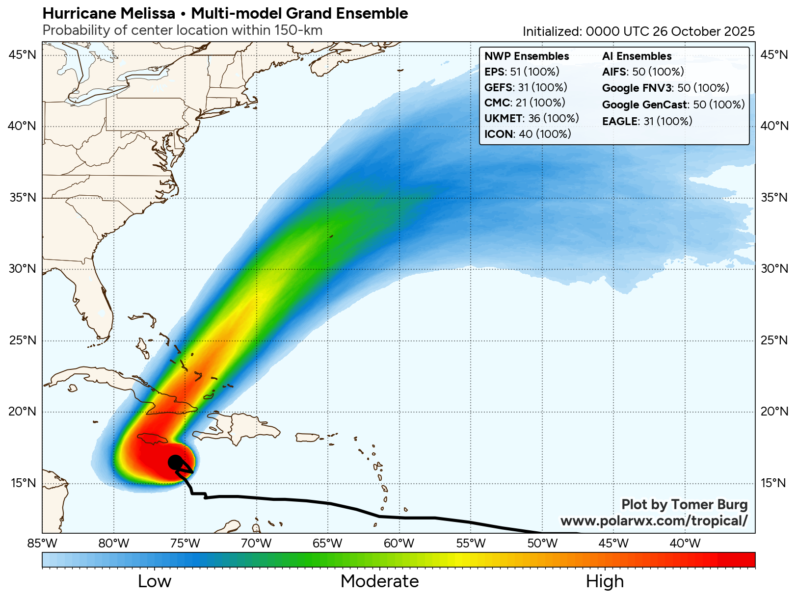
Model Track Forecast:
Satellite Imagery:
The next tropical weather discussion will be issued on Monday.