Coastal Storm Located Near The North Carolina Outer Banks: Weather analysis of satellite imagery and marine weather observations indicates that the coastal storm that we’ve been watching is currently located about 75 miles to the east-northeast of Cape Hatteras at the time of this writing. It is expected that this low pressure system will continue to track slowly along the outer banks of North Carolina before crossing the coast near Albemarle Sound by later today. From there, this low pressure system will slow down and weaken near the Virginia-North Carolina border tonight.
The gustiest winds from this storm system will occur across northeastern North Carolina and southeastern Virginia throughout the day today through tonight. Wind gusts of up to 35-45 mph can be expected, especially along the immediate coast.
In addition, bands of moderate to heavy rain associated with this low pressure system will affect mostly northeastern North Carolina and eastern and southeastern Virginia throughout the rest of today through tonight. Additional rainfall totals of 2 to 3 inches with locally higher amounts can be expected over the next 12-24 hours.
Finally, there is the expectation of some additional minor coastal flooding across eastern North Carolina and the outer banks, eastern and southeastern Virginia, coastal Maryland and coastal Delaware during the high tides the rest of today, tonight and Wednesday.
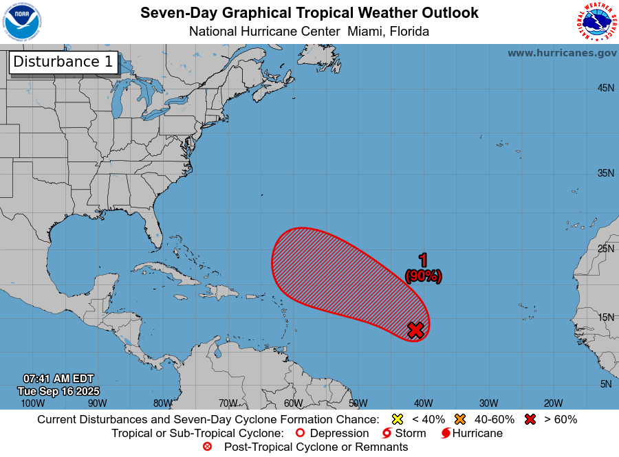
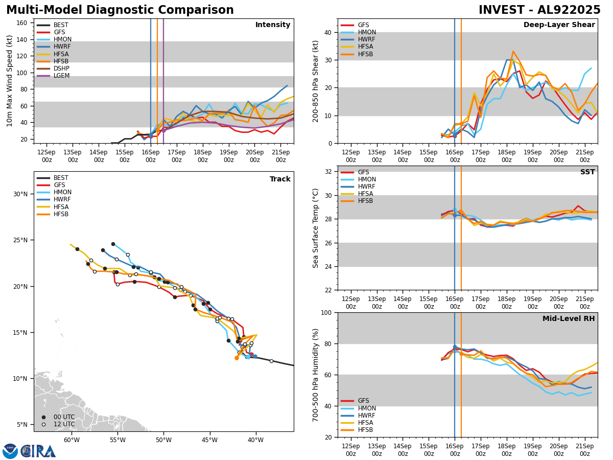
Invest 92-L Located Halfway Between The Lesser Antilles & The West Coast Of Africa: Invest 92-L is certainly organizing this morning as satellite imagery reveals that the disturbance is producing quite a bit in the way of deeper convection. Additionally, there is a good amount of low-level rotation noted in satellite loops.
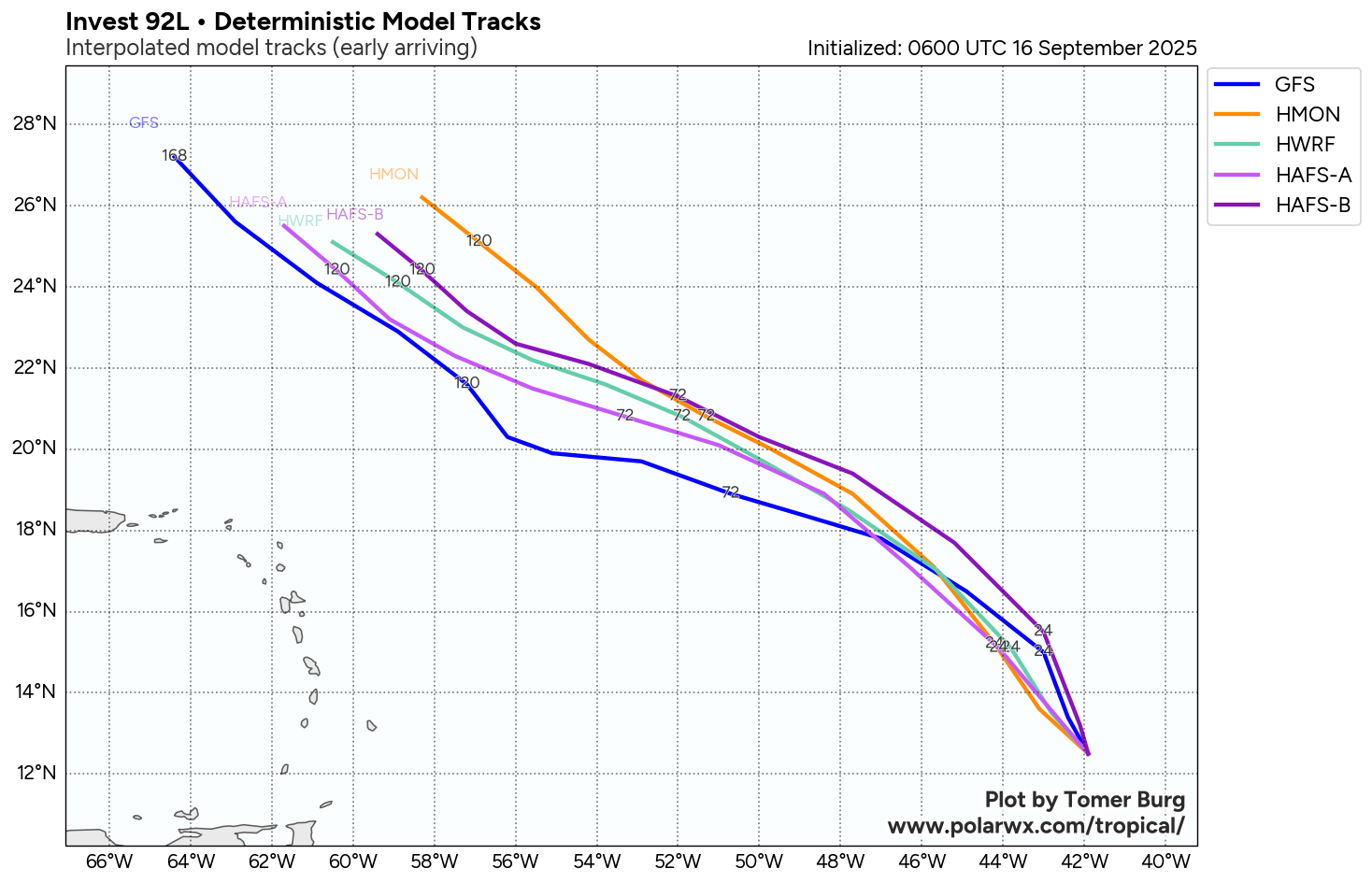
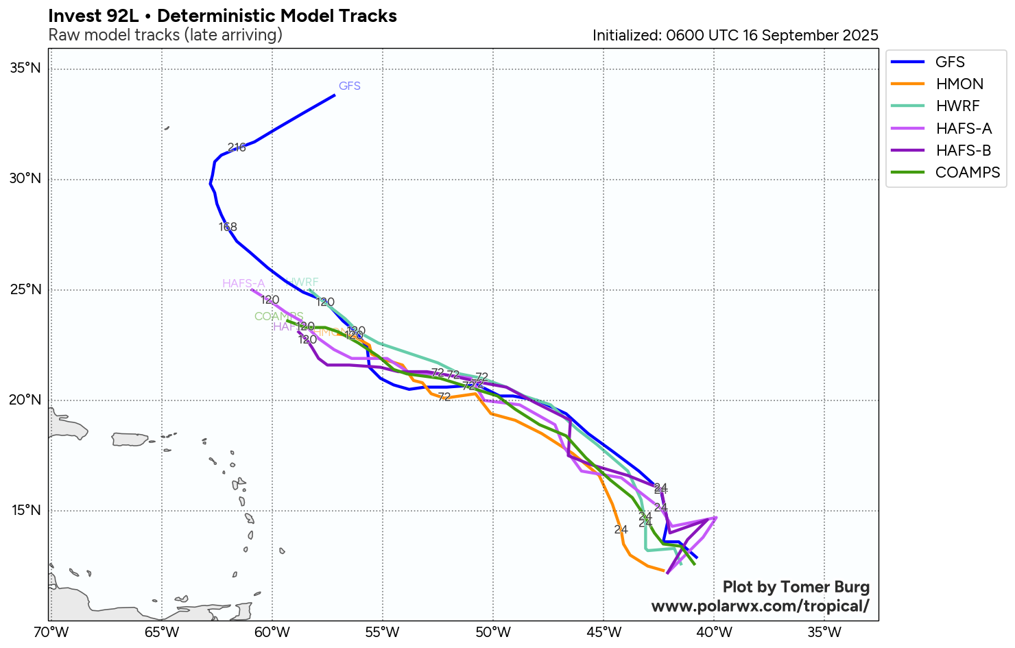
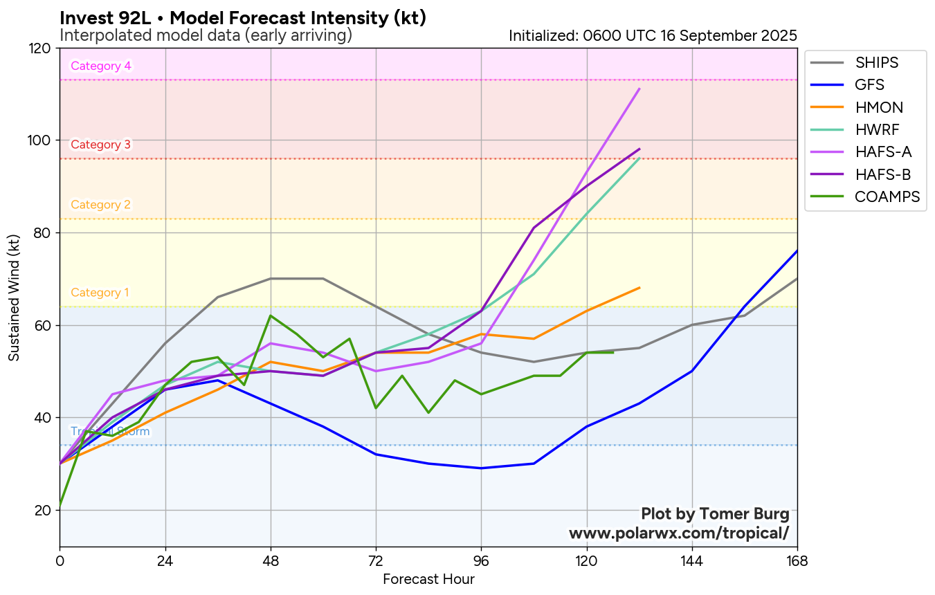
All indications seem to point towards Invest 92-L developing into a depression over the next couple of days or so & then going on to become a tropical storm and even a hurricane. The next name on the list is Gabrielle.
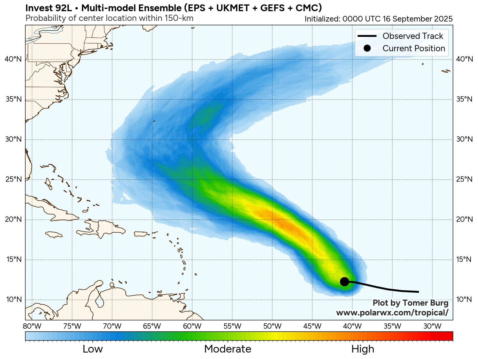
Invest 92-L is expected to head in a west-northwest to northwest direction throughout the rest of this week and this will most certainly keep this system well north of the Lesser Antilles and the northeastern Caribbean by this weekend.
Beyond this, I think that the island of Bermuda really needs to keep a close eye on the progress of Invest 92-L as it could pose a threat to you in about a week from now. The latest ensemble guidance from the GFS and European models show a majority of their members either threatening or directly impacting the island of Bermuda around next Tuesday. Additionally, some of the model guidance are showing that Invest 92-L could be a strong hurricane when it passes near or over Bermuda, so this is something to certainly keep a very close eye on.
As for the Bahamas and the East Coast of the United States, it continues to look fairly likely that an upper level trough located over the western North Atlantic will keep Invest 92-L from heading towards the Bahamas or the East Coast of the United States. Instead, this upper level trough will deflect Invest 92-L and turn it to the north and northeast away from the Bahamas and the US East Coast. It should be noted though that if Invest 92-L does become a strong hurricane in the middle of the North Atlantic, it could send another round of rough surf and rip currents to the East Coast of the United States during next week.
Model Track Forecast:
Satellite Imagery:

The next tropical weather discussion will be issued on Wednesday.