The development of Tropical Storm Andrea yesterday over the North Atlantic between Bermuda and the Azores was very short-lived. Andrea ended up dissipating yesterday evening as the system was impacted by colder ocean waters, dry air and strong amounts of wind shear. All is quiet across the rest of the Atlantic, Caribbean and Gulf with no other areas of interest. The environmental conditions across a large part of the Atlantic Basin are unfavorable for any sort of development.
So, we close the books on Andrea, even though it wasn’t much to begin with.
Elsewhere Across The Atlantic, Caribbean & Gulf: All is quiet across the rest of the Atlantic, Caribbean and Gulf with no other areas of interest. The environmental conditions across a large part of the Atlantic Basin are unfavorable for any sort of development.
Analysis of wind shear values reveals that very strong levels of wind shear are impacting the entire tropical Atlantic, the entire Caribbean and the eastern Gulf. The only area right now that has low enough wind shear for development is across the western Gulf where wind shear values are less than 20 knots. That said, no development is expected anywhere across the Atlantic Basin throughout the rest of this week through this weekend.
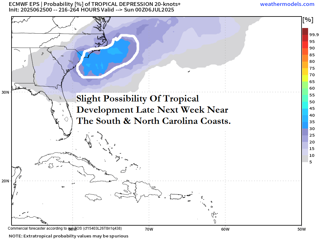
Tropical Development Is A Slight Possibility Near The Southeastern Coast Of The United States Late Next Week: Some of the model guidance (particularly the Canadian model) continues to hint that there will be the development of a low pressure system near the tail end of a frontal boundary near the South and North Carolina coasts around Thursday and Friday of next week. This low pressure system is then forecast by the model guidance to track northeastward passing near or just east of Cape Cod by next weekend. Additionally, the European ensemble model guidance is forecasting around a 30-35 percent chance for tropical development near the South and North Carolina coasts during the late parts of next week.
My takeaway from all of this is that the area near the South and North Carolina coasts may need to be watched closely for possible tropical development around Thursday and Friday of next week. For now though, it’s nothing to be overly concerned about or worried about – just something to keep an eye on.
Needless to say, I will be keeping close tabs on the slight possibility for tropical development late next week near the Carolina coastline and will update you as needed.
The next tropical weather discussion will be issued on Friday.