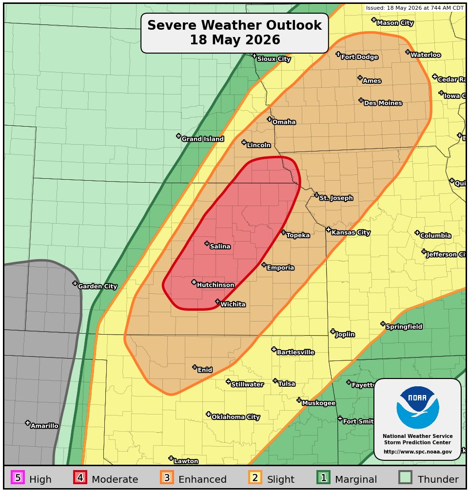
Summary: A significant tornado outbreak is looking very likely across central & eastern Kansas, southeastern Nebraska, northwestern Missouri and southwestern Iowa during this afternoon and this evening. Very large to giant hail and multiple strong to violent tornadoes are expected across this entire area.
Details: It’s going to be a dangerous afternoon and evening across a large part of central and eastern Kansas, southeastern Nebraska, northwestern Missouri and southwestern Iowa as an extremely unstable air mass combines with strong amounts of low-level wind shear to produce intense supercells.
These supercell severe thunderstorms will track northeastward across central and eastern Kansas into southeastern Nebraska, northwestern Missouri and southwestern Iowa during this afternoon and this evening. The environment across this entire area will be extremely favorable for strong to violent tornadoes, large to giant hail and damaging winds.
A Potentially Dangerous Situation Tornado Watch is already in effect across northeastern Kansas and southeastern Nebraska & I anticipate to see additional Tornado Watches be issued across eastern and central Kansas, western and northwestern Missouri and southwestern Iowa during this afternoon and this evening.
Finally – I wanted to mention that there is an area of convection that’s present over the southwestern North Atlantic just east of the Bahamas. While this convection looks “impressive” on satellite imagery, there is no chance at all of it developing into a tropical system. The environmental conditions are highly unfavorable for development due to strong amounts of wind shear. I just wanted to mention it, in case you were curious about it.