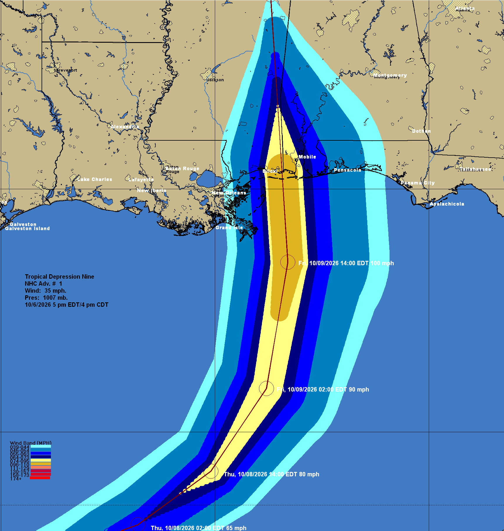


Invest 92-L has organized enough this afternoon to be classified as a tropical depression & thus we now have Tropical Depression #9 over the southwestern Gulf. TD 9 is very likely to strengthen quite a bit in the coming days and because of this, it will likely become a tropical storm (name will be Isaias) as soon as later tonight or during Wednesday.
The environmental conditions around the depression are favorable for strengthening and because of this, I suspect we will see it not only become a tropical storm, but very possibly a hurricane as soon as Thursday night or early Friday. Also, the strengthening of this system should cause it to be steered more by the southwesterly upper-level winds & because of this, it should travel in a north-northeast to northeast direction. This could lead to this system to make landfall somewhere along the coast of southern Alabama and the western Florida Panhandle on Friday evening. This could be a fast moving storm & because of this, it may weaken little before making landfall. Because of this, I am now forecasting this system to come ashore as a hurricane with between 80 and 95 mph maximum winds along the Alabama or western Florida Panhandle coastline.
For Those Of You Along The Northern Gulf Coast From Louisiana To The Florida Panhandle – While the exact details on how this system will impact the northern Gulf coast still need to be figured out, I think there is the increasing likelihood for a hurricane to come ashore by Friday evening. I urge everyone from Louisiana to the Florida Panhandle to check back often for the latest updates.
I do still think that the biggest hazard from this system will probably be heavy rain and the threat for flooding along the northern Gulf coast from southern Louisiana through the Florida Panhandle. Additional rainfall totals of 4 to 8 inches are likely, especially during later this week into the holiday weekend. Isolated rain totals of 10 inches or more are a possibility over the western Florida Panhandle.
The next potential hazard from this system will be storm surge, as well as the likelihood of tropical storm to hurricane force winds across the central and eastern Gulf coast. The higher coastal flood and wind threats from this system would potentially occur on the eastern side of it. This means that areas from southern Alabama and the Florida Panhandle to the west coast of Florida may end up seeing the worst of the weather from this system, even if it’s weakening at landfall. This could include a storm surge of up to 6 feet and winds that gust up to over 60 mph at times during Friday into Saturday. Wind gusts in the hurricane force range could occur across southern Alabama and across the western and central Florida Panhandle during Friday afternoon into Friday night.
Finally, there will very likely be the potential for tornadoes on Friday into Saturday across areas to the east of where this system makes landfall. This means that possibly the Panhandle of Florida and parts of the central and northern Florida Peninsula may have a potential for tornadoes on Friday into Saturday.
I am keeping very close tabs on the progress of TD 9 and will have many more updates as needed.