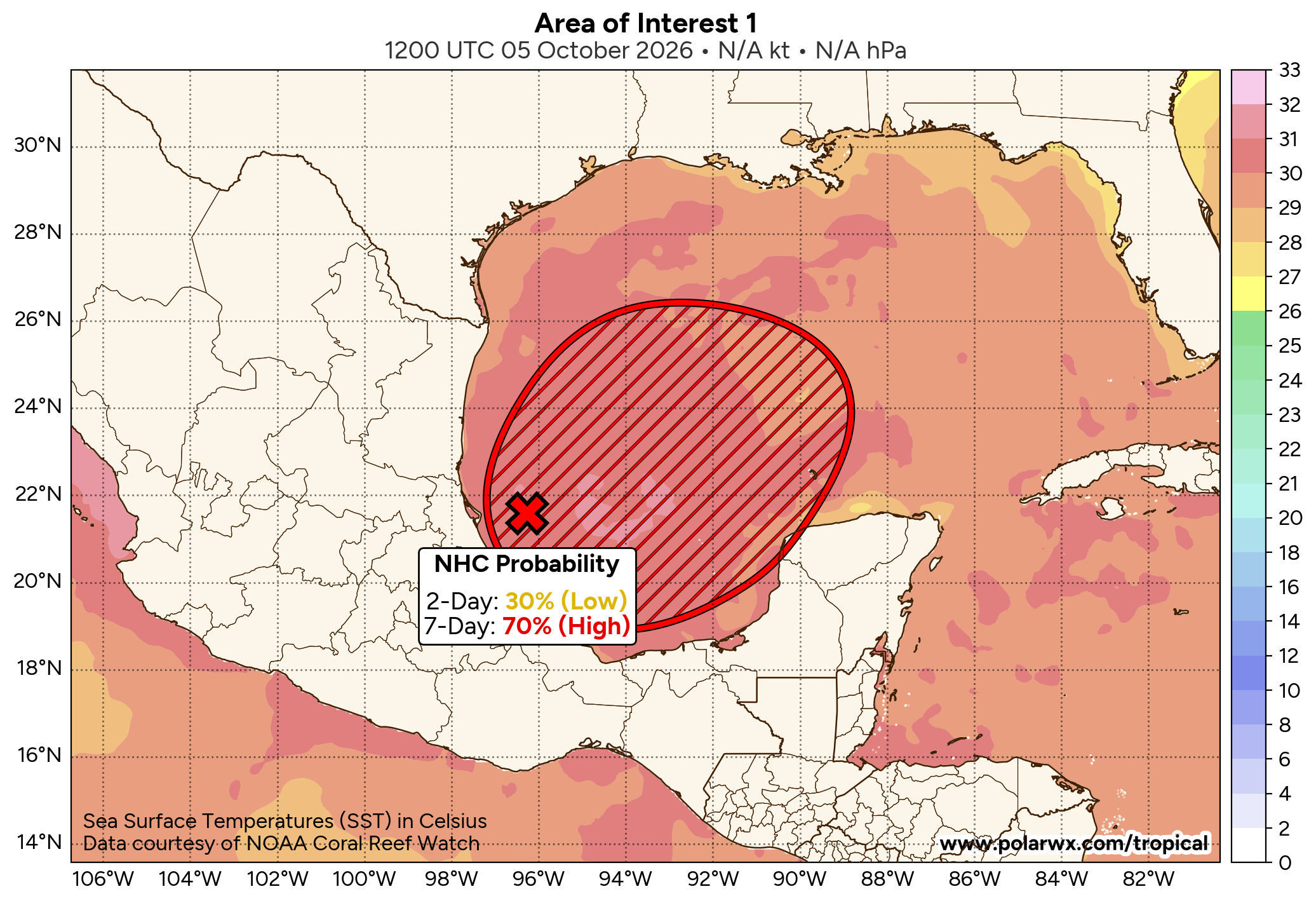


It now looks very likely that we will see the development of a tropical depression and very likely a tropical storm in the southwestern Gulf a little later this week. Weather analysis today revealed that there is a frontal boundary now draped across the northern Gulf. An area of low pressure seems to be trying to form over the southwestern Gulf & this is the low pressure system that’s probably going to become our tropical depression and then tropical storm a little later this week.
A look at the current environmental conditions reveals that the wind shear values are very low across the southern and southwestern Gulf & this will lead to a favorable environment for this system to develop this week.
A Look At The Latest Model Guidance reveals that some of the guidance are pretty robust in the amount of strengthening they forecast this system to undergo by late this week and during the weekend. That said, not all of the model guidance agree with this & some show this system just becoming a very sloppy and wet tropical storm, at most.
On one end of the spectrum we have the European model guidance and their ensemble members that are showing this system to gradually become a tropical storm by about Friday over the southwestern Gulf. From there, the European model guidance shows this system to head northward this weekend and come ashore along the central Gulf coast as a weak, sloppy and very wet tropical storm on about Sunday.
On the other end of the spectrum is the Google Deep Mind ensemble model guidance which are showing a stronger system. They indicate this system becoming a tropical storm by about Thursday and then forecast this system to head for the Florida Panhandle or the Alabama coastline as a strong tropical storm or even a hurricane. The reason these models are stronger is due to it not being impacted as much by strong wind shear over the northern Gulf.
Here Are My Thoughts: As I already mentioned, I think that it is extremely likely that we will see a tropical depression and very probably a tropical storm form in the southwestern Gulf sometime between Wednesday and Friday. I put the chances of this occurring at around 90 percent.
Now, where could this tropical system go and how strong could it get? It is expected that an upper-level trough of low pressure will be in place over the eastern United States throughout this week right through this weekend. This upper-level trough of low pressure will pull our tropical system north or northeastward towards the northern Gulf Coast somewhere between southern Louisiana and the Florida Panhandle by this weekend.
The question then becomes what will the environmental conditions be like over the northern Gulf late this week and this weekend. That upper-level trough is likely to produce some strong amounts of wind shear over the northern Gulf. This means, in all likelihood, this is going to be a highly sheared, very messy and very wet tropical storm that stays pretty weak. This is what I’m thinking in terms of a scenario right now.
There is, however, another scenario and that is this tropical system travels in a more northeasterly direction and aligns itself with the upper-level winds. If this happened, it would lead to a net low wind shear environment for this system. In this case, we’d see this system strengthen into an upper-end tropical storm or even a hurricane before coming ashore on the Florida Panhandle or the Alabama coast on about Saturday. At this point, I think the chances for this outcome occurring is very low, but it is one that does need to be watched, just in case.
At the minimum, I think that we’re probably looking at a large, messy and very wet system that brings quite a bit of rain to much of the northern Gulf Coast throughout this weekend. This would lead to the threat for flooding for many along the northern Gulf Coast from southern Louisiana eastward to the Florida Panhandle.
Now, should this system come in stronger than a weak tropical storm, then we’d have to watch out for the possibility of strong winds, some storm surge and a lot of rain along the northern Gulf Coast this weekend. Again, I’m leaning much more towards this system being a weak system & not a strong one.
Either way, I will be keeping very close tabs on this system and will have many more updates for you in the coming days.