

Things remain quiet across the Atlantic, Caribbean and Gulf right now & it appears likely that tropical development will not occur throughout the rest of this week through this weekend.
Even though things are quiet right now, there are some signals in the model data that suggest things may pick up in terms of activity as soon as next week. A majority of the most recent model guidance are now showing a marked increase in the chances for tropical development over the eastern tropical Atlantic next week that gradually pushes into the central Tropical Atlantic by the very end of this month.
The system that a majority of the model guidance are latching onto for potential tropical development is a tropical wave that’s expected to push off of the coast of Africa by early next week. This signal from both the regular models such as the GFS model and the European model and the AI models like the European AIFS and the Google Deep Mind model are the strongest we’ve seen so far this season in the deep tropics. The question then becomes is this signal real or are we looking at another phantom storm that never develops. Unfortunately, that’s something that really can’t be figured out until we get into this weekend and next week & see if the real-time data matches up with the model data.
I do want to address the GFS model guidance, which is showing a conga line of storms that stretch from the Bahamas to the eastern Tropical Atlantic by the very end of this month. Given that the environmental conditions out across the Atlantic are pretty hostile for development, I do think that the GFS model may be going way too overboard with its forecast of 3 named storms going at the same time.
The European model’s forecast of just one storm that tracks from the eastern Tropical Atlantic next week & ends up curving northward out into the open Atlantic by the very start of September may end up being closer to reality.
For now, there is a chance that things might become a little more active in terms of tropical activity across the Atlantic in about a week from now. That being said, anything that does try to form may do so well away from both the United States and the Caribbean & because of this, there will be plenty of time to keep an eye on it.
One thing that I want to mention is that none of the model guidance show any sort of a threat to the US coastline, the Bahamas or the Caribbean & they all seem to point towards anything that forms would stay out in the open Atlantic.
No matter what happens, I will be keeping an eye on things closely & will have updates as needed.
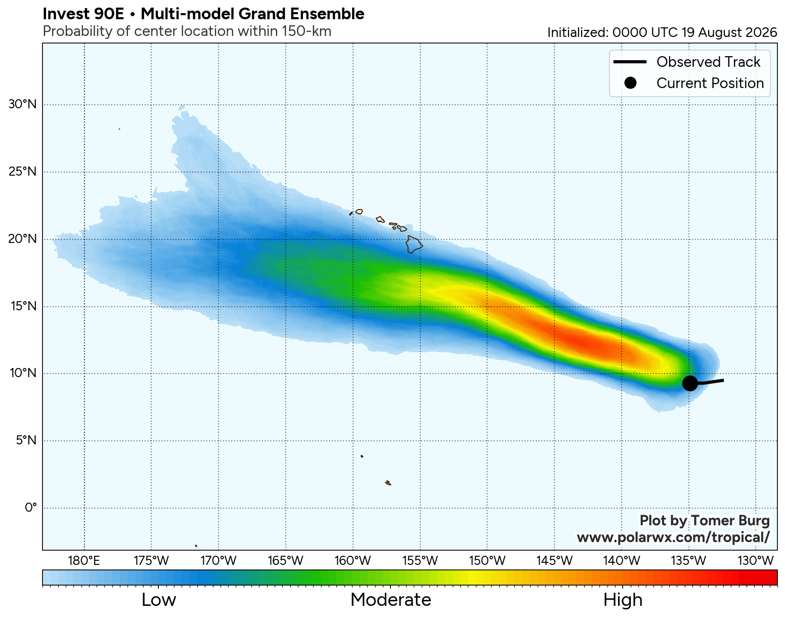
Finally, I wanted to cover the activity in the Pacific for a minute as a disturbance, designated Invest 90-E by the National Hurricane Center, is organizing well to the east-southeast of the Hawaiian Islands. It looks very likely that this disturbance will organize and strengthen in the coming days and become a tropical storm towards the end of this week and this weekend.
The reason why I’m mentioning Invest 90-E is because the model guidance are pointing towards the possibility of this system tracking just south of the Big Island of Hawaii & possibly threatening the Big Island with some impacts by early next week. This will be something to keep an eye on as any sort of impact (rain or wind) would lead to problems across the Big Island as they are still recovering from the big floods caused by Lala.