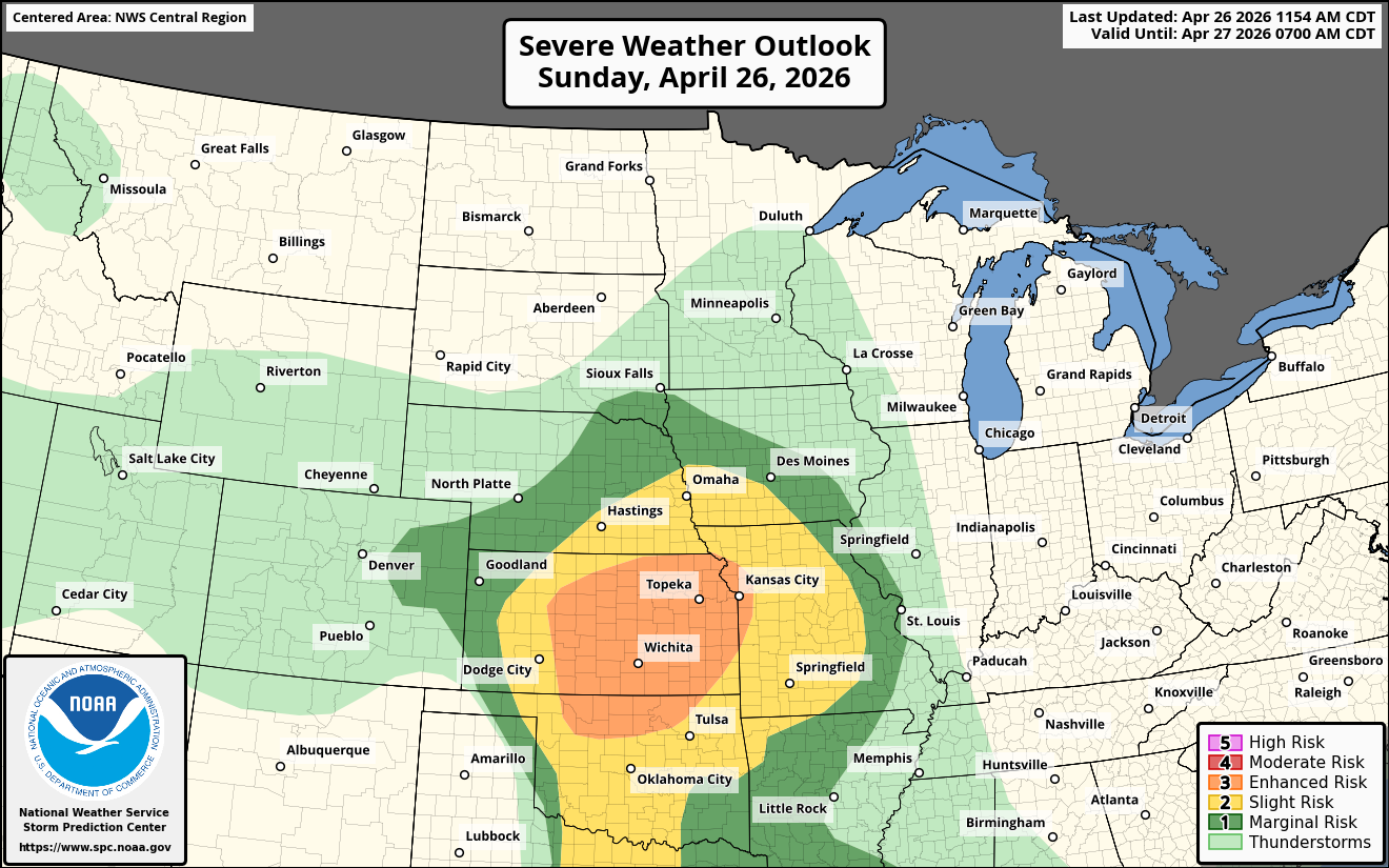
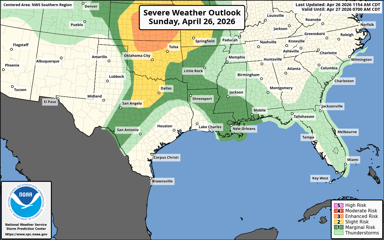
Summary: Severe thunderstorms with very large hail, damaging winds and tornadoes are expected this afternoon and tonight across parts of the central and southern Plains states. Strong tornadoes and hailstones of up to 3 inches in diameter are a possibility across central and eastern Kansas, northern and central Oklahoma and far western Missouri.
Details: Significant severe weather potential looks quite probable later this afternoon and tonight across parts of the central and southern Plans states.
An area of severe storms currently exists across central and northern Kansas and these storms are expected to push into northeastern Kansas and parts of western Missouri, including Topeka and Kansas City by later this afternoon. Damaging winds and large hail will be the main threat with these storms.
A surface low pressure system is expected to develop over the Oklahoma Panhandle and southwestern Kansas by this evening. A very unstable to extremely unstable air mass is expected to be in place to the east of this low pressure system across much of central and eastern Kansas into Oklahoma.
It looks possible that supercell severe thunderstorms will develop over north-central Oklahoma into central Kansas by early this evening. Other supercell storms may develop around or just after sunset across central and southern Oklahoma into north Texas. These supercell severe storms will continue through the nighttime hours of tonight, especially before midnight and will pose a threat for very large hail and tornadoes, some of which will be strong. The area of most concern for the nighttime severe storms will be across much of southern, central and northeast Oklahoma into central and eastern Kansas and even possibly into north Texas.