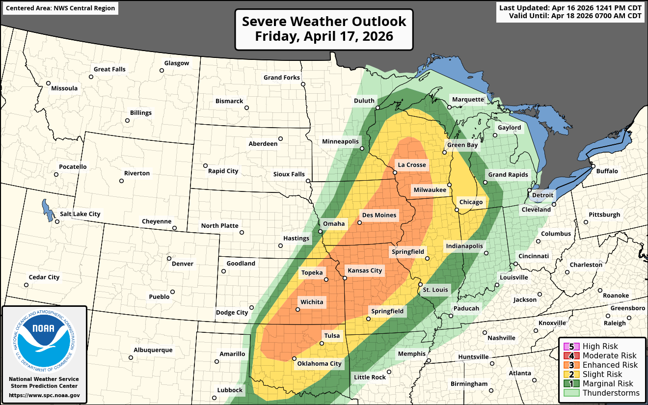
Summary: Widespread significant severe weather is expected across a large area from the southern Plains states into the middle and upper Mississippi Valley during Friday afternoon and Friday night. Tornadoes, some strong, very large hail and damaging winds will all be a threat.
For Southern & Eastern Iowa, Western Illinois & Southern Wisconsin: Strong tornadoes are going to be a threat Friday afternoon into Friday evening across southern and eastern Iowa, southern Wisconsin and western Illinois. The atmosphere across this area is expected to be very unstable. This will combine with strong amounts of low-level wind shear due to the proximity of a surface low pressure system and a warm front.
Scattered supercell severe thunderstorms are expected to develop after about 2 pm CDT Friday afternoon across southern and eastern Iowa, southern Wisconsin and western Illinois. This is the area that’s most likely to see strong tornadoes during the mid and late afternoon hours of Friday.
These supercell storms will eventually consolidate into a squall line by Friday evening as the storms push towards Lake Michigan. This means that damaging winds from the squall line will be a threat across much of northern Illinois, eastern Wisconsin and northwestern Indiana during Friday night.
For Northern Oklahoma, Southern & Eastern Kansas & Central & Northern Missouri: Another area to watch closely Friday afternoon into Friday evening will be across northern Oklahoma, southern and eastern Kansas and central and northern Missouri. The atmosphere across the entire area is expected to be very favorable for the production of very large hail, damaging winds and tornadoes.
Supercell severe thunderstorms look to initially develop across this entire area by mid-afternoon Friday and these storms will be capable of producing very large hail and tornadoes.
Eventually these storms will evolve into a squall line that is capable of producing very damaging winds of up to 80 mph and large hail across northern Oklahoma, eastern Kansas and central and eastern Missouri during Friday evening.