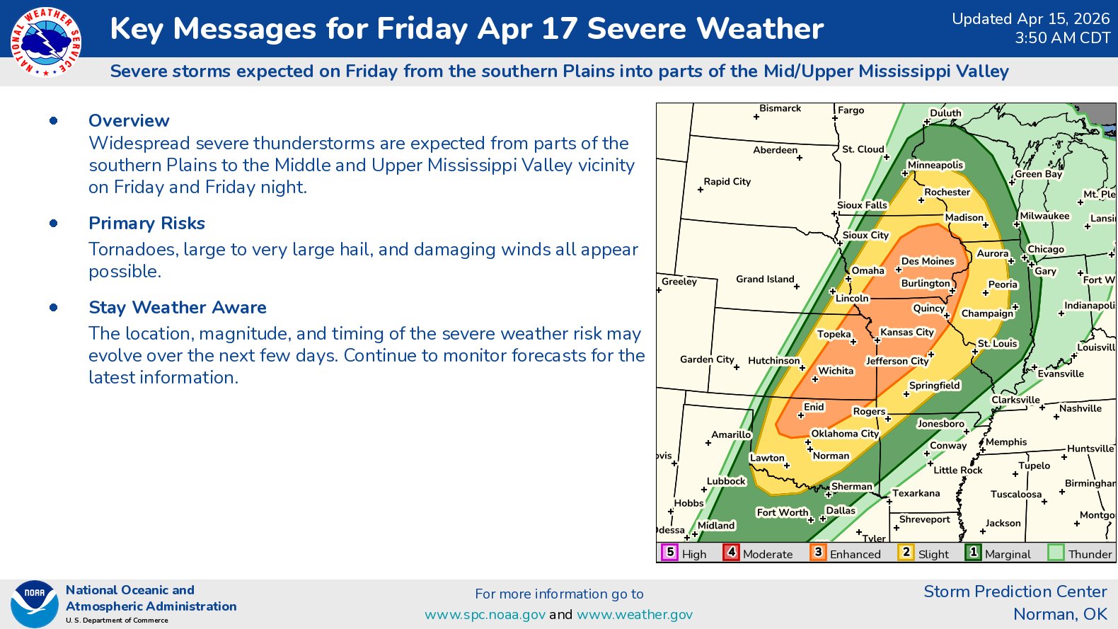
Summary: Widespread severe thunderstorms are expected from the southern Plains states to the middle and upper Mississippi Valley during Friday afternoon and Friday night. This includes northern Oklahoma, eastern Kansas, western, central and northern Missouri, central and southern Iowa. Damaging winds, very large hail and tornadoes, some strong, will all be a threat.
Details: A strong upper level trough of low pressure is expected to move from the central Rockies into the upper Midwestern United States and the central Plains states during Friday. At the same time this is happening, a cold front will push eastward from the Plains states into the Midwest.
A warm and humid air mass will be found to the east of this cold front leading to a moderately to very unstable air mass from the Midwest to the southern Plains by Friday afternoon and Friday night.
It appears that a squall line will evolve from northeastern Kansas through northwestern Missouri into southern and central Iowa during Friday afternoon and Friday evening. While damaging winds will be the main threat from this squall line, tornadoes will also be a threat as well as they push into northern and central Missouri, southern and eastern Iowa.
Further south, supercell severe thunderstorms will be a threat during Friday afternoon and Friday evening across southern and southeastern Kansas and northern Oklahoma. Any supercells that do develop will pose a threat for very large hail, strong tornadoes and damaging winds.