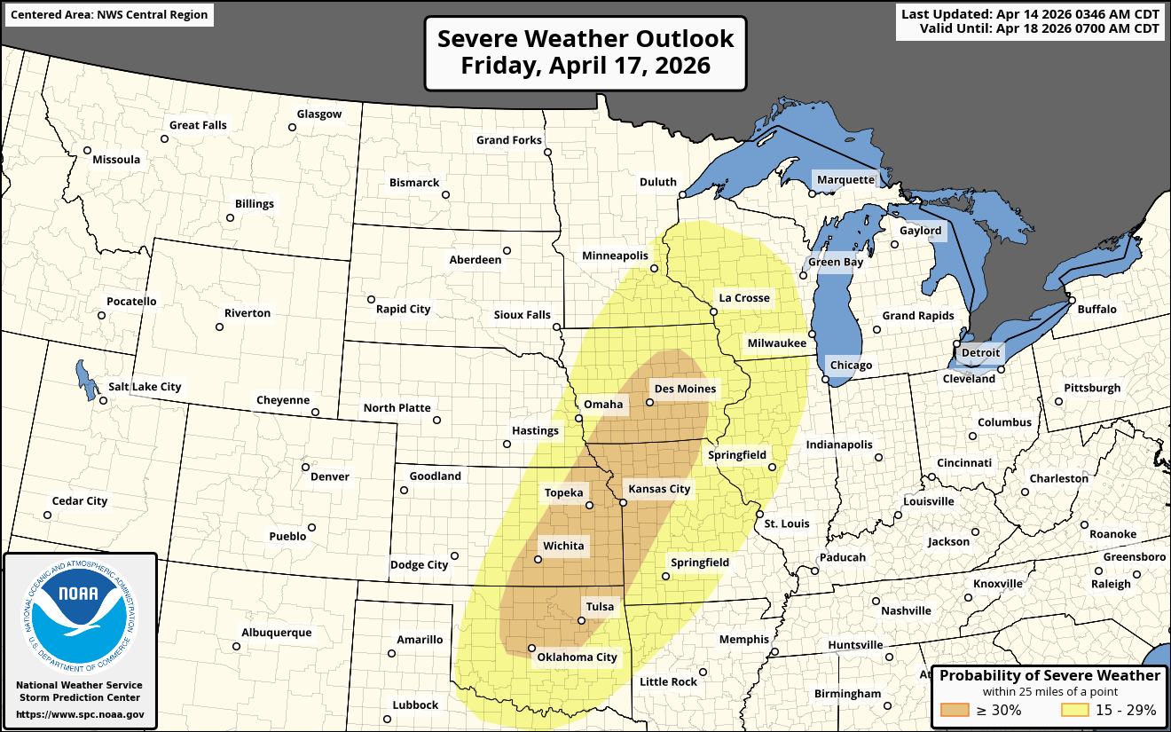
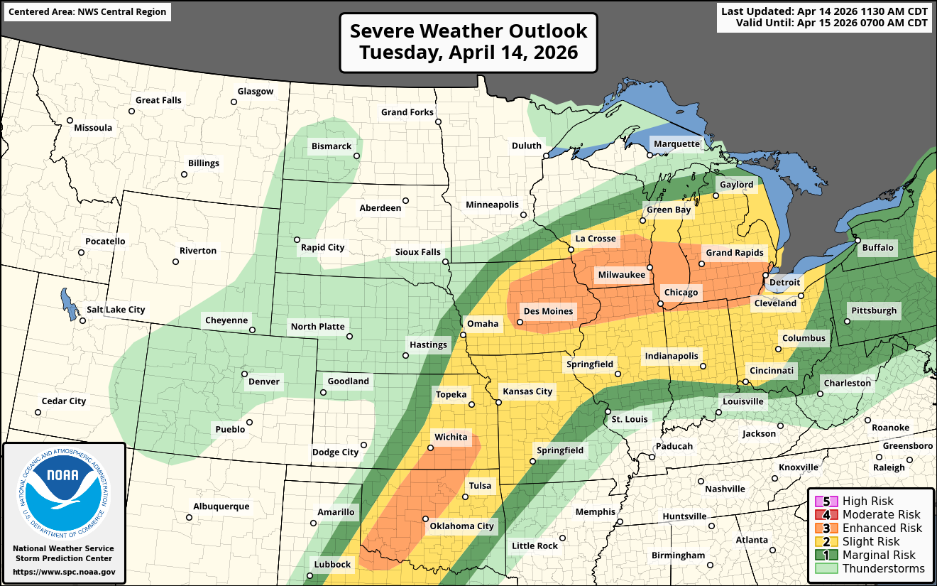
Summary: A large area of severe weather, some of it significant, is expected from the southern and central Plains states northeastward into the Midwestern United States and the southern Great Lakes. Very large hail, tornadoes, some strong and damaging winds are all expected, especially from central and eastern Iowas through northern Illinois, southern Wisconsin and southern Lower Michigan.
For The Midwest & The Southern Great Lakes: It appears likely that multiple supercell severe thunderstorms will form by mid to late afternoon across central and eastern Iowa, southern Wisconsin and northern Illinois. The air mass is expected to be very favorable for very large hail and damaging winds.
Additionally, the supercells that do form across central and eastern Iowa, southern Wisconsin and northern Illinois will be capable of producing tornadoes, some of which will be strong. The area across southern Wisconsin and northern Illinois, including Madison, Milwaukee and Chicago, is an area that’s particularly concerning in terms of strong tornadoes.
These storms are then expected to evolve into a cluster of severe storms that produces damaging winds this evening that pushes across southern Lower Michigan.
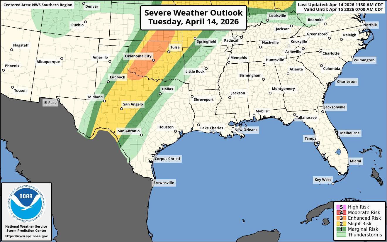
Southern & Central Plains States: It appears that supercell severe thunderstorms will develop across western and central Oklahoma northeastward into south-central and southeast Kansas by mid to late afternoon. The environment is expected to be very favorable for extremely large hail of up to 3 to 4 inches in diameter.
Additionally, a strengthening low-level jet stream by early this evening will support the threat for a few tornadoes across central Oklahoma into south-central and southeastern Kansas.
A Significant Severe Weather Outbreak Is Quite Possible Friday Afternoon & Friday Evening From The Southern Plains Into The Midwestern United States: A strong upper level trough of low pressure is expected to push eastward into the Plains states during Friday and Friday night. At the surface, an area of low pressure is expected to strengthen as it moves into western Oklahoma with a second low pressure system located near the middle Missouri Valley.
Ahead of all of the weather features, a warm and humid air mass will be in place from the southern and central Plains states northeastward into the Midwest. Supercell severe thunderstorms capable of producing very large hail, strong tornadoes and damaging winds are expected across much of central and northern Oklahoma, southern and eastern Kansas, western and northern Missouri and southern and eastern Iowa during late Friday afternoon and Friday evening.
These storms should push eastward reaching the Mississippi River from eastern Missouri into western Illinois and western and southern Wisconsin during the overnight hours of Friday night. Damaging winds and a few tornadoes will be a threat.