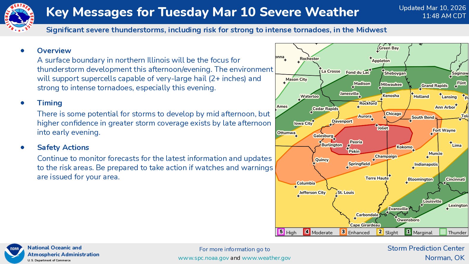
Summary: Severe weather with the threat for strong to intense tornadoes are expected late this afternoon into this evening across northern and central Illinois, northern Indiana and southern Lower Michigan.
Details: A warm front is expected to be in place across northern Illinois, northern Indiana and lower Michigan throughout this afternoon. While this is occurring, an area of low pressure will track along this front & help to produce an environment that’s highly favorable for severe weather, including tornadoes.
Supercell severe thunderstorms are expected to develop across northern and central Illinois as early as 3-5 pm CDT this afternoon. A very unstable air mass & strong amounts of low-level wind shear will lead to a environment that’s favorable for very significant severe thunderstorms across northern and central Illinois, including very large hail and tornadoes.
By this evening, very strong low-level wind shear will increase the significant tornado threat across northern and central Illinois and northern Indiana throughout this evening.