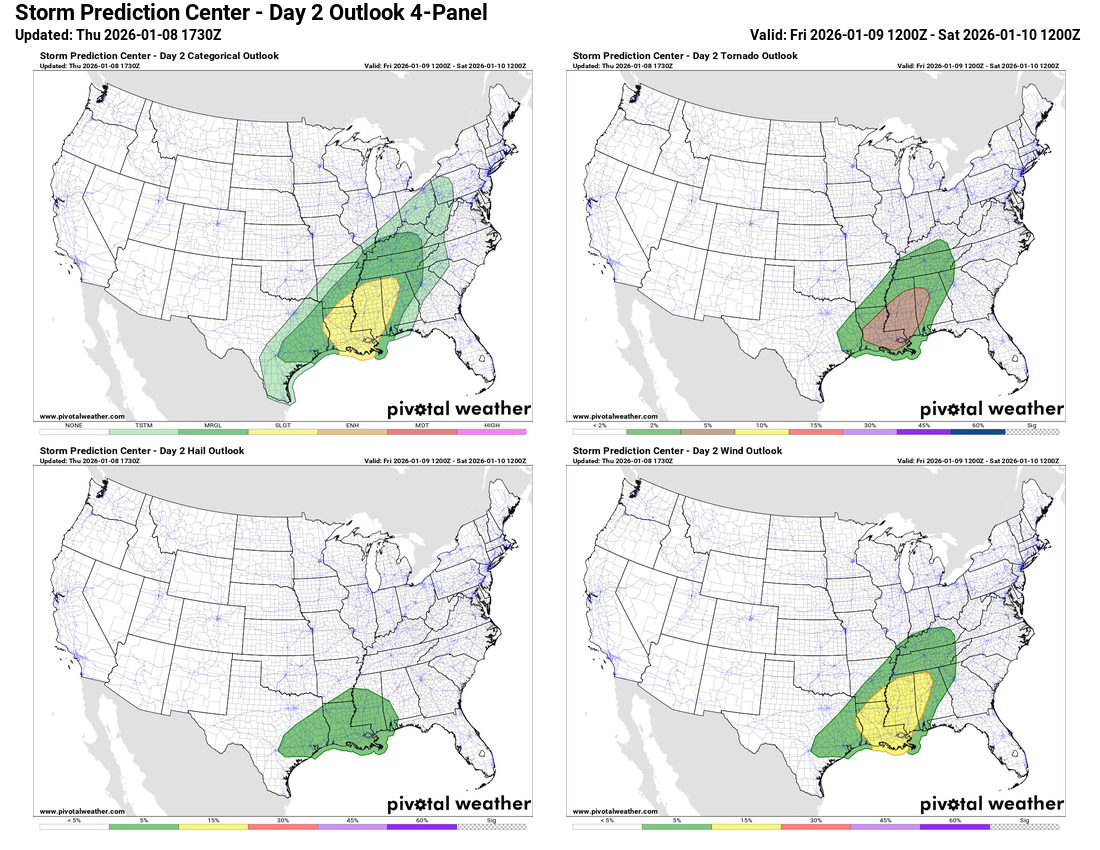
Summary: Severe thunderstorms are expected on Friday from the central Gulf coast into parts of the lower Mississippi Valley and the Tennessee Valley. Damaging winds and a few tornadoes look to be the main threat. The area of most concern looks to be across much of Louisiana, central and southern Mississippi and western Alabama.
Details: An area of low pressure is expected to push across the Great Lakes region and towards southeastern Canada during the day on Friday. A cold front is expected to extend southwestward from this low pressure system. This frontal system is expected to push eastward across the Ohio and Tennessee Valleys during Friday.
It is expected that the area of most concern in terms of severe weather will lie from the central Gulf coast into the lower Mississippi Valley and the Tennessee Valley. It is expected that a strengthening area of low-level warm and humid air will lift northward ahead of the front and cover much of the lower Mississippi Valley during Friday. This, in turn, will lead to an increase in strong to severe thunderstorms by Friday afternoon with this severe weather threat continuing through Friday evening.
The area of relative maximized severe weather with damaging winds and a few tornadoes looks to be across much of Louisiana, central and southern Mississippi and western Alabama during Friday afternoon and Friday evening.
As I mentioned yesterday, this does not look like any sort of a severe weather outbreak. Instead, this just looks to be one of the first severe weather events of 2026 across the Deep South.