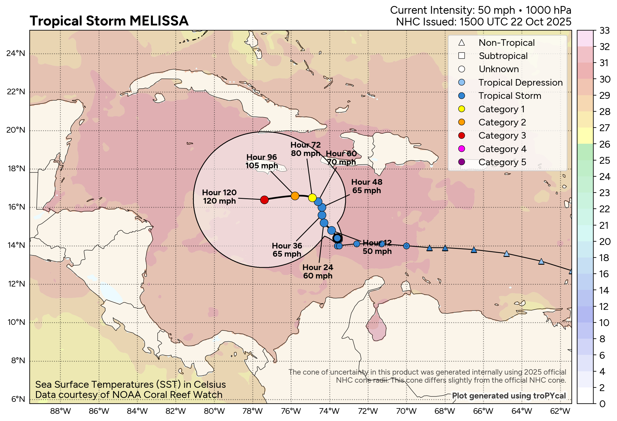
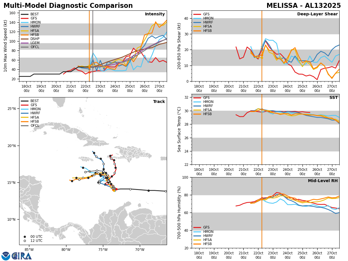
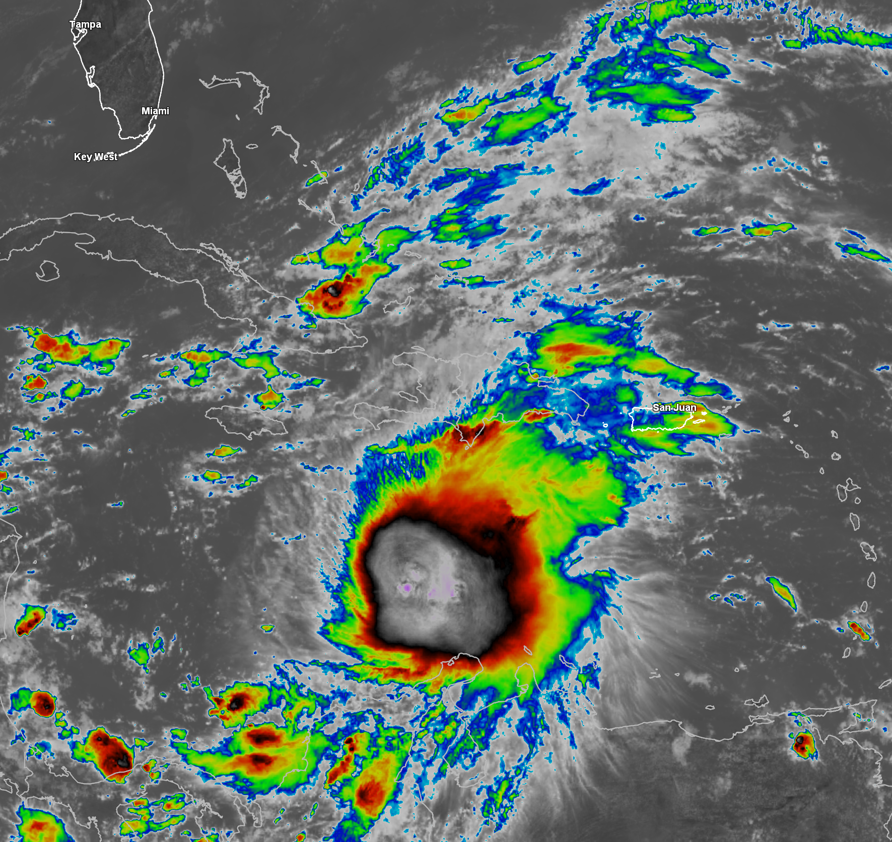
Tropical Storm Melissa: Even though Melissa is producing deep convection, most of this convection is being blown to the east of the low-level center. The reason for this is due to westerly wind shear of 20-30 knots impacting the storm. Because of this, any strengthening over the past 12-24 hours has been very slow. Still though, reconnaissance aircraft are finding that Melissa has 50 mph maximum winds and a central barometric pressure of 1000 millibars.
Melissa has slowed down to nearly a crawl today after racing to the west over the past few days. The reason why Melissa has slowed way down in forward speed to almost a stall is due to the fact that it’s caught in-between two high pressure systems. It is expected that Melissa will remain in this weak steering environment for at least the next several days, which means that Melissa will move very slowly in forward speed throughout the rest of this week right through this weekend.
I do think that Melissa may end up moving very slowly to the northwest over the next couple of days reaching the area to the southeast of Jamaica by Friday into Saturday where it should be a hurricane by then.
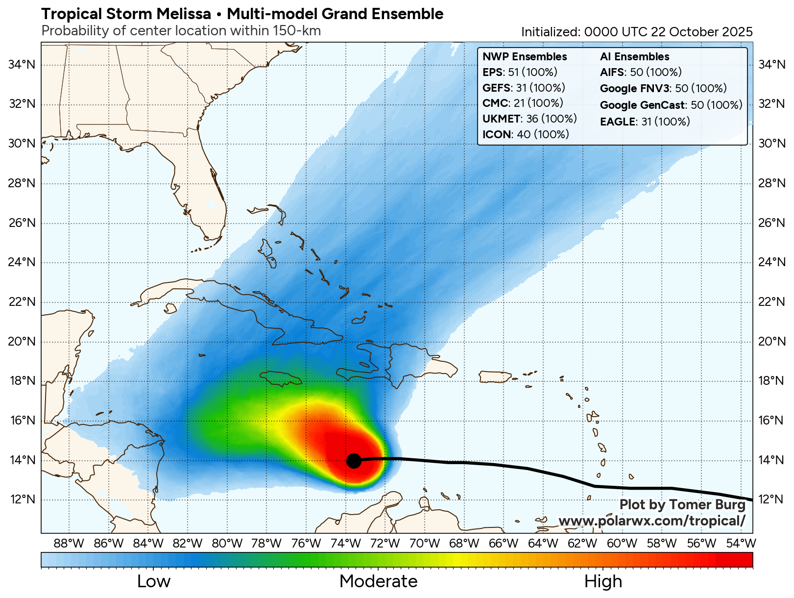
Beyond this, the forecast of where Melissa may go and how strong it may become gets much more complicated and uncertain. As I mentioned already, the steering currents around Melissa are expected to be very weak right through this weekend & probably even into next week. This means that I think that we will see Melissa drift around the west-central Caribbean for at least the next 7 days, if not longer. It may not be until the second half of next week that Melissa is pulled north and northeastward out of the Caribbean by a strong upper level trough pushing off of the Eastern Seaboard.
I do think that we’ll probably see Melissa move to the south of Jamaica during the first half of next week where the environmental and thermodynamic conditions will be extremely favorable for rapid strengthening.
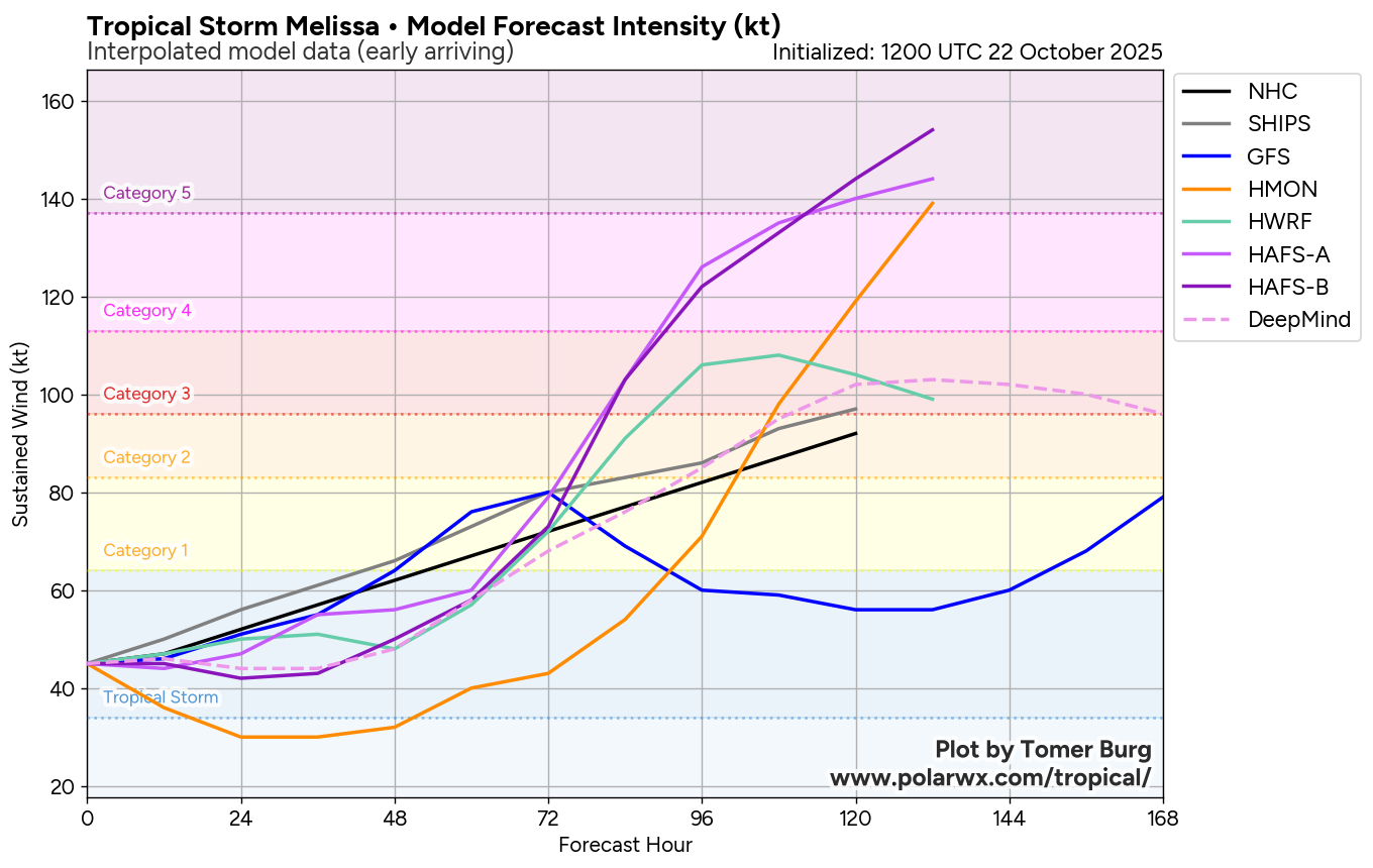
Most of the intensity guidance are pointing towards a scenario where Melissa strengthens into a major Category 3-plus hurricane with even a few intensity members suggesting Melissa may reach Category 5 intensity. Given the potential for very favorable conditions south of Jamaica, this sort of strengthening is very much possible. These favorable conditions will include very warm ocean waters that go deep down; a large upper level high pressure system leading to low wind shear conditions; diverging upper level air, which will allow Melissa to “breathe” and a very moist environment with no dry air to be found.
This all means that by the first half of next week, we could have a major hurricane of somewhere between Category 3 and Category 5 strength sitting over the western Caribbean to the south and southwest of Jamaica. It also means that depending on its ultimate track, Melissa could directly impact Jamaica, central and eastern Cuba and some part of the Bahamas with significant to severe hurricane conditions as its pulled out of the Caribbean by that upper level trough.
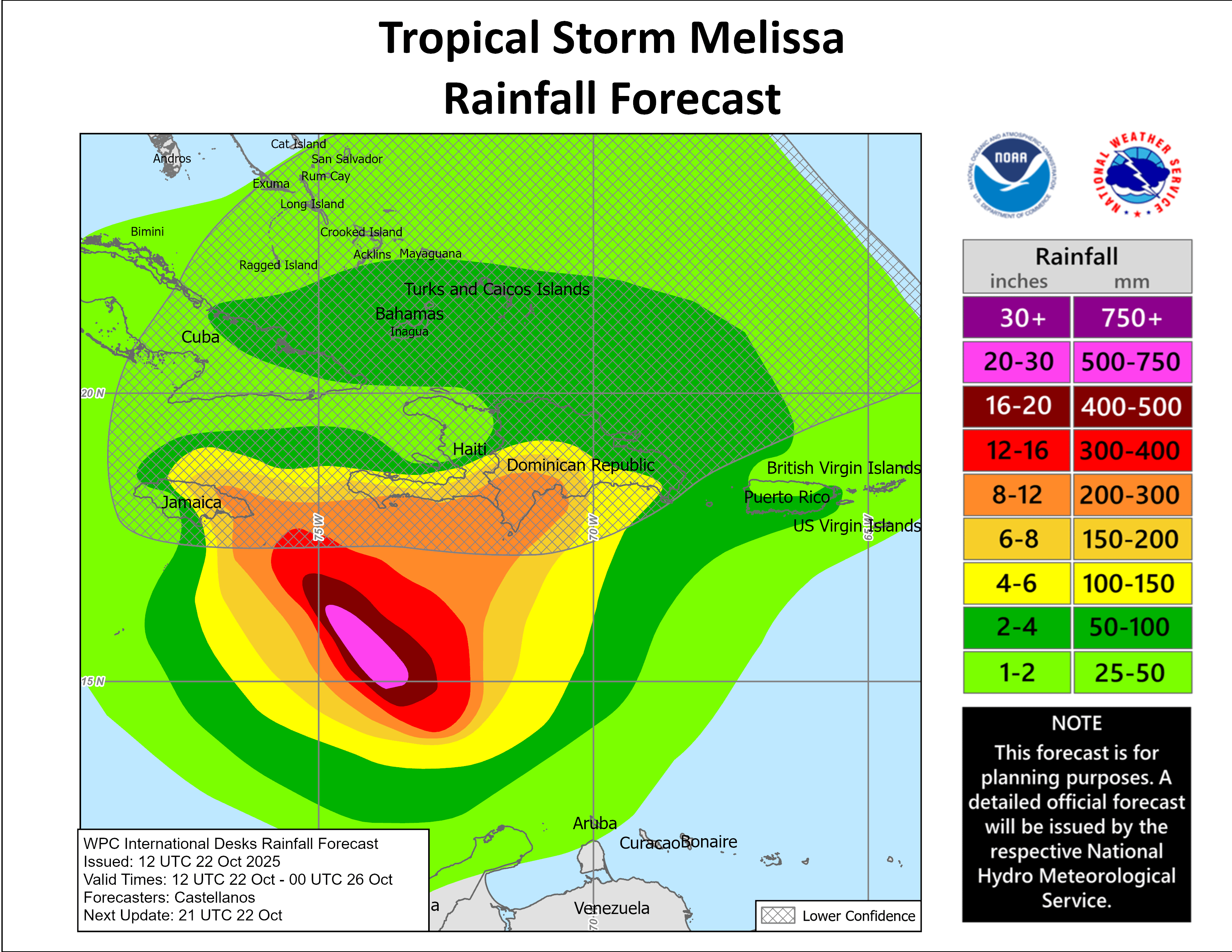
Forecast Impacts For The Central & Western Caribbean: For now, extremely heavy rainfall with the potential for major flooding will be a big concern for parts of the islands of the central and western Caribbean. It’s possible that 10 to 20 inches (250 to 500 mm) of rain could occur in parts of the Dominican Republic, Haiti and Jamaica over the next week or so. This sort of rainfall could lead to major to catastrophic flooding.
We’re going to have to assess which Caribbean islands will be impacted by tropical storm and hurricane force winds over the next few days. For now, the island of Jamaica will probably see tropical storm force winds beginning on Saturday and lasting through this weekend and into at least early next week. It’s then possible that hurricane to major hurricane force winds could impact Jamaica, central and eastern Cuba and the central and southeastern Bahamas as we get into the middle parts of next week.
Bottom Line Is That for those of you in the central and western Caribbean, Melissa is going to be a big, big time problem for you for at least the next 7 days bringing extremely heavy rain and strong winds to many of you.
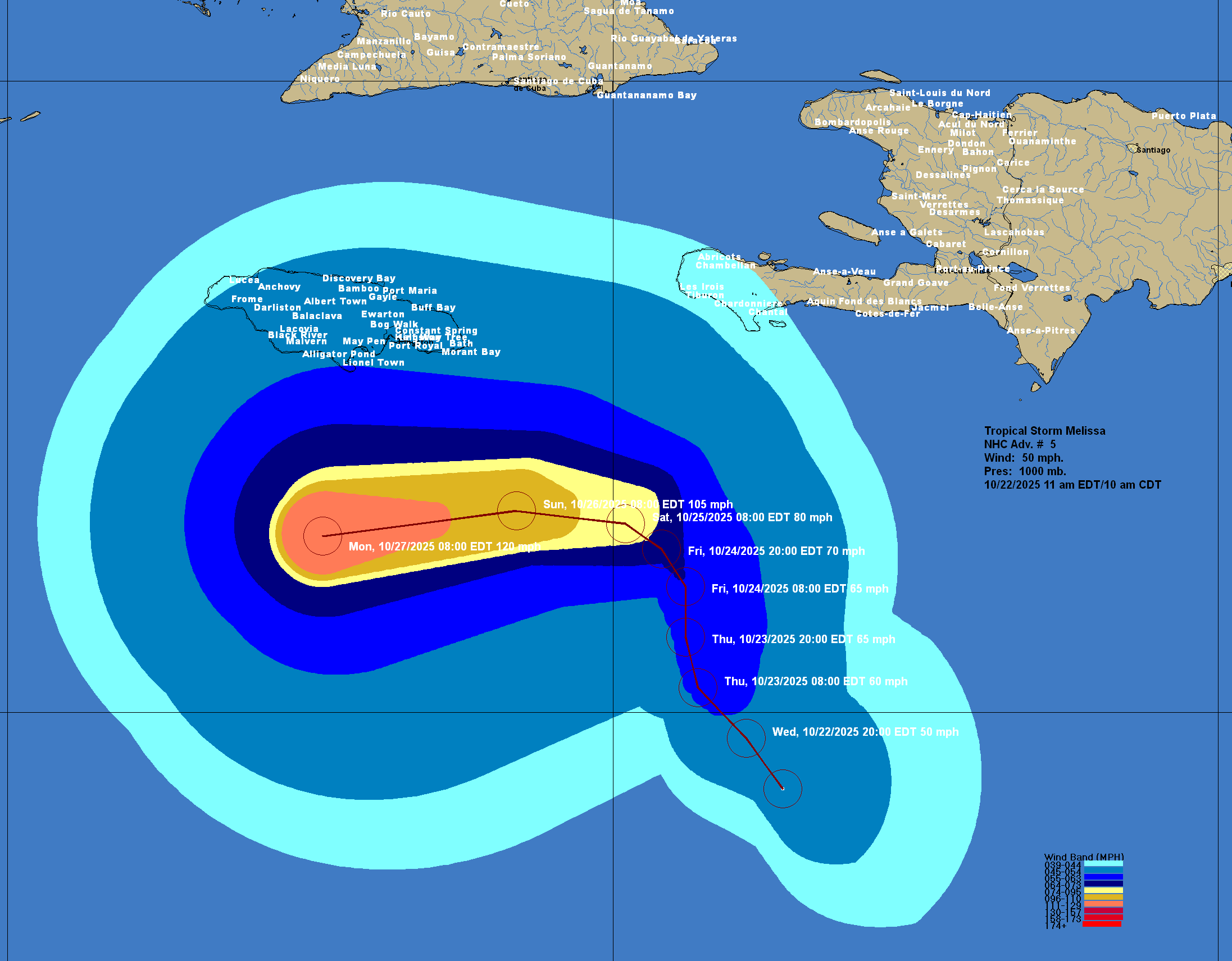
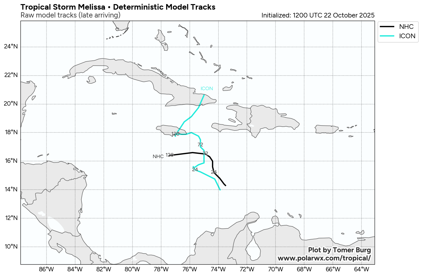
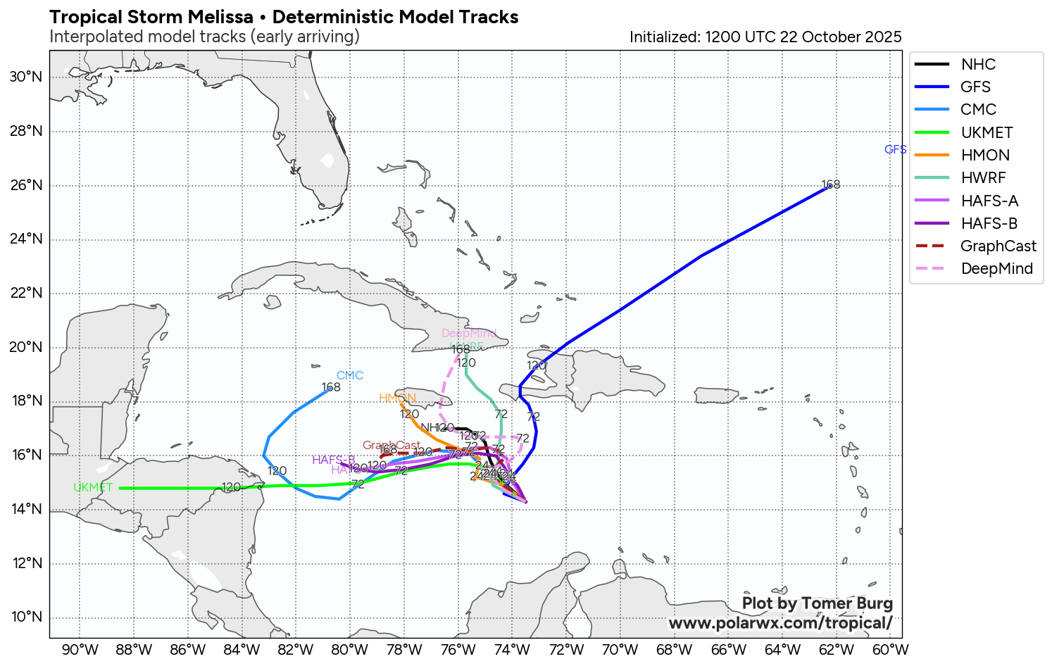
Model Track Forecast:
Satellite Imagery:
The next tropical weather discussion will be issued on Thursday.