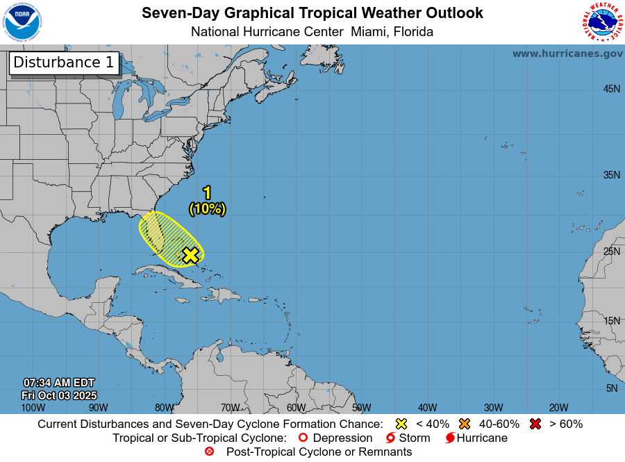
Low Pressure Will Bring Heavy Rain To Florida’s East Coast This Weekend: Weather analysis today reveals that there is a weak low pressure system located over the central Bahamas. This weather system is currently producing some scattered shower and thunderstorm activity across eastern Florida. This convection is also occurring over the northern and eastern Bahamas, however, all of the convection is very disorganized.
Analysis of environmental conditions reveals that there is strong wind shear occurring over this system & because of this, development into a tropical system looks highly unlikely.
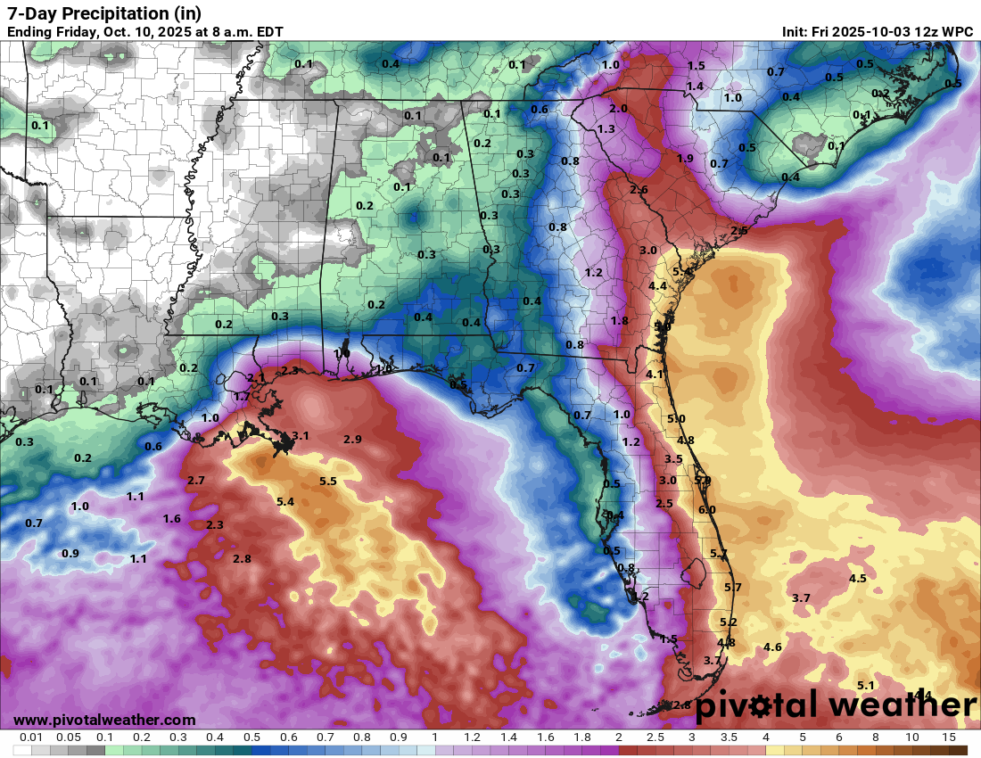
It is expected that this low pressure system will meander in the area around the northern Bahamas and the Florida Peninsula through this weekend. Because of this, it will produce rounds of thunderstorms with heavy rainfall all along Florida’s East Coast throughout this weekend. In addition, this heavy rain looks to persist along Florida’s East Coast right into much of next week, which could exacerbate the flood threat.
All-in-all, rainfall totals of 4 to 8 inches with locally higher amounts can be expected up and down Florida’s East Coast, which will probably lead to urban flood issues.
Additionally, the weather setup over the Bahamas and Florida will likely lead to a persistent onshore wind flow to be in place for the next several days along Florida’s East Coast. Because of this, expect rip currents, rough surf and hazardous marine conditions all along Florida’s East Coast.
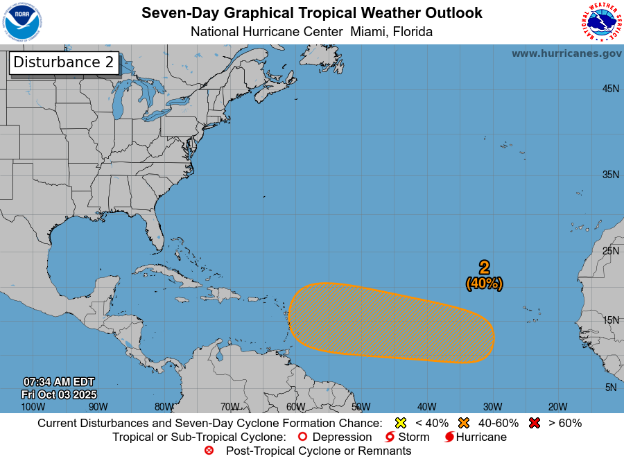
Tropical Development Continues To Be Possible Over The Central Tropical Atlantic As Soon As The First Half Of Next Week: A tropical wave has pushed off of the coast of Africa and is currently located over the far eastern Tropical Atlantic. This wave is producing a large area of convection, however, none of the convection is organized or concentrated.
It is expected that this wave will interact with a surface trough of low pressure that’s located to the northwest of the Cape Verde Islands during this weekend. It is then expected that this entire system should push into the central Tropical Atlantic during the first half of next week & tropical development may become somewhat possible by then.
Even though development is a possibility, it is definitely not a certainty. The reason why is because it appears that the conditions for development are not all that favorable. This includes some dry air over the tropical Atlantic, especially in the region between 35 and 45 West Longitude. Also, the easterly mid-level winds over the tropical Atlantic look rather quick & because of this, our wave might have a hard time trying to consolidate and develop as it will not really be able to vertically align.
All-in-all, while development of this wave looks definitely possible as it heads westward across the tropical Atlantic, I think there’s actually a better chance that it doesn’t develop much at all due to the unfavorable conditions I’ve already mentioned. It’s not out of the realm of possibilities that this disturbance could end up being a “dud” like Invest 99-L from late August.
That being said, my recommendation to those of you in the Lesser Antilles, Virgin Island and Puerto Rico is to keep a close eye on the progress of this wave. While I do think development looks very slow to occur, it is still possible, especially once it gets near the Lesser Antilles late next week.
The next tropical weather discussion will be issued on Saturday.