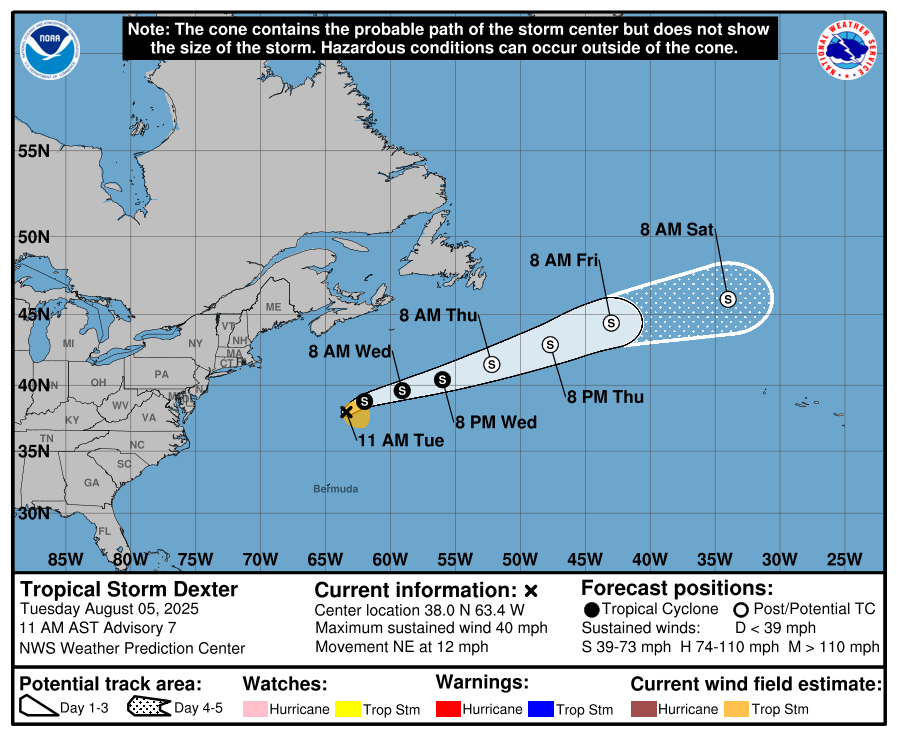
Tropical Storm Dexter: Dexter is headed out in the open Atlantic and is currently located to the northeast of Bermuda. It’s expected that Dexter will continue moving to the northeast into the open Atlantic with no threats to land.
Additionally, it is anticipated that Dexter will become a pretty strong post-tropical storm in a couple of days from now.
All-in-all, Dexter is nothing to be concerned about and because of that, let’s take a look at what else is going on.
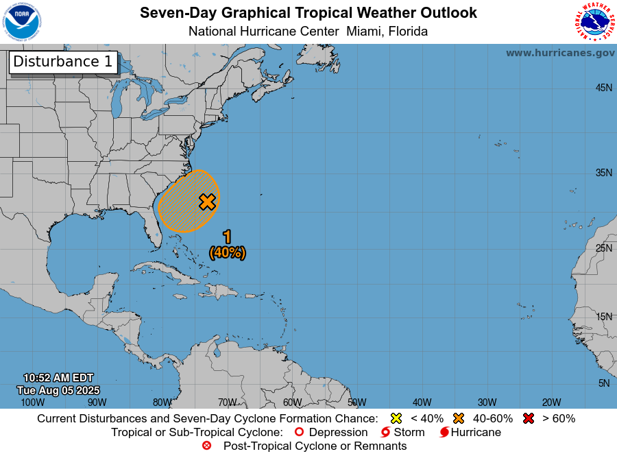
Tropical Development Is A Possibility Near Coastal Parts Of South Carolina & North Carolina Later This Week: Satellite imagery and weather analysis reveals that there is a trough of low pressure located just east of the Bahamas. It is anticipated that this trough of low pressure will head in a northwestward towards the coastal Carolinas over the next 2-3 days or so. Additionally, it seems possible that a low pressure system might form from this trough in a couple of days from now.
The environmental conditions around this low pressure system are expected to be favorable enough to support slow development. This means that development of this system into a depression or a tropical storm is possible as it heads slowly northward between Friday and Sunday where it’ll reach the eastern parts of North Carolina by Sunday.
That said, it doesn’t appear that this system will become all that strong & may strengthen just enough to be considered a depression or a low-end tropical storm that affects eastern parts of South Carolina and eastern parts of North Carolina this weekend.
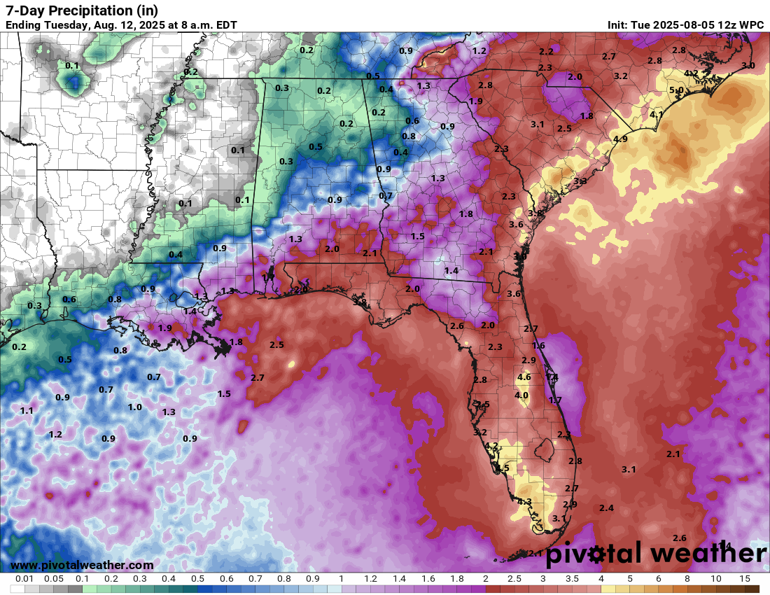
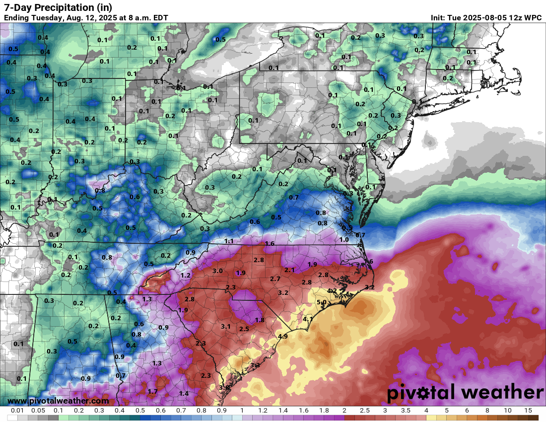
Whether this system develops into a tropical cyclone or not, the main impacts will be heavy rainfall late this week through this weekend across areas from the Florida Peninsula through the coastal Carolinas where rain totals of 3 to 5 inches can be expected. Additionally, rip currents are expected along the coasts of North Carolina and South Carolina later this week through this weekend.
Bottom line is that this system definitely should be watched for potential development, especially given how close it’ll be to land.
Rainfall Totals From Later This Week Until Early Next Week:
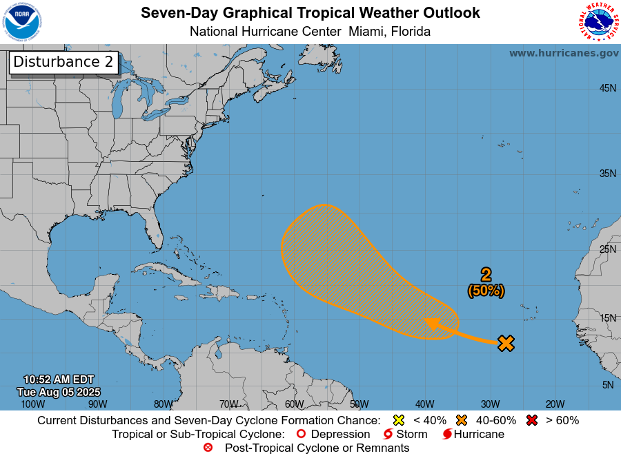
Tropical Development Is Possible By Late This Week Over The Central Tropical Atlantic: Analysis today reveals that there is a tropical wave located over the far eastern tropical Atlantic near about 33 West Longitude. Satellite imagery shows that there is some increase in convection associated with the wave as compared to what it looked like yesterday.
The environmental conditions across the eastern tropical Atlantic are favorable for development and these favorable conditions are expected to exist as this wave pushes into the central Tropical Atlantic by later this week. Because of this, development into a depression or a tropical storm is quite possible late this week or this weekend. That being said, any development that does occur is likely to be slow and again, probably wont occur for a few days.
The model guidance are split in what they want to do with this wave and how much development occurs from it.
The European model and its ensemble members forecast quicker development and a faster turn to the northwest into the central Atlantic by this weekend. This leads to a system that stays way out in the Atlantic with no threats at all.
On the other hand, the GFS model and its ensemble members show a weaker system that takes its time to develop. Because of this, the GFS model forecasts a much more westward and west-northwestward track that leads to this system tracking near or just north of the northeastern Caribbean by late this weekend and early next week.
Beyond this, the GFS model and its ensemble members show the conditions potentially becoming quite favorable for development and strengthening over the southwestern North Atlantic next week. Because of this, if this wave does not curve to the northwest and north and instead drives westward and west-northwestward, it would mean we would really have to watch it very closely.
Here Are My Thoughts: I’m skeptical of the European model’s forecast of quick development and instead I think that we’re probably looking at much slower development, like what the GFS model seems to show. This means that if this wave does wait to develop until it makes it past 60 West Longitude, it may become an issue in terms of being a threat.
The weather pattern setup for next week when this system is possibly pushing into the southwestern North Atlantic is going to include an upper level high pressure system that sets up over the western Atlantic. This high pressure ridge could guide any developing system westward towards the Bahamas and the US East Coast.
This means that while the wave is of no threat for at least the next several days, it could become a threat next week once it passes by the northeastern Caribbean and heads for the Bahamas.
It goes without saying that I will be keeping a very close eye on this tropical wave over at least the next several days. For now though, this wave is nothing to be overly concerned or worried about and is something to just keep an eye on.
Another Tropical Wave Pushing Off Of The Coast Of Africa In A Few Days Has A Better Chance Of Becoming Something To Be Concerned About: Yet another robust tropical wave will be pushing off of the coast of Africa late this week and I do think this wave and the tropical wave right behind this one may actually have a slightly higher chance of organizing and developing. Also these two waves probably will track lower in latitude and thus could be a concern to the Lesser Antilles in about a week from now.
At this point, it would be pure speculation to say what will happen when these two waves splash down in the eastern Atlantic at the end of this week. I will say though that the steering winds next week should steer these two waves due westward reaching the Lesser Antilles by the middle part of next week. Because of this, these two waves also need to be watched very closely in the coming days.
One Final Item To Mention: The eastern Gulf might need to be watched for another low pressure to spin up over this weekend. Some of the European ensemble model guidance members are hinting that a low pressure system may form over the eastern and northeastern Gulf this weekend and head for the northeastern Gulf Coast by early next week.
Should any low pressure system form and become organized, it could try to become a depression or a tropical storm. One thing that the stalled frontal boundary and any low pressure system will do is bring wetter than average conditions to the central and eastern Gulf Coast from later this week through this weekend into early next week.
So, this is yet something else to keep an eye on over the next several days.
The next tropical weather discussion will be issued on Wednesday.