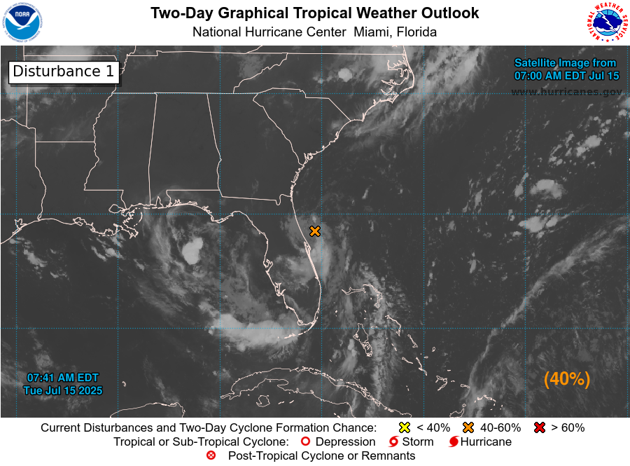
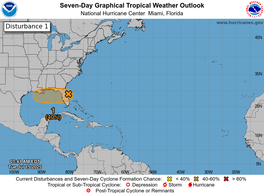
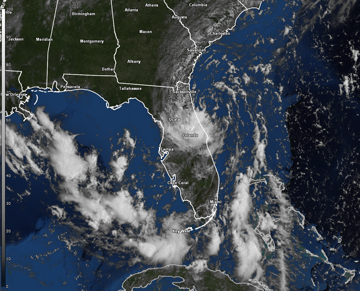
Invest 93-L Located Just Offshore Of Florida’s East Coast: An area of low pressure, designated Invest 93-L by the National Hurricane Center, is currently located less than 50 miles east of Daytona Beach today.
Analysis of satellite imagery reveals that the low pressure center is located to the north of all of the thunderstorm activity. This is due to northerly wind shear that is displacing the convection to the south of the low pressure center.
Looking even closer at the data indicates that Invest 93-L is a tilted system with the mid-level center displaced to the southwest of the surface circulation due to the north and northeasterly wind shear. It’s going to be interesting to see if the current low-level circulation dissipates over the Florida Peninsula as the mid-level circulation heads westward. If this occurs, then I could see a new low-level circulation develop underneath that mid-level circulation as Invest 93-L moves into the northeastern Gulf during Wednesday. Now, should that low-level center remain intact, then a much shorter time, if any, over the Gulf would occur and then we’d see no development at all (I’m not expecting this to happen, but I wanted to mention it).
I expect to see Invest 93-L cross the central Florida Peninsula during this afternoon and tonight and then move into the northeastern Gulf during Wednesday. A ridge of high pressure to the north of the disturbance will continue to guide this system westward across the northeastern and north-central Gulf where it will be located near the Mississippi Delta on Thursday. Once it reaches southeastern Louisiana, Invest 93-L is expected to slow way down in forward speed and crawl across southern Louisiana from late Thursday through Friday and Saturday. This slow-down in forward speed is probably going to lead to some big time problems in terms of heavy rain induced flash flooding across southern and southeastern Louisiana and southern Mississippi beginning on Thursday and continuing through Friday and into this weekend.
As for whether Invest 93-L is going to develop or not – The environmental conditions across the northern Gulf is expected to be at least somewhat favorable for development. This means that this system does have a decent shot of developing into a tropical depression or even a tropical storm as it heads westward across the northern Gulf during Wednesday and Thursday.
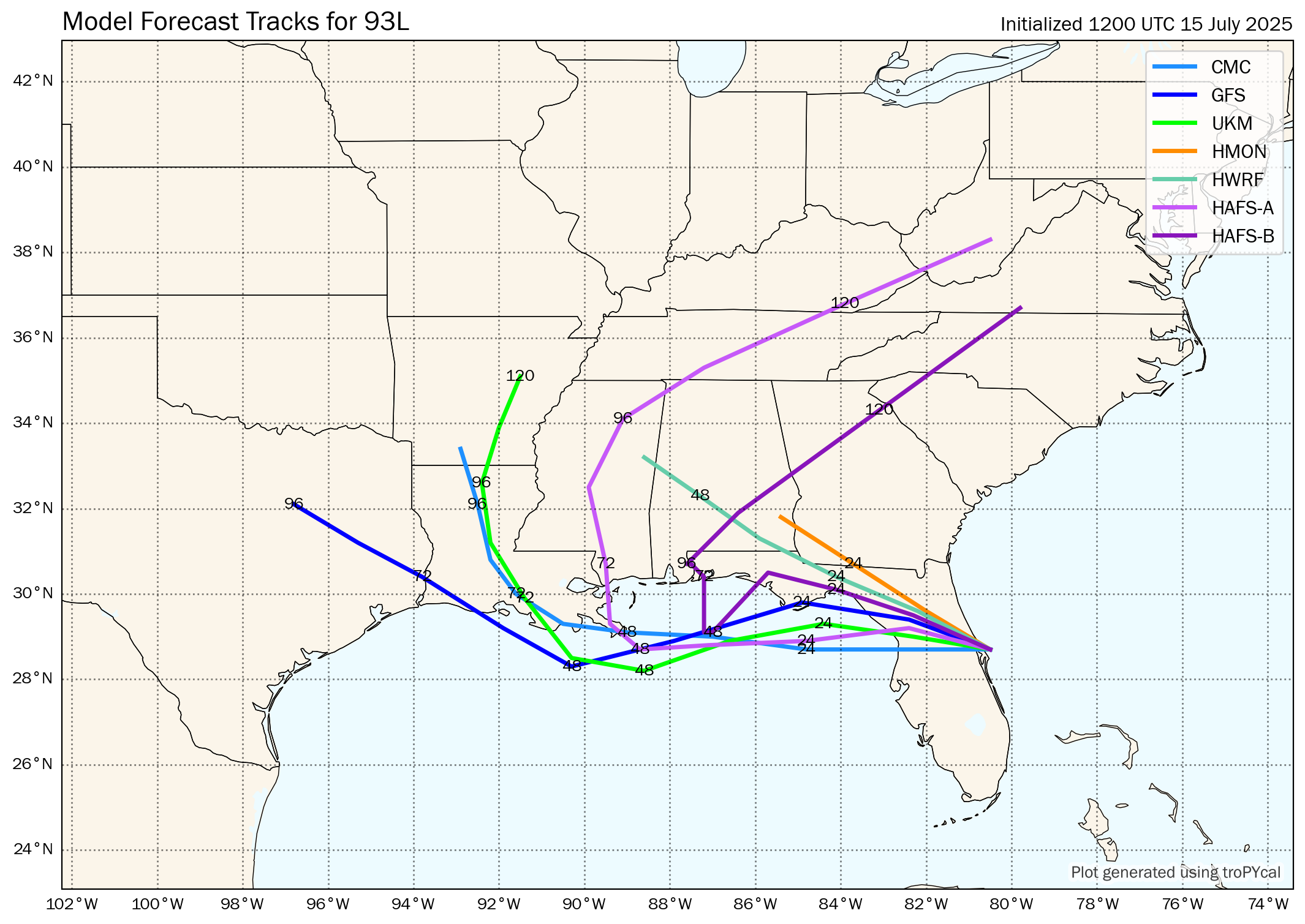
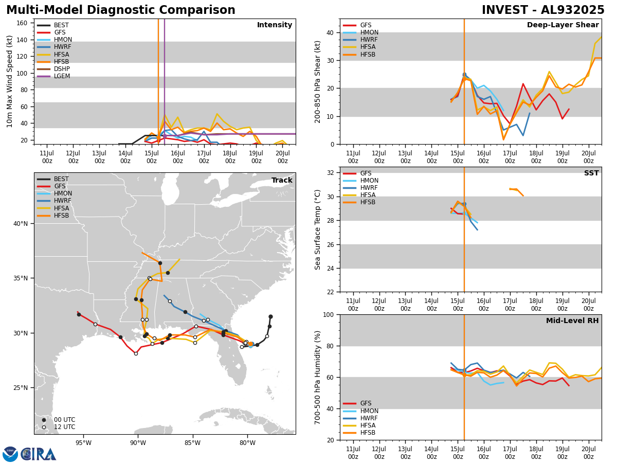
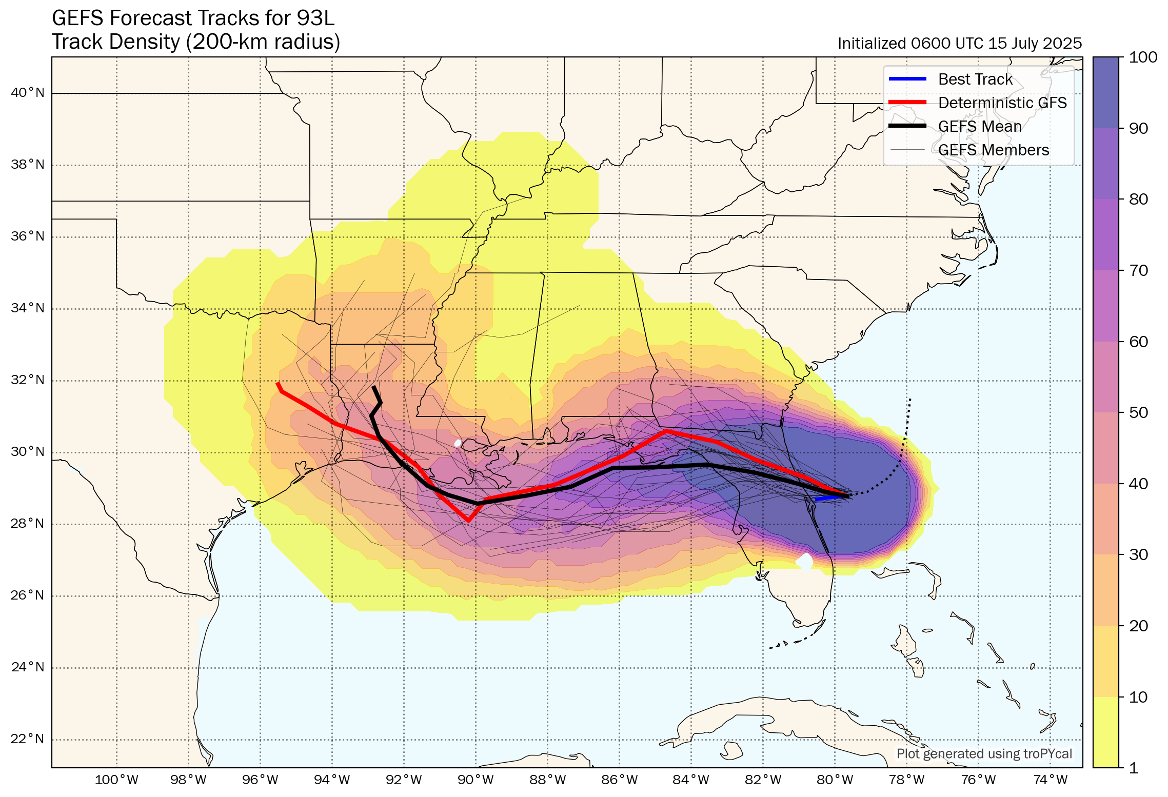
Latest Model Guidance: A majority of track model guidance forecast a westward course across the northeastern and north-central Gulf during Wednesday into Thursday with most models showing Invest 93-L coming ashore in the area of Louisiana between Morgan City and Grand Isle during the day on Thursday.
Both the Google Deep Mind AI ensemble guidance and the European ensemble model guidance agree with the track guidance with a majority of members showing Invest 93-L coming ashore on the Louisiana coast between Vermilion Bay and the Mississippi Delta during the day on Thursday.
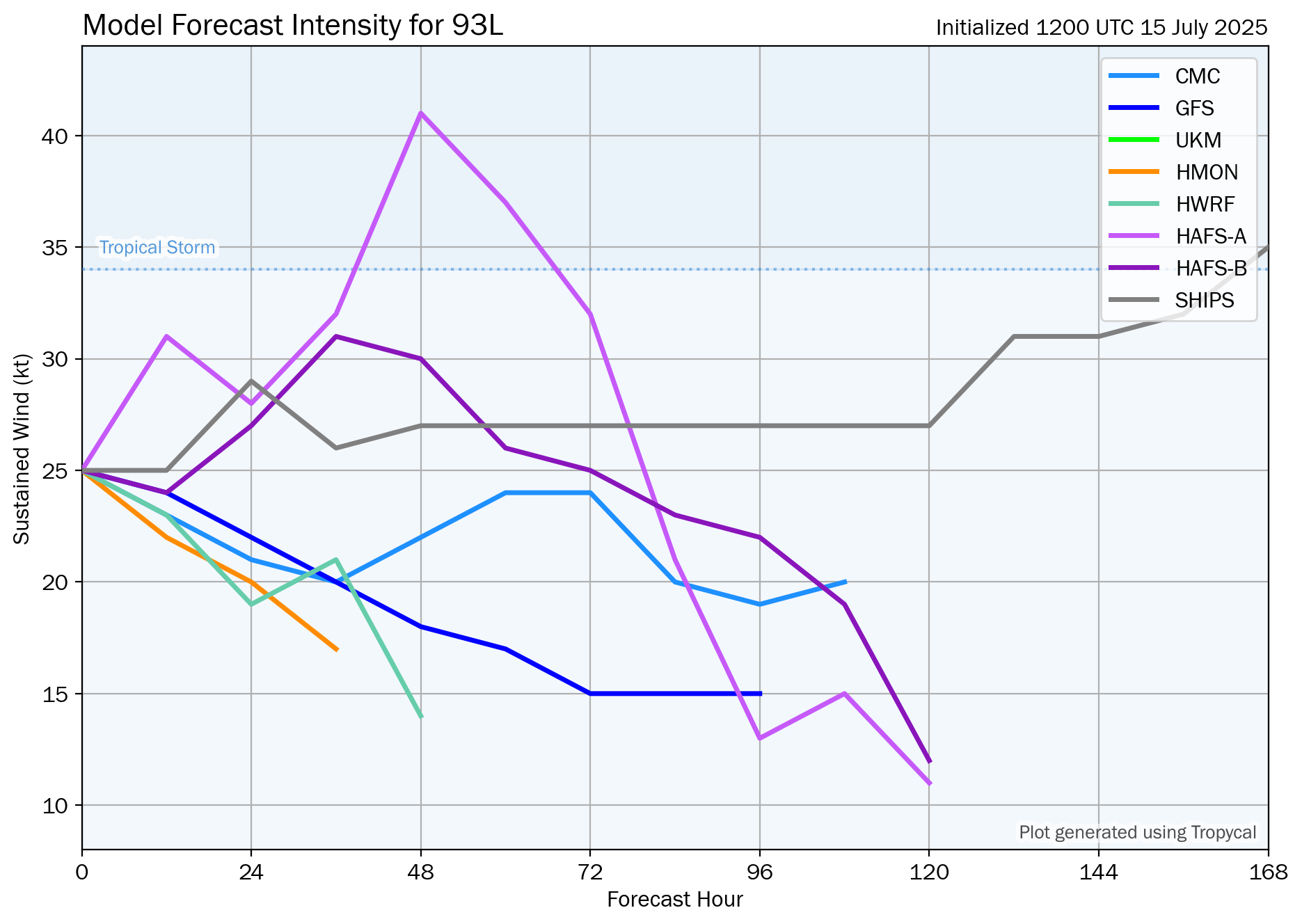
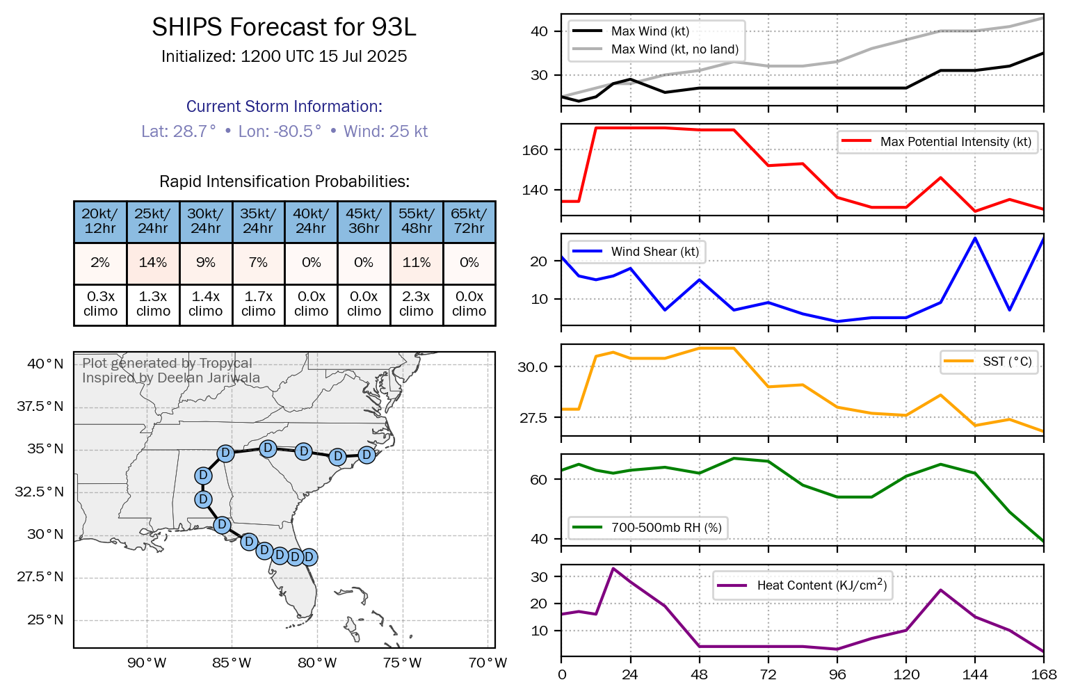
As for the intensity guidance, none of the guidance show Invest 93-L strengthening into a tropical storm and all keep it as a tropical depression, at most.
Here Are My Thoughts: I do think that there’s still a very decent chance that Invest 93-L will become a tropical depression in the northeastern Gulf sometime during Wednesday and Wednesday night.
The question then becomes whether Invest 93-L will take advantage of the very warm waters of the Gulf and strengthen into a tropical storm or not before it comes ashore in southern Louisiana on Thursday. Looking at the model guidance, none of the guidance now show this system strengthening into a tropical storm.
My take is that I still think that there is about an 80 percent chance of Invest 93-L becoming a depression in the northeastern Gulf Wednesday afternoon or Wednesday night. I do think that there’s perhaps a 40-50 percent chance or so of this system strengthening into a 40 mph or so tropical storm by the time it comes ashore across southern and southeastern Louisiana during the day on Thursday.
The main impediment to more robust organization and strengthening is going to be the persistent north and northeasterly wind shear over the Gulf that will prevent it to really organize.
No matter what happens to Invest 93-L in regards to development, this system will most definitely be a significant heavy rainfall producer, which will lead to significant flash flooding across southern Louisiana, southern Mississippi and southern Alabama beginning late Wednesday and continuing through Thursday and Friday and into this weekend. The significant flash flood potential will be the big story with this system.
Model Track Forecast:
Satellite Imagery:
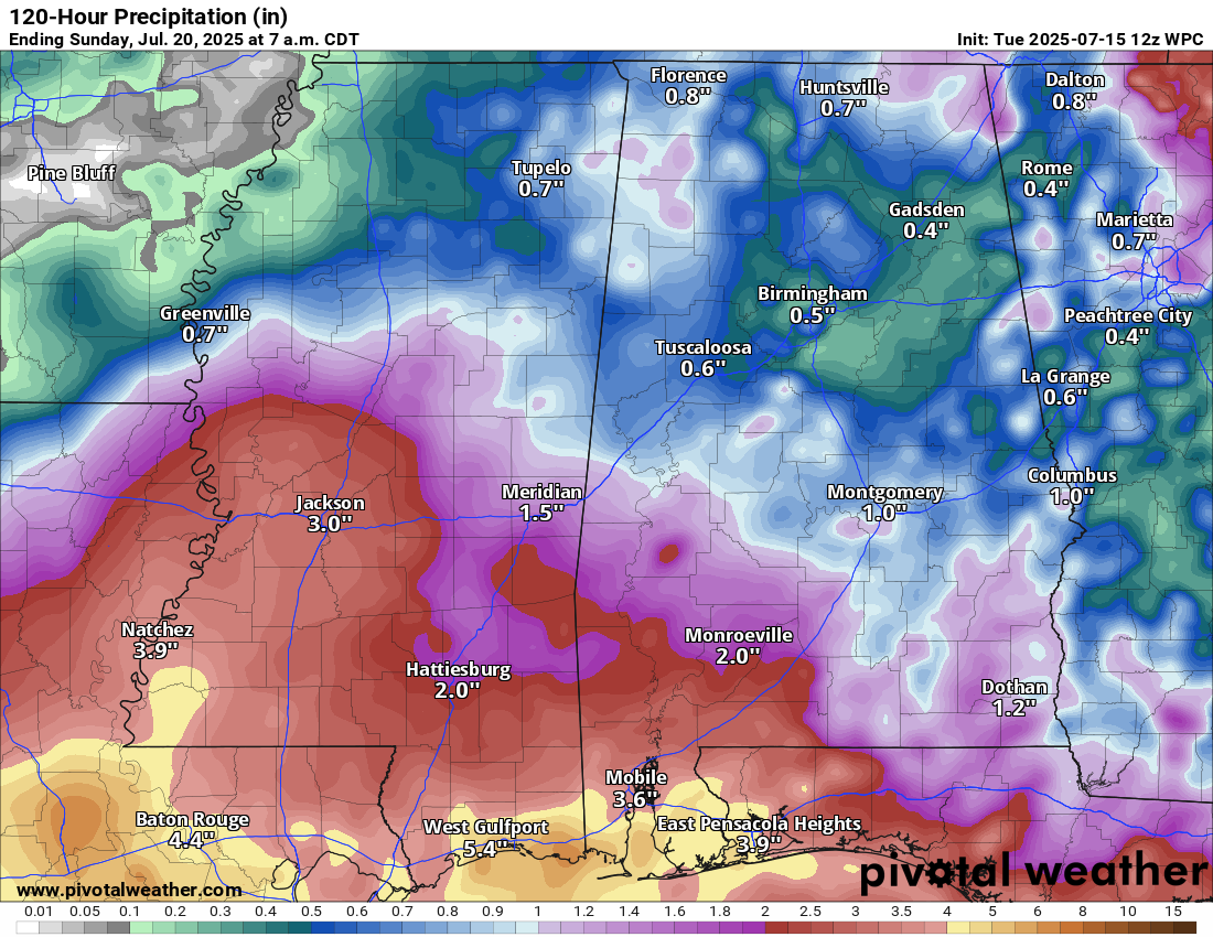
A Significant Flash Flood Threat Looms For Southern & Southeastern Louisiana, Southern Mississippi & Southern Alabama From Wednesday Through Thursday & Friday & Into This Weekend: The overwhelming threat from Invest 93-L will be heavy rain that will produce a significant flash flood risk across southern and southeastern Louisiana, southern Mississippi and southern Alabama beginning late Wednesday and continuing through Thursday and Friday and right into this weekend.
In fact, I am particularly concerned about the amount of rain that’s going to occur across southern and southeastern Louisiana. Current indications seem to be pointing towards rain totals of at least 5 to 10 inches to occur in areas including Lafayette, Baton Rouge, New Iberia, Morgan City, Houma & the New Orleans Metro. Local rain amounts of over one foot seem quite likely in these areas.
Those of you in southern and southeastern Louisiana need to pay very close attention to the forecasts as the threat for flash flooding looks quite high.
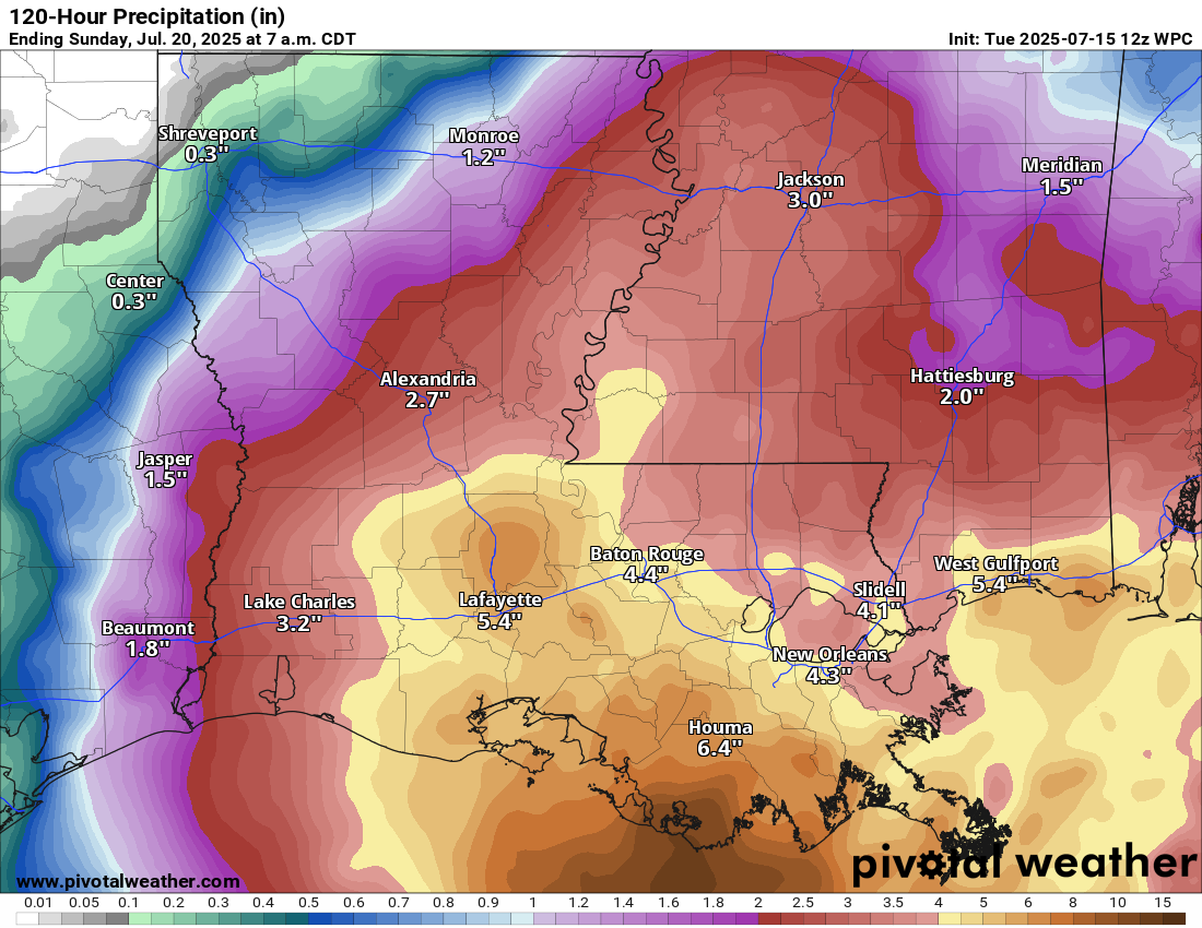
Southern Mississippi and southern Alabama are also likely to be impacted by heavy rain from Wednesday through at least Friday with rain totals of 4 to 8 inches expected leading to flash flood issues. I urge those of you across southern Mississippi and southern Alabama to also pay very close attention to the forecasts & be aware that flash flooding will be a threat.
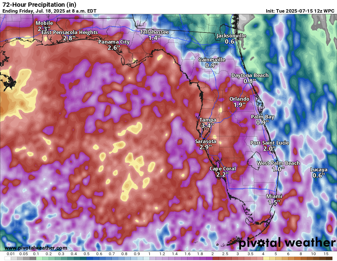
As for the Florida Peninsula – Following yesterday’s very serious flash flooding in Plant City, the rain so far this morning across east-central Florida has led to the issuance of Flash Flood Warnings across parts of the Space Coast of Florida. Flood watches are also in effect across all of Central Florida throughout the rest of today.
Additional rain totals of 1 to 3 inches with local amounts of up to 4 to 6 inches expected across Central and South Florida over the next couple of days or so. This additional rain is probably going to lead to additional localized flood issues across Central and South Florida.
The next tropical weather discussion will be issued on Wednesday.