Tropical Storm Andrea: This will be a short update.
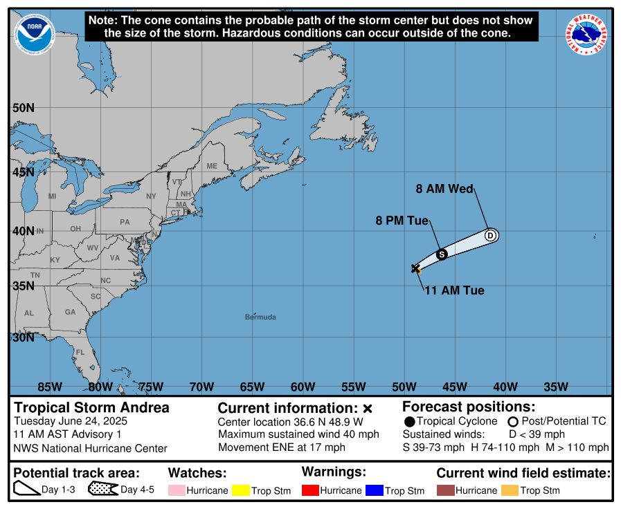
The area of low pressure, designated Invest 90-L by the National Hurricane Center, has developed overnight into this morning and has strengthened into a tropical storm. Tropical Storm Andrea is located way out in the open Atlantic between Bermuda and the Azores.
Satellite imagery last night into this morning showed that Andrea has developed some deeper convection and satellite estimated winds indicated that this system is producing 40 mph winds. That said, the deep convection that was occurring a little earlier has decreased some, but it seems it’s still barely a tropical storm.
Andrea is moving to the east-northeast and this will lead to the storm moving to the north of the Azores later this week. It is very likely that Andrea will be a very short-lived tropical storm as environmental conditions will become very hostile by tomorrow and Thursday. This means that Andrea will likely weaken by later today and Wednesday and dissipate by later Wednesday and Thursday.

A full tropical weather discussion will be issued on Wednesday.

