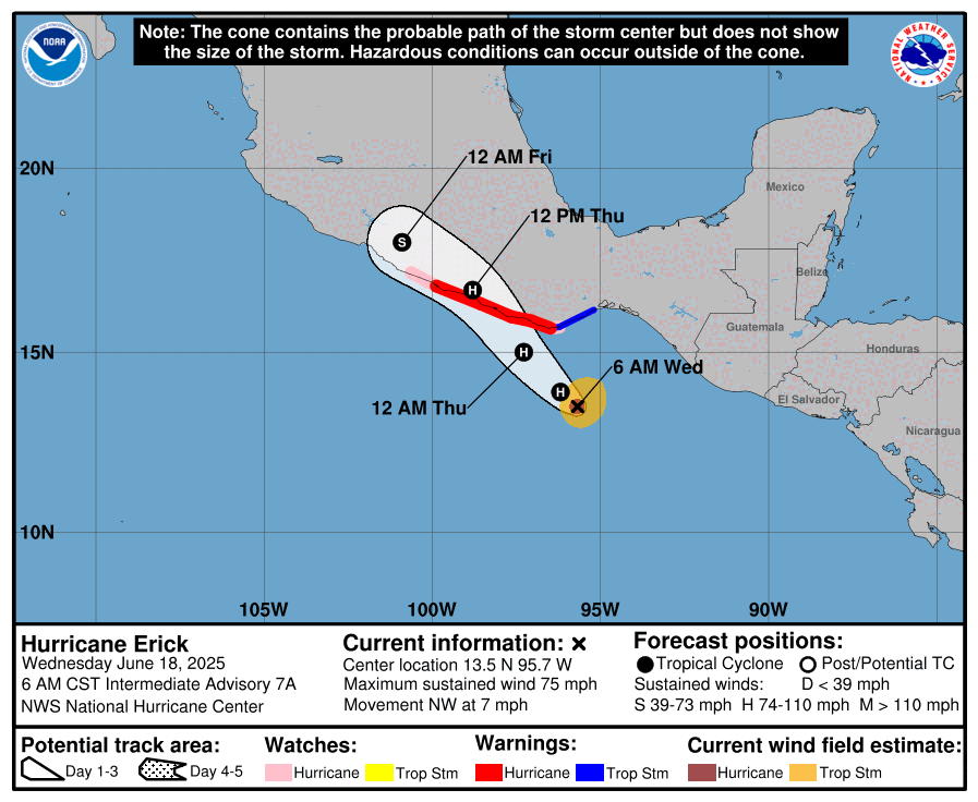
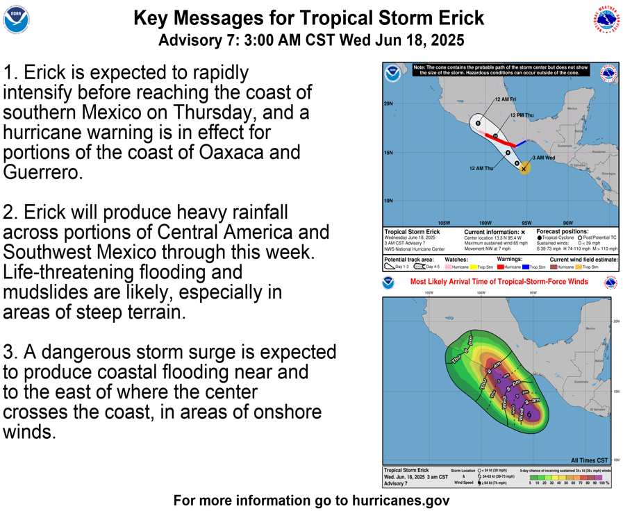
Hurricane Erick In The Eastern Pacific: The big weather story in the western Hemisphere is the quick intensification of now Hurricane Erick that’s located in the eastern Pacific about 200 miles to the south of the coast of southern Mexico.
It is expected that Erick will rapidly strengthen and make landfall on the coast of southwestern Mexico during the day on Thursday as a borderline Category 2-Category 3 hurricane. Should Erick make landfall as a 110-115 mph hurricane as landfall, it would be the strongest pre-July hurricane on record to strike Mexico.
It is somewhat uncertain as to where exactly Erick will make landfall along the coast of southwestern Mexico. The reason why is due to the angle that Erick is making landfall along the coast. At this point, it seems most likely that the eye of Erick will make landfall near San Marcos and Copala in the state of Guerrero, located to the east of Acapulco.
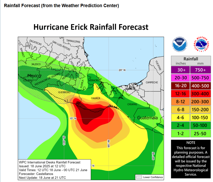
Damaging winds and life taking flooding is going to be a big problem across the Mexican states of Guerrero and Oaxaca the rest of today through Thursday and Friday. Rain totals of up to 20 inches are likely & this will cause flash flooding and mudslides in these areas.
No Tropical Development Is Expected Across The Atlantic, Caribbean & Gulf Throughout The Rest Of This Week Through This Weekend: It appears that tropical development is highly unlikely across the Atlantic, Caribbean and Gulf throughout the rest of this week through this weekend. It no longer appears that the remnants of Erick will try to cross-over southern Mexico and into the Bay of Campeche, even the chances of this occurring were already extremely low.
The weather pattern for at least the next week looks unfavorable for any sort of tropical development. None of the models are really showing any sort of tropical development for at least the next week. In fact, some of the model guidance forecasts no tropical development at all for the rest of this month. This means that it’s quite possible that we could end up with no named storms in June this year.
The next tropical weather discussion will be issued on Friday.