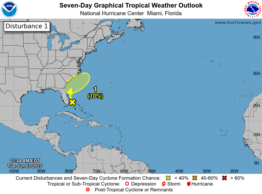
Tropical Development Remains A Possibility Near The Carolinas Later This Week: It looks like there is a chance that we could see the development of a tropical depression or even a low end tropical storm late this week near the coast of the Carolinas. That said, the chances of tropical development occurring are low as of right now.
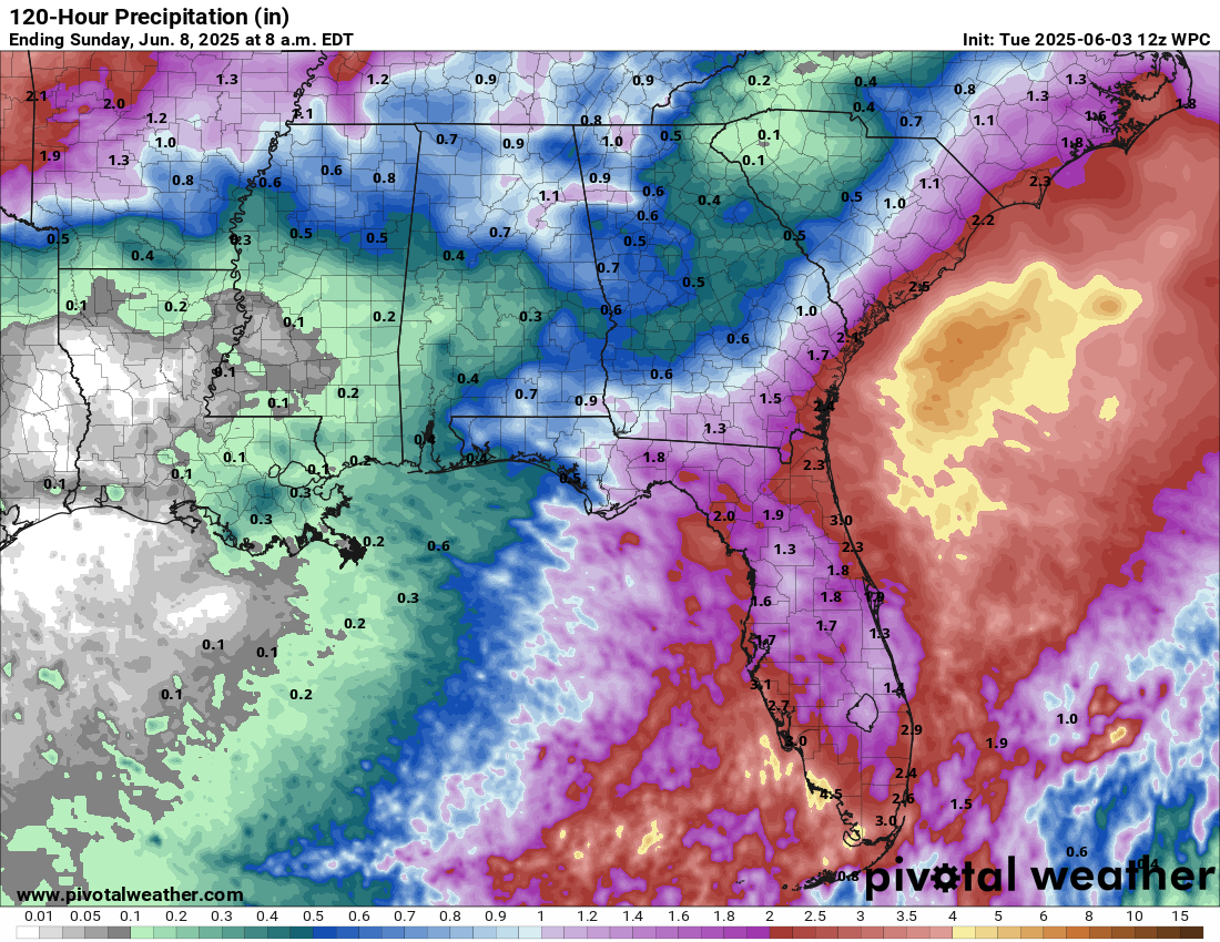
A weather disturbance located along a old frontal boundary is currently located in the area from South Florida into the northern Bahamas as of today. This weather disturbance is expected to continue to produce heavy rainfall in the form of showers and thunderstorms across South Florida and the Bahamas throughout the rest of today. Additional rainfall amounts of 2 to 4 inches with local amounts of up to 6 inches can be expected across South Florida and across the northern and central Bahamas.
This weather disturbance is expected to lift northward and will be located near northeast Florida by Wednesday evening. This means that locally heavy rain can be expected on Wednesday across central and northern Florida with amounts of 1 to 3 inches expected.
As we get into Thursday, it is expected that a low pressure system will form right along the South Carolina coast. This low pressure system is then expected to track northeastward into southeastern and eastern North Carolina on Thursday night and Friday.
The greatest chance for any possible development looks to be from Thursday right through Friday. What needs to occur for development to happen is that the low pressure system will need to stay just offshore over or near the Gulf Stream. If that happens, then the chances are certainly there for tropical development to occur. On the other hand, if this low pressure system stays near or just inland across the Carolinas, then development likely would not occur.
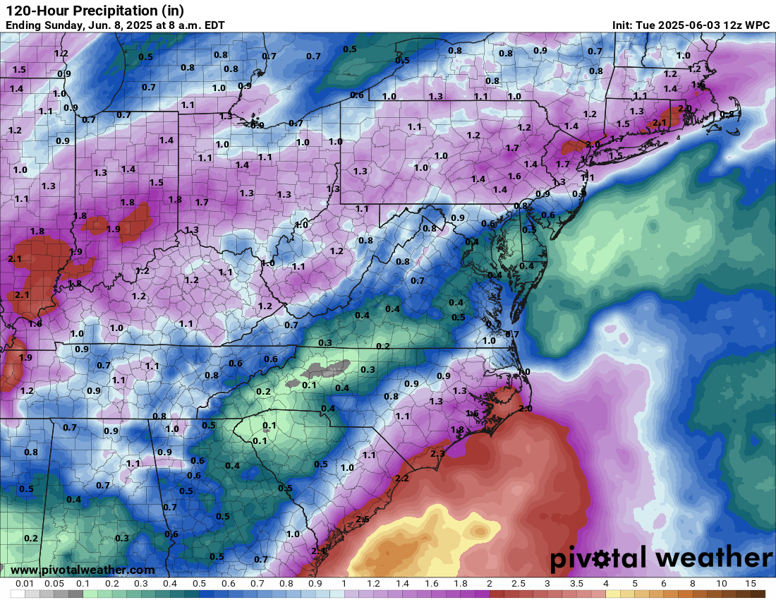
Either way, this low pressure system will bring locally heavy rainfall across southeastern Georgia, southern South Carolina and southeastern and eastern North Carolina during Thursday into Friday. Up to 1 to 3 inches of rainfall is a possibility.
By Saturday, this low pressure system will be swept out into the open Atlantic as a cold front pushes eastward.
Even though the chances of tropical development are very low, I will still be keeping close tabs on this weather system. This means that I will keep you updated over the next couple of days or so.
Forecast Total Rainfall Amounts Through Saturday:
The next tropical weather discussion will be issued on Wednesday.